Rotenburg (Wümme) (Landkreis Rotenburg (Wümme))
- German district in Lower Saxony
Rotenburg (district), located in Lower Saxony, Germany, offers various hiking opportunities, particularly for those interested in exploring scenic landscapes and natural beauty. Here are some highlights and suggestions for hiking in this region:
Scenic Trails and Nature Parks
-
Spargelroute: This route is part of a network that celebrates local agriculture, especially asparagus farming. It generally leads you through picturesque countryside and charming villages.
-
Lüneburg Heath Nature Reserve: While technically just outside the district, this area is close enough for day trips and is known for its heathland, blooming heather, and unique flora and fauna. The extensive network of trails offers options for all skill levels.
-
Weserbergland: This region along the upper Weser River features rolling hills, wooded areas, and stunning vistas. The trails here often connect historic towns and landmarks.
-
Forest Trails: The area is rich in forests, such as the Solling-Vogler Nature Park. Trails through these woodlands offer both shaded walks and the chance to spot wildlife.
Routes and Difficulty Levels
-
Easy Trails: Many low-impact trails are suitable for families and beginners. These often follow gentle paths through fields and forests.
-
Moderate to Difficult Trails: For more experienced hikers, routes that lead to higher elevations or more rugged terrain are available. These often offer the best views and a chance for solitude.
Tips for Hiking in Rotenburg
-
Maps and Guides: It's wise to have a reliable hiking map or use a hiking app, as some trails may not be well-marked.
-
Weather Preparedness: Always check the weather forecast before heading out, and dress in layers to adapt to changing conditions.
-
Safety Considerations: Take plenty of water, snacks, and a first aid kit. Inform someone about your hiking plans, especially for longer or more remote hikes.
-
Local Regulations: Respect local wildlife and vegetation. Stick to marked trails to minimize environmental impact.
Conclusion
Hiking in the Rotenburg district offers a splendid mix of nature, history, and culture. Whether you're looking for a leisurely walk or a more challenging trek, there are options to suit every hiker's preference. Enjoy the beauty of this charming region while taking in the fresh air and picturesque scenery!
- Country:

- Licence Plate Code: ROW; BRV
- Coordinates: 53° 15' 0" N, 9° 19' 48" E


- GPS tracks (wikiloc): [Link]
- AboveSeaLevel: 28 м m
- Population: 163372
- Web site: http://www.lk-row.de/
- Wikipedia en: wiki(en)
- Wikipedia: wiki(de)
- Wikidata storage: Wikidata: Q5923
- Wikipedia Commons Category: [Link]
- Wikipedia Commons Maps Category: [Link]
- Freebase ID: [/m/0137nv]
- Freebase ID: [/m/0137nv]
- Freebase ID: [/m/0137nv]
- GeoNames ID: Alt: [3221044]
- GeoNames ID: Alt: [3221044]
- GeoNames ID: Alt: [3221044]
- BnF ID: [16218476t]
- BnF ID: [16218476t]
- BnF ID: [16218476t]
- VIAF ID: Alt: [130689544]
- VIAF ID: Alt: [130689544]
- VIAF ID: Alt: [130689544]
- OSM relation ID: [62617]
- OSM relation ID: [62617]
- OSM relation ID: [62617]
- GND ID: Alt: [4050656-3]
- GND ID: Alt: [4050656-3]
- GND ID: Alt: [4050656-3]
- archINFORM location ID: [11070]
- archINFORM location ID: [11070]
- archINFORM location ID: [11070]
- Library of Congress authority ID: Alt: [n80123459]
- Library of Congress authority ID: Alt: [n80123459]
- Library of Congress authority ID: Alt: [n80123459]
- ISNI: Alt: [0000 0001 2264 5764]
- ISNI: Alt: [0000 0001 2264 5764]
- ISNI: Alt: [0000 0001 2264 5764]
- National Library of Israel ID: [000981288]
- National Library of Israel ID: [000981288]
- National Library of Israel ID: [000981288]
- NUTS code: [DE937]
- NUTS code: [DE937]
- NUTS code: [DE937]
- German district key: 03357
- German district key: 03357
- German district key: 03357
Includes regions:
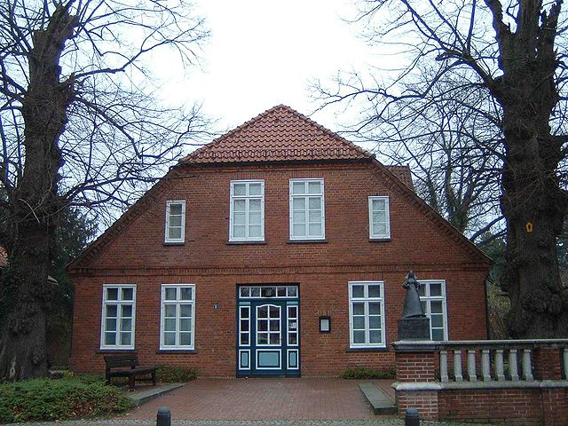

Zeven
- Samtgemeinde in Lower Saxony
Zeven, located in the Samtgemeinde of the same name in Lower Saxony, Germany, is surrounded by beautiful natural landscapes, making it a great spot for hiking enthusiasts. The region boasts a mix of scenic countryside, picturesque forests, and charming villages. Here are some highlights about hiking in the area:...
- Country:

- Capital: Zeven
- Coordinates: 53° 18' 0" N, 9° 17' 0" E


- GPS tracks (wikiloc): [Link]
- Population: 22958
- Web site: [Link]
Tarmstedt
- Samtgemeinde in Lower Saxony
Tarmstedt is a charming town located in the Samtgemeinde of Tarmstedt in Lower Saxony, Germany. While it's not as widely known for hiking as some other regions, there are still lovely outdoor opportunities in and around the area. Here are some details to consider for hiking in Tarmstedt:...
- Country:

- Coordinates: 53° 13' 0" N, 9° 5' 0" E


- GPS tracks (wikiloc): [Link]
- Population: 10820
- Web site: [Link]

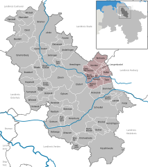
Sittensen
- Samtgemeinde in Lower Saxony
Sittensen, located in the Samtgemeinde of Sittensen in Lower Saxony, Germany, is a charming area that offers various opportunities for hiking lovers. While it may not be as widely known for hiking as some more mountainous regions, the area features a mix of scenic landscapes, forests, farmland, and small waterways that can provide an enjoyable hiking experience....
- Country:

- Coordinates: 53° 17' 0" N, 9° 30' 0" E


- GPS tracks (wikiloc): [Link]
- Population: 11037
- Web site: [Link]


Sottrum
- Samtgemeinde in Lower Saxony
Sottrum, located in Niedersachsen, Germany, offers a variety of hiking opportunities. The surrounding areas feature a mix of landscapes, including forests, meadows, and agricultural fields, providing a peaceful setting for hikers....
- Country:

- Coordinates: 53° 7' 0" N, 9° 14' 0" E


- GPS tracks (wikiloc): [Link]
- Population: 14531
- Web site: [Link]
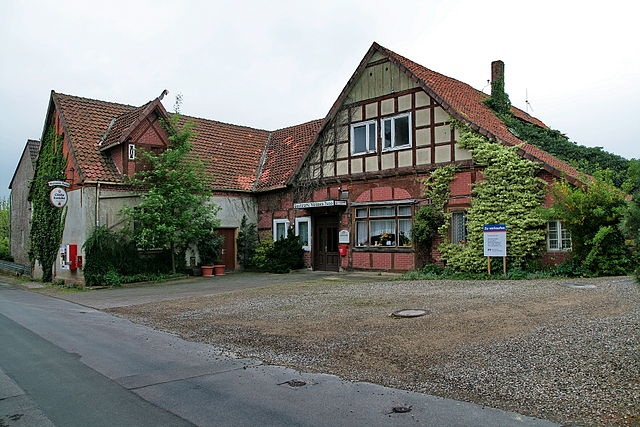

Fintel
- Samtgemeinde in Lower Saxony
Fintel, located in the Samtgemeinde of Fintel in Lower Saxony, Germany, is a charming area known for its natural beauty and hiking opportunities. The region offers a mix of picturesque landscapes, tranquil forests, and scenic trails suitable for hikers of all levels....
- Country:

- Postal Code: 27389
- Coordinates: 53° 12' 0" N, 9° 34' 0" E


- GPS tracks (wikiloc): [Link]
- Population: 7387
- Web site: [Link]

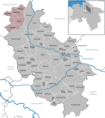
Geestequelle
- Samtgemeinde in Lower Saxony
Geestequelle, located in Germany, offers a charming outdoor experience for hikers. While specific trails may vary, the area generally features lush landscapes, picturesque views, and a serene atmosphere ideal for both novice and experienced hikers....
- Country:

- Coordinates: 53° 29' 0" N, 9° 3' 0" E


- GPS tracks (wikiloc): [Link]
- Population: 6472
- Web site: [Link]

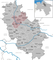
Selsingen
- Samtgemeinde in Lower Saxony
Selsingen, located in the Samtgemeinde (joint municipality) of Selsingen in Lower Saxony, Germany, offers a variety of scenic hiking options. The region is characterized by its gentle rolling hills, lush forests, and agricultural landscapes, making it a pleasant destination for both casual walkers and more dedicated hikers....
- Country:

- Coordinates: 53° 22' 0" N, 9° 13' 0" E


- GPS tracks (wikiloc): [Link]
- Population: 9877
- Web site: [Link]
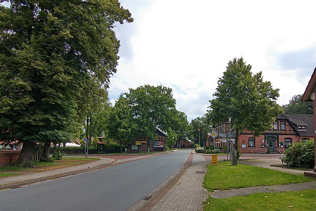

Bothel
- Samtgemeinde in Lower Saxony
Bothel, located in the Samtgemeinde of Bothel in Lower Saxony, Germany, is a relatively small area that offers a peaceful hiking experience amidst nature. While it may not be as well-known for extensive hiking trails as some larger regions, it can still provide beautiful rural scenery, forests, and serene landscapes for those looking for a quiet escape into nature....
- Country:

- Coordinates: 53° 4' 12" N, 9° 29' 51" E


- GPS tracks (wikiloc): [Link]
- Population: 8157
- Web site: [Link]


Rotenburg an der Wümme
- municipality of Germany
 Hiking in Rotenburg an der Wümme
Rotenburg an der Wümme is a charming town located in Lower Saxony, Germany, known for its beautiful landscapes and outdoor activities, including hiking. The region features a mix of forests, rivers, and fields, making it an attractive destination for nature lovers and outdoor enthusiasts....
- Country:

- Postal Code: 27356
- Local Dialing Code: 04261
- Licence Plate Code: ROW
- Coordinates: 53° 6' 25" N, 9° 23' 49" E


- GPS tracks (wikiloc): [Link]
- AboveSeaLevel: 30 м m
- Area: 99.01 sq km
- Population: 21694
- Web site: [Link]


Visselhövede
- municipality of Germany
Visselhövede is a lovely town located in Lower Saxony, Germany. It offers a peaceful setting for hiking enthusiasts, with various trails that showcase the beautiful rural landscapes of the region. Here are some highlights you can expect when hiking in and around Visselhövede:...
- Country:

- Postal Code: 27374
- Local Dialing Code: 04262
- Licence Plate Code: ROW
- Coordinates: 52° 58' 0" N, 9° 35' 0" E


- GPS tracks (wikiloc): [Link]
- AboveSeaLevel: 70 м m
- Area: 158.85 sq km
- Population: 9700
- Web site: [Link]


Scheeßel
- municipality of Germany
Scheeßel is a charming town located in Lower Saxony, Germany, known for its picturesque landscapes and outdoor activities, including hiking. Here are some highlights and tips for hiking in the area:...
- Country:

- Postal Code: 27383
- Local Dialing Code: 04263
- Licence Plate Code: ROW
- Coordinates: 53° 10' 0" N, 9° 29' 0" E


- GPS tracks (wikiloc): [Link]
- AboveSeaLevel: 30 м m
- Area: 150.02 sq km
- Population: 12934
- Web site: [Link]


Bremervörde
- municipality of Germany
Bremervörde, located in Lower Saxony, Germany, is a charming town surrounded by the natural beauty of the Elbe-Weser region. It offers a variety of hiking opportunities suitable for all skill levels. Here are some highlights and tips for hiking in and around Bremervörde:...
- Country:

- Postal Code: 27432
- Local Dialing Code: 04761
- Licence Plate Code: BRV; BRV
- Coordinates: 53° 29' 0" N, 9° 8' 0" E


- GPS tracks (wikiloc): [Link]
- AboveSeaLevel: 4 м m
- Area: 150.18 sq km
- Population: 18623
- Web site: [Link]

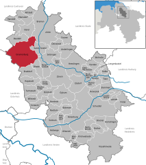
Gnarrenburg
- municipality of Germany
Gnarrenburg, located in Lower Saxony, Germany, is a quaint village surrounded by beautiful countryside, offering opportunities for hiking enthusiasts. The area features scenic trails that wind through forests, fields, and near water bodies, making it ideal for nature lovers....
- Country:

- Postal Code: 27442
- Local Dialing Code: 04763
- Licence Plate Code: ROW
- Coordinates: 53° 23' 0" N, 9° 0' 0" E


- GPS tracks (wikiloc): [Link]
- AboveSeaLevel: 10 м m
- Area: 123.23 sq km
- Population: 9222
- Web site: [Link]
Shares border with regions:
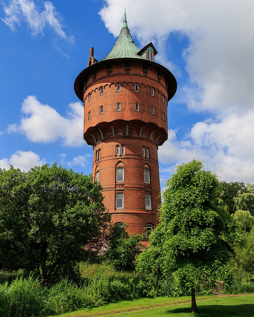

Cuxhaven
- German district of Lower Saxony
Cuxhaven, located in Lower Saxony, Germany, offers a unique hiking experience with its combination of coastal landscapes, nature reserves, and historical sites. Here are some highlights of hiking in the Cuxhaven district:...
- Country:

- Capital: Cuxhaven
- Licence Plate Code: CUX
- Coordinates: 53° 40' 12" N, 8° 49' 48" E


- GPS tracks (wikiloc): [Link]
- AboveSeaLevel: 5 м m
- Area: 2057.78 sq km
- Population: 198670
- Web site: [Link]


Stade
- German district of Lower Saxony
Stade, located in Lower Saxony, Germany, offers a range of hiking opportunities that allow you to explore its picturesque natural landscapes, historical sites, and charming small towns. Here are some highlights for hiking in the Stade district:...
- Country:

- Licence Plate Code: STD
- Coordinates: 53° 34' 48" N, 9° 25' 12" E


- GPS tracks (wikiloc): [Link]
- AboveSeaLevel: 1 м m
- Area: 1266.00 sq km
- Population: 201638
- Web site: [Link]


Harburg
- German district in Lower Saxony
Harburg, a district in the southern part of Hamburg, Germany, offers various hiking opportunities that allow you to explore the beautiful natural landscapes and scenic views of the region. Here are some key points about hiking in Harburg:...
- Country:

- Capital: Winsen
- Licence Plate Code: WL
- Coordinates: 53° 19' 43" N, 9° 58' 11" E


- GPS tracks (wikiloc): [Link]
- AboveSeaLevel: 49 м m
- Population: 250326
- Web site: [Link]


Heidekreis
- district in Lower Saxony, Germany
Heidekreis, located in Lower Saxony, Germany, offers a variety of hiking opportunities amidst beautiful natural landscapes. The region is characterized by its mix of heathlands, forests, and moorlands, making it an attractive destination for outdoor enthusiasts....
- Country:

- Capital: Bad Fallingbostel
- Licence Plate Code: HK
- Coordinates: 52° 55' 12" N, 9° 45' 0" E


- GPS tracks (wikiloc): [Link]
- AboveSeaLevel: 64 м m
- Area: 1873.50 sq km
- Population: 139641
- Web site: [Link]


Verden
- district in Lower Saxony, Germany
Verden, located in Lower Saxony, Germany, is an area that offers various outdoor activities, including hiking. The district is characterized by its lush landscapes, woodlands, and scenic countryside, making it a pleasant spot for nature lovers and hikers alike....
- Country:

- Licence Plate Code: VER
- Coordinates: 53° 0' 0" N, 9° 10' 12" E


- GPS tracks (wikiloc): [Link]
- AboveSeaLevel: 23 м m
- Area: 787.70 sq km
- Population: 135842
- Web site: [Link]
