Gond-Pontouvre (Gond-Pontouvre)

- commune in Charente, France
- Country:

- Postal Code: 16160
- Coordinates: 45° 40' 9" N, 0° 9' 58" E


- GPS tracks (wikiloc): [Link]
- AboveSeaLevel: 38 м m
- Area: 7.45 sq km
- Population: 5951
- Web site: http://www.gond-pontouvre.fr
- Wikipedia en: wiki(en)
- Wikipedia: wiki(fr)
- Wikidata storage: Wikidata: Q1450508
- Wikipedia Commons Category: [Link]
- Freebase ID: [/m/03mcbfd]
- GeoNames ID: Alt: [3004078]
- SIREN number: [211601547]
- BnF ID: [152485935]
- INSEE municipality code: 16154
Shares border with regions:


Angoulême
- commune in Charente, France
- Country:
- Postal Code: 16000
- Coordinates: 45° 38' 58" N, 0° 9' 34" E
- GPS tracks (wikiloc): [Link]
- AboveSeaLevel: 100 м m
- Area: 21.85 sq km
- Population: 42081
- Web site: [Link]


L'Isle-d'Espagnac
- commune in Charente, France
- Country:
- Postal Code: 16340
- Coordinates: 45° 39' 41" N, 0° 11' 59" E
- GPS tracks (wikiloc): [Link]
- Area: 5.95 sq km
- Population: 5514
- Web site: [Link]


Saint-Yrieix-sur-Charente
- commune in Charente, France
- Country:
- Postal Code: 16710
- Coordinates: 45° 40' 31" N, 0° 7' 39" E
- GPS tracks (wikiloc): [Link]
- AboveSeaLevel: 175 м m
- Area: 14.65 sq km
- Population: 7206
- Web site: [Link]

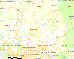
Champniers
- commune in Charente, France
- Country:
- Postal Code: 16430
- Coordinates: 45° 42' 54" N, 0° 12' 20" E
- GPS tracks (wikiloc): [Link]
- Area: 45.29 sq km
- Population: 5217
- Web site: [Link]


Balzac
- commune in Charente, France
- Country:
- Postal Code: 16430
- Coordinates: 45° 42' 35" N, 0° 8' 11" E
- GPS tracks (wikiloc): [Link]
- AboveSeaLevel: 40 м m
- Area: 9.64 sq km
- Population: 1329
- Web site: [Link]


Ruelle-sur-Touvre
- commune in Charente, France
- Country:
- Postal Code: 16600
- Coordinates: 45° 40' 40" N, 0° 13' 13" E
- GPS tracks (wikiloc): [Link]
- Area: 10.66 sq km
- Population: 7227
- Web site: [Link]