Saint-Yrieix-sur-Charente (Saint-Yrieix-sur-Charente)

- commune in Charente, France
- Country:

- Postal Code: 16710
- Coordinates: 45° 40' 31" N, 0° 7' 39" E


- GPS tracks (wikiloc): [Link]
- AboveSeaLevel: 175 м m
- Area: 14.65 sq km
- Population: 7206
- Web site: http://www.saintyrieixsurcharente.fr
- Wikipedia en: wiki(en)
- Wikipedia: wiki(fr)
- Wikidata storage: Wikidata: Q1624697
- Wikipedia Commons Category: [Link]
- Freebase ID: [/m/03mcdr9]
- GeoNames ID: Alt: [2976542]
- SIREN number: [211603584]
- BnF ID: [15248795d]
- INSEE municipality code: 16358
Shares border with regions:


Angoulême
- commune in Charente, France
- Country:
- Postal Code: 16000
- Coordinates: 45° 38' 58" N, 0° 9' 34" E
- GPS tracks (wikiloc): [Link]
- AboveSeaLevel: 100 м m
- Area: 21.85 sq km
- Population: 42081
- Web site: [Link]

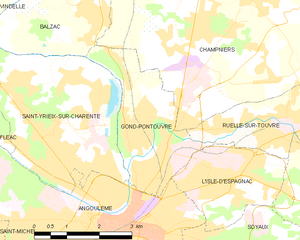
Gond-Pontouvre
- commune in Charente, France
- Country:
- Postal Code: 16160
- Coordinates: 45° 40' 9" N, 0° 9' 58" E
- GPS tracks (wikiloc): [Link]
- AboveSeaLevel: 38 м m
- Area: 7.45 sq km
- Population: 5951
- Web site: [Link]

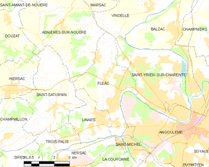
Fléac
- commune in Charente, France
- Country:
- Postal Code: 16730
- Coordinates: 45° 39' 55" N, 0° 5' 37" E
- GPS tracks (wikiloc): [Link]
- Area: 12.6 sq km
- Population: 3708
- Web site: [Link]


Balzac
- commune in Charente, France
- Country:
- Postal Code: 16430
- Coordinates: 45° 42' 35" N, 0° 8' 11" E
- GPS tracks (wikiloc): [Link]
- AboveSeaLevel: 40 м m
- Area: 9.64 sq km
- Population: 1329
- Web site: [Link]


Vindelle
- commune in Charente, France
- Country:
- Postal Code: 16430
- Coordinates: 45° 43' 13" N, 0° 7' 18" E
- GPS tracks (wikiloc): [Link]
- Area: 10.93 sq km
- Population: 1049
- Web site: [Link]