Grèzes (Grèzes)

- commune in Lozère, France
- Country:

- Postal Code: 48100
- Coordinates: 44° 30' 47" N, 3° 20' 19" E


- GPS tracks (wikiloc): [Link]
- Area: 16.21 sq km
- Population: 204
- Wikipedia en: wiki(en)
- Wikipedia: wiki(fr)
- Wikidata storage: Wikidata: Q473344
- Wikipedia Commons Category: [Link]
- Freebase ID: [/m/02z0yhh]
- Freebase ID: [/m/02z0yhh]
- GeoNames ID: Alt: [6449370]
- GeoNames ID: Alt: [6449370]
- SIREN number: [214800724]
- SIREN number: [214800724]
- BnF ID: [15261478q]
- BnF ID: [15261478q]
- INSEE municipality code: 48072
- INSEE municipality code: 48072
Shares border with regions:


Esclanèdes
- commune in Lozère, France
- Country:
- Postal Code: 48230
- Coordinates: 44° 28' 54" N, 3° 21' 41" E
- GPS tracks (wikiloc): [Link]
- Area: 12.51 sq km
- Population: 376


Chanac
- commune in Lozère, France
- Country:
- Postal Code: 48230
- Coordinates: 44° 27' 59" N, 3° 20' 35" E
- GPS tracks (wikiloc): [Link]
- Area: 71.14 sq km
- Population: 1460
- Web site: [Link]
Gabrias
- commune in Lozère, France
- Country:
- Postal Code: 48100
- Coordinates: 44° 32' 15" N, 3° 22' 10" E
- GPS tracks (wikiloc): [Link]
- Area: 20.65 sq km
- Population: 145
- Web site: [Link]
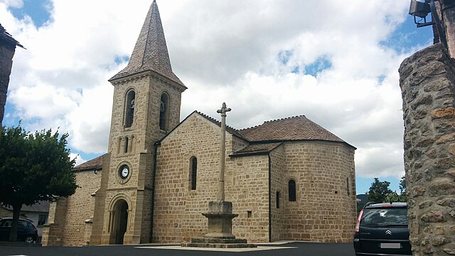
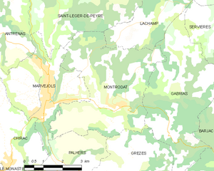
Montrodat
- commune in Lozère, France
- Country:
- Postal Code: 48100
- Coordinates: 44° 33' 6" N, 3° 19' 44" E
- GPS tracks (wikiloc): [Link]
- Area: 20.65 sq km
- Population: 1225
- Web site: [Link]

Palhers
- commune in Lozère, France
- Country:
- Postal Code: 48100
- Coordinates: 44° 31' 13" N, 3° 17' 54" E
- GPS tracks (wikiloc): [Link]
- Area: 8.59 sq km
- Population: 195
- Web site: [Link]