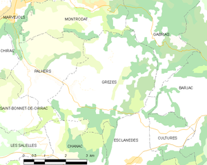
Palhers (Palhers)

- commune in Lozère, France
- Country:

- Postal Code: 48100
- Coordinates: 44° 31' 13" N, 3° 17' 54" E


- GPS tracks (wikiloc): [Link]
- Area: 8.59 sq km
- Population: 195
- Web site: http://www.palhers.fr
- Wikipedia en: wiki(en)
- Wikipedia: wiki(fr)
- Wikidata storage: Wikidata: Q719233
- Wikipedia Commons Category: [Link]
- Freebase ID: [/m/02z0wbq]
- Freebase ID: [/m/02z0wbq]
- GeoNames ID: Alt: [6435126]
- GeoNames ID: Alt: [6435126]
- SIREN number: [214801078]
- SIREN number: [214801078]
- BnF ID: [15261513d]
- BnF ID: [15261513d]
- PACTOLS thesaurus ID: [pcrte3Ujm8EBiM]
- PACTOLS thesaurus ID: [pcrte3Ujm8EBiM]
- INSEE municipality code: 48107
- INSEE municipality code: 48107
Shares border with regions:


Saint-Bonnet-de-Chirac
- commune in Lozère, France
- Country:
- Postal Code: 48100
- Coordinates: 44° 30' 30" N, 3° 16' 44" E
- GPS tracks (wikiloc): [Link]
- Area: 7.68 sq km
- Population: 74


Chirac
- former commune in Lozère, France
- Country:
- Postal Code: 48100
- Coordinates: 44° 31' 26" N, 3° 15' 55" E
- GPS tracks (wikiloc): [Link]
- Area: 33.79 sq km
- Population: 1178
- Web site: [Link]


Marvejols
- commune in Lozère, France
- Country:
- Postal Code: 48100
- Coordinates: 44° 33' 12" N, 3° 17' 24" E
- GPS tracks (wikiloc): [Link]
- Area: 12.45 sq km
- Population: 4841
- Web site: [Link]

Grèzes
- commune in Lozère, France
- Country:
- Postal Code: 48100
- Coordinates: 44° 30' 47" N, 3° 20' 19" E
- GPS tracks (wikiloc): [Link]
- Area: 16.21 sq km
- Population: 204


Chanac
- commune in Lozère, France
- Country:
- Postal Code: 48230
- Coordinates: 44° 27' 59" N, 3° 20' 35" E
- GPS tracks (wikiloc): [Link]
- Area: 71.14 sq km
- Population: 1460
- Web site: [Link]

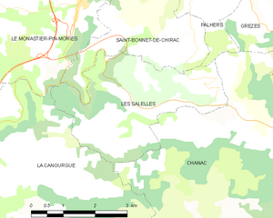
Les Salelles
- commune in Lozère, France
- Country:
- Postal Code: 48230
- Coordinates: 44° 28' 53" N, 3° 16' 46" E
- GPS tracks (wikiloc): [Link]
- Area: 10.62 sq km
- Population: 167
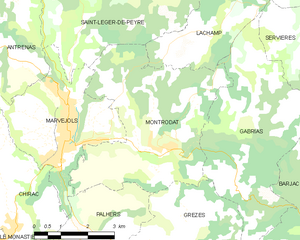
Montrodat
- commune in Lozère, France
- Country:
- Postal Code: 48100
- Coordinates: 44° 33' 6" N, 3° 19' 44" E
- GPS tracks (wikiloc): [Link]
- Area: 20.65 sq km
- Population: 1225
- Web site: [Link]