
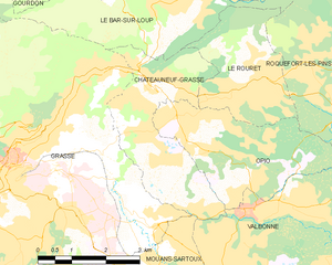
Grasse (Grasse)

- commune in Alpes-Maritimes, France
 Hiking in Grasse
Grasse, located in the Alpes-Maritimes department in the Provence-Alpes-Côte d'Azur region of France, is famous for its perfume industry and beautiful landscapes. Hiking in and around Grasse offers a range of trails, stunning views, and a chance to experience the rich natural and cultural heritage of the area.
Hiking Trails
-
Le Chemin de la Montalban: A moderate trail that leads you through the scenic hills surrounding Grasse. The path provides beautiful views of both the town itself and the surrounding countryside.
-
Les Gorges du Loup: This area features more challenging hikes with stunning canyon views. The trails in the Gorges du Loup allow you to explore the dramatic cliffs and diverse flora and fauna.
-
The Scenic Walks of the Pays de Grasse: There are various marked hiking routes that link villages in the Pays de Grasse, showcasing the charming Provençal landscapes, including olive groves, lavender fields, and vineyards.
-
Montagne de Grasse: For a more strenuous hike, the trails that lead to the Montagne de Grasse offer panoramic views of the Mediterranean coast and the nearby Alpes.
Tips for Hiking in Grasse
- Weather: Check the weather conditions before heading out, as they can vary. Summers can be hot, while winters might be chilly in the higher altitudes.
- Footwear: Wear sturdy hiking boots with good grip, as some trails can be rocky or steep.
- Hydration: Bring enough water, especially during the warmer months.
- Trail Maps: Pick up a local hiking map from the tourist office or download a GPS trail app to navigate more easily.
- Wildlife: Be aware of the local wildlife, including various birds and sometimes snakes in the warmer regions.
Additional Considerations
- Local Culture: Take the time to explore the charming old town of Grasse after your hike, known for its narrow streets, historic buildings, and, of course, its perfume museums.
- Combination Activities: If you're interested in perfumery, consider visiting a local perfume factory, as many of these are located in proximity to hiking trails.
Overall, hiking in Grasse is an excellent way to immerse yourself in both nature and the unique cultural offerings of this picturesque town.
- Country:

- Postal Code: 06520; 06130
- Coordinates: 43° 39' 29" N, 6° 55' 31" E


- GPS tracks (wikiloc): [Link]
- AboveSeaLevel: 333 м m
- Area: 44.44 sq km
- Population: 50937
- Web site: http://www.ville-grasse.fr
- Wikipedia en: wiki(en)
- Wikipedia: wiki(fr)
- Wikidata storage: Wikidata: Q173705
- Wikipedia Commons Gallery: [Link]
- Wikipedia Commons Category: [Link]
- Freebase ID: [/m/0ch62]
- Freebase ID: [/m/0ch62]
- Freebase ID: [/m/0ch62]
- GeoNames ID: Alt: [3014856]
- GeoNames ID: Alt: [3014856]
- GeoNames ID: Alt: [3014856]
- SIREN number: [210600698]
- SIREN number: [210600698]
- SIREN number: [210600698]
- BnF ID: [11864230c]
- BnF ID: [11864230c]
- BnF ID: [11864230c]
- VIAF ID: Alt: [146600551]
- VIAF ID: Alt: [146600551]
- VIAF ID: Alt: [146600551]
- GND ID: Alt: [4021869-7]
- GND ID: Alt: [4021869-7]
- GND ID: Alt: [4021869-7]
- Library of Congress authority ID: Alt: [n82050977]
- Library of Congress authority ID: Alt: [n82050977]
- Library of Congress authority ID: Alt: [n82050977]
- PACTOLS thesaurus ID: [pcrtaveQOswPTT]
- PACTOLS thesaurus ID: [pcrtaveQOswPTT]
- PACTOLS thesaurus ID: [pcrtaveQOswPTT]
- MusicBrainz area ID: [733780b3-0599-437d-97c3-e9647bf454ee]
- MusicBrainz area ID: [733780b3-0599-437d-97c3-e9647bf454ee]
- MusicBrainz area ID: [733780b3-0599-437d-97c3-e9647bf454ee]
- SUDOC authorities ID: [026384558]
- SUDOC authorities ID: [026384558]
- SUDOC authorities ID: [026384558]
- Encyclopædia Britannica Online ID: [place/Grasse]
- Encyclopædia Britannica Online ID: [place/Grasse]
- Encyclopædia Britannica Online ID: [place/Grasse]
- EMLO location ID: [16ce1327-79db-4ded-9c91-0a744e232790]
- EMLO location ID: [16ce1327-79db-4ded-9c91-0a744e232790]
- EMLO location ID: [16ce1327-79db-4ded-9c91-0a744e232790]
- Great Russian Encyclopedia Online ID: [2376452]
- Great Russian Encyclopedia Online ID: [2376452]
- Great Russian Encyclopedia Online ID: [2376452]
- ISNI: Alt: [0000 0001 2297 4031]
- ISNI: Alt: [0000 0001 2297 4031]
- ISNI: Alt: [0000 0001 2297 4031]
- DMOZ ID: Alt: [Regional/Europe/France/Regions/Provence-Alpes-Cote_d'Azur/Alpes-Maritimes/Localities/Grasse/]
- DMOZ ID: Alt: [Regional/Europe/France/Regions/Provence-Alpes-Cote_d'Azur/Alpes-Maritimes/Localities/Grasse/]
- DMOZ ID: Alt: [Regional/Europe/France/Regions/Provence-Alpes-Cote_d'Azur/Alpes-Maritimes/Localities/Grasse/]
- National Library of Israel ID: [000992231]
- National Library of Israel ID: [000992231]
- National Library of Israel ID: [000992231]
- INSEE municipality code: 06069
- INSEE municipality code: 06069
- INSEE municipality code: 06069
Shares border with regions:

Pégomas
- commune in Alpes-Maritimes, France
Hiking in Pégomas
Pégomas, a quaint commune located in the Alpes-Maritimes department in the French Riviera, offers a range of hiking opportunities that showcase its beautiful natural surroundings. Here are some key points to consider when hiking in the Pégomas area:...
- Country:
- Postal Code: 06580
- Coordinates: 43° 35' 48" N, 6° 56' 0" E
- GPS tracks (wikiloc): [Link]
- Area: 11.28 sq km
- Population: 7845
- Web site: [Link]

Mouans-Sartoux
- commune in Alpes-Maritimes, France
Hiking in Mouans-Sartoux
Mouans-Sartoux is a charming village located in the Alpes-Maritimes department in the Provence-Alpes-Côte d'Azur region of France. It offers attractive hiking opportunities, primarily through its beautiful surroundings and proximity to natural parks and the Mediterranean coastline....
- Country:
- Postal Code: 06370
- Coordinates: 43° 37' 12" N, 6° 58' 19" E
- GPS tracks (wikiloc): [Link]
- Area: 13.52 sq km
- Population: 9510
- Web site: [Link]

Châteauneuf-Grasse
- commune in Alpes-Maritimes, France
Hiking in Châteauneuf-Grasse
Châteauneuf-Grasse, located in the Alpes-Maritimes department of the Provence-Alpes-Côte d'Azur region in France, offers a picturesque backdrop for hiking enthusiasts. The area is characterized by its stunning landscapes, charming villages, and a mild Mediterranean climate, making it an ideal destination for outdoor activities....
- Country:
- Postal Code: 06740
- Coordinates: 43° 40' 30" N, 6° 58' 30" E
- GPS tracks (wikiloc): [Link]
- Area: 8.95 sq km
- Population: 3219
- Web site: [Link]


Auribeau-sur-Siagne
- commune in Alpes-Maritimes, France
Hiking in Auribeau-sur-Siagne
Auribeau-sur-Siagne is a picturesque village located in the Alpes-Maritimes region of France, near the French Riviera. It's nestled in the hills and offers a variety of hiking opportunities that showcase its natural beauty and the surrounding landscape....
- Country:
- Postal Code: 06810
- Coordinates: 43° 36' 3" N, 6° 54' 40" E
- GPS tracks (wikiloc): [Link]
- Area: 5.48 sq km
- Population: 3219
- Web site: [Link]

Peymeinade
- commune in Alpes-Maritimes, France
Hiking in Peymeinade
Peymeinade, a charming village located in the Alpes-Maritimes region of France, is an excellent starting point for hiking enthusiasts. Nestled in the foothills of the picturesque Provencal countryside, it offers a variety of trails that cater to all skill levels....
- Country:
- Postal Code: 06530
- Coordinates: 43° 38' 32" N, 6° 52' 33" E
- GPS tracks (wikiloc): [Link]
- Area: 9.76 sq km
- Population: 8116
- Web site: [Link]


Le Bar-sur-Loup
- commune in Alpes-Maritimes, France
Hiking in Le Bar-sur-Loup
Le Bar-sur-Loup is a picturesque village in the Alpes-Maritimes region of France, nestled in the foothills of the French Alps. Known for its stunning scenery and proximity to nature, it offers several opportunities for hiking enthusiasts. Here are some key points to consider when planning a hike in and around Le Bar-sur-Loup:...
- Country:
- Postal Code: 06620
- Coordinates: 43° 42' 5" N, 6° 59' 20" E
- GPS tracks (wikiloc): [Link]
- AboveSeaLevel: 310 м m
- Area: 14.47 sq km
- Population: 3014
- Web site: [Link]

Cabris
- commune in Alpes-Maritimes, France
Hiking in Cabris
Cabris is a charming village located in the Alpes-Maritimes department of the Provence-Alpes-Côte d'Azur region in southeastern France. Perched on a hill, it offers stunning views of the surrounding countryside, making it a wonderful base for hiking enthusiasts. Here are some highlights of hiking in the Cabris area:...
- Country:
- Postal Code: 06530
- Coordinates: 43° 39' 22" N, 6° 52' 25" E
- GPS tracks (wikiloc): [Link]
- Area: 5.43 sq km
- Population: 1295
- Web site: [Link]


Saint-Vallier-de-Thiey
- commune in Alpes-Maritimes, France
Hiking in Saint-Vallier-de-Thiey
Saint-Vallier-de-Thiey is a charming village located in the Alpes-Maritimes department in southeastern France, offering a variety of hiking opportunities amidst beautiful landscapes. The region is characterized by its diverse terrain, which includes forested areas, rocky outcrops, and panoramic views of the surrounding mountains and valleys....
- Country:
- Postal Code: 06460
- Coordinates: 43° 41' 56" N, 6° 50' 52" E
- GPS tracks (wikiloc): [Link]
- Area: 50.68 sq km
- Population: 3526