Saint-Vallier-de-Thiey (Saint-Vallier-de-Thiey)

- commune in Alpes-Maritimes, France
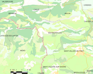
 Hiking in Saint-Vallier-de-Thiey
Saint-Vallier-de-Thiey is a charming village located in the Alpes-Maritimes department in southeastern France, offering a variety of hiking opportunities amidst beautiful landscapes. The region is characterized by its diverse terrain, which includes forested areas, rocky outcrops, and panoramic views of the surrounding mountains and valleys.
Hiking Trails:
-
Le Sentier des Ocres:
- This trail takes you through areas rich in ochre deposits, showcasing stunning colors and unique geological formations. It’s a relatively easy hike, making it suitable for families and those looking for a leisurely walk.
-
Plateau de Caussols:
- Just a short distance from the village, this plateau offers various trails with breathtaking views of the Alpine landscape. It's a great spot for both hiking and enjoying a picnic. The trails here can range from easy to moderate, accommodating different skill levels.
-
Chemin des Crêtes:
- This trail follows the ridges and provides some of the best views of the region. It’s particularly scenic and is a favorite for more experienced hikers. Be sure to carry enough water and snacks, as the hike can be longer and more challenging.
-
Les Gorges du Loup:
- Although a bit further away, this area is worth a visit for hiking. The gorge features stunning cliffs, waterfalls, and the opportunity for swimming in some spots during the summer months.
Hiking Tips:
- Best Time to Visit: Spring and fall are ideal for hiking in Saint-Vallier-de-Thiey, as temperatures are milder and the landscape is vibrant with flora.
- What to Bring: Always carry plenty of water, snacks, sun protection, and a map or GPS device. Proper footwear is essential for navigating the varying terrain.
- Local Guides: Consider hiring a local guide or joining a hiking group for a more informed experience, especially if you’re unfamiliar with the area.
Accessibility:
The village is accessible by car and is located not far from major cities like Nice and Grasse, making it a convenient destination for a day hike or a weekend getaway.
Conclusion:
Hiking in Saint-Vallier-de-Thiey combines natural beauty with cultural charm, offering trails that cater to all levels of experience. Whether you’re interested in a peaceful stroll or a more demanding hike, this area has something to offer every outdoor enthusiast.
- Country:

- Postal Code: 06460
- Coordinates: 43° 41' 56" N, 6° 50' 52" E


- GPS tracks (wikiloc): [Link]
- Area: 50.68 sq km
- Population: 3526
- Wikipedia en: wiki(en)
- Wikipedia: wiki(fr)
- Wikidata storage: Wikidata: Q840084
- Wikipedia Commons Category: [Link]
- Freebase ID: [/m/03g_8pv]
- Freebase ID: [/m/03g_8pv]
- GeoNames ID: Alt: [6425679]
- GeoNames ID: Alt: [6425679]
- SIREN number: [210601308]
- SIREN number: [210601308]
- VIAF ID: Alt: [145555329]
- VIAF ID: Alt: [145555329]
- Library of Congress authority ID: Alt: [n91077078]
- Library of Congress authority ID: Alt: [n91077078]
- PACTOLS thesaurus ID: [pcrtR5QXwsH5Yn]
- PACTOLS thesaurus ID: [pcrtR5QXwsH5Yn]
- INSEE municipality code: 06130
- INSEE municipality code: 06130
Shares border with regions:


Grasse
- commune in Alpes-Maritimes, France
Hiking in Grasse
Grasse, located in the Alpes-Maritimes department in the Provence-Alpes-Côte d'Azur region of France, is famous for its perfume industry and beautiful landscapes. Hiking in and around Grasse offers a range of trails, stunning views, and a chance to experience the rich natural and cultural heritage of the area....
- Country:
- Postal Code: 06520; 06130
- Coordinates: 43° 39' 29" N, 6° 55' 31" E
- GPS tracks (wikiloc): [Link]
- AboveSeaLevel: 333 м m
- Area: 44.44 sq km
- Population: 50937
- Web site: [Link]


Spéracèdes
- commune in Alpes-Maritimes, France
Hiking in Spéracèdes
Spéracèdes is a charming village located in the Alpes-Maritimes department in the Provence-Alpes-Côte d'Azur region of France. It offers a variety of hiking opportunities amidst stunning landscapes, rolling hills, and nearby natural parks. Here are some highlights and tips for hiking in and around Spéracèdes:...
- Country:
- Postal Code: 06530
- Coordinates: 43° 38' 55" N, 6° 51' 31" E
- GPS tracks (wikiloc): [Link]
- Area: 3.46 sq km
- Population: 1295

Escragnolles
- commune in Alpes-Maritimes, France
Hiking in Escragnolles
Escragnolles is a charming village located in the Alpes-Maritimes department in the Provence-Alpes-Côte d'Azur region of southern France. It's a part of the stunning French Riviera's mountainous landscape, offering numerous hiking opportunities for outdoor enthusiasts....
- Country:
- Postal Code: 06460
- Coordinates: 43° 43' 51" N, 6° 47' 0" E
- GPS tracks (wikiloc): [Link]
- Area: 25.48 sq km
- Population: 614


Le Bar-sur-Loup
- commune in Alpes-Maritimes, France
Hiking in Le Bar-sur-Loup
Le Bar-sur-Loup is a picturesque village in the Alpes-Maritimes region of France, nestled in the foothills of the French Alps. Known for its stunning scenery and proximity to nature, it offers several opportunities for hiking enthusiasts. Here are some key points to consider when planning a hike in and around Le Bar-sur-Loup:...
- Country:
- Postal Code: 06620
- Coordinates: 43° 42' 5" N, 6° 59' 20" E
- GPS tracks (wikiloc): [Link]
- AboveSeaLevel: 310 м m
- Area: 14.47 sq km
- Population: 3014
- Web site: [Link]

Cabris
- commune in Alpes-Maritimes, France
Hiking in Cabris
Cabris is a charming village located in the Alpes-Maritimes department of the Provence-Alpes-Côte d'Azur region in southeastern France. Perched on a hill, it offers stunning views of the surrounding countryside, making it a wonderful base for hiking enthusiasts. Here are some highlights of hiking in the Cabris area:...
- Country:
- Postal Code: 06530
- Coordinates: 43° 39' 22" N, 6° 52' 25" E
- GPS tracks (wikiloc): [Link]
- Area: 5.43 sq km
- Population: 1295
- Web site: [Link]


Andon
- commune in Alpes-Maritimes, France
Hiking in Andon
Andon, located in the Alpes-Maritimes region of France, is a charming village that offers a range of hiking opportunities amidst stunning natural landscapes. Nestled in the foothills of the Alpes, it serves as a gateway to the surrounding mountains and valleys. Here are some highlights and tips for hiking in and around Andon:...
- Country:
- Postal Code: 06750
- Coordinates: 43° 46' 23" N, 6° 47' 11" E
- GPS tracks (wikiloc): [Link]
- Area: 54.3 sq km
- Population: 562
- Web site: [Link]


Caussols
- commune in Alpes-Maritimes, France
Hiking in Caussols
Caussols is a picturesque village located in the Alpes-Maritimes region of France, known for its stunning natural landscapes and diverse hiking opportunities. Nestled in the Provencal countryside and surrounded by beautiful forests, hills, and rocky outcrops, it offers a range of trails that cater to different skill levels....
- Country:
- Postal Code: 06460
- Coordinates: 43° 44' 29" N, 6° 54' 0" E
- GPS tracks (wikiloc): [Link]
- AboveSeaLevel: 1200 м m
- Area: 27.39 sq km
- Population: 260
- Web site: [Link]

Saint-Cézaire-sur-Siagne
- commune in Alpes-Maritimes, France
Hiking in Saint-Cézaire-sur-Siagne
Saint-Cézaire-sur-Siagne is a picturesque village located in the Alpes-Maritimes department of France, near the Mediterranean coast. This area is renowned for its beautiful landscapes, lush vegetation, and proximity to the Siagne River, making it a wonderful spot for hiking enthusiasts....
- Country:
- Postal Code: 06530
- Coordinates: 43° 38' 56" N, 6° 47' 34" E
- GPS tracks (wikiloc): [Link]
- Area: 30.02 sq km
- Population: 3927
- Web site: [Link]