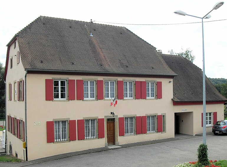
Grentzingen (Grentzingen)

- former commune in Haut-Rhin, France
 Hiking in Grentzingen
Grentzingen is a small village located in the Alsace region of France, near the border with Germany. While Grentzingen itself may not be the most famous hiking destination, its proximity to the Vosges mountains and the beautiful Alsace countryside offers some excellent hiking opportunities.
Hiking in the Region:
-
Scenic Trails: The area around Grentzingen features a mix of rolling hills, vineyards, and charming villages. You can find various scenic trails that highlight the picturesque landscapes typical of the Alsace region.
-
Vineyard Trails: Exploring the wine routes (Route des Vins) is a fantastic option. Many of these routes can be tackled on foot, allowing you to enjoy the vineyards, wine cellars, and traditional Alsatian architecture along the way.
-
Vosges Mountains: A bit further to the west, the Vosges rise up with numerous trails ranging from easy walks to challenging hikes. The Ballons des Vosges Regional Nature Park features diverse flora and fauna, beautiful landscapes, and panoramic views.
-
Local Nature Reserves: Nearby nature reserves may also offer well-marked hiking paths, allowing you to observe local wildlife and enjoy the serenity of the natural environment.
-
Cultural Aspects: As you hike, take advantage of the chance to experience local culture, including traditional Alsatian cuisine at establishments in nearby towns.
Hiking Tips:
- Trail Maps: It’s advisable to carry a detailed map or use a hiking app to navigate the trails and check for any trail conditions or closures.
- Seasonal Considerations: Spring and fall are ideal for hiking in this region, with mild temperatures and beautiful scenery. However, summer can also be pleasant, especially in the early mornings or later afternoons to avoid heat.
- Local Regulations: Be sure to check local regulations on trail access and any restrictions that may be in place.
Overall, while Grentzingen may not have its own set of hiking trails, it serves as a great base for exploring the beautiful hiking landscapes of the surrounding regions. Enjoy your hike!
- Country:

- Postal Code: 68960
- Coordinates: 47° 33' 55" N, 7° 17' 56" E


- GPS tracks (wikiloc): [Link]
- Area: 5.18 sq km
- Population: 568
- Wikipedia en: wiki(en)
- Wikipedia: wiki(fr)
- Wikidata storage: Wikidata: Q392096
- Wikipedia Commons Category: [Link]
- Freebase ID: [/m/03nssly]
- Freebase ID: [/m/03nssly]
- GeoNames ID: Alt: [3014721]
- GeoNames ID: Alt: [3014721]
- BnF ID: [15271810d]
- BnF ID: [15271810d]
- INSEE municipality code: 68108
- INSEE municipality code: 68108
Shares border with regions:


Oberdorf
- former commune in Haut-Rhin, France
Hiking in Oberdorf
Oberdorf in the Haut-Rhin region of France is a beautiful area that offers various hiking opportunities, thanks to its scenic landscapes and proximity to the Vosges mountains. Here’s what you can expect when hiking in and around Oberdorf:...
- Country:
- Postal Code: 68960
- Coordinates: 47° 33' 32" N, 7° 18' 27" E
- GPS tracks (wikiloc): [Link]
- Area: 4.13 sq km
- Population: 598


Riespach
- commune in Haut-Rhin, France
Hiking in Riespach
Riespach is a small region in the Vosges mountains of France, known for its picturesque landscapes and outdoor activities, including hiking. Here are some key points to consider if you plan to hike in Riespach:...
- Country:
- Postal Code: 68640
- Coordinates: 47° 32' 26" N, 7° 17' 15" E
- GPS tracks (wikiloc): [Link]
- Area: 7.57 sq km
- Population: 686


Ruederbach
- commune in Haut-Rhin, France
Hiking in Ruederbach
Ruederbach, located in the Alsace region of France, offers various hiking opportunities that showcase the beauty of the surrounding landscape, including vineyards, scenic hills, and the Rhine River. Here are some highlights and tips for hiking in Ruederbach:...
- Country:
- Postal Code: 68560
- Coordinates: 47° 33' 49" N, 7° 16' 10" E
- GPS tracks (wikiloc): [Link]
- Area: 4.46 sq km
- Population: 383
Illtal
- commune in Haut-Rhin, France
Hiking in Illtal
Illtal, located in the Alsace region of France near the border with Germany, is known for its picturesque landscapes, charming villages, and diverse hiking trails. Here are some highlights and tips for hiking in the Illtal area:...
- Country:
- Postal Code: 68960
- Licence Plate Code: 68
- Coordinates: 47° 33' 34" N, 7° 18' 29" E
- GPS tracks (wikiloc): [Link]
- Area: 11.96 sq km


Henflingen
- former commune in Haut-Rhin, France
Hiking in Henflingen
Henflingen is a small village located in the picturesque region of Germany, known for its scenic beauty and outdoor activities, including hiking. While Henflingen may not have the extensive network of trails that larger hiking destinations do, it can serve as a wonderful starting point for exploring the surrounding countryside....
- Country:
- Postal Code: 68960
- Coordinates: 47° 34' 27" N, 7° 17' 19" E
- GPS tracks (wikiloc): [Link]
- Area: 2.65 sq km
- Population: 222

Bettendorf
- commune in Haut-Rhin, France
Hiking in Bettendorf
Bettendorf, located in the Haut-Rhin department of the Alsace region in France, offers beautiful landscapes and hiking opportunities. Surrounded by rolling hills, vineyards, and picturesque villages, this area is a great destination for both beginner and experienced hikers....
- Country:
- Postal Code: 68560
- Coordinates: 47° 35' 2" N, 7° 16' 36" E
- GPS tracks (wikiloc): [Link]
- Area: 4.73 sq km
- Population: 461


Willer
- commune in Haut-Rhin, France
Hiking in Willer
Willer, a small community nestled in a scenic area, offers a variety of hiking opportunities that cater to different skill levels. While specific trails and conditions may vary, here are some key points to consider for hiking in or around Willer:...
- Country:
- Postal Code: 68960
- Coordinates: 47° 35' 9" N, 7° 19' 11" E
- GPS tracks (wikiloc): [Link]
- Area: 6.21 sq km
- Population: 324
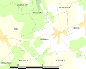
Feldbach
- commune in Haut-Rhin, France
Hiking in Feldbach
Feldbach is a charming commune located in the Haut-Rhin department of the Alsace region in northeastern France. This area is rich in natural beauty, making it a great destination for hiking enthusiasts. Here are some highlights and tips for hiking in and around Feldbach:...
- Country:
- Postal Code: 68640
- Coordinates: 47° 32' 8" N, 7° 15' 51" E
- GPS tracks (wikiloc): [Link]
- Area: 5.02 sq km
- Population: 439
- Web site: [Link]