Guengat (Guengat)

- commune in Finistère, France
- Country:

- Postal Code: 29180
- Coordinates: 48° 2' 31" N, 4° 12' 17" E


- GPS tracks (wikiloc): [Link]
- Area: 22.72 sq km
- Population: 1755
- Web site: http://www.guengat.fr
- Wikipedia en: wiki(en)
- Wikipedia: wiki(fr)
- Wikidata storage: Wikidata: Q431567
- Wikipedia Commons Gallery: [Link]
- Wikipedia Commons Category: [Link]
- Freebase ID: [/m/03gw044]
- Freebase ID: [/m/03gw044]
- GeoNames ID: Alt: [3014403]
- GeoNames ID: Alt: [3014403]
- SIREN number: [212900666]
- SIREN number: [212900666]
- BnF ID: [15254420x]
- BnF ID: [15254420x]
- INSEE municipality code: 29066
- INSEE municipality code: 29066
Shares border with regions:
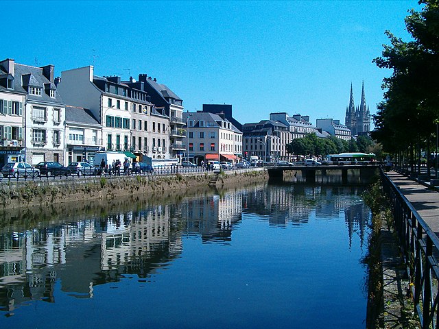

Quimper
- commune in Finistère, France
- Country:
- Postal Code: 29000
- Coordinates: 47° 59' 45" N, 4° 5' 52" E
- GPS tracks (wikiloc): [Link]
- AboveSeaLevel: 6 м m
- Area: 84.45 sq km
- Population: 63508
- Web site: [Link]


Le Juch
- commune in Finistère, France
- Country:
- Postal Code: 29100
- Coordinates: 48° 3' 58" N, 4° 15' 16" E
- GPS tracks (wikiloc): [Link]
- Area: 14.38 sq km
- Population: 725
- Web site: [Link]


Plogonnec
- commune in Finistère, France
- Country:
- Postal Code: 29180
- Coordinates: 48° 4' 40" N, 4° 11' 40" E
- GPS tracks (wikiloc): [Link]
- Area: 54.14 sq km
- Population: 3126
- Web site: [Link]


Gourlizon
- commune in Finistère, France
- Country:
- Postal Code: 29710
- Coordinates: 48° 1' 7" N, 4° 15' 58" E
- GPS tracks (wikiloc): [Link]
- Area: 9.91 sq km
- Population: 898
- Web site: [Link]


Plonéis
- commune in Finistère, France
- Country:
- Postal Code: 29710
- Coordinates: 48° 1' 1" N, 4° 12' 38" E
- GPS tracks (wikiloc): [Link]
- Area: 21.99 sq km
- Population: 2307
- Web site: [Link]