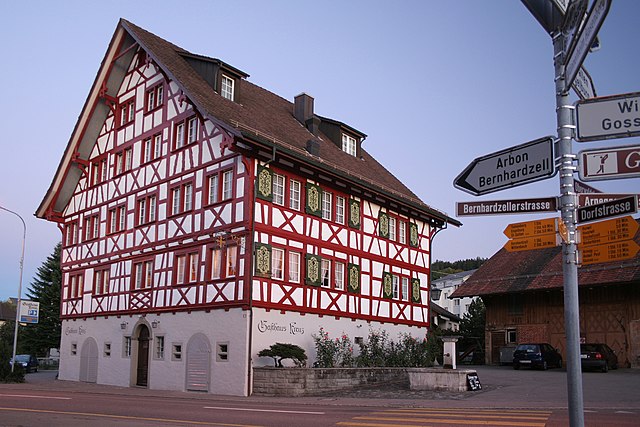
Häggenschwil (Häggenschwil)

- municipality in Switzerland
 Hiking in Häggenschwil
Häggenschwil is a picturesque village located near the city of St. Gallen in Switzerland, offering access to beautiful hiking opportunities. The region is characterized by its rolling hills, lush forests, and views of the surrounding landscape, making it a great destination for outdoor enthusiasts.
Hiking Trails
-
Hiking Routes: There are several well-marked trails around Häggenschwil that cater to various skill levels. You can find easy paths suitable for families as well as more challenging routes for seasoned hikers.
-
Scenic Views: The trails often provide stunning views of the Lake Constance region and the Alps on clear days. Look for viewpoints along the routes where you can pause and enjoy the scenery.
-
Natural Beauty: As you hike, you may encounter diverse flora and fauna, including wildflowers in the spring and summer, as well as beautiful forests that change color in the autumn.
Tips for Hiking in Häggenschwil
-
Gear Up: Ensure you have proper hiking boots, weather-appropriate clothing, and enough water and snacks.
-
Navigation: While trails are usually well-marked, consider taking a map or downloading a hiking app for added assistance in navigating.
-
Local Information: Check in with local tourist information centers for the latest trail conditions and any recommended routes.
-
Respect Nature: Follow the principles of Leave No Trace to keep the area pristine for future hikers.
Access and Transportation
Häggenschwil is easily accessible by public transport from major cities like St. Gallen. There are also parking options for those driving.
Conclusion
Hiking in Häggenschwil offers a delightful escape into nature with a chance to experience the stunning landscapes of Switzerland. Whether you are looking for a peaceful walk or an adventurous hike, you'll find something to suit your needs in this charming region.
- Country:

- Postal Code: 9312
- Local Dialing Code: 071
- Licence Plate Code: SG
- Coordinates: 47° 28' 59" N, 9° 21' 0" E


- GPS tracks (wikiloc): [Link]
- AboveSeaLevel: 554 м m
- Area: 9.10 sq km
- Population: 1332
- Web site: http://www.haeggenschwil.ch
- Wikipedia en: wiki(en)
- Wikipedia: wiki(de)
- Wikidata storage: Wikidata: Q66087
- Wikipedia Commons Category: [Link]
- Freebase ID: [/m/0glj_b]
- GeoNames ID: Alt: [2660425]
- VIAF ID: Alt: [240557015]
- OSM relation ID: [1683897]
- HDS ID: [1319]
- Swiss municipality code: [3201]
Shares border with regions:

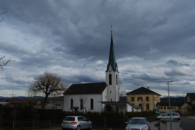
Waldkirch
- municipality in the canton of St. Gallen, Switzerland
Hiking in Waldkirch
Waldkirch is a charming village located in the scenic region of the Emmental in Switzerland, surrounded by picturesque landscapes that are perfect for hiking enthusiasts. Here are some highlights and tips for hiking in and around Waldkirch:...
- Country:
- Postal Code: 9205
- Local Dialing Code: 071
- Licence Plate Code: SG
- Coordinates: 47° 27' 59" N, 9° 16' 59" E
- GPS tracks (wikiloc): [Link]
- AboveSeaLevel: 629 м m
- Area: 31.25 sq km
- Population: 3498
- Web site: [Link]

Egnach
- municipality in Switzerland
Hiking in Egnach
Egnach is a charming village located in the canton of Thurgau, Switzerland, situated near the shores of Lake Constance. The area is known for its stunning natural beauty and offers various hiking opportunities that cater to all levels of hikers....
- Country:
- Postal Code: 9322
- Local Dialing Code: 071
- Licence Plate Code: TG
- Coordinates: 47° 31' 44" N, 9° 21' 55" E
- GPS tracks (wikiloc): [Link]
- AboveSeaLevel: 442 м m
- Area: 18.5 sq km
- Population: 4708
- Web site: [Link]
Zihlschlacht-Sitterdorf
- municipality in Switzerland
Hiking in Zihlschlacht-Sitterdorf
Zihlschlacht-Sitterdorf is a picturesque area located in the canton of Thurgau in Switzerland, known for its stunning landscapes and diverse hiking opportunities. Here’s a general overview of what you can expect when hiking in this beautiful region:...
- Country:
- Postal Code: 8588
- Local Dialing Code: 071
- Licence Plate Code: TG
- Coordinates: 47° 31' 0" N, 9° 15' 59" E
- GPS tracks (wikiloc): [Link]
- AboveSeaLevel: 527 м m
- Area: 12.2 sq km
- Population: 2367
- Web site: [Link]
Roggwil
- municipality of Switzerland
Hiking in Roggwil
Roggwil, located in the Thurgau region of Switzerland, offers a variety of hiking opportunities that cater to different skill levels and preferences. Here are some highlights and tips for hiking in this picturesque area:...
- Country:
- Postal Code: 9325
- Local Dialing Code: 071
- Licence Plate Code: TG
- Coordinates: 47° 29' 58" N, 9° 23' 42" E
- GPS tracks (wikiloc): [Link]
- AboveSeaLevel: 440 м m
- Area: 11.9 sq km
- Population: 3066
- Web site: [Link]


Wittenbach
- municipality in the canton of St. Gallen, Switzerland
Hiking in Wittenbach
Wittenbach is a beautiful area for hiking, located in the canton of St. Gallen in Switzerland. The region offers a mix of lush landscapes, scenic views, and well-marked trails that can cater to various skill levels. Here are some key points to consider if you're planning a hiking trip in Wittenbach:...
- Country:
- Postal Code: 9300
- Local Dialing Code: 071
- Licence Plate Code: SG
- Coordinates: 47° 28' 0" N, 9° 22' 46" E
- GPS tracks (wikiloc): [Link]
- AboveSeaLevel: 588 м m
- Area: 12.22 sq km
- Population: 9784
- Web site: [Link]

Hauptwil-Gottshaus
- municipality in Switzerland
Hiking in Hauptwil-Gottshaus
Hauptwil-Gottshaus is a charming area located in the Canton of Thurgau in Switzerland, known for its beautiful landscapes, rolling hills, and scenic trails. Hiking in this region offers a chance to experience the tranquility of the Swiss countryside, with a mix of forested areas, farmland, and stunning viewpoints....
- Country:
- Postal Code: 9213
- Local Dialing Code: 071
- Licence Plate Code: TG
- Coordinates: 47° 27' 59" N, 9° 16' 59" E
- GPS tracks (wikiloc): [Link]
- AboveSeaLevel: 550 м m
- Area: 12.5 sq km
- Population: 1943
- Web site: [Link]


Muolen
- municipality in Switzerland
Hiking in Muolen
Muolen is a charming region known for its scenic landscapes and outdoor activities, making it a fantastic destination for hikers. It offers a variety of trails that cater to different skill levels, from beginners to more experienced hikers. Here are some key aspects of hiking in Muolen:...
- Country:
- Postal Code: 9313
- Local Dialing Code: 071
- Licence Plate Code: SG
- Coordinates: 47° 31' 0" N, 9° 18' 59" E
- GPS tracks (wikiloc): [Link]
- AboveSeaLevel: 490 м m
- Area: 10.30 sq km
- Population: 1200
- Web site: [Link]