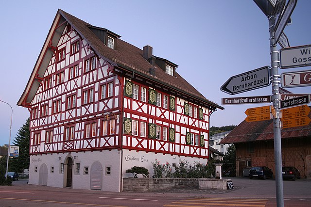
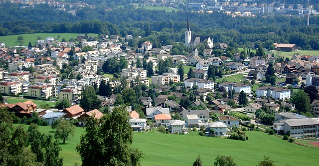
Wittenbach (Wittenbach SG)

- municipality in the canton of St. Gallen, Switzerland
 Hiking in Wittenbach
Wittenbach is a beautiful area for hiking, located in the canton of St. Gallen in Switzerland. The region offers a mix of lush landscapes, scenic views, and well-marked trails that can cater to various skill levels. Here are some key points to consider if you're planning a hiking trip in Wittenbach:
Trails and Routes
- Well-Marked Trails: Wittenbach has a network of well-marked hiking trails, ensuring that hikers can navigate easily without losing their way.
- Variety of Difficulty Levels: There are hikes suitable for beginners, families, and more experienced hikers, allowing everyone to enjoy the beautiful surroundings.
- Length and Duration: Hikes can vary from short loops to longer, more challenging routes. You can typically find trails that range from 1 to 4 hours in duration.
Scenic Views
- Panoramic Landscapes: Hiking in Wittenbach offers stunning views of the surrounding area, including rolling hills, forests, and the distant mountains of the Alps.
- Flora and Fauna: The area is rich in biodiversity, with opportunities to spot various flora and fauna, especially during spring and summer.
Accessibility
- Public Transport: Wittenbach is accessible by public transport from St. Gallen, making it easy to reach the starting points of many hiking trails.
- Trailheads: Popular trailheads can often be reached on foot from the local community, making it a great place to start your adventure.
Recommendations
- Best Time to Hike: Late spring to early autumn is the best season for hiking, as the weather is generally mild and the trails are clear.
- Safety Gear: Ensure you have the right footwear, plenty of water, and appropriate clothing for varying weather conditions.
- Map and Apps: While trails are generally well-marked, it’s always a good idea to carry a map or have a hiking app that works offline, just in case.
Nearby Attractions
- Cultural Sites: Consider checking out local cultural sites or enjoying the regional cuisine after your hike.
- Other Activities: Depending on the time of year, there may also be opportunities for mountain biking or winter sports in the area.
Overall, Wittenbach offers a fantastic hiking experience in a stunning natural setting. Whether you're looking for a leisurely walk or a more rigorous hike, you'll find plenty of options to explore. Happy hiking!
- Country:

- Postal Code: 9300
- Local Dialing Code: 071
- Licence Plate Code: SG
- Coordinates: 47° 28' 0" N, 9° 22' 46" E


- GPS tracks (wikiloc): [Link]
- AboveSeaLevel: 588 м m
- Area: 12.22 sq km
- Population: 9784
- Web site: http://www.wittenbach.ch
- Wikipedia en: wiki(en)
- Wikipedia: wiki(de)
- Wikidata storage: Wikidata: Q66056
- Wikipedia Commons Category: [Link]
- Freebase ID: [/m/0glkcr]
- GeoNames ID: Alt: [7287596]
- BnF ID: [122949394]
- VIAF ID: Alt: [148429645]
- OSM relation ID: [1683967]
- HDS ID: [1322]
- Swiss municipality code: [3204]
Shares border with regions:


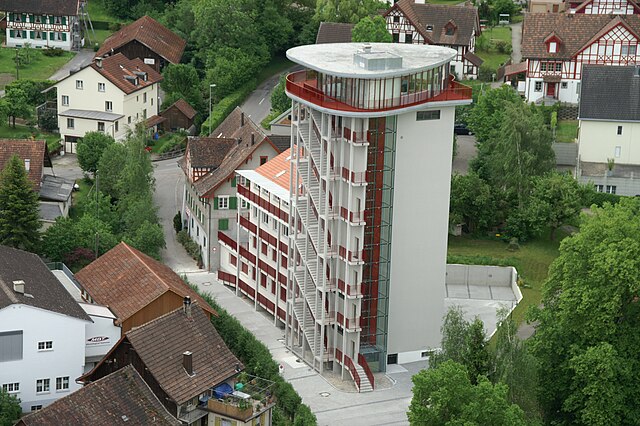
St. Gallen
- capital of St. Gallen canton in Switzerland
Hiking in St. Gallen
St. Gallen, located in the northeastern part of Switzerland, is an excellent destination for hiking enthusiasts. The region is characterized by stunning landscapes, including rolling hills, lush forests, and panoramic mountain views. Here are some highlights of hiking in and around St. Gallen:...
- Country:
- Postal Code: 9000
- Local Dialing Code: 071
- Licence Plate Code: SG
- Coordinates: 47° 25' 24" N, 9° 22' 38" E
- GPS tracks (wikiloc): [Link]
- AboveSeaLevel: 675 м m
- Area: 39.41 sq km
- Population: 75481
- Web site: [Link]

Waldkirch
- municipality in the canton of St. Gallen, Switzerland
Hiking in Waldkirch
Waldkirch is a charming village located in the scenic region of the Emmental in Switzerland, surrounded by picturesque landscapes that are perfect for hiking enthusiasts. Here are some highlights and tips for hiking in and around Waldkirch:...
- Country:
- Postal Code: 9205
- Local Dialing Code: 071
- Licence Plate Code: SG
- Coordinates: 47° 27' 59" N, 9° 16' 59" E
- GPS tracks (wikiloc): [Link]
- AboveSeaLevel: 629 м m
- Area: 31.25 sq km
- Population: 3498
- Web site: [Link]
Roggwil
- municipality of Switzerland
Hiking in Roggwil
Roggwil, located in the Thurgau region of Switzerland, offers a variety of hiking opportunities that cater to different skill levels and preferences. Here are some highlights and tips for hiking in this picturesque area:...
- Country:
- Postal Code: 9325
- Local Dialing Code: 071
- Licence Plate Code: TG
- Coordinates: 47° 29' 58" N, 9° 23' 42" E
- GPS tracks (wikiloc): [Link]
- AboveSeaLevel: 440 м m
- Area: 11.9 sq km
- Population: 3066
- Web site: [Link]


Häggenschwil
- municipality in Switzerland
Hiking in Häggenschwil
Häggenschwil is a picturesque village located near the city of St. Gallen in Switzerland, offering access to beautiful hiking opportunities. The region is characterized by its rolling hills, lush forests, and views of the surrounding landscape, making it a great destination for outdoor enthusiasts....
- Country:
- Postal Code: 9312
- Local Dialing Code: 071
- Licence Plate Code: SG
- Coordinates: 47° 28' 59" N, 9° 21' 0" E
- GPS tracks (wikiloc): [Link]
- AboveSeaLevel: 554 м m
- Area: 9.10 sq km
- Population: 1332
- Web site: [Link]


Mörschwil
- municipality in Switzerland
Hiking in Mörschwil
Mörschwil is a charming municipality located in the canton of St. Gallen, Switzerland. With its picturesque landscapes and proximity to Lake Constance, it offers a variety of hiking opportunities that cater to different skill levels and preferences. Here are some highlights:...
- Country:
- Postal Code: 9402
- Local Dialing Code: 071
- Licence Plate Code: SG
- Coordinates: 47° 28' 3" N, 9° 25' 34" E
- GPS tracks (wikiloc): [Link]
- AboveSeaLevel: 551 м m
- Area: 9.83 sq km
- Population: 3583
- Web site: [Link]

Gaiserwald
- municipality in Switzerland
Hiking in Gaiserwald
Gaiserwald is a beautiful area in Switzerland, known for its picturesque landscapes and diverse hiking trails. Here are some key points to consider when hiking in Gaiserwald:...
- Country:
- Postal Code: 9030
- Local Dialing Code: 071
- Licence Plate Code: SG
- Coordinates: 47° 25' 49" N, 9° 19' 39" E
- GPS tracks (wikiloc): [Link]
- AboveSeaLevel: 650 м m
- Area: 12.64 sq km
- Population: 8368
- Web site: [Link]


Berg
- municipality in the canton of St. Gallen, Switzerland
Hiking in Berg
Berg, located in the St. Gallen region of Switzerland, offers beautiful hiking opportunities with stunning natural landscapes, scenic vistas, and a variety of trails suitable for different skill levels. Here are some highlights and considerations for hiking in the area:...
- Country:
- Postal Code: 9305
- Local Dialing Code: 071
- Licence Plate Code: SG
- Coordinates: 47° 29' 5" N, 9° 24' 12" E
- GPS tracks (wikiloc): [Link]
- AboveSeaLevel: 535 м m
- Area: 3.74 sq km
- Population: 823
- Web site: [Link]