
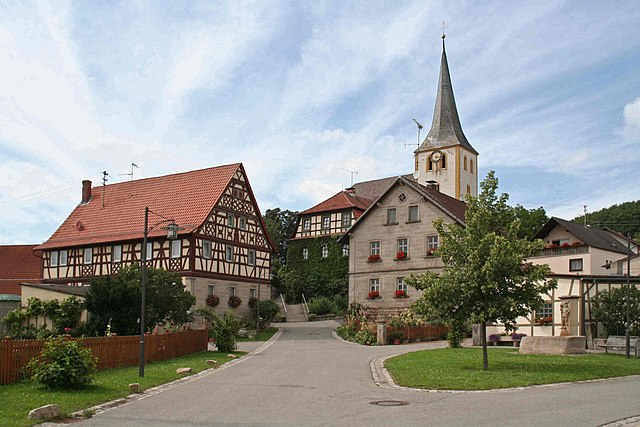
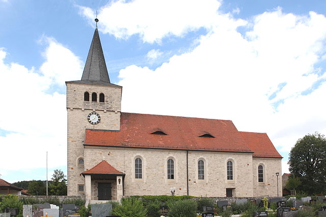
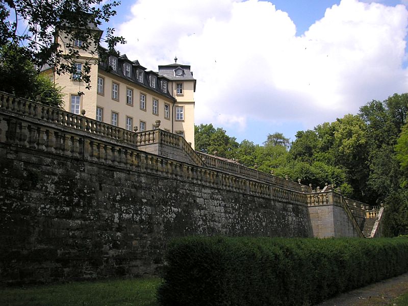
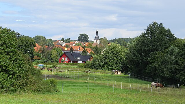
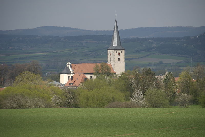
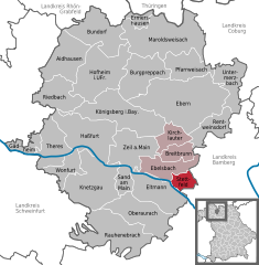
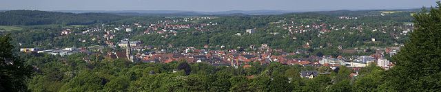
Haßberge (Landkreis Haßberge)

- district in Bavaria, Germany
 Hiking in Haßberge
The Haßberge district, located in the northern part of Bavaria, Germany, is known for its beautiful landscapes, rolling hills, dense forests, and quaint villages, making it an excellent destination for hiking enthusiasts. Here are some key points about hiking in the Haßberge district:
Scenic Trails
-
Nature Trails: The region offers a variety of well-marked trails that cater to different skill levels, from easy walks to more challenging hikes. The diverse terrain provides hikers with stunning views of the valleys, forests, and the distinctive sandstone formations.
-
Hiking Loops: Many trails form loops, allowing hikers to explore various sections of the landscape without retracing their steps. The "Haßberge Trail," for instance, is a well-known long-distance hiking trail that spans the entire district.
Notable Highlights
-
Burg Rieneck: This medieval castle offers a rewarding view after a hike. The trails surrounding this site lead through charming scenery and historical landmarks.
-
The Haßberge Nature Park: This park features a network of hiking paths that delve deep into the natural beauty of the area, showcasing local flora and fauna.
-
Charming Villages: As you hike, you can explore small villages like Ebern and Seßlach, which are steeped in history and offer a glimpse of traditional Bavarian architecture.
Best Time to Hike
- Spring and Fall: These seasons tend to have mild weather, perfect for hiking, with spring flowers or fall foliage enhancing the experience.
- Summer: While the temperatures can be warmer, early morning or late afternoon hikes can be very enjoyable.
Practical Tips
- Trail Maps: It’s advisable to carry a detailed map or a hiking app, as mobile coverage can be spotty in remote areas.
- Appropriate Gear: Wear sturdy hiking boots, and carry plenty of water, snacks, and first-aid supplies.
- Weather Check: Always check the weather forecast before heading out, as conditions can change quickly in mountainous areas.
Local Culture
Hiking in the Haßberge district also allows you to experience local culture and cuisine. After a day on the trails, you can enjoy regional dishes at local Gasthäuser (guesthouses) or visit local markets to try traditional Bavarian snacks.
Hiking in Haßberge is a blend of outdoor adventure, cultural exploration, and relaxation amidst nature, making it a wonderful destination for both seasoned hikers and those looking to enjoy a leisurely walk in the countryside.
- Country:

- Capital: Haßfurt
- Licence Plate Code: HAS
- Coordinates: 50° 4' 48" N, 10° 40' 12" E


- GPS tracks (wikiloc): [Link]
- AboveSeaLevel: 368 м m
- Area: 956.00 sq km
- Population: 80257
- Web site: http://www.hassberge.de/
- Wikipedia en: wiki(en)
- Wikipedia: wiki(de)
- Wikidata storage: Wikidata: Q10462
- Wikipedia Commons Category: [Link]
- Freebase ID: [/m/01v4gd]
- GeoNames ID: Alt: [2909461]
- VIAF ID: Alt: [242069410]
- OSM relation ID: [62520]
- GND ID: Alt: [4023609-2]
- archINFORM location ID: [3834]
- TGN ID: [7077080]
- Bavarikon ID: [ODB_A00000329]
- NUTS code: [DE267]
- BabelNet ID: [02538598n]
- German district key: 09674
Includes regions:


Hofheim
- municipality of Germany
Hiking in Hofheim
Hofheim, located in Bavaria, Germany, is nestled in a picturesque area that offers a range of hiking opportunities. The region is characterized by its scenic landscapes, rolling hills, forests, and charming villages. Here are some highlights and tips for hiking in and around Hofheim:...
- Country:
- Postal Code: 97461
- Local Dialing Code: 09523
- Coordinates: 50° 8' 0" N, 10° 31' 0" E
- GPS tracks (wikiloc): [Link]
- AboveSeaLevel: 250 м m
- Area: 56.35 sq km
- Population: 5007
- Web site: [Link]

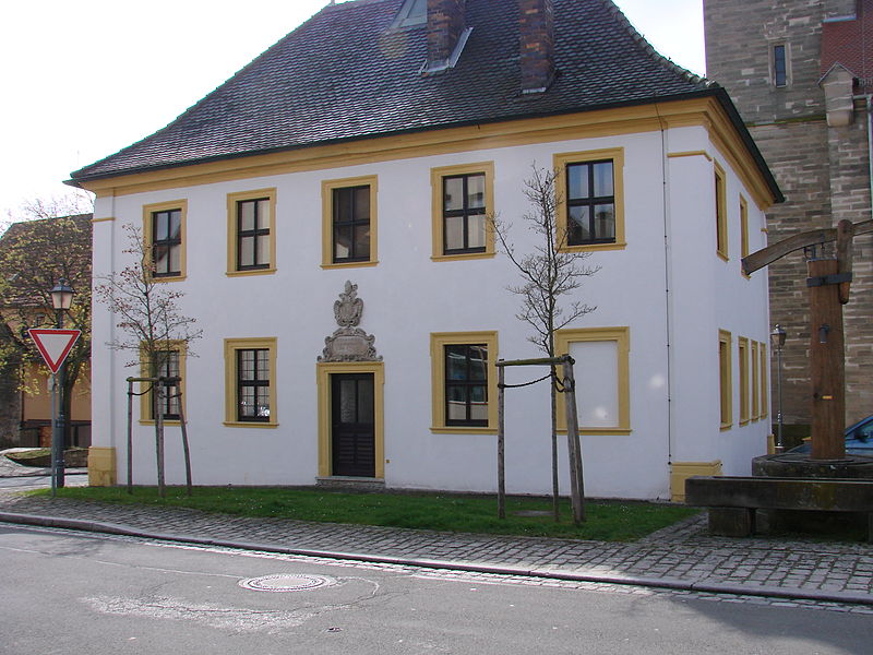
Zeil am Main
- town in the Haßberge district of Germany
Hiking in Zeil am Main
Zeil am Main, located in Bavaria, Germany, is a charming town surrounded by beautiful landscapes ideal for hiking enthusiasts. The region offers a variety of trails that cater to different skill levels, making it accessible for both beginners and experienced hikers....
- Country:
- Postal Code: 97475
- Local Dialing Code: 09524
- Licence Plate Code: HAS
- Coordinates: 50° 1' 0" N, 10° 36' 0" E
- GPS tracks (wikiloc): [Link]
- AboveSeaLevel: 230 м m
- Area: 35.74 sq km
- Population: 5597
- Web site: [Link]

Theres
- municipality of Germany
Hiking in Theres
Theres, a small town located in the Bamberg district of Bavaria, Germany, offers a unique setting for hikers. While it may not be as well-known as some larger hiking destinations, it is surrounded by picturesque landscapes, forests, and trails that cater to various skill levels....
- Country:
- Postal Code: 97531
- Local Dialing Code: 09528; 09521
- Licence Plate Code: HAS
- Coordinates: 50° 0' 0" N, 10° 25' 40" E
- GPS tracks (wikiloc): [Link]
- AboveSeaLevel: 250 м m
- Area: 30.79 sq km
- Population: 2375
- Web site: [Link]


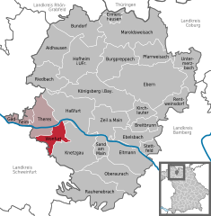
Sand am Main
- municipality in the district of Haßberge in Bavaria in Germany
Hiking in Sand am Main
Sand am Main is a picturesque town located in Bavaria, Germany, and offers a variety of beautiful hiking opportunities. The surrounding landscapes are characterized by rolling hills, forests, and the scenic riverbanks of the Main River. Here are some highlights and tips for hiking in and around Sand am Main:...
- Country:
- Postal Code: 97522
- Local Dialing Code: 09524
- Licence Plate Code: HAS
- Coordinates: 49° 59' 0" N, 10° 36' 0" E
- GPS tracks (wikiloc): [Link]
- AboveSeaLevel: 227 м m
- Area: 12.28 sq km
- Population: 2596
- Web site: [Link]

Oberaurach
- municipality of Germany
Hiking in Oberaurach
Oberaurach, located in Bavaria, Germany, offers a variety of hiking opportunities amid picturesque landscapes. This area is characterized by rolling hills, wooded paths, and scenic views, making it a suitable destination for both casual hikers and more experienced trekkers....
- Country:
- Postal Code: 97514
- Local Dialing Code: 09529
- Licence Plate Code: HAS
- Coordinates: 49° 55' 0" N, 10° 37' 0" E
- GPS tracks (wikiloc): [Link]
- AboveSeaLevel: 350 м m
- Area: 36.76 sq km
- Population: 3901
- Web site: [Link]

Ebern
- municipality of Germany
Hiking in Ebern
Ebern is a charming town located in the Bavaria region of Germany, offering a variety of hiking opportunities across beautiful landscapes. Here are some highlights about hiking in and around Ebern:...
- Country:
- Postal Code: 96106
- Local Dialing Code: 09531
- Coordinates: 50° 6' 0" N, 10° 47' 37" E
- GPS tracks (wikiloc): [Link]
- AboveSeaLevel: 270 м m
- Area: 95.02 sq km
- Population: 7067
- Web site: [Link]
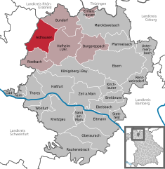
Aidhausen
- municipality of Germany
Hiking in Aidhausen
Aidhausen is a small village located in Bavaria, Germany, that offers a range of hiking opportunities in a picturesque setting. The surrounding area is known for its rolling hills, forests, and scenic views, making it a great destination for outdoor enthusiasts....
- Country:
- Postal Code: 97491
- Local Dialing Code: 09523
- Licence Plate Code: HAS
- Coordinates: 50° 9' 18" N, 10° 26' 9" E
- GPS tracks (wikiloc): [Link]
- AboveSeaLevel: 292 м m
- Area: 37.3 sq km
- Population: 1911
- Web site: [Link]


Haßfurt
- city in Germany
Hiking in Haßfurt
Haßfurt, located in Bavaria, Germany, is known for its picturesque landscapes and charming countryside, making it a lovely destination for hiking enthusiasts. The region is characterized by its rolling hills, vineyards, and the nearby Main River, providing a variety of trails for hikers of different skill levels....
- Country:
- Postal Code: 97437
- Local Dialing Code: 09521
- Licence Plate Code: HAS
- Coordinates: 50° 1' 0" N, 10° 30' 0" E
- GPS tracks (wikiloc): [Link]
- AboveSeaLevel: 220 м m
- Area: 52.77 sq km
- Population: 13277
- Web site: [Link]


Gädheim
- municipality of Germany
Hiking in Gädheim
Gädheim is a charming village located in Germany, specifically in the Bavaria region. While it might not be widely known for extensive hiking trails, the surrounding area offers beautiful landscapes and outdoor activities suitable for hiking enthusiasts....
- Country:
- Postal Code: 97503
- Local Dialing Code: 09727
- Licence Plate Code: HAS
- Coordinates: 50° 2' 0" N, 10° 21' 0" E
- GPS tracks (wikiloc): [Link]
- AboveSeaLevel: 228 м m
- Area: 9.58 sq km
- Population: 1085
- Web site: [Link]


Kirchlauter
- municipality of Germany
Hiking in Kirchlauter
Kirchlauter is a picturesque village located in Bavaria, Germany, known for its scenic landscapes and outdoor activities, including hiking. The area around Kirchlauter offers a variety of hiking trails suitable for different skill levels, ranging from leisurely walks to more challenging hikes....
- Country:
- Postal Code: 96166
- Local Dialing Code: 09536
- Licence Plate Code: HAS
- Coordinates: 50° 2' 39" N, 10° 43' 4" E
- GPS tracks (wikiloc): [Link]
- AboveSeaLevel: 344 м m
- Area: 16.91 sq km
- Population: 1391
- Web site: [Link]


Maroldsweisach
- human settlement in Germany
Hiking in Maroldsweisach
Maroldsweisach is a charming town in Bavaria, Germany, nestled in the picturesque landscape of the Franconian region. The area offers a variety of hiking opportunities for outdoor enthusiasts of all skill levels. Here are some key points to consider when hiking in and around Maroldsweisach:...
- Country:
- Postal Code: 96126
- Local Dialing Code: 09532
- Licence Plate Code: HAS
- Coordinates: 50° 11' 51" N, 10° 39' 49" E
- GPS tracks (wikiloc): [Link]
- AboveSeaLevel: 334 м m
- Area: 71.87 sq km
- Population: 3339
- Web site: [Link]


Burgpreppach
- human settlement in Germany
Hiking in Burgpreppach
Burgpreppach is a quaint village located in the Lower Franconia region of Bavaria, Germany. Known for its picturesque landscapes, it can be an appealing destination for hiking enthusiasts. While it may not be as famous as larger hiking regions, it offers some lovely trails that provide opportunities to enjoy the natural beauty of Franconian countryside....
- Country:
- Postal Code: 97496
- Local Dialing Code: 09534
- Licence Plate Code: HAS
- Coordinates: 50° 8' 30" N, 10° 39' 0" E
- GPS tracks (wikiloc): [Link]
- AboveSeaLevel: 290 м m
- Area: 38.76 sq km
- Population: 1535
- Web site: [Link]


Rauhenebrach
- municipality of Germany
Hiking in Rauhenebrach
Rauhenebrach, located in Bavaria, Germany, is a quaint village nestled within the picturesque landscapes of the Franconian region. It offers a range of hiking opportunities for outdoor enthusiasts, featuring scenic trails that wind through lush forests, rolling hills, and beautiful meadows....
- Country:
- Postal Code: 96181
- Local Dialing Code: 09554
- Licence Plate Code: HAS
- Coordinates: 49° 53' 0" N, 10° 37' 0" E
- GPS tracks (wikiloc): [Link]
- AboveSeaLevel: 320 м m
- Area: 61.07 sq km
- Population: 3078
- Web site: [Link]

Breitbrunn
- municipality of Germany
Hiking in Breitbrunn
Breitbrunn is a charming village located in Bavaria, Germany, near the scenic Chiemsee, which is often referred to as the "Bavarian Sea." It offers a variety of hiking opportunities that cater to different skill levels and provide beautiful views of the lake, the surrounding countryside, and the Alps....
- Country:
- Postal Code: 96151
- Local Dialing Code: 09536
- Licence Plate Code: HAS
- Coordinates: 50° 1' 0" N, 10° 42' 0" E
- GPS tracks (wikiloc): [Link]
- AboveSeaLevel: 294 м m
- Area: 12.41 sq km
- Population: 961
- Web site: [Link]


Riedbach
- municipality of Germany
Hiking in Riedbach
Riedbach is likely a picturesque location offering various hiking opportunities, but since there could be multiple places with similar names, I will provide general advice for hiking in scenic areas that could relate to Riedbach, particularly if it's located in the Alps or a similar mountainous region....
- Country:
- Postal Code: 97519
- Local Dialing Code: 09526
- Licence Plate Code: HAS
- Coordinates: 50° 6' 0" N, 10° 26' 0" E
- GPS tracks (wikiloc): [Link]
- AboveSeaLevel: 285 м m
- Area: 31.67 sq km
- Population: 1724
- Web site: [Link]


Pfarrweisach
- municipality of Germany
Hiking in Pfarrweisach
Pfarrweisach is a small village located in Bavaria, Germany, and while it might not be as famous as some larger hiking destinations, it offers a charming experience for those looking to enjoy the outdoors. Here are some key points about hiking in and around Pfarrweisach:...
- Country:
- Postal Code: 96176
- Local Dialing Code: 09535
- Licence Plate Code: HAS
- Coordinates: 50° 9' 0" N, 10° 44' 0" E
- GPS tracks (wikiloc): [Link]
- AboveSeaLevel: 285 м m
- Area: 28.43 sq km
- Population: 1595
- Web site: [Link]


Eltmann
- human settlement in Germany
Hiking in Eltmann
Eltmann, located in Bavaria, Germany, offers a charming backdrop for hiking enthusiasts. Nestled near the banks of the River Main, it features a variety of trails that cater to different skill levels and preferences. Here are some highlights of hiking in and around Eltmann:...
- Country:
- Postal Code: 97483
- Local Dialing Code: 09522
- Licence Plate Code: HAS
- Coordinates: 49° 58' 0" N, 10° 40' 0" E
- GPS tracks (wikiloc): [Link]
- AboveSeaLevel: 237 м m
- Area: 39.97 sq km
- Population: 5238
- Web site: [Link]


Rentweinsdorf
- municipality in the district of Haßberge in Bavaria in Germany
Hiking in Rentweinsdorf
Rentweinsdorf is a small village in the Bavaria region of Germany, which can offer a charming backdrop for hiking enthusiasts. While it may not be as well-known as larger hiking destinations, the area has its own unique appeal with beautiful landscapes and local nature....
- Country:
- Postal Code: 96184
- Local Dialing Code: 09536; 09531
- Licence Plate Code: HAS
- Coordinates: 50° 4' 0" N, 10° 48' 0" E
- GPS tracks (wikiloc): [Link]
- AboveSeaLevel: 266 м m
- Area: 24.62 sq km
- Population: 1361
- Web site: [Link]

Wonfurt
- municipality of Germany
Hiking in Wonfurt
Würzburg is a beautiful region in Germany known for its picturesque landscapes, rolling hills, and historical sites. When considering hiking in the area around Wonfurt, you'll likely find several trails that showcase the natural beauty of the Franconian countryside....
- Country:
- Postal Code: 97539
- Local Dialing Code: 09521
- Licence Plate Code: HAS
- Coordinates: 50° 1' 0" N, 10° 28' 0" E
- GPS tracks (wikiloc): [Link]
- AboveSeaLevel: 220 м m
- Area: 17.36 sq km
- Population: 1930
- Web site: [Link]

Untermerzbach
- municipality of Germany
Hiking in Untermerzbach
Untermerzbach is a charming village located in the Bavaria region of Germany. It offers various hiking opportunities for outdoor enthusiasts, as it is surrounded by beautiful countryside, forests, and scenic views. Here are some highlights and tips for hiking in the area:...
- Country:
- Postal Code: 96190
- Local Dialing Code: 09533
- Licence Plate Code: HAS
- Coordinates: 50° 7' 46" N, 10° 51' 36" E
- GPS tracks (wikiloc): [Link]
- AboveSeaLevel: 264 м m
- Area: 27.75 sq km
- Population: 1757
- Web site: [Link]

Ermershausen
- municipality of Germany
Hiking in Ermershausen
Ermershausen is a small village located in the scenic regions of Germany, which is often characterized by its natural beauty and tranquility. Hiking in and around Ermershausen can offer a peaceful retreat into nature, showcasing the picturesque landscapes typical of this part of the country....
- Country:
- Postal Code: 96126
- Local Dialing Code: 09532
- Licence Plate Code: HAS
- Coordinates: 50° 13' 0" N, 10° 37' 0" E
- GPS tracks (wikiloc): [Link]
- AboveSeaLevel: 339 м m
- Area: 9.21 sq km
- Population: 573
- Web site: [Link]

Knetzgau
- municipality of Germany
Hiking in Knetzgau
Knetzgau is a charming municipality located in the Franconia region of Bavaria, Germany. The area is surrounded by scenic landscapes, including rolling hills, forests, and rivers, making it a great destination for hiking enthusiasts. Here are some highlights and tips for hiking in Knetzgau:...
- Country:
- Postal Code: 97478
- Local Dialing Code: 09527
- Licence Plate Code: HAS
- Coordinates: 49° 59' 0" N, 10° 33' 0" E
- GPS tracks (wikiloc): [Link]
- AboveSeaLevel: 238 м m
- Area: 43.98 sq km
- Population: 6396
- Web site: [Link]


Ebelsbach
- municipality of Germany
Hiking in Ebelsbach
Ebelsbach is a small town located in Bavaria, Germany, and while it may not be as famous for hiking as some of the larger national parks or mountainous regions, it does offer some beautiful opportunities for outdoor activities. The surrounding area features picturesque landscapes, rolling hills, and quaint countryside, making it suitable for nature walks and hikes....
- Country:
- Postal Code: 97500
- Local Dialing Code: 09522
- Licence Plate Code: HAS
- Coordinates: 49° 59' 0" N, 10° 41' 0" E
- GPS tracks (wikiloc): [Link]
- AboveSeaLevel: 228 м m
- Area: 25.76 sq km
- Population: 3549
- Web site: [Link]


Bundorf
- municipality of Germany
Hiking in Bundorf
Bundorf is a charming village located in Germany, particularly known for its scenic landscapes and nature trails. Although it may not be as widely recognized as some other hiking destinations, it offers a peaceful environment for outdoor enthusiasts....
- Country:
- Postal Code: 97494
- Local Dialing Code: 09763; 09523
- Licence Plate Code: HAS
- Coordinates: 50° 13' 0" N, 10° 31' 0" E
- GPS tracks (wikiloc): [Link]
- AboveSeaLevel: 326 м m
- Area: 40.24 sq km
- Population: 1050
- Web site: [Link]


Königsberg in Bayern
- town in the Haßberge district, in Lower Franconia, Bavaria, Germany
Hiking in Königsberg in Bayern
Königsberg, located in Bavaria, Germany, offers a mix of natural beauty and historical intrigue for hiking enthusiasts. The region is characterized by rolling hills, dense forests, and picturesque landscapes, making it an excellent choice for outdoor activities....
- Country:
- Postal Code: 97486
- Local Dialing Code: 09525
- Licence Plate Code: HAS
- Coordinates: 50° 4' 40" N, 10° 34' 0" E
- GPS tracks (wikiloc): [Link]
- AboveSeaLevel: 280 м m
- Area: 61.86 sq km
- Population: 3596
- Web site: [Link]

Stettfeld
- municipality of Germany
Hiking in Stettfeld
Stettfeld is a small village in Germany, located near the city of Bamberg in Bavaria. While it may not be widely known as a hiking hotspot, the surrounding area offers beautiful landscapes and opportunities for walking and hiking enthusiasts....
- Country:
- Postal Code: 96188
- Local Dialing Code: 09522
- Licence Plate Code: HAS
- Coordinates: 49° 58' 19" N, 10° 43' 26" E
- GPS tracks (wikiloc): [Link]
- AboveSeaLevel: 240 м m
- Area: 11.16 sq km
- Population: 1024
- Web site: [Link]
Shares border with regions:
Coburg
- district in Bavaria, Germany
Hiking in Coburg
Coburg district, located in Bavaria, Germany, offers a variety of hiking opportunities for outdoor enthusiasts. The region is characterized by beautiful landscapes, including rolling hills, woodlands, and scenic views that make for enjoyable hiking experiences....
- Country:
- Capital: Coburg
- Licence Plate Code: NEC; CO
- Coordinates: 50° 16' 0" N, 10° 55' 0" E
- GPS tracks (wikiloc): [Link]
- AboveSeaLevel: 306 м m
- Area: 592.00 sq km
- Population: 82033
- Web site: [Link]
Bamberg
- district in Bavaria, Germany
Hiking in Bamberg
Bamberg district, located in Bavaria, Germany, offers a variety of scenic hiking opportunities amidst its charming landscapes, historical sites, and cultural attractions. Here’s an overview of what you can expect when hiking in the region:...
- Country:
- Capital: Bamberg
- Licence Plate Code: BA
- Coordinates: 49° 49' 48" N, 10° 49' 48" E
- GPS tracks (wikiloc): [Link]
- AboveSeaLevel: 275 м m
- Area: 1168.00 sq km
- Population: 119829
- Web site: [Link]

Schweinfurt
- district of Bavaria, Germany
Hiking in Schweinfurt
Schweinfurt, located in the northern part of Bavaria, Germany, offers a variety of hiking opportunities that showcase the beautiful landscapes of the region. The area is characterized by rolling hills, forests, and scenic valleys, making it ideal for both leisurely strolls and more challenging hikes....
- Country:
- Capital: Schweinfurt
- Licence Plate Code: GEO; SW
- Coordinates: 50° 1' 12" N, 10° 15' 36" E
- GPS tracks (wikiloc): [Link]
- AboveSeaLevel: 222 м m
- Area: 842.00 sq km
- Population: 103697
- Web site: [Link]

Rhön-Grabfeld
- district in Bavaria, Germany
Hiking in Rhön-Grabfeld
Rhön-Grabfeld is a picturesque region located in Bavaria, Germany, renowned for its scenic landscapes, rolling hills, and rich natural beauty. It comprises part of the UNESCO Biosphere Reserve Rhön, which is characterized by its unique geology, biodiversity, and well-maintained hiking trails....
- Country:
- Capital: Bad Neustadt an der Saale
- Licence Plate Code: MET; KÖN; NES
- Coordinates: 50° 19' 48" N, 10° 15' 0" E
- GPS tracks (wikiloc): [Link]
- AboveSeaLevel: 320 м m
- Area: 1022.00 sq km
- Population: 77197
- Web site: [Link]
Hildburghausen
- district of Thuringia, Germany
Hiking in Hildburghausen
Hildburghausen is a picturesque district located in the state of Thuringia, Germany, known for its diverse landscapes, history, and plenty of outdoor activities, including hiking. Here are some highlights for hiking in the Hildburghausen district:...
- Country:
- Licence Plate Code: HBN
- Coordinates: 50° 25' 12" N, 10° 45' 0" E
- GPS tracks (wikiloc): [Link]
- AboveSeaLevel: 482 м m
- Area: 938.42 sq km
- Population: 64524
- Web site: [Link]