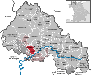
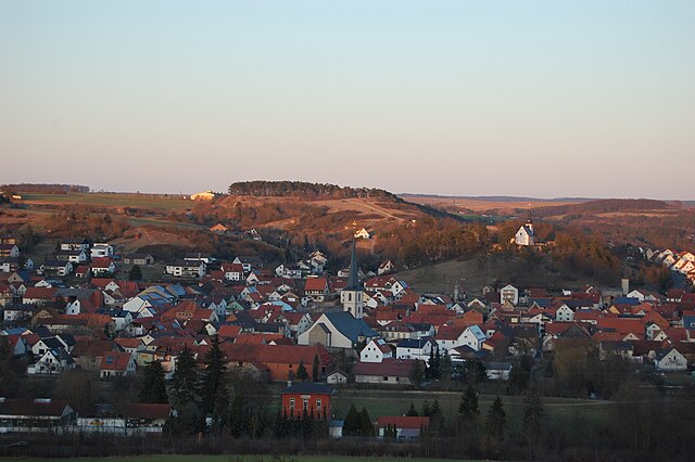
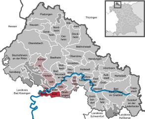
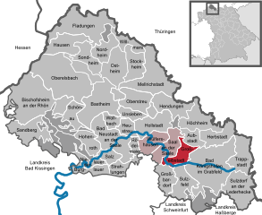
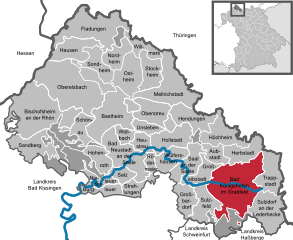
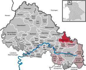
Rhön-Grabfeld (Landkreis Rhön-Grabfeld)

- district in Bavaria, Germany
 Hiking in Rhön-Grabfeld
Rhön-Grabfeld is a picturesque region located in Bavaria, Germany, renowned for its scenic landscapes, rolling hills, and rich natural beauty. It comprises part of the UNESCO Biosphere Reserve Rhön, which is characterized by its unique geology, biodiversity, and well-maintained hiking trails.
Key Features for Hiking in Rhön-Grabfeld:
-
Diverse Trails: The region offers a variety of hiking trails suitable for all experience levels. You can find gentle walks for beginners and more challenging routes for seasoned hikers. Popular trails include the Bayerischer Veldensteinweg and various circular trails that provide stunning views of the surrounding landscapes.
-
Scenic Views: Hikers can enjoy breathtaking views of mountains, valleys, and historical landmarks. The Kuppenrhön area, with its distinctive hilltops, offers panoramic vistas that are especially stunning during sunrise and sunset.
-
Flora and Fauna: The Rhön-Grabfeld region is home to diverse ecosystems. As you hike, you might encounter various plant species, wildflowers, and wildlife. Look for the famous "Rhön sheep," a local breed known for grazing in the pastures.
-
Cultural Heritage: Along the trails, you can explore charming villages, historical sites, and traditional Bavarian culture. Keep an eye out for local farms, blacksmiths, and outdoor markets.
-
Well-Marked Trails: The trails in Rhön-Grabfeld are well-marked, making it easy to navigate. Look for the distinctive signage that indicates various routes, distances, and points of interest.
-
Hiking Season: The best time for hiking in this region is typically from late spring to early autumn when the weather is mild, and the flora is in full bloom. However, winter hiking is also popular, especially for those interested in snowshoeing.
-
Safety Considerations: Always check the weather conditions before heading out, wear appropriate footwear, and take plenty of water and snacks. It's also advisable to carry a map or GPS device, especially when exploring less-trailed areas.
-
Local Amenities: The region has plenty of guesthouses, restaurants, and cafes where hikers can rest and enjoy local cuisine after a day of exploring.
Conclusion
Hiking in Rhön-Grabfeld provides a fantastic opportunity to immerse yourself in nature while enjoying a mix of scenic beauty and cultural experiences. Whether you're looking for a casual walk or a demanding hike, the region has something to offer every outdoor enthusiast.
- Country:

- Capital: Bad Neustadt an der Saale
- Licence Plate Code: MET; KÖN; NES
- Coordinates: 50° 19' 48" N, 10° 15' 0" E


- GPS tracks (wikiloc): [Link]
- AboveSeaLevel: 320 м m
- Area: 1022.00 sq km
- Population: 77197
- Web site: http://www.rhoen-grabfeld.de/
- Wikipedia en: wiki(en)
- Wikipedia: wiki(de)
- Wikidata storage: Wikidata: Q10465
- Wikipedia Commons Category: [Link]
- Freebase ID: [/m/02btpk]
- GeoNames ID: Alt: [2847553]
- VIAF ID: Alt: [312793214]
- OSM relation ID: [62739]
- GND ID: Alt: [4076712-7]
- archINFORM location ID: [2586]
- Library of Congress authority ID: Alt: [n79016872]
- TGN ID: [7111927]
- Bavarikon ID: [ODB_A00000291]
- NUTS code: [DE266]
- German district key: 09673
Includes regions:


Bundorfer Forst
- unincorporated area in Germany
Hiking in Bundorfer Forst
Bundorfer Forst, located in Germany, is a beautiful forest area that offers a variety of hiking opportunities for outdoor enthusiasts. The region is known for its picturesque landscapes, diverse flora and fauna, and well-maintained trails, making it an excellent destination for both casual walkers and seasoned hikers....
- Country:
- Coordinates: 50° 13' 28" N, 10° 27' 11" E
- GPS tracks (wikiloc): [Link]
Burgwallbacher Forst
- unincorporated area in Germany
Hiking in Burgwallbacher Forst
Burgwallbacher Forst is a beautiful forested area located in Germany, ideal for outdoor activities like hiking. The area is characterized by its serene landscapes, diverse flora and fauna, and well-marked trails. Here are some key points to consider if you're planning a hike in Burgwallbacher Forst:...
- Country:
- Coordinates: 50° 21' 48" N, 10° 3' 55" E
- GPS tracks (wikiloc): [Link]
- AboveSeaLevel: 436 м m
Sulzfelder Forst
- unincorporated area in Germany
Hiking in Sulzfelder Forst
Sulzfelder Forst is a forested area located near the town of Sulzfeld in Germany. It offers a variety of hiking opportunities for outdoor enthusiasts. Here are some key points to consider when hiking in this picturesque region:...
- Country:
- Coordinates: 50° 13' 45" N, 10° 25' 51" E
- GPS tracks (wikiloc): [Link]


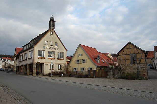
Wollbach
- municipality of Germany
Hiking in Wollbach
Wollbach is a charming village located in the Rhön-Grabfeld district of Bavaria, Germany, nestled in the beautiful Rhön mountain range. This area is known for its rolling landscapes, rich natural beauty, and a variety of hiking opportunities that cater to different skill levels....
- Country:
- Postal Code: 97618
- Local Dialing Code: 09773
- Licence Plate Code: NES
- Coordinates: 50° 21' 57" N, 10° 13' 25" E
- GPS tracks (wikiloc): [Link]
- AboveSeaLevel: 266 м m
- Area: 7.58 sq km
- Population: 1146
- Web site: [Link]
Weigler
- unincorporated area in Germany
Hiking in Weigler
It seems there might be a misunderstanding with the name "Weigler." It doesn't correspond to a well-known hiking location or area as of my last update in October 2023. It's possible you might be referring to a specific trail or a less-known region....
- Country:
- Coordinates: 50° 21' 28" N, 10° 23' 22" E
- GPS tracks (wikiloc): [Link]
Mellrichstadter Forst
- unincorporated area in Germany
Hiking in Mellrichstadter Forst
Mellrichstadter Forst, located in Bavaria, Germany, is an ideal destination for hiking enthusiasts. This forested area offers a variety of trails suitable for different skill levels, making it perfect for both beginners and seasoned hikers....
- Country:
- Coordinates: 50° 30' 57" N, 10° 11' 59" E
- GPS tracks (wikiloc): [Link]
Steinacher Forst rechts der Saale
- unincorporated area in Germany
Hiking in Steinacher Forst rechts der Saale
Steinacher Forst, located to the right of the Saale River in Germany, offers a delightful hiking experience for both beginners and experienced hikers alike. This forested area is characterized by its diverse landscapes, including lush woodlands, meandering trails, and scenic views of the Saale River....
- Country:
- Coordinates: 50° 19' 5" N, 10° 6' 14" E
- GPS tracks (wikiloc): [Link]


Oberelsbach
- human settlement in Germany
Hiking in Oberelsbach
Oberelsbach is a charming village located in the Rhön Mountains of Bavaria, Germany. It's an excellent destination for hiking enthusiasts, offering a variety of trails that cater to different skill levels and provide stunning natural scenery....
- Country:
- Postal Code: 97656
- Local Dialing Code: 09774
- Licence Plate Code: NES
- Coordinates: 50° 26' 0" N, 10° 8' 0" E
- GPS tracks (wikiloc): [Link]
- AboveSeaLevel: 420 м m
- Area: 67.66 sq km
- Population: 2871
- Web site: [Link]


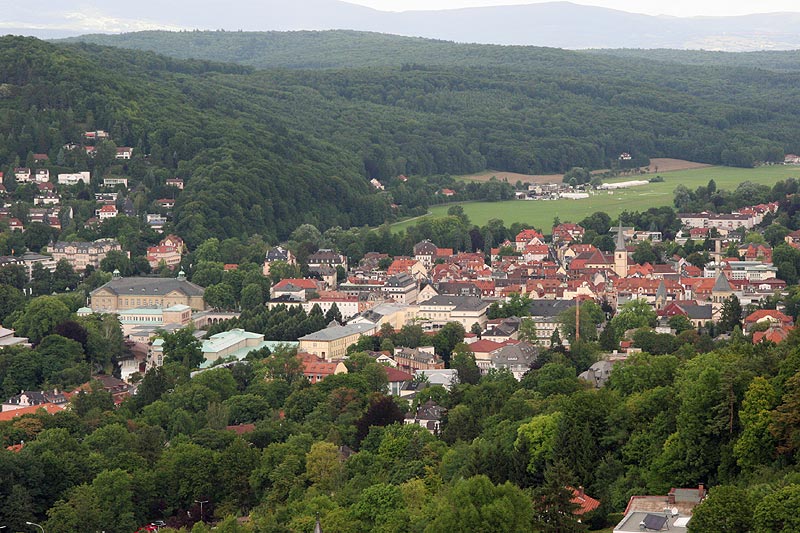
Bad Neustadt an der Saale
- municipality of Germany
Hiking in Bad Neustadt an der Saale
Bad Neustadt an der Saale is a charming town located in Bavaria, Germany, surrounded by beautiful landscapes that make it a great location for hiking enthusiasts. Here are some highlights and tips for hiking in the area:...
- Country:
- Postal Code: 97616
- Local Dialing Code: 09771
- Licence Plate Code: NES
- Coordinates: 50° 19' 19" N, 10° 12' 58" E
- GPS tracks (wikiloc): [Link]
- AboveSeaLevel: 242 м m
- Area: 36.79 sq km
- Population: 15154
- Web site: [Link]


Ostheim vor der Rhön
- municipality of Germany
Hiking in Ostheim vor der Rhön
Ostheim is a charming village located in the German region of Bavaria, near the beautiful Rhön Mountains, making it an excellent base for hiking enthusiasts. The surrounding area offers a variety of trails that cater to different skill levels, from easy walks to more challenging hikes....
- Country:
- Postal Code: 97645
- Local Dialing Code: 09777
- Licence Plate Code: NES
- Coordinates: 50° 28' 0" N, 10° 13' 0" E
- GPS tracks (wikiloc): [Link]
- AboveSeaLevel: 300 м m
- Area: 40.73 sq km
- Population: 3388
- Web site: [Link]


Bischofsheim an der Rhön
- human settlement in Germany
Hiking in Bischofsheim an der Rhön
Bischofsheim an der Rhön is a picturesque village located in the Rhön mountain range in Bavaria, Germany. It's an excellent destination for hiking enthusiasts, offering various trails that cater to different skill levels and interests....
- Country:
- Postal Code: 97653
- Local Dialing Code: 09772
- Licence Plate Code: NES, KÖN, MET
- Coordinates: 50° 24' 0" N, 10° 1' 0" E
- GPS tracks (wikiloc): [Link]
- AboveSeaLevel: 448 м m
- Area: 67.72 sq km
- Population: 4698
- Web site: [Link]


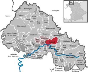
Mellrichstadt
- human settlement in Germany
Hiking in Mellrichstadt
Mellrichstadt, located in the Bavarian region of Germany, offers a variety of hiking opportunities for outdoor enthusiasts. Its scenery includes beautiful landscapes, wooded areas, and picturesque views of the surrounding countryside, making it an attractive destination for hikers of all levels....
- Country:
- Postal Code: 97638
- Local Dialing Code: 09776
- Coordinates: 50° 25' 0" N, 10° 19' 0" E
- GPS tracks (wikiloc): [Link]
- AboveSeaLevel: 270 м m
- Area: 55.78 sq km
- Population: 5563
- Web site: [Link]


Herbstadt
- municipality of Germany
Hiking in Herbstadt
Herbstadt is a charming and scenic location, making it an excellent destination for hiking enthusiasts. While it may not be as widely known as some national parks or well-trodden trails, it offers a variety of hiking experiences that cater to different skill levels....
- Country:
- Postal Code: 97633
- Local Dialing Code: 09761
- Licence Plate Code: NES
- Coordinates: 50° 20' 0" N, 10° 30' 0" E
- GPS tracks (wikiloc): [Link]
- AboveSeaLevel: 308 м m
- Area: 20.69 sq km
- Population: 676
- Web site: [Link]

Hohenroth
- municipality of Germany
Hiking in Hohenroth
Hohenroth is a small village located in Germany, often surrounded by picturesque landscapes, making it a great destination for hiking enthusiasts. While specific trails can vary based on local conditions and season, here are some general tips and suggestions for hiking in and around Hohenroth:...
- Country:
- Postal Code: 97618
- Local Dialing Code: 09771
- Licence Plate Code: NES
- Coordinates: 50° 19' 0" N, 10° 11' 0" E
- GPS tracks (wikiloc): [Link]
- AboveSeaLevel: 296 м m
- Area: 17.14 sq km
- Population: 2493
- Web site: [Link]


Unsleben
- municipality of Germany
Hiking in Unsleben
Unsleben, a charming village located in Bavaria, Germany, offers a peaceful and scenic environment for hiking enthusiasts. The surrounding landscape is characterized by rolling hills, lush forests, and picturesque views of the Franconian countryside. Here are a few highlights and tips for hiking in Unsleben:...
- Country:
- Postal Code: 97618
- Local Dialing Code: 09773
- Licence Plate Code: NES
- Coordinates: 50° 23' 0" N, 10° 16' 0" E
- GPS tracks (wikiloc): [Link]
- AboveSeaLevel: 248 м m
- Area: 8.93 sq km
- Population: 936
- Web site: [Link]


Rödelmaier
- municipality in Rhön-Grabfeld, Bavaria, Germany
Hiking in Rödelmaier
Rödelmaier is a small village in Bavaria, Germany, located near the scenic landscapes of the Rhön Mountains. This region is known for its lush greenery, rolling hills, and diverse wildlife, making it an excellent destination for hiking enthusiasts....
- Country:
- Postal Code: 97618
- Local Dialing Code: 09771
- Licence Plate Code: NES
- Coordinates: 50° 19' 0" N, 10° 17' 0" E
- GPS tracks (wikiloc): [Link]
- AboveSeaLevel: 344 м m
- Area: 6.28 sq km
- Population: 752
- Web site: [Link]


Aubstadt
- municipality of Germany
Hiking in Aubstadt
Aubstadt is a small municipality located in the Bavaria region of Germany, known for its picturesque landscapes and rural charm. While it may not be a well-known hiking destination, it offers opportunities for lovely walks and outdoor experiences. Here are some insights into hiking in and around Aubstadt:...
- Country:
- Postal Code: 97633
- Local Dialing Code: 09761
- Licence Plate Code: NES
- Coordinates: 50° 20' 0" N, 10° 26' 0" E
- GPS tracks (wikiloc): [Link]
- AboveSeaLevel: 326 м m
- Area: 11.93 sq km
- Population: 750
- Web site: [Link]

Strahlungen
- municipality of Germany
Hiking in Strahlungen
It seems there might be a misspelling or misunderstanding regarding "Strahlungen," as it doesn't correspond to any well-known hiking destination. It could be a specific locale or region that I’m not familiar with up to October 2023. If you meant a general area or another location, such as "Strahlungen" in Germany or elsewhere, please clarify....
- Country:
- Postal Code: 97618
- Local Dialing Code: 09733
- Licence Plate Code: NES
- Coordinates: 50° 17' 0" N, 10° 14' 0" E
- GPS tracks (wikiloc): [Link]
- AboveSeaLevel: 308 м m
- Area: 13.43 sq km
- Population: 818
- Web site: [Link]

Hollstadt
- municipality of Germany
Hiking in Hollstadt
Hollstadt, a quaint town in Bavaria, Germany, is surrounded by picturesque landscapes and offers a variety of hiking opportunities for outdoor enthusiasts. The region is characterized by rolling hills, lush forests, and charming villages, making it perfect for both novice and experienced hikers....
- Country:
- Postal Code: 97618
- Local Dialing Code: 09773
- Licence Plate Code: NES
- Coordinates: 50° 21' 0" N, 10° 18' 0" E
- GPS tracks (wikiloc): [Link]
- AboveSeaLevel: 252 м m
- Area: 24.31 sq km
- Population: 1411
- Web site: [Link]


Niederlauer
- municipality of Germany
Hiking in Niederlauer
Niederlauer, located in the Thuringia region of Germany, offers a variety of hiking opportunities for enthusiasts of all skill levels. The area is characterized by its picturesque landscapes, including rolling hills, forests, and scenic valleys....
- Country:
- Postal Code: 97618
- Local Dialing Code: 09771
- Licence Plate Code: NES
- Coordinates: 50° 17' 0" N, 10° 11' 0" E
- GPS tracks (wikiloc): [Link]
- AboveSeaLevel: 242 м m
- Area: 9.07 sq km
- Population: 1333
- Web site: [Link]


Nordheim vor der Rhön
- municipality of Germany
Hiking in Nordheim vor der Rhön
Nordheim vor der Rhön is a charming village located in the Rhön mountain range in Bavaria, Germany. Known for its natural beauty and scenic landscapes, it offers numerous hiking opportunities suitable for all levels of hikers. Here are some highlights about hiking in this region:...
- Country:
- Postal Code: 97647
- Local Dialing Code: 09779
- Licence Plate Code: NES
- Coordinates: 50° 29' 0" N, 10° 11' 0" E
- GPS tracks (wikiloc): [Link]
- AboveSeaLevel: 340 м m
- Area: 16.56 sq km
- Population: 1176
- Web site: [Link]


Trappstadt
- human settlement in Germany
Hiking in Trappstadt
Trappstadt, located in Bavaria, Germany, is a picturesque destination for hiking enthusiasts. Nestled in a beautiful natural landscape, it offers a mix of hiking trails suitable for various skill levels, from easy walks to more challenging routes. Here are some highlights:...
- Country:
- Postal Code: 97633
- Local Dialing Code: 09765
- Licence Plate Code: NES
- Coordinates: 50° 19' 0" N, 10° 35' 0" E
- GPS tracks (wikiloc): [Link]
- AboveSeaLevel: 310 м m
- Area: 25.80 sq km
- Population: 1022
- Web site: [Link]

Willmars
- municipality of Germany
Hiking in Willmars
Willmar, located in Minnesota, is surrounded by a variety of natural landscapes that offer opportunities for hiking and outdoor activities. While Willmar itself may not have extensive hiking trails within the city, nearby areas provide great options for hikers of all skill levels....
- Country:
- Postal Code: 97647
- Local Dialing Code: 09779
- Licence Plate Code: NES
- Coordinates: 50° 30' 0" N, 10° 15' 0" E
- GPS tracks (wikiloc): [Link]
- AboveSeaLevel: 340 м m
- Area: 12.17 sq km
- Population: 673
- Web site: [Link]

Heustreu
- municipality in the district of Rhön-Grabfeld in lower Franconia in Germany
Hiking in Heustreu
Heustreu is a small municipality in Bavaria, Germany, surrounded by beautiful rural landscapes and various natural attractions, making it a pleasant place for hiking enthusiasts. While Heustreu itself may not be widely recognized for extensive hiking trails, there are several key aspects to consider when planning a hike in and around the area:...
- Country:
- Postal Code: 97618
- Local Dialing Code: 09773
- Licence Plate Code: NES
- Coordinates: 50° 21' 0" N, 10° 15' 0" E
- GPS tracks (wikiloc): [Link]
- AboveSeaLevel: 232 м m
- Area: 10.56 sq km
- Population: 1157
- Web site: [Link]

Burglauer
- municipality of Germany
Hiking in Burglauer
Burglauer is a scenic area located in the region of Bavaria, Germany, close to the border with Thuringia. It offers a variety of hiking opportunities for outdoor enthusiasts. Here’s what you should know about hiking in Burglauer:...
- Country:
- Postal Code: 97724
- Local Dialing Code: 09733
- Licence Plate Code: NES
- Coordinates: 50° 16' 0" N, 10° 11' 0" E
- GPS tracks (wikiloc): [Link]
- AboveSeaLevel: 240 м m
- Area: 13.95 sq km
- Population: 1372
- Web site: [Link]


Hendungen
- municipality of Germany
Hiking in Hendungen
Hendungen is a charming village located in Bavaria, Germany, offering various hiking opportunities in the surrounding countryside and nearby mountain ranges. The area is known for its picturesque landscapes, including lush forests, rolling hills, and scenic views....
- Country:
- Postal Code: 97640
- Local Dialing Code: 09776
- Licence Plate Code: NES
- Coordinates: 50° 24' 0" N, 10° 21' 0" E
- GPS tracks (wikiloc): [Link]
- AboveSeaLevel: 308 м m
- Area: 22.85 sq km
- Population: 1023
- Web site: [Link]


Saal an der Saale
- human settlement in Germany
Hiking in Saal an der Saale
Saal an der Saale is a charming village located in the eastern part of Germany, in the state of Saxony-Anhalt. The area is characterized by its beautiful natural landscapes, including rolling hills, forests, and proximity to the Saale River, making it an excellent destination for hiking enthusiasts....
- Country:
- Postal Code: 97633
- Local Dialing Code: 09762
- Licence Plate Code: NES
- Coordinates: 50° 19' 1" N, 10° 21' 18" E
- GPS tracks (wikiloc): [Link]
- AboveSeaLevel: 254 м m
- Area: 21.57 sq km
- Population: 1588
- Web site: [Link]

Großeibstadt
- municipality of Germany
Hiking in Großeibstadt
Großeibstadt is a small village in Germany, located in the state of Thuringia. While it may not be as well-known as some larger hiking destinations, it offers a peaceful and scenic environment ideal for outdoor enthusiasts....
- Country:
- Postal Code: 97633
- Local Dialing Code: 09761
- Licence Plate Code: NES
- Coordinates: 50° 18' 0" N, 10° 25' 0" E
- GPS tracks (wikiloc): [Link]
- AboveSeaLevel: 286 м m
- Area: 16.64 sq km
- Population: 1172
- Web site: [Link]


Bastheim
- municipality of Germany
Hiking in Bastheim
Bastheim is a scenic area located in the heart of Germany, known for its beautiful landscapes, lush forests, and charming villages. While specific hiking trails may not be widely documented, the general region around Bastheim offers a variety of outdoor activities and excellent hiking opportunities. Here are some tips and highlights for hiking in and around Bastheim:...
- Country:
- Postal Code: 97654
- Local Dialing Code: 09775; 09774; 09773
- Licence Plate Code: NES
- Coordinates: 50° 24' 0" N, 10° 12' 0" E
- GPS tracks (wikiloc): [Link]
- AboveSeaLevel: 284 м m
- Area: 41.75 sq km
- Population: 2175
- Web site: [Link]
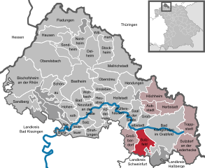
Bad Königshofen im Grabfeld
- german village
Hiking in Bad Königshofen im Grabfeld
Bad Königshofen, located in the northern part of Bavaria, Germany, is a charming spa town surrounded by beautiful landscapes, making it an excellent destination for hiking enthusiasts. The region features a mix of rolling hills, wooded areas, and scenic trails, providing a variety of hiking experiences for all skill levels....
- Country:
- Postal Code: 97631
- Local Dialing Code: 09761
- Coordinates: 50° 17' 57" N, 10° 28' 0" E
- GPS tracks (wikiloc): [Link]
- AboveSeaLevel: 275 м m
- Area: 69.52 sq km
- Population: 5901
- Web site: [Link]


Wülfershausen
- municipality of Germany
Hiking in Wülfershausen
Wülfershausen is a small village in Bavaria, Germany, known for its scenic landscapes and opportunities for outdoor activities, including hiking. Here are some insights into hiking in and around Wülfershausen:...
- Country:
- Postal Code: 97618
- Local Dialing Code: 09762
- Licence Plate Code: NES
- Coordinates: 50° 20' 0" N, 10° 21' 0" E
- GPS tracks (wikiloc): [Link]
- AboveSeaLevel: 266 м m
- Area: 18.12 sq km
- Population: 1483
- Web site: [Link]


Sandberg
- municipality of Germany
Hiking in Sandberg
Sandberg, situated in Bavaria, Germany, is a beautiful destination for hiking enthusiasts. The area is characterized by scenic landscapes, lush forests, and panoramic views of the surrounding countryside. Here are some key aspects to consider when planning a hiking trip to Sandberg:...
- Country:
- Postal Code: 97657
- Local Dialing Code: 09701
- Licence Plate Code: NES
- Coordinates: 50° 21' 0" N, 10° 0' 0" E
- GPS tracks (wikiloc): [Link]
- AboveSeaLevel: 470 м m
- Area: 28.04 sq km
- Population: 2798
- Web site: [Link]

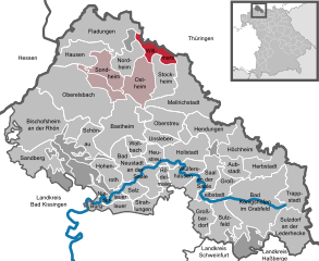
Fladungen
- human settlement in Germany
Hiking in Fladungen
Fladungen is a charming town located in the Rhön Mountains of Bavaria, Germany, known for its beautiful natural landscapes and outdoor recreational opportunities, including hiking. Here are some highlights and recommendations for hiking in and around Fladungen:...
- Country:
- Postal Code: 97650
- Local Dialing Code: 09778
- Licence Plate Code: NES
- Coordinates: 50° 31' 16" N, 10° 8' 43" E
- GPS tracks (wikiloc): [Link]
- AboveSeaLevel: 414 м m
- Area: 46.37 sq km
- Population: 2322
- Web site: [Link]


Hausen
Hiking in Hausen
Hiking in Hausen, located in the Rhön-Grabfeld district of Bavaria, Germany, offers a unique blend of beautiful landscapes, diverse flora and fauna, and rich cultural heritage. The region is part of the larger Rhön Biosphere Reserve, known for its scenic beauty and natural diversity....
- Country:
- Postal Code: 97647
- Local Dialing Code: 09778
- Licence Plate Code: NES
- Coordinates: 50° 30' 20" N, 10° 7' 30" E
- GPS tracks (wikiloc): [Link]
- AboveSeaLevel: 444 м m
- Area: 24.21 sq km
- Population: 722
- Web site: [Link]


Sondheim
- municipality of Germany
Hiking in Sondheim
It seems there may be a misunderstanding, as "Sondheim" refers to the renowned composer Stephen Sondheim, and not a hiking destination. However, if you're looking for hiking information in a scenic location, I can provide general hiking tips or information on popular hiking destinations, such as the Sondre Norheim trail in Norway or other notable hiking spots around the world. Alternatively, if you meant a specific location, please clarify, and I’d be happy to assist!...
- Country:
- Postal Code: 97647
- Local Dialing Code: 09779
- Licence Plate Code: NES
- Coordinates: 50° 28' 0" N, 10° 10' 0" E
- GPS tracks (wikiloc): [Link]
- AboveSeaLevel: 358 м m
- Area: 18.58 sq km
- Population: 1061
- Web site: [Link]


Oberstreu
- municipality of Germany
Hiking in Oberstreu
Oberstreu is a charming village located in Bavaria, Germany, surrounded by beautiful landscapes that offer great opportunities for hiking and outdoor activities. Nestled in the foothills of the Franconian Forest, the area is known for its picturesque scenery, lush woodlands, and rolling hills....
- Country:
- Postal Code: 97640
- Local Dialing Code: 09776
- Licence Plate Code: NES
- Coordinates: 50° 24' 0" N, 10° 17' 0" E
- GPS tracks (wikiloc): [Link]
- AboveSeaLevel: 256 м m
- Area: 22.60 sq km
- Population: 1481
- Web site: [Link]


Schönau an der Brend
- municipality of Germany
Hiking in Schönau an der Brend
Schönau an der Brend is a charming village in Bavaria, Germany, nestled in the scenic landscape near the Brend River. It's an excellent base for hiking enthusiasts looking to explore the beautiful trails of the region. Here are some key points to consider when hiking in and around Schönau an der Brend:...
- Country:
- Postal Code: 97659
- Local Dialing Code: 09775
- Licence Plate Code: NES
- Coordinates: 50° 23' 0" N, 10° 6' 0" E
- GPS tracks (wikiloc): [Link]
- AboveSeaLevel: 320 м m
- Area: 15.58 sq km
- Population: 1353
- Web site: [Link]


Großbardorf
- human settlement in Germany
Hiking in Großbardorf
Großbardorf, located in Bavaria, Germany, is a charming village that offers a variety of hiking opportunities amidst beautiful natural landscapes. The area is characterized by rolling hills, lush forests, and picturesque fields, making it a great destination for both casual walkers and more experienced hikers....
- Country:
- Postal Code: 97633
- Local Dialing Code: 09766
- Licence Plate Code: NES
- Coordinates: 50° 16' 0" N, 10° 22' 0" E
- GPS tracks (wikiloc): [Link]
- AboveSeaLevel: 296 м m
- Area: 16.54 sq km
- Population: 876
- Web site: [Link]

Stockheim
- human settlement in Germany
Hiking in Stockheim
Stockheim, located in Lower Franconia, Germany, offers several opportunities for hikers to explore the beautiful landscapes of the region. Here are some highlights and tips for hiking in this area:...
- Country:
- Postal Code: 97640
- Local Dialing Code: 09776
- Licence Plate Code: NES
- Coordinates: 50° 27' 0" N, 10° 17' 0" E
- GPS tracks (wikiloc): [Link]
- AboveSeaLevel: 284 м m
- Area: 19.86 sq km
- Population: 1056
- Web site: [Link]

Sulzfeld
- municipality of Germany
Hiking in Sulzfeld
Sulzfeld, situated in the Rhön-Grabfeld district of Bavaria, Germany, offers a unique hiking experience characterized by picturesque landscapes, rolling hills, and diverse natural habitats. The Rhön region is known for its moderately rugged terrain and is part of a UNESCO Biosphere Reserve, which emphasizes the importance of preserving its natural environment....
- Country:
- Postal Code: 97633
- Local Dialing Code: 09761
- Licence Plate Code: NES
- Coordinates: 50° 16' 0" N, 10° 24' 0" E
- GPS tracks (wikiloc): [Link]
- AboveSeaLevel: 302 м m
- Area: 22.52 sq km
- Population: 1607
- Web site: [Link]


Sulzdorf an der Lederhecke
- municipality of Germany
Hiking in Sulzdorf an der Lederhecke
Sulzdorf an der Lederhecke, located in Bavaria, Germany, offers a charming and scenic environment for hiking enthusiasts. While it may not be as widely known as some major hiking destinations, it features beautiful landscapes typical of the Franconian region, including rolling hills, forests, and picturesque rural scenery....
- Country:
- Postal Code: 97528
- Local Dialing Code: 09763
- Licence Plate Code: NES
- Coordinates: 50° 14' 0" N, 10° 34' 0" E
- GPS tracks (wikiloc): [Link]
- AboveSeaLevel: 330 м m
- Area: 36.41 sq km
- Population: 1213
- Web site: [Link]


Salz
- municipality in the district of Rhön-Grabfeld in Bavaria in Germany
Hiking in Salz
Salz, Bavaria is a stunning area for hiking, characterized by its beautiful landscapes, picturesque villages, and rich cultural heritage. Located in southeastern Germany, this part of Bavaria offers a mix of rolling hills, dense forests, and majestic mountains, making it an excellent destination for both casual walkers and experienced hikers....
- Country:
- Postal Code: 97616
- Local Dialing Code: 09771
- Licence Plate Code: NES
- Coordinates: 50° 18' 0" N, 10° 13' 0" E
- GPS tracks (wikiloc): [Link]
- AboveSeaLevel: 234 м m
- Area: 8.65 sq km
- Population: 1696
- Web site: [Link]

Höchheim
- municipality of Germany
Hiking in Höchheim
Höchheim, a scenic area located in Germany, offers various hiking opportunities for outdoor enthusiasts. The region is characterized by its picturesque landscapes, including rolling hills, lush forests, and scenic river valleys. Here are some key points to consider when planning a hike in Höchheim:...
- Country:
- Postal Code: 97633
- Local Dialing Code: 09764
- Licence Plate Code: NES
- Coordinates: 50° 22' 0" N, 10° 27' 0" E
- GPS tracks (wikiloc): [Link]
- AboveSeaLevel: 296 м m
- Area: 25.25 sq km
- Population: 1269
- Web site: [Link]
Forst Schmalwasser-Nord
- unincorporated area in Germany
Hiking in Forst Schmalwasser-Nord
Forst Schmalwasser-Nord is a beautiful area located within the Thuringian Forest in Germany. It's known for its picturesque landscapes, rich flora and fauna, and various hiking trails suitable for different skill levels. Here are some key features you can expect while hiking in this area:...
- Country:
- Coordinates: 50° 21' 22" N, 10° 1' 19" E
- GPS tracks (wikiloc): [Link]
Forst Schmalwasser-Süd
- unincorporated area in Germany
Hiking in Forst Schmalwasser-Süd
Forst Schmalwasser-Süd is a beautiful area located in Germany, ideal for hiking enthusiasts. The region is characterized by its dense forests, picturesque landscapes, and a variety of trails catering to different skill levels. Here are some key points to consider if you're planning a hike in Forst Schmalwasser-Süd:...
- Country:
- Coordinates: 50° 19' 59" N, 10° 3' 0" E
- GPS tracks (wikiloc): [Link]
Shares border with regions:

Schweinfurt
- district of Bavaria, Germany
Hiking in Schweinfurt
Schweinfurt, located in the northern part of Bavaria, Germany, offers a variety of hiking opportunities that showcase the beautiful landscapes of the region. The area is characterized by rolling hills, forests, and scenic valleys, making it ideal for both leisurely strolls and more challenging hikes....
- Country:
- Capital: Schweinfurt
- Licence Plate Code: GEO; SW
- Coordinates: 50° 1' 12" N, 10° 15' 36" E
- GPS tracks (wikiloc): [Link]
- AboveSeaLevel: 222 м m
- Area: 842.00 sq km
- Population: 103697
- Web site: [Link]

Haßberge
- district in Bavaria, Germany
Hiking in Haßberge
The Haßberge district, located in the northern part of Bavaria, Germany, is known for its beautiful landscapes, rolling hills, dense forests, and quaint villages, making it an excellent destination for hiking enthusiasts. Here are some key points about hiking in the Haßberge district:...
- Country:
- Capital: Haßfurt
- Licence Plate Code: HAS
- Coordinates: 50° 4' 48" N, 10° 40' 12" E
- GPS tracks (wikiloc): [Link]
- AboveSeaLevel: 368 м m
- Area: 956.00 sq km
- Population: 80257
- Web site: [Link]
Bad Kissingen
- district in Bavaria, Germany
Hiking in Bad Kissingen
Bad Kissingen, located in Bavaria, Germany, is a beautiful spa town known for its healing mineral waters and lovely natural surroundings. The area's scenic landscapes make it an excellent destination for hiking enthusiasts. Here are some key points about hiking in Bad Kissingen:...
- Country:
- Capital: Bad Kissingen
- Licence Plate Code: HAB; BRK; KG
- Coordinates: 50° 15' 0" N, 10° 0' 0" E
- GPS tracks (wikiloc): [Link]
- AboveSeaLevel: 330 м m
- Area: 1137.00 sq km
- Population: 99022
- Web site: [Link]
Schmalkalden-Meiningen
- district in Thuringia, Germany
Hiking in Schmalkalden-Meiningen
Schmalkalden-Meiningen, located in the state of Thuringia, Germany, offers a variety of hiking opportunities that cater to both casual walkers and experienced hikers. The region is characterized by its picturesque landscapes, including forests, hills, and historical towns, making it an attractive destination for outdoor enthusiasts. Here are some key highlights:...
- Country:
- Licence Plate Code: SM
- Coordinates: 50° 40' 12" N, 10° 25' 12" E
- GPS tracks (wikiloc): [Link]
- AboveSeaLevel: 478 м m
- Area: 1210.73 sq km
- Population: 124623
- Web site: [Link]
Hildburghausen
- district of Thuringia, Germany
Hiking in Hildburghausen
Hildburghausen is a picturesque district located in the state of Thuringia, Germany, known for its diverse landscapes, history, and plenty of outdoor activities, including hiking. Here are some highlights for hiking in the Hildburghausen district:...
- Country:
- Licence Plate Code: HBN
- Coordinates: 50° 25' 12" N, 10° 45' 0" E
- GPS tracks (wikiloc): [Link]
- AboveSeaLevel: 482 м m
- Area: 938.42 sq km
- Population: 64524
- Web site: [Link]


Fulda
- district in Hesse, Germany
Hiking in Fulda
Fulda is a beautiful district located in Hesse, Germany, known for its scenic landscapes, historical sites, and outdoor activities, including hiking. Here are some key aspects of hiking in Fulda:...
- Country:
- Capital: Fulda
- Licence Plate Code: FD
- Coordinates: 50° 33' 37" N, 9° 41' 10" E
- GPS tracks (wikiloc): [Link]
- AboveSeaLevel: 297 м m
- Area: 1380.40 sq km
- Population: 216093
- Web site: [Link]