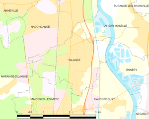
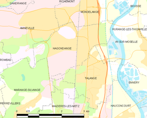
Hagondange (Hagondange)
- commune in Moselle, France
- Country:

- Postal Code: 57300
- Coordinates: 49° 15' 15" N, 6° 10' 5" E


- GPS tracks (wikiloc): [Link]
- Area: 5.5 sq km
- Population: 9281
- Web site: http://www.ville-hagondange.fr/
- Wikipedia en: wiki(en)
- Wikipedia: wiki(fr)
- Wikidata storage: Wikidata: Q21913
- Wikipedia Commons Category: [Link]
- Freebase ID: [/m/03g_50y]
- Freebase ID: [/m/03g_50y]
- GeoNames ID: Alt: [3014080]
- GeoNames ID: Alt: [3014080]
- SIREN number: [215702838]
- SIREN number: [215702838]
- BnF ID: [15265790c]
- BnF ID: [15265790c]
- VIAF ID: Alt: [241216129]
- VIAF ID: Alt: [241216129]
- GND ID: Alt: [4606452-7]
- GND ID: Alt: [4606452-7]
- Library of Congress authority ID: Alt: [no2002079740]
- Library of Congress authority ID: Alt: [no2002079740]
- PACTOLS thesaurus ID: [pcrtedB3rhskFD]
- PACTOLS thesaurus ID: [pcrtedB3rhskFD]
- INSEE municipality code: 57283
- INSEE municipality code: 57283
Shares border with regions:


Maizières-lès-Metz
- commune in Moselle, France
- Country:

- Postal Code: 57280
- Coordinates: 49° 12' 44" N, 6° 9' 40" E


- GPS tracks (wikiloc): [Link]
- Area: 8.82 sq km
- Population: 11200
- Web site: [Link]


Ay-sur-Moselle
- commune in Moselle, France
- Country:

- Postal Code: 57300
- Coordinates: 49° 14' 36" N, 6° 12' 26" E


- GPS tracks (wikiloc): [Link]
- Area: 4.69 sq km
- Population: 1493


Mondelange
- commune in Moselle, France
- Country:

- Postal Code: 57300
- Coordinates: 49° 15' 45" N, 6° 10' 7" E


- GPS tracks (wikiloc): [Link]
- Area: 4.1 sq km
- Population: 5809
- Web site: [Link]


Talange
- commune in Moselle, France
- Country:

- Postal Code: 57525
- Coordinates: 49° 14' 12" N, 6° 10' 28" E


- GPS tracks (wikiloc): [Link]
- Area: 3.7 sq km
- Population: 7698
- Web site: [Link]


Amnéville
- commune in Moselle, France
- Country:

- Postal Code: 57360
- Coordinates: 49° 15' 39" N, 6° 8' 31" E


- GPS tracks (wikiloc): [Link]
- Area: 10.46 sq km
- Population: 10657
- Web site: [Link]


Marange-Silvange
- commune in Moselle, France
- Country:

- Postal Code: 57535
- Coordinates: 49° 12' 39" N, 6° 6' 14" E


- GPS tracks (wikiloc): [Link]
- Area: 15.24 sq km
- Population: 5965
- Web site: [Link]
