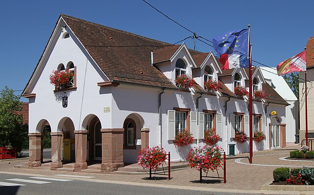
Hatten (Hatten)

- commune in Bas-Rhin, France
- Country:

- Postal Code: 67690
- Coordinates: 48° 54' 7" N, 7° 58' 44" E


- GPS tracks (wikiloc): [Link]
- Area: 18.91 sq km
- Population: 1925
- Wikipedia en: wiki(en)
- Wikipedia: wiki(fr)
- Wikidata storage: Wikidata: Q21554
- Wikipedia Commons Category: [Link]
- Freebase ID: [/m/03m986l]
- Freebase ID: [/m/03m986l]
- Freebase ID: [/m/03m986l]
- GeoNames ID: Alt: [6441135]
- GeoNames ID: Alt: [6441135]
- GeoNames ID: Alt: [6441135]
- SIREN number: [216701847]
- SIREN number: [216701847]
- SIREN number: [216701847]
- BnF ID: [15271326d]
- BnF ID: [15271326d]
- BnF ID: [15271326d]
- VIAF ID: Alt: [158117604]
- VIAF ID: Alt: [158117604]
- VIAF ID: Alt: [158117604]
- PACTOLS thesaurus ID: [pcrt0D1DNy0TBY]
- PACTOLS thesaurus ID: [pcrt0D1DNy0TBY]
- PACTOLS thesaurus ID: [pcrt0D1DNy0TBY]
- WOEID: [594364]
- WOEID: [594364]
- WOEID: [594364]
- INSEE municipality code: 67184
- INSEE municipality code: 67184
- INSEE municipality code: 67184
Shares border with regions:


Kesseldorf
- commune in Bas-Rhin, France
- Country:
- Postal Code: 67930
- Coordinates: 48° 52' 33" N, 8° 4' 3" E
- GPS tracks (wikiloc): [Link]
- Area: 7.26 sq km
- Population: 408


Forstfeld
- commune in Bas-Rhin, France
- Country:
- Postal Code: 67480
- Coordinates: 48° 51' 37" N, 8° 2' 19" E
- GPS tracks (wikiloc): [Link]
- Area: 4.9 sq km
- Population: 731


Rittershoffen
- commune in Bas-Rhin, France
- Country:
- Postal Code: 67690
- Coordinates: 48° 54' 13" N, 7° 57' 5" E
- GPS tracks (wikiloc): [Link]
- Area: 12.13 sq km
- Population: 910


Stundwiller
- commune in Bas-Rhin, France
- Country:
- Postal Code: 67250
- Coordinates: 48° 55' 32" N, 7° 59' 26" E
- GPS tracks (wikiloc): [Link]
- Area: 3.32 sq km
- Population: 477


Buhl
- commune in Bas-Rhin, France
- Country:
- Postal Code: 67470
- Coordinates: 48° 55' 2" N, 8° 0' 24" E
- GPS tracks (wikiloc): [Link]
- Area: 4.4 sq km
- Population: 528

Niederrœdern
- commune in Bas-Rhin, France
- Country:
- Postal Code: 67470
- Coordinates: 48° 54' 22" N, 8° 2' 52" E
- GPS tracks (wikiloc): [Link]
- Area: 6.88 sq km
- Population: 923


Oberrœdern
- commune in Bas-Rhin, France
- Country:
- Postal Code: 67250
- Coordinates: 48° 55' 18" N, 7° 58' 27" E
- GPS tracks (wikiloc): [Link]
- Area: 5 sq km
- Population: 536