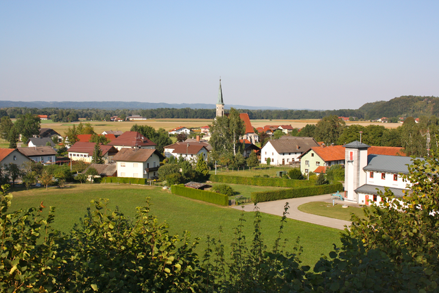
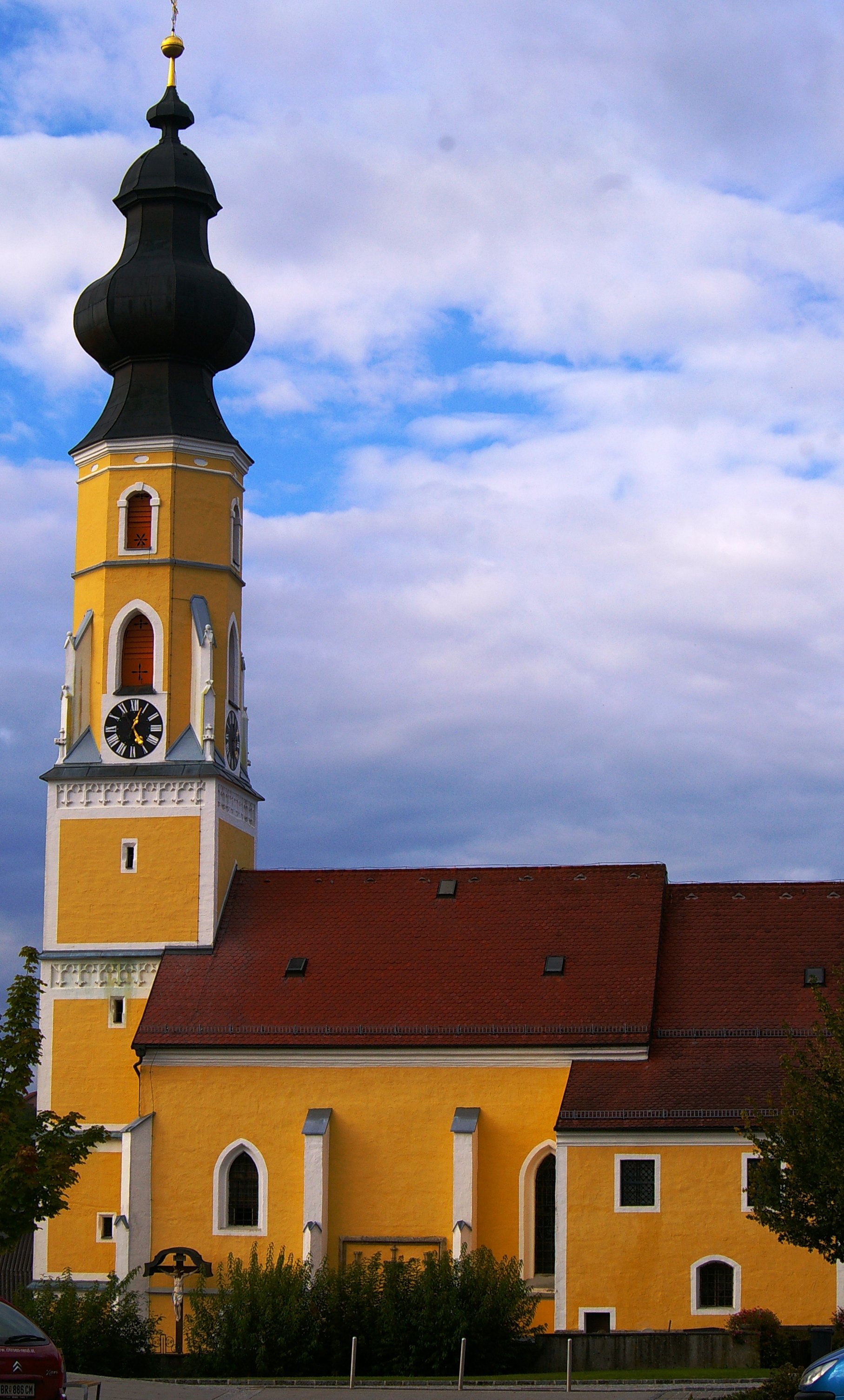
Hochburg-Ach (Hochburg-Ach)
- municipality in Austria
Hochburg-Ach, located in Bavaria, Germany, near the Austrian border, offers a variety of hiking opportunities that showcase the beautiful landscapes of the region. Here are some key points about hiking in Hochburg-Ach:
Scenic Trails
- Natural Beauty: The area is surrounded by lush green fields, forests, and the scenic Ach River. Hikers can enjoy the serene countryside and picturesque views.
- Trail Variety: There are several hiking trails catering to different skill levels, from easy walks suitable for families to more challenging routes for experienced hikers.
Recommended Trails
- Local Trails: Look for trails that lead through nearby forests, farms, and along the riverbanks. Check local maps or guides for specific routes, as there might be trail signage indicating distances and difficulty levels.
- Nature Trails: Some trails may be dedicated to nature observation, allowing hikers to appreciate the local flora and fauna.
Preparation Tips
- Fitness Level: Evaluate your fitness level and choose trails that match your capabilities.
- Weather Conditions: Always check the weather before you head out, as it can change rapidly in mountainous areas.
- Footwear: Wear appropriate hiking shoes for comfort and stability, especially if you plan to explore uneven terrain.
Safety
- Stay on Marked Trails: To protect the environment and ensure your safety, stick to marked paths.
- Hydration and Snacks: Carry sufficient water and snacks, especially for longer hikes.
- Companions: Hike with a buddy or let someone know your route and estimated return time.
Cultural Aspects
- Local Heritage: While hiking, you might encounter historical landmarks or sites of cultural significance unique to the area, enriching your hiking experience.
Before heading out, it's a good idea to check with local tourism information for updated trail conditions and any recommendations or regulations. Enjoy your hiking adventure in Hochburg-Ach!
- Country:

- Postal Code: 5122
- Local Dialing Code: 07727
- Licence Plate Code: BR
- Coordinates: 48° 7' 50" N, 12° 52' 40" E


- GPS tracks (wikiloc): [Link]
- AboveSeaLevel: 462 м m
- Area: 40.12 sq km
- Population: 3236
- Web site: http://www.hochburg-ach.at/
- Wikipedia en: wiki(en)
- Wikipedia: wiki(de)
- Wikidata storage: Wikidata: Q671323
- Wikipedia Commons Category: [Link]
- Freebase ID: [/m/03gv28k]
- GeoNames ID: Alt: [7871972]
- VIAF ID: Alt: [247392773]
- GND ID: Alt: [4647663-5]
- MusicBrainz area ID: [fb0b7bdd-31f3-4887-aa53-6441e88df2ee]
- Austrian municipality key: [40414]
Shares border with regions:

Geretsberg
- municipality in Austria
Geretsberg, located in Austria, offers beautiful hiking opportunities amidst stunning natural landscapes. The region is characterized by rolling hills, lush forests, and picturesque views, making it a delightful destination for outdoor enthusiasts....
- Country:

- Local Dialing Code: 07748
- Licence Plate Code: BR
- Coordinates: 48° 5' 20" N, 12° 56' 5" E


- GPS tracks (wikiloc): [Link]
- AboveSeaLevel: 491 м m
- Area: 37.54 sq km
- Population: 1187
- Web site: [Link]


Burghausen
- town in Bavaria, Germany
Burghausen, a picturesque town in the Altötting district of Bavaria, Germany, is known for its stunning landscapes, historical sites, and extensive hiking opportunities. Situated along the Salzach River and close to the Austrian border, it offers a diverse range of hiking trails that cater to various skill levels and preferences....
- Postal Code: 84489
- Local Dialing Code: 08677
- Coordinates: 48° 10' 0" N, 12° 50' 0" E


- GPS tracks (wikiloc): [Link]
- AboveSeaLevel: 421 м m
- Area: 19.85 sq km
- Population: 16736
- Web site: [Link]

Überackern
- municipality in Austria
Überackern is a beautiful location for hiking, nestled in Austria. While the specifics can vary based on the specific trails and areas you choose, here are some general aspects to consider when hiking in and around Überackern:...
- Country:

- Postal Code: 5122
- Local Dialing Code: 07727
- Licence Plate Code: BR
- Coordinates: 48° 11' 35" N, 12° 52' 36" E


- GPS tracks (wikiloc): [Link]
- AboveSeaLevel: 356 м m
- Area: 27.1 sq km
- Population: 685
- Web site: [Link]
Gilgenberg am Weilhart
- municipality in Austria
 Hiking in Gilgenberg am Weilhart
Gilgenberg am Weilhart is a picturesque village in Austria, located in the state of Upper Austria. While it might not be as well-known as some of the larger hiking destinations, it offers a number of scenic trails and beautiful countryside, making it a great spot for hiking enthusiasts....
- Country:

- Postal Code: 5133
- Local Dialing Code: 07728
- Licence Plate Code: BR
- Coordinates: 48° 7' 54" N, 12° 56' 21" E


- GPS tracks (wikiloc): [Link]
- AboveSeaLevel: 466 м m
- Area: 26.58 sq km
- Population: 1327
- Web site: [Link]

Sankt Radegund
- municipality in Austria
Sankt Radegund, located in Austria near Graz, is a beautiful destination for hikers, offering a range of trails that showcase the stunning landscapes of the Styrian region. Here are some key points about hiking in Sankt Radegund:...
- Country:

- Postal Code: 5121
- Local Dialing Code: 06278
- Licence Plate Code: BR
- Coordinates: 48° 5' 48" N, 12° 45' 43" E


- GPS tracks (wikiloc): [Link]
- AboveSeaLevel: 480 м m
- Area: 17.97 sq km
- Population: 589
- Web site: [Link]

Tarsdorf
- municipality in Austria
Tarsdorf, located in Austria near the border with Germany, offers a charming backdrop for hiking enthusiasts. The area features picturesque landscapes, rolling hills, and a mix of agricultural land and forests, making it suitable for both recreational walks and more challenging hikes. Here are some highlights for hiking in Tarsdorf:...
- Country:

- Postal Code: 5121
- Local Dialing Code: 06278
- Licence Plate Code: BR
- Coordinates: 48° 4' 48" N, 12° 49' 33" E


- GPS tracks (wikiloc): [Link]
- AboveSeaLevel: 429 м m
- Area: 32.34 sq km
- Population: 2068
- Web site: [Link]
