Kulmbach (Landkreis Kulmbach)
- district in Bavaria, Germany
Kulmbach district, located in Bavaria, Germany, offers a variety of hiking opportunities that showcase the region’s scenic beauty, rich history, and diverse landscapes. Here are some highlights and tips for hiking in Kulmbach:
Key Hiking Areas and Trails
-
Fränkische Schweiz (Franconian Switzerland):
- This nearby area is famous for its unique rock formations, deep valleys, and extensive forested areas. Several hiking trails in this region can be accessed from Kulmbach.
- Popular routes include climbs to the scenic lookouts and trails that meander through quaint villages.
-
Main River Valley:
- The Main River and its valley offer peaceful hiking paths. Trails along the river provide opportunities for leisurely strolls, enjoying the natural beauty and local wildlife.
-
Historical Trails:
- Look for trails that connect historical sites such as castles and remnants of medieval fortifications. Hiking these trails allows you to explore the cultural heritage of the region.
-
Local Nature Reserves:
- Nature reserves in the district, such as the Naturpark Fichtelgebirge, provide a range of trails for different skill levels and the chance to experience local flora and fauna.
Trail Difficulty and Recommendations
- Trails in the Kulmbach district range from easy walks suitable for families to more challenging hikes for experienced trekkers. Be sure to check trail descriptions beforehand to determine the right fit for your group.
- Always wear appropriate hiking footwear and layered clothing to accommodate changing weather conditions.
- It's advisable to bring enough water and snacks to keep your energy up during your hikes.
Local Amenities
- Many areas will have local inns or restaurants where you can stop for a meal or some rest. Kulmbach is known for its beer culture, so trying local brews and accompanying snacks is a must.
- Make use of local maps or hiking apps to identify specific trails and their difficulty levels.
Seasonal Considerations
- Spring and fall are particularly beautiful seasons to hike in Kulmbach, with vibrant foliage and milder temperatures. Summer can be warm, while winter may bring snow, so check trail accessibility and safety.
Conclusion
Hiking in Kulmbach offers a great blend of nature, history, and local culture. Whether you're an experienced hiker or a casual walker, you're likely to find trails that suit your preferences. Always make sure to prepare adequately, and enjoy the stunning Bavarian landscape!
- Country:

- Capital: Kulmbach
- Licence Plate Code: SAN; KU; EBS
- Coordinates: 50° 5' 12" N, 11° 23' 50" E


- GPS tracks (wikiloc): [Link]
- AboveSeaLevel: 391 м m
- Area: 656.00 sq km
- Population: 73055
- Web site: http://www.landkreis-kulmbach.de
- Wikipedia en: wiki(en)
- Wikipedia: wiki(de)
- Wikidata storage: Wikidata: Q10436
- Wikipedia Commons Category: [Link]
- Wikipedia Commons Maps Category: [Link]
- Freebase ID: [/m/01yvh0]
- GeoNames ID: Alt: [3220851]
- VIAF ID: Alt: [131533147]
- OSM relation ID: [2145178]
- GND ID: Alt: [4118777-5]
- archINFORM location ID: [7509]
- Library of Congress authority ID: Alt: [n99020189]
- Quora topic ID: [Kulmbach]
- TGN ID: [7077101]
- Historical Gazetteer (GOV) ID: [adm_139477]
- Bavarikon ID: [ODB_A00002107]
- NUTS code: [DE24B]
- BabelNet ID: [02828362n]
- German district key: 09477
Includes regions:


Kulmbach
- town in Bavaria, Germany
Kulmbach, located in Bavaria, Germany, is surrounded by beautiful natural landscapes, making it a great destination for hiking enthusiasts. Here are some highlights about hiking in the Kulmbach area:...
- Country:

- Postal Code: 95312–95326
- Local Dialing Code: 09221
- Licence Plate Code: KU
- Coordinates: 50° 6' 0" N, 11° 26' 0" E


- GPS tracks (wikiloc): [Link]
- AboveSeaLevel: 304 м m
- Area: 92770000 sq km
- Population: 26217
- Web site: [Link]


Mainleus
- municipality of Germany
Mainleus, located in Bavaria, Germany, is an excellent destination for hiking enthusiasts. The region is known for its stunning landscapes, lush forests, and charming villages, making it an ideal place for both beginners and experienced hikers....
- Country:

- Postal Code: 95336
- Local Dialing Code: 09229
- Licence Plate Code: KU
- Coordinates: 50° 6' 0" N, 11° 22' 45" E


- GPS tracks (wikiloc): [Link]
- AboveSeaLevel: 299 м m
- Area: 49.41 sq km
- Population: 6189
- Web site: [Link]


Stadtsteinach
- municipality of Germany
Stadtsteinach, located in Bavaria, Germany, is surrounded by beautiful nature and offers a variety of hiking trails suitable for different skill levels. Here are some aspects to consider when hiking in and around Stadtsteinach:...
- Country:

- Postal Code: 95346
- Local Dialing Code: 09225
- Coordinates: 50° 10' 0" N, 11° 30' 0" E


- GPS tracks (wikiloc): [Link]
- AboveSeaLevel: 351 м m
- Area: 39.65 sq km
- Population: 3481
- Web site: [Link]


Marktleugast
- municipality of Germany
Marktleugast, a charming town in Bavaria, Germany, offers various hiking opportunities in its picturesque surroundings. The area is characterized by gentle hills, beautiful forests, and scenic trails that make it an excellent destination for hikers of all levels....
- Country:

- Postal Code: 95352
- Local Dialing Code: 09255
- Licence Plate Code: KU
- Coordinates: 50° 10' 0" N, 11° 37' 0" E


- GPS tracks (wikiloc): [Link]
- AboveSeaLevel: 554 м m
- Area: 33.87 sq km
- Population: 3184
- Web site: [Link]


Presseck
- municipality of Germany
Presseck is a picturesque village located in Bavaria, Germany, surrounded by beautiful landscapes that make it an ideal destination for hiking enthusiasts. The region is characterized by its rolling hills, dense forests, and scenic views, offering a variety of hiking trails suitable for all levels of experience, from beginners to seasoned hikers....
- Country:

- Postal Code: 95355
- Local Dialing Code: 09222
- Licence Plate Code: KU
- Coordinates: 50° 13' 0" N, 11° 33' 0" E


- GPS tracks (wikiloc): [Link]
- AboveSeaLevel: 642 м m
- Area: 54.96 sq km
- Population: 2369
- Web site: [Link]


Neudrossenfeld
- municipality of Germany
Neudrossenfeld, located in Bavaria, Germany, is surrounded by beautiful landscapes and offers a variety of hiking opportunities. The region is characterized by its lush forests, rolling hills, and rivers, providing an excellent backdrop for both casual and experienced hikers....
- Country:

- Postal Code: 95512
- Local Dialing Code: 09203
- Licence Plate Code: KU
- Coordinates: 50° 1' 0" N, 11° 30' 0" E


- GPS tracks (wikiloc): [Link]
- AboveSeaLevel: 334 м m
- Area: 50.25 sq km
- Population: 3002
- Web site: [Link]


Wonsees
- municipality of Germany
Wonsees is a small town located in Bavaria, Germany, known for its beautiful natural surroundings and outdoor activities, including hiking. The region offers a mix of trails suitable for different levels of hikers, ranging from easy walks to more challenging routes....
- Country:

- Postal Code: 96197
- Local Dialing Code: 09274
- Licence Plate Code: KU
- Coordinates: 49° 58' 0" N, 11° 18' 0" E


- GPS tracks (wikiloc): [Link]
- AboveSeaLevel: 431 м m
- Area: 36.79 sq km
- Population: 1068
- Web site: [Link]

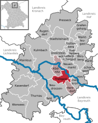
Trebgast
- municipality of Germany
Trebgast is a small municipality located in Bavaria, Germany, surrounded by picturesque landscapes that are ideal for hiking enthusiasts. While it may not be as widely recognized as some larger hiking destinations, the region offers beautiful trails that can cater to various skill levels....
- Country:

- Postal Code: 95367
- Local Dialing Code: 09227
- Licence Plate Code: KU
- Coordinates: 50° 4' 0" N, 11° 33' 0" E


- GPS tracks (wikiloc): [Link]
- AboveSeaLevel: 361 м m
- Area: 17.08 sq km
- Population: 1588
- Web site: [Link]

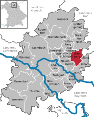
Wirsberg
- municipality of Germany
Wirsberg, a quaint town located in Bavaria, Germany, offers a delightful experience for hiking enthusiasts. Nestled in the scenic countryside, it serves as a great starting point for various trails that showcase the region's natural beauty....
- Country:

- Postal Code: 95339
- Local Dialing Code: 09227
- Licence Plate Code: KU
- Coordinates: 50° 6' 23" N, 11° 36' 23" E


- GPS tracks (wikiloc): [Link]
- AboveSeaLevel: 370 м m
- Area: 17.21 sq km
- Population: 1842
- Web site: [Link]
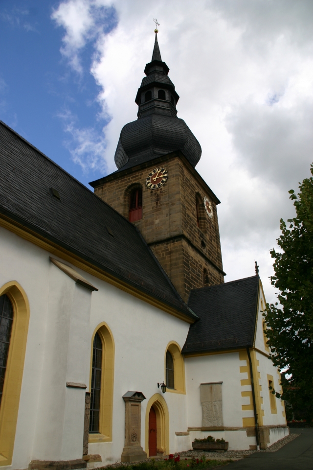

Untersteinach
- municipality of Germany
Untersteinach is a small town located in the Bavarian region of Germany, known for its beautiful landscapes and outdoor activities, including hiking. The area around Untersteinach offers a variety of trails suitable for different skill levels, making it a great destination for both novice hikers and experienced trekkers....
- Country:

- Postal Code: 95369
- Local Dialing Code: 09225
- Licence Plate Code: KU
- Coordinates: 50° 7' 52" N, 11° 31' 39" E


- GPS tracks (wikiloc): [Link]
- AboveSeaLevel: 333 м m
- Area: 11.42 sq km
- Population: 1966
- Web site: [Link]


Himmelkron
- municipality of Germany
Himmelkron is located in Bavaria, Germany, and offers a mix of beautiful landscapes and cultural sites. While it's not as widely known as some of the larger hiking destinations in Germany, it can provide some lovely outdoor experiences for those looking to enjoy nature....
- Country:

- Postal Code: 95502
- Local Dialing Code: 09273; 09227
- Licence Plate Code: KU
- Coordinates: 50° 4' 0" N, 11° 35' 0" E


- GPS tracks (wikiloc): [Link]
- AboveSeaLevel: 360 м m
- Area: 23.06 sq km
- Population: 2833
- Web site: [Link]


Rugendorf
- municipality of Germany
Rugendorf is a small village located in Bavaria, Germany, surrounded by beautiful natural landscapes that make it an excellent destination for hiking enthusiasts. The region is characterized by its rolling hills, forests, and picturesque countryside, providing a variety of trails suitable for different skill levels....
- Country:

- Postal Code: 95365
- Local Dialing Code: 09223
- Licence Plate Code: KU
- Coordinates: 50° 12' 0" N, 11° 28' 0" E


- GPS tracks (wikiloc): [Link]
- AboveSeaLevel: 404 м m
- Area: 17.32 sq km
- Population: 968
- Web site: [Link]
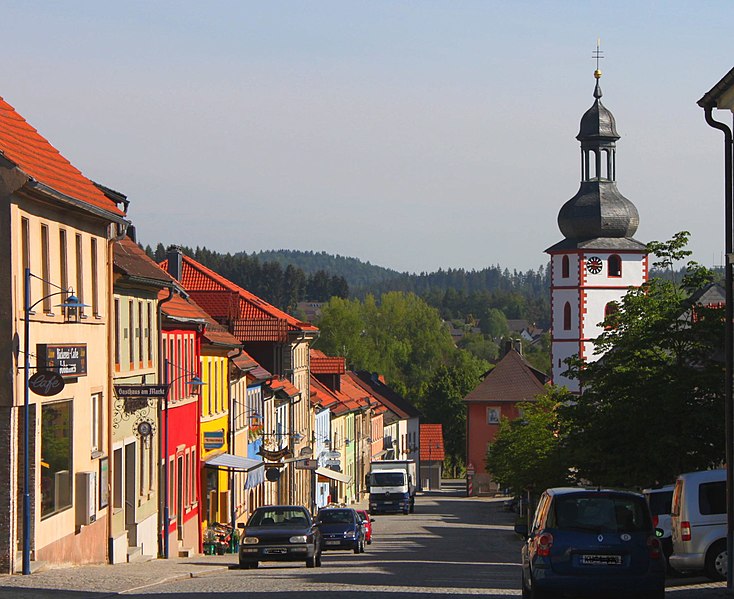
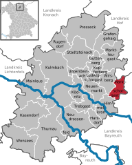
Marktschorgast
- municipality of Germany
Marktschorgast is a small community located in Bavaria, Germany, known for its beautiful natural landscapes, making it an excellent destination for hiking enthusiasts. The area is characterized by its rolling hills, dense forests, and scenic views, offering a variety of trails for different skill levels....
- Country:

- Postal Code: 95509
- Local Dialing Code: 09227
- Licence Plate Code: KU
- Coordinates: 50° 6' 0" N, 11° 39' 0" E


- GPS tracks (wikiloc): [Link]
- AboveSeaLevel: 476 м m
- Area: 15.82 sq km
- Population: 1418
- Web site: [Link]


Kasendorf
- municipality of Germany
Kasendorf is a small municipality located in the Upper Franconia region of Bavaria, Germany. While it may not be as widely known as some of the larger hiking destinations in the country, the surrounding area offers beautiful landscapes and opportunities for outdoor enthusiasts....
- Country:

- Postal Code: 95359
- Local Dialing Code: 09228
- Licence Plate Code: KU
- Coordinates: 50° 1' 0" N, 11° 20' 0" E


- GPS tracks (wikiloc): [Link]
- AboveSeaLevel: 380 м m
- Area: 39 sq km
- Population: 2467
- Web site: [Link]


Neuenmarkt
- municipality of Germany
Neuenmarkt, located in the beautiful Bavaria region of Germany, offers a serene hiking experience with its picturesque landscapes and well-maintained trails. Here are some highlights and tips for hiking in and around Neuenmarkt:...
- Country:

- Postal Code: 95339
- Local Dialing Code: 09227
- Licence Plate Code: KU
- Coordinates: 50° 5' 38" N, 11° 35' 3" E


- GPS tracks (wikiloc): [Link]
- AboveSeaLevel: 348 м m
- Area: 18.95 sq km
- Population: 2750
- Web site: [Link]
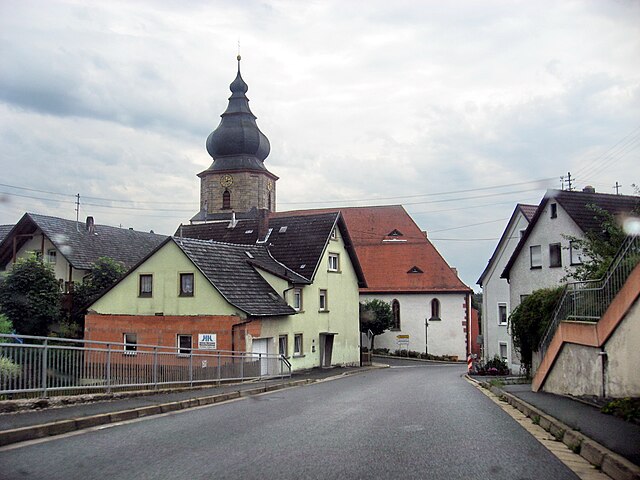

Kupferberg
- municipality of Germany
Kupferberg, located in Germany, is known for its beautiful landscapes and hiking opportunities. While I'm not familiar with a specific region called Kupferberg that is widely recognized, it’s possible that you are referring to a local area known for its hiking trails or perhaps a smaller mountain or hillock in a particular region....
- Country:

- Postal Code: 95362
- Local Dialing Code: 09227
- Licence Plate Code: KU
- Coordinates: 50° 8' 21" N, 11° 34' 39" E


- GPS tracks (wikiloc): [Link]
- AboveSeaLevel: 467 м m
- Area: 8.29 sq km
- Population: 1033
- Web site: [Link]
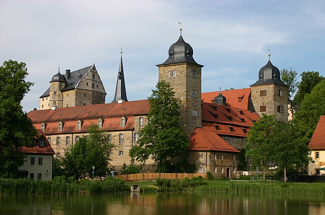
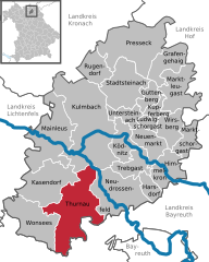
Thurnau
- municipality of Germany
Thurnau, located in Bavaria, Germany, offers a wonderful backdrop for hiking enthusiasts. The region is characterized by picturesque landscapes, charming villages, and a variety of trails suitable for different skill levels. Here are some highlights and tips for hiking in Thurnau:...
- Country:

- Postal Code: 95349
- Local Dialing Code: 09228
- Licence Plate Code: KU
- Coordinates: 50° 1' 32" N, 11° 23' 39" E


- GPS tracks (wikiloc): [Link]
- AboveSeaLevel: 363 м m
- Area: 64.18 sq km
- Population: 4183
- Web site: [Link]


Harsdorf
- municipality of Germany
Harsdorf is a quaint village located in Poland, surrounded by beautiful natural landscapes that are well-suited for hiking and outdoor activities. While it may not be as famous as larger hiking destinations, it offers a unique experience for nature enthusiasts. Here are some tips and highlights for hiking in and around Harsdorf:...
- Country:

- Postal Code: 95499
- Local Dialing Code: 09203
- Licence Plate Code: KU
- Coordinates: 50° 1' 46" N, 11° 33' 59" E


- GPS tracks (wikiloc): [Link]
- AboveSeaLevel: 351 м m
- Area: 11.25 sq km
- Population: 988
- Web site: [Link]


Grafengehaig
- municipality of Germany
Grafengehaig is a charming village located in Bavaria, Germany, and offers several opportunities for hiking enthusiasts. The surrounding region is characterized by beautiful landscapes, including forests, hills, and picturesque valleys, making it an ideal location for a variety of outdoor activities....
- Country:

- Postal Code: 95356
- Local Dialing Code: 09255
- Licence Plate Code: KU
- Coordinates: 50° 12' 0" N, 11° 34' 0" E


- GPS tracks (wikiloc): [Link]
- AboveSeaLevel: 568 м m
- Area: 20.8 sq km
- Population: 958
- Web site: [Link]


Ködnitz
- municipality of Germany
Ködnitz is a picturesque area known for its scenic landscapes and natural beauty, making it a great destination for hiking enthusiasts. Located near the city of Kronach in Bavaria, Germany, it offers various trails suitable for all skill levels, from easy walks to more challenging hikes....
- Country:

- Postal Code: 95361
- Local Dialing Code: 09221
- Licence Plate Code: KU
- Coordinates: 50° 6' 0" N, 11° 31' 0" E


- GPS tracks (wikiloc): [Link]
- AboveSeaLevel: 318 м m
- Area: 19.62 sq km
- Population: 1595
- Web site: [Link]


Ludwigschorgast
- municipality of Germany
Ludwigschorgast is a charming municipality located in Bavaria, Germany, known for its picturesque landscapes and outdoor recreational opportunities, including hiking. Nestled near the beautiful Franconian Forest, it offers a range of hiking trails that cater to different skill levels and preferences....
- Country:

- Postal Code: 95364
- Local Dialing Code: 09227
- Licence Plate Code: KU
- Coordinates: 50° 7' 32" N, 11° 33' 35" E


- GPS tracks (wikiloc): [Link]
- AboveSeaLevel: 339 м m
- Area: 5.95 sq km
- Population: 881
- Web site: [Link]
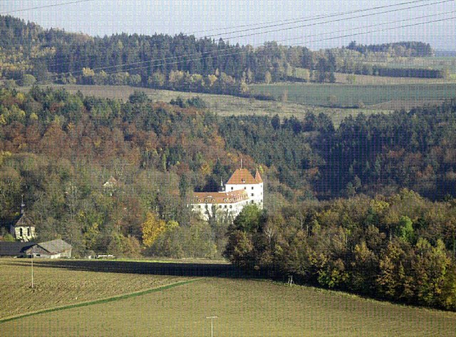
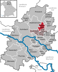
Guttenberg
- Municipality in the District of Kulmbach, Upper Franconia, Bavaria, Germany
Guttenberg, located in Bavaria, Germany, is a small town that offers access to beautiful hiking trails, scenic landscapes, and cultural experiences. While Guttenberg itself may not have extensive hiking routes, you can explore the surrounding areas, which are rich in natural beauty and hiking opportunities....
- Country:

- Postal Code: 95358
- Local Dialing Code: 09225
- Licence Plate Code: KU
- Coordinates: 50° 9' 18" N, 11° 33' 53" E


- GPS tracks (wikiloc): [Link]
- AboveSeaLevel: 452 м m
- Area: 10.66 sq km
- Population: 502
- Web site: [Link]
Shares border with regions:


Hof
- district in Bavaria, Germany
Hof is a district located in Bavaria, Germany, known for its scenic landscapes, charming towns, and outdoor recreational opportunities. The region offers various hiking trails that cater to different skill levels, making it a great destination for both beginners and experienced hikers....
- Country:

- Capital: Hof
- Licence Plate Code: SAN; REH; NAI; MÜB; HO
- Coordinates: 50° 15' 0" N, 11° 49' 48" E


- GPS tracks (wikiloc): [Link]
- AboveSeaLevel: 581 м m
- Area: 893.00 sq km
- Population: 105628
- Web site: [Link]

Kronach
- district in Bavaria, Germany
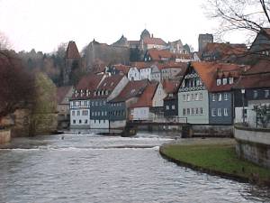
Kronach, located in Bavaria, Germany, is an excellent destination for hiking enthusiasts. The district is characterized by its beautiful landscapes, rich history, and diverse trails suitable for all levels of hikers. Here are some highlights regarding hiking in Kronach:...
- Country:

- Capital: Kronach
- Licence Plate Code: SAN; KC
- Coordinates: 50° 19' 48" N, 11° 22' 12" E


- GPS tracks (wikiloc): [Link]
- AboveSeaLevel: 412 м m
- Area: 651.00 sq km
- Population: 75353
- Web site: [Link]


Bayreuth
- district in Bavaria, Germany
Bayreuth, located in the northern part of Bavaria, Germany, offers a diverse range of hiking opportunities set against a backdrop of beautiful landscapes, forests, and cultural sites. The region is known for its rich history, stunning scenery, and well-marked trails suitable for hikers of all levels....
- Country:

- Capital: Bayreuth
- Licence Plate Code: PEG; MÜB; KEM; ESB; EBS; BT
- Coordinates: 49° 55' 12" N, 11° 30' 0" E


- GPS tracks (wikiloc): [Link]
- AboveSeaLevel: 507 м m
- Area: 1273.00 sq km
- Population: 96772
- Web site: [Link]


Lichtenfels
- district in Bavaria, Germany
Lichtenfels is a district in Bavaria, Germany, known for its picturesque landscapes and scenic hiking trails. Nestled in the heart of the Franconian region, it offers a variety of hiking opportunities suitable for different skill levels and preferences. Here are some key points about hiking in Lichtenfels:...
- Country:

- Capital: Lichtenfels
- Licence Plate Code: STE; LIF
- Coordinates: 50° 6' 36" N, 11° 7' 12" E


- GPS tracks (wikiloc): [Link]
- AboveSeaLevel: 422 м m
- Area: 552.00 sq km
- Population: 65602
- Web site: [Link]

