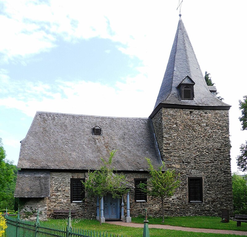
Hohenstein (Hohenstein)

- Rheingau-Taunus municipality in Germany
 Hiking in Hohenstein
Hohenstein, located in the state of Hesse, Germany, offers an array of hiking opportunities that highlight the region’s natural beauty and rich cultural heritage.
Overview
Hohenstein is characterized by its well-preserved landscapes, including rolling hills, dense forests, and charming villages. The area is part of the picturesque Hintertaunus region, making it a fantastic destination for outdoor enthusiasts and hikers of all levels.
Popular Trails
-
Hohenstein Circular Trail (Rundweg Hohenstein):
- This circular trail provides an excellent introduction to the area. It usually covers around 10–15 km and allows hikers to experience stunning panoramic views from various viewpoints.
- The trail takes you through thick forests and past scenic meadows, making it a perfect way to enjoy the tranquility of nature.
-
Lahn-Taunus Trail:
- This longer trail connects the Lahn Valley with the Taunus mountains and passes through Hohenstein. It’s well-marked and offers several stages that can be tackled individually.
- The terrain varies, providing both challenging sections and easier walks, ideal for both experienced hikers and families.
-
Local Paths:
- There are numerous lesser-known trails around Hohenstein that can offer a more tranquil hiking experience. These might be more rustic and can lead you to hidden gems such as small streams, historical structures, and quiet forested areas.
Best Times to Hike
- Spring and Fall: These seasons generally have mild temperatures and vibrant colors, making them ideal for hiking. Wildflowers bloom in spring, and the autumn foliage is breathtaking.
- Summer: It can get warm, but early morning or late afternoon hikes can be quite pleasant.
Preparation Tips
- Gear: Make sure to wear sturdy hiking shoes suitable for varying terrain, and dress in layers since weather can change throughout the day.
- Water & Snacks: Bring enough water and some snacks, especially if you're taking on longer trails.
- Navigation: While the trails in Hohenstein are generally well-marked, carrying a map or using a hiking app can be helpful.
Local Attractions
- Castles and Historic Sites: The area around Hohenstein features several historical sites, including castles and ruins that can add an educational element to your hikes.
- Local Cuisine: Stop by local eateries in nearby villages to enjoy traditional Hessian cuisine, particularly their apple wine and regional dishes.
Always check local trail conditions before heading out, and consider stopping by a local visitor center for updated information and trail maps. Enjoy your hiking adventure in Hohenstein!
- Country:

- Postal Code: 65329
- Local Dialing Code: 06128; 06124; 06120
- Coordinates: 50° 11' 37" N, 8° 6' 1" E


- GPS tracks (wikiloc): [Link]
- AboveSeaLevel: 334 м m
- Area: 63.79 sq km
- Population: 6137
- Web site: http://www.hohenstein-hessen.de
- Wikipedia en: wiki(en)
- Wikipedia: wiki(de)
- Wikidata storage: Wikidata: Q640473
- Wikipedia Commons Category: [Link]
- Freebase ID: [/m/02vvmjb]
- GeoNames ID: Alt: [2901431]
- OSM relation ID: [412939]
- GND ID: Alt: [4222268-0]
- German municipality key: 06439006
Includes regions:
Burg-Hohenstein
- municipal district of Hohenstein in Rheingau-Taunus-Kreis, Germany
Hiking in Burg-Hohenstein
Burg-Hohenstein, often simply referred to as Hohenstein, is a picturesque area that offers a wealth of hiking opportunities in the region. Located in Germany, it is particularly known for its captivating landscapes, historical significance, and well-marked trails that cater to various skill levels....
- Country:
- Postal Code: 65329
- Local Dialing Code: 06120
- Coordinates: 50° 11' 28" N, 8° 3' 25" E
- GPS tracks (wikiloc): [Link]
- AboveSeaLevel: 354 м m
- Area: 8.2 sq km
Hennethal
- municipal district of Hohenstein in Rheingau-Taunus-Kreis, Germany
Hiking in Hennethal
Hennethal is a picturesque area that offers a variety of hiking opportunities in a stunning natural environment. Located in the region of Germany, specifically in the state of Hesse, Hennethal is known for its beautiful landscapes, rolling hills, forests, and serene valleys. Here are some key points to consider when hiking in Hennethal:...
- Country:
- Postal Code: 65329
- Local Dialing Code: 06120
- Coordinates: 50° 13' 46" N, 8° 7' 15" E
- GPS tracks (wikiloc): [Link]
- AboveSeaLevel: 247 м m
- Area: 8.2 sq km
Holzhausen über Aar
- municipal district of Hohenstein in Rheingau-Taunus-Kreis, Germany
Hiking in Holzhausen über Aar
Holzhausen über Aar is a small village in the state of Hesse, Germany, offering a serene environment for hiking enthusiasts. Nestled near the Aar river and surrounded by picturesque landscapes, it provides a great opportunity to explore the natural beauty of the area....
- Country:
- Postal Code: 65329
- Local Dialing Code: 06120
- Coordinates: 50° 12' 30" N, 8° 5' 20" E
- GPS tracks (wikiloc): [Link]
- AboveSeaLevel: 296 м m
- Area: 11.0 sq km

Steckenroth
- municipal district of Hohenstein in Rheingau-Taunus-Kreis, Germany
Hiking in Steckenroth
Steckenroth is a small village located in Germany, often known for its beautiful natural landscapes and accessibility to outdoor activities, including hiking. Although it's not as widely known as larger hiking destinations, it offers a variety of trails that cater to different skill levels and experiences. Here are some key points to consider when planning a hike in and around Steckenroth:...
- Country:
- Postal Code: 65329
- Local Dialing Code: 06128
- Coordinates: 50° 11' 24" N, 8° 7' 29" E
- GPS tracks (wikiloc): [Link]
- AboveSeaLevel: 332 м m
- Area: 9.2 sq km
Strinz-Margarethä
- municipal district of Hohenstein in Rheingau-Taunus-Kreis, Germany
Hiking in Strinz-Margarethä
Strinz-Margarethä is a small area in Germany, located in the state of Rhineland-Palatinate. While it may not be as widely known for hiking as some of the larger national parks or mountainous regions, there are still beautiful and scenic trails suitable for outdoor enthusiasts....
- Country:
- Postal Code: 65329
- Local Dialing Code: 06128
- Coordinates: 50° 12' 27" N, 8° 7' 58" E
- GPS tracks (wikiloc): [Link]
- AboveSeaLevel: 301 м m
- Area: 8.9 sq km
Born
- municipal district of Hohenstein in Rheingau-Taunus-Kreis, Germany
Hiking in Born
Hiking in Born (Hohenstein) offers a fantastic experience, especially for nature enthusiasts and outdoor adventurers. Born is a small village located in the picturesque region of Hohenstein in Germany, surrounded by beautiful landscapes, dense forests, and scenic trails....
- Country:
- Postal Code: 65329
- Local Dialing Code: 06124
- Coordinates: 50° 9' 35" N, 8° 6' 10" E
- GPS tracks (wikiloc): [Link]
- AboveSeaLevel: 397 м m
- Area: 6.8 sq km
Breithardt
- municipal district of Hohenstein in Rheingau-Taunus-Kreis, Germany
Hiking in Breithardt
Breithardt is a lesser-known hiking destination that can provide a peaceful experience in nature. It usually offers a mix of well-marked trails that cater to various skill levels. While specific routes and conditions may vary, here are some general aspects to consider if you're planning a hike in the area:...
- Country:
- Postal Code: 65329
- Local Dialing Code: 06120
- Coordinates: 50° 11' 43" N, 8° 5' 51" E
- GPS tracks (wikiloc): [Link]
- AboveSeaLevel: 290 м m
- Area: 11.5 sq km
Shares border with regions:
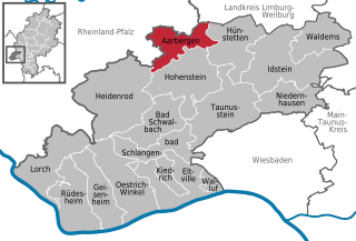
Aarbergen
- Rheingau-Taunus municipality in Hesse, Germany
Hiking in Aarbergen
Aarbergen, a picturesque municipality in the Rhine Valley of Germany, offers a variety of hiking opportunities that cater to different skill levels and preferences. Nestled within the scenic landscapes of the Taunus Mountains, hikers can enjoy lush forests, rolling hills, and stunning views of the surrounding countryside....
- Country:
- Postal Code: 65326
- Local Dialing Code: 06120
- Coordinates: 50° 14' 47" N, 8° 4' 20" E
- GPS tracks (wikiloc): [Link]
- AboveSeaLevel: 230 м m
- Area: 33.94 sq km
- Population: 6082
- Web site: [Link]


Bad Schwalbach
- seat of Rheingau-Taunus-Kreis and town in Hesse, Germany
Hiking in Bad Schwalbach
Bad Schwalbach, located in the scenic Taunus region of Germany, offers a wonderful hiking experience for outdoor enthusiasts. The area is known for its beautiful landscapes, forests, rolling hills, and thermal springs, making it a tranquil destination for hikers of all skill levels. Here are some key points to consider:...
- Country:
- Postal Code: 65307
- Local Dialing Code: 06124
- Coordinates: 50° 8' 25" N, 8° 4' 10" E
- GPS tracks (wikiloc): [Link]
- AboveSeaLevel: 361 м m
- Area: 40.27 sq km
- Population: 11063
- Web site: [Link]

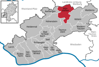
Hünstetten
- Rheingau-Taunus municipality in Germany
Hiking in Hünstetten
Hünstetten is a charming municipality located in the Rheingau-Taunus district of Hesse, Germany. It's nestled on the edge of the Taunus mountain range, making it an excellent spot for hiking enthusiasts. Here are some aspects to consider when planning a hiking trip in Hünstetten:...
- Country:
- Postal Code: 65510
- Local Dialing Code: 06438; 06128; 06126
- Coordinates: 50° 14' 58" N, 8° 11' 43" E
- GPS tracks (wikiloc): [Link]
- AboveSeaLevel: 360 м m
- Area: 50.56 sq km
- Population: 10475
- Web site: [Link]
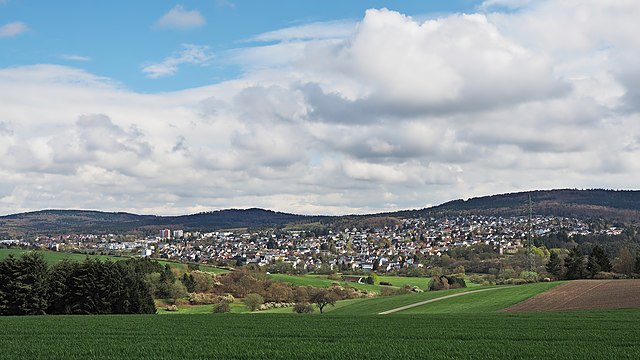

Taunusstein
- town in Rheingau-Taunus-Kreis in Hesse, Germany
Hiking in Taunusstein
Taunusstein is a beautiful town located in the Taunus mountain range in Hesse, Germany. The area is known for its stunning natural landscapes, diverse flora and fauna, and numerous hiking trails suitable for various skill levels. Here are some aspects to consider if you're planning to hike in Taunusstein:...
- Country:
- Postal Code: 65232
- Local Dialing Code: 06128
- Coordinates: 50° 8' 36" N, 8° 9' 38" E
- GPS tracks (wikiloc): [Link]
- AboveSeaLevel: 381 м m
- Area: 67030000 sq km
- Population: 29746
- Web site: [Link]


Heidenrod
- Rheingau-Taunus municipality in Hesse, in Germany
Hiking in Heidenrod
Heidenrod is a picturesque area located in the state of Hesse, Germany. Known for its natural beauty, it offers various opportunities for hiking enthusiasts to explore serene landscapes, forests, and charming villages. Here are some key points to consider if you're planning a hike in Heidenrod:...
- Country:
- Postal Code: 65321
- Local Dialing Code: 06775; 06772; 06124; 06120
- Coordinates: 50° 12' 48" N, 7° 59' 49" E
- GPS tracks (wikiloc): [Link]
- AboveSeaLevel: 361 м m
- Area: 95.94 sq km
- Population: 7880
- Web site: [Link]