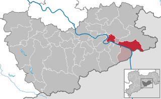
Hohnstein (Hohnstein)

- town in the Sächsische Schweiz-Osterzgebirge district, in the Free State of Saxony, Germany
 Hiking in Hohnstein
Hohnstein is a charming town located in Saxon Switzerland, Germany, an area known for its stunning natural landscapes, unique rock formations, and excellent hiking opportunities. Here are some highlights and tips for hiking in and around Hohnstein:
Scenic Trails
-
Malerweg (Painter's Way): This is one of the most famous hiking trails in the Saxon Switzerland region. It stretches about 112 km and passes near Hohnstein, offering breathtaking views, rugged cliffs, and picturesque landscapes. It generally takes around 8 days to complete, but you can choose shorter sections.
-
Schrammsteine: This rock formation near Hohnstein features several trails that lead to spectacular viewpoints. The trails can be steep in places, offering a rewarding hike for those seeking scenic vistas.
-
Kleinhennersdorfer Stein: Another beautiful spot, this trail provides a mix of wooded paths and rocky outcrops, allowing hikers to experience the diverse topography of the region.
Hiking Tips
-
Trail Markings: Saxon Switzerland has a well-marked network of trails, but make sure to familiarize yourself with the markers and maps. The trails are generally well-signposted.
-
Difficulty Levels: Hiking routes vary widely in difficulty. Some trails are family-friendly and suitable for beginners, while others require a good level of fitness and climbing skills. Always check the trail difficulty before setting out.
-
Weather: The weather in Saxon Switzerland can be quite variable. It’s best to dress in layers and be prepared for changing conditions. Rain gear is advisable, and sturdy hiking boots are a must.
-
Local Advice: Consider stopping at local information centers for maps and advice on current trail conditions. They can provide insights into the best routes based on your interests and skill level.
Points of Interest
-
Hohnstein Castle: The local castle adds historical context to your hiking experience, and it’s a great place to enjoy the views once you’ve reached the top.
-
Local Flora and Fauna: The region is rich in biodiversity, so keep an eye out for various plant species and wildlife, particularly in the spring and summer months.
-
Cafés and Rest Stops: After a long day of hiking, you can relax in one of Hohnstein’s cozy cafés or restaurants.
Safety
Ensure you carry enough water and snacks, especially on longer hikes. It’s also wise to let someone know your hiking plans and expected return time.
With its stunning scenery and extensive trail network, Hohnstein is a fantastic destination for both casual walkers and serious hikers. Enjoy your adventure!
- Country:

- Postal Code: 01848
- Local Dialing Code: 035975
- Licence Plate Code: PIR
- Coordinates: 50° 59' 0" N, 14° 7' 0" E


- GPS tracks (wikiloc): [Link]
- AboveSeaLevel: 330 м m
- Area: 64.61 sq km
- Population: 3301
- Web site: http://www.hohnstein.de
- Wikipedia en: wiki(en)
- Wikipedia: wiki(de)
- Wikidata storage: Wikidata: Q6780
- Wikipedia Commons Category: [Link]
- Freebase ID: [/m/0fdqw8]
- GeoNames ID: Alt: [6550820]
- VIAF ID: Alt: [242112095]
- OSM relation ID: [534530]
- GND ID: Alt: [4095540-0]
- MusicBrainz area ID: [58fb49fd-27d1-4bba-b918-29e72deb6d9b]
- WOEID: [661482]
- Historical Gazetteer (GOV) ID: [HOHEINJO70BX]
- Facebook Places ID: [104005419637031]
- German municipality key: 14628190
- German regional key: 146280190190
Includes regions:
Rathewalde
- human settlement in Germany
Hiking in Rathewalde
Rathewalde is a small village located in the Saxon Switzerland region of Germany, which is renowned for its stunning natural landscapes, unique rock formations, and well-maintained hiking trails. The area offers a variety of hiking opportunities that appeal to both novice and experienced hikers....
- Country:
- Postal Code: 01848
- Local Dialing Code: 035975
- AboveSeaLevel: 300 м m


Cunnersdorf
- human settlement in Germany
Hiking in Cunnersdorf
Cunnersdorf, a small village in the Hohnstein area of Saxon Switzerland in Germany, is an excellent destination for hiking enthusiasts. This region is renowned for its stunning sandstone rock formations, dense forests, and picturesque landscapes, making it a popular spot for both casual walkers and serious hikers....
- Country:
- Postal Code: 01848
- Local Dialing Code: 035975
- Coordinates: 51° 0' 30" N, 14° 8' 20" E
- GPS tracks (wikiloc): [Link]
- AboveSeaLevel: 360 м m
- Area: 9.03 sq km
- Population: 252
Ehrenberg
- human settlement in Germany
Hiking in Ehrenberg
Ehrenberg, located near Hohnstein in the Saxon Switzerland region of Germany, offers a wonderful opportunity for hiking enthusiasts to explore stunning landscapes, rock formations, and historical sites. Here are some highlights and tips for hiking in the Ehrenberg area:...
- Country:
- Postal Code: 01848
- Local Dialing Code: 035975
- AboveSeaLevel: 330 м m
- Area: 11.35 sq km


Goßdorf
- human settlement in Germany
Hiking in Goßdorf
Goßdorf, a charming village located in the Saxon Switzerland region of Germany, offers a variety of hiking opportunities for outdoor enthusiasts. The stunning sandstone formations, lush forests, and picturesque views make it an attractive destination for hikers of all levels. Here’s what you should know about hiking in Goßdorf:...
- Country:
- Postal Code: 01848
- Local Dialing Code: 035975
- Coordinates: 50° 57' 15" N, 14° 10' 0" E
- GPS tracks (wikiloc): [Link]
- AboveSeaLevel: 300 м m
- Area: 3.1 sq km
- Population: 237
Lohsdorf
- human settlement in Germany
Hiking in Lohsdorf
Lohsdorf, located near Hohnstein in the Saxon Switzerland region of Germany, is a great destination for hiking enthusiasts. This area is renowned for its stunning sandstone rock formations, picturesque landscapes, and well-marked trails suitable for hikers of all skill levels....
- Country:
- Postal Code: 01848
- Local Dialing Code: 035975
- AboveSeaLevel: 290 м m
Ulbersdorf
- ortsteil of Hohnstein in Saxony, Germany
Hiking in Ulbersdorf
Ulbersdorf is a picturesque village located in Germany, surrounded by beautiful landscapes that offer great hiking opportunities. The area is characterized by its scenic views, forests, and rolling hills, making it an ideal destination for outdoor enthusiasts....
- Country:
- Postal Code: 01848
- Local Dialing Code: 035971
- Coordinates: 50° 57' 40" N, 14° 12' 40" E
- GPS tracks (wikiloc): [Link]
- AboveSeaLevel: 282 м m
- Area: 8.46 sq km
Waitzdorf
- human settlement in Germany
Hiking in Waitzdorf
Waitzdorf is a picturesque area in Germany, known for its beautiful landscapes and hiking opportunities, located near the border of the Saxon Switzerland National Park. Although it may not be as widely recognized as some major hiking destinations, it offers a range of trails catering to various skill levels. Here are some insights into hiking in and around Waitzdorf:...
- Country:
- Postal Code: 01848
- Local Dialing Code: 035975
- AboveSeaLevel: 330 м m
Shares border with regions:

Bad Schandau
- town in Germany
Hiking in Bad Schandau
Bad Schandau, located in the Saxon Switzerland National Park in Germany, is a splendid destination for hiking enthusiasts. Known for its stunning sandstone formations, lush forests, and picturesque landscapes along the Elbe River, it offers a variety of trails for all skill levels. Here are some highlights:...
- Country:
- Postal Code: 01812–01814
- Local Dialing Code: 035022
- Licence Plate Code: PIR
- Coordinates: 50° 55' 0" N, 14° 9' 0" E
- GPS tracks (wikiloc): [Link]
- AboveSeaLevel: 146 м m
- Area: 46.77 sq km
- Population: 3606
- Web site: [Link]


Dürrröhrsdorf-Dittersbach
- municipality in the district of Sächsische Schweiz-Osterzgebirge, Germany
Hiking in Dürrröhrsdorf-Dittersbach
Dürrröhrsdorf-Dittersbach is a beautiful area located in the Saxony region of Germany, known for its picturesque landscapes, charming villages, and numerous opportunities for outdoor activities, including hiking. Here are some highlights for hiking in this region:...
- Country:
- Postal Code: 01833
- Local Dialing Code: 035026
- Licence Plate Code: PIR
- Coordinates: 51° 2' 0" N, 14° 0' 0" E
- GPS tracks (wikiloc): [Link]
- AboveSeaLevel: 240 м m
- Area: 43.5 sq km
- Population: 4200
- Web site: [Link]