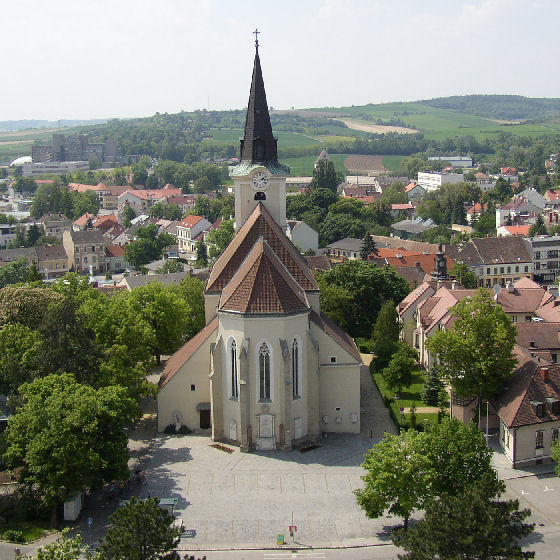
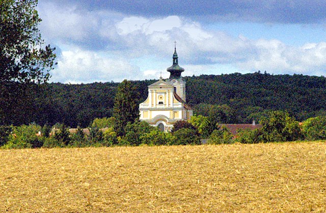
Sitzendorf an der Schmida (Sitzendorf an der Schmida)
- municipality in Austria
 Hiking in Sitzendorf an der Schmida
Sitzendorf an der Schmida is a picturesque village located in the Lower Austria region of Austria. The surrounding countryside offers a delightful range of hiking opportunities, making it a great destination for outdoor enthusiasts.
Hiking Trails and Nature
- Scenic Landscapes: The region features beautiful rolling hills, vineyards, and forests. Hikers can enjoy the serene natural environment, rich in local flora and fauna.
- Trails: There are several marked hiking trails in and around Sitzendorf, suitable for varying skill levels. Many trails can take you through charming landscapes and traditional villages, offering a glimpse into local life.
Recommended Hikes
- Local Nature Trails: There are numerous signposted nature trails in the vicinity that vary in length and difficulty. These trails are often well-maintained and suitable for families.
- Wine Hiking Trails: The region is also known for its wine production, and some trails take you through vineyards, making it possible to enjoy wine tastings at local wineries as part of your hike.
- Loop Trails: Some loops can be completed within a few hours, perfect for those looking for a short day hike.
Preparation and Tips
- Footwear: Wear sturdy hiking boots to navigate various terrain types.
- Weather: Check the weather forecast before heading out, as conditions can change quickly in the mountains.
- Maps and Information: Bring a map or download hiking apps that provide trail information for the area to ensure you stay on track.
- Hydration and Snacks: Carry plenty of water and snacks, especially on longer hikes.
- Cultural Sites: Consider incorporating visits to local attractions or cultural sites along your route, enhancing your hiking experience.
Conclusion
Hiking in Sitzendorf an der Schmida is a refreshing way to explore the stunning landscapes of Lower Austria. Whether you're an experienced hiker or a beginner, the area offers a range of trails that allow you to experience the natural beauty and charm of the region. Remember to take your time to enjoy the views and the peaceful environment!
- Country:

- Postal Code: 3714
- Local Dialing Code: 02959
- Licence Plate Code: HL
- Coordinates: 48° 35' 59" N, 15° 56' 24" E


- GPS tracks (wikiloc): [Link]
- AboveSeaLevel: 244 м m
- Area: 61.85 sq km
- Population: 2162
- Web site: http://www.sitzendorf.at
- Wikipedia en: wiki(en)
- Wikipedia: wiki(de)
- Wikidata storage: Wikidata: Q669583
- Wikipedia Commons Category: [Link]
- Freebase ID: [/m/02qx7mq]
- GeoNames ID: Alt: [2764981]
- VIAF ID: Alt: [158678159]
- Library of Congress authority ID: Alt: [no2009113569]
- Austrian municipality key: [31043]
Shares border with regions:

Zellerndorf
- municipality in Austria
Zellerndorf, located in the scenic wine region of Lower Austria, offers a beautiful backdrop for hiking enthusiasts. The area is characterized by rolling hills, vineyards, and picturesque landscapes, making it ideal for both moderate day hikes and leisurely strolls....
- Country:

- Postal Code: 2051
- Local Dialing Code: 02945
- Licence Plate Code: HL
- Coordinates: 48° 42' 0" N, 15° 57' 0" E


- GPS tracks (wikiloc): [Link]
- AboveSeaLevel: 230 м m
- Area: 41.12 sq km
- Population: 2432
- Web site: [Link]

Ziersdorf
- municipality in Austria
Ziersdorf, located in Lower Austria, is known for its beautiful countryside and scenic landscapes, making it a great destination for hiking enthusiasts. Here are some key points to consider when planning a hiking trip in Ziersdorf:...
- Country:

- Postal Code: 3710
- Local Dialing Code: 02956
- Licence Plate Code: HL
- Coordinates: 48° 32' 0" N, 15° 56' 0" E


- GPS tracks (wikiloc): [Link]
- AboveSeaLevel: 230 м m
- Area: 48.72 sq km
- Population: 3446
- Web site: [Link]

Hollabrunn
- municipality in Austria
Hollabrunn is a town located in Lower Austria, surrounded by beautiful landscapes, which makes it a great place for hiking enthusiasts. The region offers a variety of trails suitable for different skill levels, ranging from leisurely walks to more challenging hikes....
- Country:

- Postal Code: 2020
- Local Dialing Code: 02952
- Licence Plate Code: HL
- Coordinates: 48° 34' 0" N, 16° 5' 0" E


- GPS tracks (wikiloc): [Link]
- AboveSeaLevel: 236 м m
- Area: 152.38 sq km
- Population: 11681
- Web site: [Link]

Maissau
- municipality in Austria
Maissau is a charming town located in the Lower Austria region, offering a variety of hiking opportunities and scenic trails that showcase the beautiful landscapes of the area. Here are some highlights regarding hiking in Maissau:...
- Country:

- Postal Code: 3712
- Local Dialing Code: 02958
- Licence Plate Code: HL
- Coordinates: 48° 34' 0" N, 15° 49' 0" E


- GPS tracks (wikiloc): [Link]
- AboveSeaLevel: 341 м m
- Area: 43.14 sq km
- Population: 1946
- Web site: [Link]

Guntersdorf
- municipality in Austria
Guntersdorf is a charming village located in Austria, nestled in the scenic landscape of Lower Austria. While Guntersdorf itself is small, the surrounding area offers beautiful hiking opportunities that allow you to explore nature, enjoy the countryside, and soak in the tranquil atmosphere....
- Country:

- Postal Code: 2042
- Local Dialing Code: 02951
- Licence Plate Code: HL
- Coordinates: 48° 39' 0" N, 16° 3' 0" E


- GPS tracks (wikiloc): [Link]
- AboveSeaLevel: 246 м m
- Area: 28.41 sq km
- Population: 1145
- Web site: [Link]

Straning-Grafenberg
- municipality in Austria
Straning-Grafenberg is located in Austria and offers beautiful hiking opportunities, particularly in the surrounding areas of the Austrian Alps. Here are some highlights and tips for hiking in this region:...
- Country:

- Postal Code: 3722
- Local Dialing Code: 02984
- Licence Plate Code: HO
- Coordinates: 48° 37' 14" N, 15° 51' 24" E


- GPS tracks (wikiloc): [Link]
- AboveSeaLevel: 292 м m
- Area: 26.47 sq km
- Population: 781
- Web site: [Link]


Ravelsbach
- municipality in Austria
Ravelsbach, located in Austria, offers a beautiful and scenic environment for hikers. Nestled in the northeastern part of Lower Austria, this area is part of the broader landscape known for its rolling hills, vineyards, and charming villages, making it an attractive destination for outdoor enthusiasts....
- Country:

- Postal Code: 3720
- Local Dialing Code: 02958
- Licence Plate Code: HL
- Coordinates: 48° 33' 0" N, 15° 51' 0" E


- GPS tracks (wikiloc): [Link]
- AboveSeaLevel: 265 м m
- Area: 26.37 sq km
- Population: 1580
- Web site: [Link]

Röschitz
- municipality in Austria
Röschitz is a charming village located in the Lower Austria region of Austria, surrounded by picturesque landscapes that are perfect for hiking enthusiasts. The area is known for its rolling hills, vineyards, and lush natural surroundings, making it an ideal destination for both novice and experienced hikers....
- Country:

- Postal Code: 3743
- Local Dialing Code: 02984
- Licence Plate Code: HO
- Coordinates: 48° 40' 0" N, 15° 53' 0" E


- GPS tracks (wikiloc): [Link]
- AboveSeaLevel: 280 м m
- Area: 21.16 sq km
- Population: 1052
- Web site: [Link]

Grabern
- municipality in Austria
Grabern, nestled in the picturesque landscapes of Lower Austria, offers a variety of hiking options for enthusiasts looking to explore its natural beauty. While it may not be as well-known as some of the larger hiking regions, the area around Grabern provides charming trails that showcase the rolling hills, vineyards, and scenic views characteristic of this part of Austria....
- Country:

- Postal Code: 2020
- Local Dialing Code: 02952
- Licence Plate Code: HL
- Coordinates: 48° 36' 51" N, 16° 1' 11" E


- GPS tracks (wikiloc): [Link]
- AboveSeaLevel: 251 м m
- Area: 30.94 sq km
- Population: 1642
- Web site: [Link]