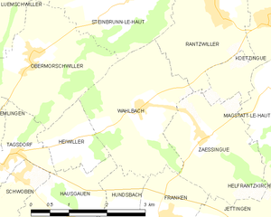
Hundsbach (Hundsbach)

- commune in Haut-Rhin, France
 Hiking in Hundsbach
Hundsbach, located in the Haut-Rhin department of the Grand Est region in France, offers a scenic backdrop for hiking enthusiasts. Nestled in the heart of the Alsace region, it's characterized by rolling hills, lush forests, and charming vineyards.
Popular Hiking Trails:
-
Local Trails: The area around Hundsbach has various marked trails that cater to different skill levels. You can explore short loops or longer excursions that lead you through beautiful landscapes.
-
Vineyard Paths: Many routes in the nearby regions include vineyard paths that offer picturesque views and the opportunity to sample local wines.
-
Forest Trails: The forests surrounding Hundsbach provide shaded pathways that are perfect for a refreshing hike, especially in warmer months.
Tips for Hiking in Hundsbach:
- Check Weather Conditions: Weather can change rapidly in this region, so be sure to check forecasts before heading out.
- Footwear: Wear sturdy hiking boots or shoes with good traction since some trails can be uneven.
- Water and Snacks: Always carry enough water and lightweight snacks to keep your energy up during the hike.
- Maps and Signage: While many trails are well-marked, carrying a map or using a hiking app can help ensure you stay on course.
- Respect Nature: Follow Leave No Trace principles, and be mindful of local wildlife and plants.
Best Time to Hike:
- Spring and Fall: These seasons offer favorable weather and stunning scenery, especially with the blooming flowers in spring and the colorful foliage in autumn.
- Summer: Invest in early morning or late afternoon hikes to avoid the heat of the day.
Whether you're looking for a leisurely stroll or a more challenging hike, Hundsbach and its surroundings offer a variety of options suitable for all hikers!
- Country:

- Postal Code: 68130
- Coordinates: 47° 36' 10" N, 7° 20' 1" E


- GPS tracks (wikiloc): [Link]
- Area: 4.03 sq km
- Population: 344
- Wikipedia en: wiki(en)
- Wikipedia: wiki(fr)
- Wikidata storage: Wikidata: Q83416
- Wikipedia Commons Category: [Link]
- Freebase ID: [/m/03nt6d9]
- Freebase ID: [/m/03nt6d9]
- GeoNames ID: Alt: [6441478]
- GeoNames ID: Alt: [6441478]
- SIREN number: [216801480]
- SIREN number: [216801480]
- BnF ID: [15271850n]
- BnF ID: [15271850n]
- VIAF ID: Alt: [248810815]
- VIAF ID: Alt: [248810815]
- INSEE municipality code: 68148
- INSEE municipality code: 68148
Shares border with regions:

Wahlbach
- commune in Haut-Rhin, France
Hiking in Wahlbach
Wahlbach is a small village located in the Haut-Rhin department of the Alsace region in northeastern France. The area surrounding Wahlbach offers beautiful hiking opportunities, showcasing the unique landscapes of the Vosges mountains and the rich natural beauty of Alsace....
- Country:
- Postal Code: 68130
- Coordinates: 47° 37' 52" N, 7° 20' 49" E
- GPS tracks (wikiloc): [Link]
- Area: 6.41 sq km
- Population: 504


Hausgauen
- commune in Haut-Rhin, France
Hiking in Hausgauen
Hausgauen, located in the picturesque region of Germany, offers a variety of hiking opportunities suitable for different skill levels. This area is known for its stunning landscapes, including lush forests, rolling hills, and scenic views, making it a great destination for nature enthusiasts....
- Country:
- Postal Code: 68130
- Coordinates: 47° 36' 16" N, 7° 19' 23" E
- GPS tracks (wikiloc): [Link]
- Area: 5.79 sq km
- Population: 398


Franken
- commune in Haut-Rhin, France
Hiking in Franken
Hiking in the Haut-Rhin area of Alsace, particularly around the village of Franken, offers a delightful experience in both natural beauty and cultural heritage. The region is known for its picturesque landscapes, charming villages, and rich history. Here are some key highlights for hiking in Franken and its surroundings:...
- Country:
- Postal Code: 68130
- Coordinates: 47° 36' 10" N, 7° 21' 18" E
- GPS tracks (wikiloc): [Link]
- Area: 6.22 sq km
- Population: 324


Willer
- commune in Haut-Rhin, France
Hiking in Willer
Willer, a small community nestled in a scenic area, offers a variety of hiking opportunities that cater to different skill levels. While specific trails and conditions may vary, here are some key points to consider for hiking in or around Willer:...
- Country:
- Postal Code: 68960
- Coordinates: 47° 35' 9" N, 7° 19' 11" E
- GPS tracks (wikiloc): [Link]
- Area: 6.21 sq km
- Population: 324