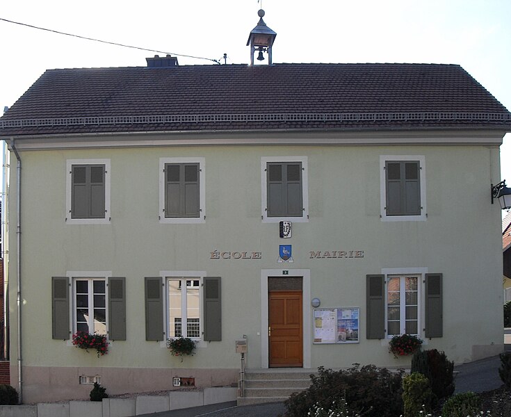
canton of Altkirch (canton d'Altkirch)

- canton of France
 Hiking in canton of Altkirch
The Canton of Altkirch, located in the Alsace region of France, offers beautiful landscapes and a variety of hiking opportunities. Here are some details to consider if you're planning a hiking trip there:
Landscape and Terrain
- Scenic Views: The region features rolling hills, vineyards, and forests, providing picturesque views that change with the seasons.
- Diverse Trails: The area has a mix of easy and moderate trails, suitable for all skill levels. Hikes can range from gentle walks through vineyards to more challenging paths in forested areas.
Popular Hiking Routes
- The Vosges Mountains: To the southwest of the Canton, the Vosges Mountains offer numerous trails with various levels of difficulty. You can explore beautiful ridges and enjoy panoramic views.
- Wine Trails: The Alsace Wine Route is a famous trail that winds through vineyards and charming villages. It's a great way to enjoy the local scenery while also experiencing the region's wine culture.
- Nature Reserves: Look for trails in nature reserves, such as the Natural Park of Ballons des Vosges, where you can hike amid protected flora and fauna, along with opportunities for bird watching.
Practical Tips
- Weather Considerations: The weather can vary, so check local forecasts and dress in layers. Spring and fall often offer the best hiking conditions.
- Trail Markings: Trails are typically well-marked with different colors indicating the level of difficulty. It's a good idea to have a map or download a hiking app that provides GPS coordinates.
- Local Resources: Visit local tourism offices for maps and suggestions on popular hiking routes, as well as guided tours if you prefer not to hike alone.
Safety and Preparedness
- Hydration and Snacks: Carry enough water and snacks, especially on longer hikes.
- Appropriate Gear: Wear sturdy hiking boots and clothing suitable for the terrain and weather. A first-aid kit is also recommended.
- Wildlife Awareness: Keep an eye out for wildlife and be respectful of nature. Follow the Leave No Trace principles to preserve the trails for future hikers.
Hiking in the Canton of Altkirch can be a delightful experience, combining the beauty of nature with the cultural richness of the Alsace region. Enjoy your hike!
- Country:

- Capital: Altkirch
- Coordinates: 47° 38' 9" N, 7° 16' 36" E


- GPS tracks (wikiloc): [Link]
- Area: 433.23 sq km
- Population: 47482
- Wikipedia en: wiki(en)
- Wikipedia: wiki(fr)
- Wikidata storage: Wikidata: Q1283547
- Wikipedia Commons Category: [Link]
- INSEE canton code: [6801]
Includes regions:


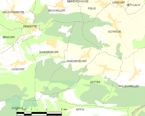
Vieux-Ferrette
- commune in Haut-Rhin, France
Hiking in Vieux-Ferrette
Vieux-Ferrette is a charming village located in the Alsace region of northeastern France, near the border with Switzerland and Germany. This area is often celebrated for its picturesque landscapes, rich history, and diverse outdoor activities, making it a great destination for hiking enthusiasts....
- Country:
- Postal Code: 68480
- Coordinates: 47° 30' 9" N, 7° 17' 57" E
- GPS tracks (wikiloc): [Link]
- Area: 6.63 sq km
- Population: 673


Lucelle
- commune in Haut-Rhin, France
Hiking in Lucelle
Lucelle is a picturesque village located in the Haut-Rhin department of the Alsace region in northeastern France, near the Swiss border. The area around Lucelle offers some beautiful opportunities for hiking, combining natural landscapes, historical sites, and the charm of the Alsace region....
- Country:
- Postal Code: 68480
- Coordinates: 47° 25' 21" N, 7° 14' 50" E
- GPS tracks (wikiloc): [Link]
- Area: 10.27 sq km
- Population: 35


Saint-Bernard
- commune in Haut-Rhin, France
Hiking in Saint-Bernard
Saint-Bernard is a charming commune located in the Haut-Rhin department in the Alsace region of France. It offers a variety of hiking opportunities for enthusiasts of all skill levels. Here’s an overview of what you can expect when hiking in the area:...
- Country:
- Postal Code: 68720
- Coordinates: 47° 40' 16" N, 7° 12' 6" E
- GPS tracks (wikiloc): [Link]
- AboveSeaLevel: 275 м m
- Area: 6.04 sq km
- Population: 553

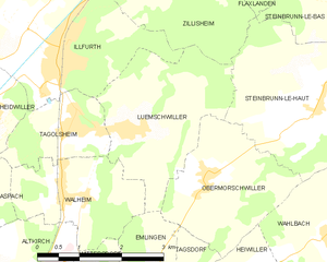
Luemschwiller
- commune in Haut-Rhin, France
Hiking in Luemschwiller
Luemschwiller is a picturesque village located in the Alsace region of France, close to the border with Switzerland. This area is known for its charming landscapes, gentle hills, and scenic views, making it an attractive destination for hiking enthusiasts....
- Country:
- Postal Code: 68720
- Coordinates: 47° 39' 19" N, 7° 17' 21" E
- GPS tracks (wikiloc): [Link]
- Area: 7.27 sq km
- Population: 768


Kœstlach
- commune in Haut-Rhin, France
Hiking in Kœstlach
Kœstlach is a charming area located in the Alsace region of France, near the Swiss border. While it may not be as widely recognized as other hiking destinations, it offers beautiful landscapes, lush forests, and a closer connection to nature....
- Country:
- Postal Code: 68480
- Coordinates: 47° 30' 22" N, 7° 16' 16" E
- GPS tracks (wikiloc): [Link]
- Area: 8.23 sq km
- Population: 508


Liebsdorf
- commune in Haut-Rhin, France
Hiking in Liebsdorf
Liebsdorf is a small village located in the state of Baden-Württemberg, Germany. Although it may not be as well-known as some larger destinations, it offers a variety of scenic landscapes and hiking opportunities that can cater to different skill levels....
- Country:
- Postal Code: 68480
- Coordinates: 47° 28' 45" N, 7° 13' 51" E
- GPS tracks (wikiloc): [Link]
- Area: 4.22 sq km
- Population: 322


Lutter
- commune in Haut-Rhin, France
Hiking in Lutter
Lutter, located in the Haut-Rhin department in the Alsace region of France, offers a variety of hiking opportunities for outdoor enthusiasts. The region is characterized by its picturesque landscapes, rolling hills, vineyards, and charming villages, making it an attractive destination for both casual walkers and seasoned hikers....
- Country:
- Postal Code: 68480
- Coordinates: 47° 27' 58" N, 7° 22' 52" E
- GPS tracks (wikiloc): [Link]
- Area: 8.46 sq km
- Population: 277

Kiffis
- commune in Haut-Rhin, France
Hiking in Kiffis
Kiffis doesn't appear to be widely recognized as a prominent hiking destination, so it's possible that you may be referring to a less-known area or a local name. If Kiffis is a specific location you're interested in, it would be helpful to know its geographic context or features....
- Country:
- Postal Code: 68480
- Coordinates: 47° 26' 25" N, 7° 21' 25" E
- GPS tracks (wikiloc): [Link]
- Area: 6.55 sq km
- Population: 248
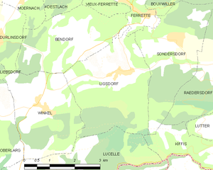
Ligsdorf
- commune in Haut-Rhin, France
Hiking in Ligsdorf
Ligsdorf is a charming area in the Grand Duchy of Luxembourg, nestled within the beautiful region of the Sûre valley. While it may not be as widely known as some other hiking destinations, it offers a selection of picturesque trails that showcase the natural beauty and tranquility of the Luxembourg countryside....
- Country:
- Postal Code: 68480
- Coordinates: 47° 28' 21" N, 7° 18' 19" E
- GPS tracks (wikiloc): [Link]
- Area: 10.03 sq km
- Population: 316

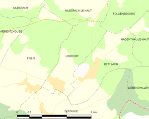
Linsdorf
- commune in Haut-Rhin, France
Hiking in Linsdorf
Linsdorf isn't widely known as a major hiking destination, which suggests it may be a smaller or less commercialized area. If Linsdorf is a rural region or a small village, it may offer some local trails suitable for hiking, often featuring picturesque landscapes, natural beauty, and potential wildlife sightings....
- Country:
- Postal Code: 68480
- Coordinates: 47° 30' 18" N, 7° 23' 49" E
- GPS tracks (wikiloc): [Link]
- Area: 3.36 sq km
- Population: 317


Levoncourt
- commune in Haut-Rhin, France
Hiking in Levoncourt
Levoncourt, located in the Haut-Rhin department of the Alsace region in France, offers a range of hiking opportunities to immerse yourself in the natural beauty of the area. The region is characterized by its picturesque landscapes, rolling hills, and vineyards, making it perfect for outdoor activities....
- Country:
- Postal Code: 68480
- Coordinates: 47° 26' 55" N, 7° 12' 16" E
- GPS tracks (wikiloc): [Link]
- Area: 5.28 sq km
- Population: 246


Oltingue
- commune in Haut-Rhin, France
Hiking in Oltingue
Oltingue is a small commune located in the Haut-Rhin department of eastern France, near the border with Switzerland. Hiking in this area can be quite rewarding, as it offers beautiful landscapes and the chance to experience the unique flora and fauna of the region....
- Country:
- Postal Code: 68480
- Coordinates: 47° 29' 29" N, 7° 23' 30" E
- GPS tracks (wikiloc): [Link]
- Area: 13.42 sq km
- Population: 721
- Web site: [Link]


Moernach
- commune in Haut-Rhin, France
Hiking in Moernach
Mœrnach, a picturesque village in the Luxembourg Ardennes, offers beautiful hiking opportunities amidst lush landscapes, rolling hills, and dense forests. Here are some highlights to consider when hiking in this region:...
- Country:
- Postal Code: 68480
- Coordinates: 47° 30' 13" N, 7° 15' 19" E
- GPS tracks (wikiloc): [Link]
- Area: 6.79 sq km
- Population: 572


Muespach-le-Haut
- commune in Haut-Rhin, France
Hiking in Muespach-le-Haut
Muespach-le-Haut is a charming commune in the Haut-Rhin department of Alsace, in northeastern France. The area is known for its picturesque landscapes, rolling hills, and rich natural surroundings, making it a great destination for hiking enthusiasts....
- Country:
- Postal Code: 68640
- Coordinates: 47° 32' 42" N, 7° 24' 11" E
- GPS tracks (wikiloc): [Link]
- Area: 6.91 sq km
- Population: 1089
- Web site: [Link]

Raedersdorf
- commune in Haut-Rhin, France
Hiking in Raedersdorf
Raedersdorf is a small village located in the Alsace region of France, not far from the German border. It offers a serene environment perfect for hiking enthusiasts who want to explore the scenic beauty of the area. Here are some details and tips for hiking in and around Raedersdorf:...
- Country:
- Postal Code: 68480
- Coordinates: 47° 28' 30" N, 7° 22' 0" E
- GPS tracks (wikiloc): [Link]
- Area: 7.39 sq km
- Population: 506


Obermorschwiller
- commune in Haut-Rhin, France
Hiking in Obermorschwiller
Obermorschwiller is a charming village located in the Alsace region of northeastern France, close to the Swiss border. The area is known for its scenic landscapes, rolling hills, and access to the Vosges Mountains, making it a great destination for hiking enthusiasts....
- Country:
- Postal Code: 68130
- Coordinates: 47° 38' 42" N, 7° 18' 39" E
- GPS tracks (wikiloc): [Link]
- Area: 6.05 sq km
- Population: 402
- Web site: [Link]


Riespach
- commune in Haut-Rhin, France
Hiking in Riespach
Riespach is a small region in the Vosges mountains of France, known for its picturesque landscapes and outdoor activities, including hiking. Here are some key points to consider if you plan to hike in Riespach:...
- Country:
- Postal Code: 68640
- Coordinates: 47° 32' 26" N, 7° 17' 15" E
- GPS tracks (wikiloc): [Link]
- Area: 7.57 sq km
- Population: 686
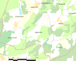
Oberlarg
- commune in Haut-Rhin, France
Hiking in Oberlarg
Oberlarg is a charming village situated in the Grand Est region of northeastern France, near the border with Germany. It's surrounded by the scenic landscapes of the Vosges Mountains, making it an ideal destination for hiking enthusiasts. Here are some key points about hiking in and around Oberlarg:...
- Country:
- Postal Code: 68480
- Coordinates: 47° 27' 27" N, 7° 14' 1" E
- GPS tracks (wikiloc): [Link]
- Area: 8.21 sq km
- Population: 138


Ruederbach
- commune in Haut-Rhin, France
Hiking in Ruederbach
Ruederbach, located in the Alsace region of France, offers various hiking opportunities that showcase the beauty of the surrounding landscape, including vineyards, scenic hills, and the Rhine River. Here are some highlights and tips for hiking in Ruederbach:...
- Country:
- Postal Code: 68560
- Coordinates: 47° 33' 49" N, 7° 16' 10" E
- GPS tracks (wikiloc): [Link]
- Area: 4.46 sq km
- Population: 383

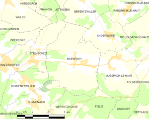
Muespach
- commune in Haut-Rhin, France
Hiking in Muespach
Muespach is a charming village located in the Alsace region of France, close to the border with Switzerland. This picturesque area offers several hiking opportunities for various skill levels, and the surrounding nature is known for its stunning landscapes, lush forests, and rolling hills....
- Country:
- Postal Code: 68640
- Coordinates: 47° 32' 51" N, 7° 22' 50" E
- GPS tracks (wikiloc): [Link]
- AboveSeaLevel: 400 м m
- Area: 11.37 sq km
- Population: 873
- Web site: [Link]


Roppentzwiller
- commune in Haut-Rhin, France
Hiking in Roppentzwiller
Roppentzwiller is a small village located in the Alsace region of France, near the border with Switzerland. This area boasts beautiful landscapes and offers a variety of hiking opportunities for outdoor enthusiasts. Here are some key points to consider when hiking in and around Roppentzwiller:...
- Country:
- Postal Code: 68480
- Coordinates: 47° 32' 25" N, 7° 19' 55" E
- GPS tracks (wikiloc): [Link]
- Area: 4.15 sq km
- Population: 696


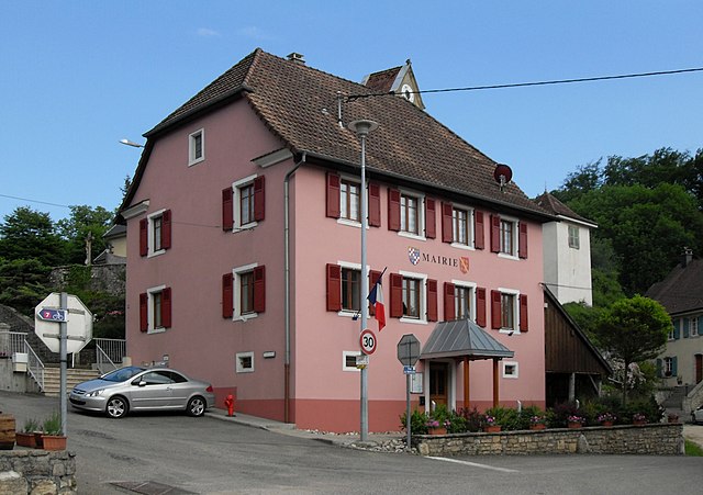
Altkirch
- commune in Haut-Rhin, France
Hiking in Altkirch
Altkirch is a charming town located in the Alsace region of France, known for its scenic beauty and proximity to various hiking trails. The surrounding landscape is characterized by rolling hills, forests, and vineyards, making it a great destination for hiking enthusiasts. Here are some highlights and tips for hiking in and around Altkirch:...
- Country:
- Postal Code: 68130
- Coordinates: 47° 37' 23" N, 7° 14' 22" E
- GPS tracks (wikiloc): [Link]
- AboveSeaLevel: 310 м m
- Area: 9.54 sq km
- Population: 5740
- Web site: [Link]


Spechbach
- commune in Haut-Rhin, France
Hiking in Spechbach
Spechbach, situated in the Haut-Rhin department of Alsace, France, offers a serene and picturesque setting for hiking enthusiasts. The region is characterized by its lush landscapes, rolling hills, and proximity to the Vosges Mountains, making it an excellent destination for outdoor activities....
- Country:
- Postal Code: 68720
- Coordinates: 47° 40' 16" N, 7° 13' 45" E
- GPS tracks (wikiloc): [Link]
- Area: 8.06 sq km


Illtal
- commune in Haut-Rhin, France
Hiking in Illtal
Illtal, located in the Alsace region of France near the border with Germany, is known for its picturesque landscapes, charming villages, and diverse hiking trails. Here are some highlights and tips for hiking in the Illtal area:...
- Country:
- Postal Code: 68960
- Licence Plate Code: 68
- Coordinates: 47° 33' 34" N, 7° 18' 29" E
- GPS tracks (wikiloc): [Link]
- Area: 11.96 sq km


Bouxwiller
- commune in Bas-Rhin, France
- Country:
- Postal Code: 67330
- Coordinates: 48° 49' 31" N, 7° 28' 58" E
- GPS tracks (wikiloc): [Link]
- Area: 25.59 sq km
- Population: 4071
- Web site: [Link]


Sondersdorf
- commune in Haut-Rhin, France
Hiking in Sondersdorf
Sondersdorf, a small town located in Bavaria, Germany, offers access to beautiful hiking trails and scenic landscapes typical of the region. The area is known for its rolling hills, lush forests, and picturesque farmland, making it an ideal location for hikers of all levels....
- Country:
- Postal Code: 68480
- Coordinates: 47° 28' 59" N, 7° 20' 7" E
- GPS tracks (wikiloc): [Link]
- Area: 8.44 sq km
- Population: 343

Biederthal
- commune in Haut-Rhin, France
Hiking in Biederthal
Biederthal is a picturesque area in the Vosges mountains of France, known for its beautiful landscapes, lush forests, and serene hiking trails. The region offers various hiking opportunities suitable for different skill levels, from easy strolls to challenging treks....
- Country:
- Postal Code: 68480
- Coordinates: 47° 28' 11" N, 7° 26' 55" E
- GPS tracks (wikiloc): [Link]
- Area: 4.16 sq km
- Population: 302


Heidwiller
- commune in Haut-Rhin, France
Hiking in Heidwiller
Heidwiller is a small commune located in the Alsace region of France, near the border with Switzerland. While it may not be a widely recognized hiking destination compared to larger national parks or mountainous areas, there are still opportunities for hiking enthusiasts to explore the surrounding countryside and enjoy the natural beauty of the region....
- Country:
- Postal Code: 68720
- Coordinates: 47° 39' 40" N, 7° 14' 38" E
- GPS tracks (wikiloc): [Link]
- Area: 4.48 sq km
- Population: 591


Hausgauen
- commune in Haut-Rhin, France
Hiking in Hausgauen
Hausgauen, located in the picturesque region of Germany, offers a variety of hiking opportunities suitable for different skill levels. This area is known for its stunning landscapes, including lush forests, rolling hills, and scenic views, making it a great destination for nature enthusiasts....
- Country:
- Postal Code: 68130
- Coordinates: 47° 36' 16" N, 7° 19' 23" E
- GPS tracks (wikiloc): [Link]
- Area: 5.79 sq km
- Population: 398


Heimersdorf
- commune in Haut-Rhin, France
Hiking in Heimersdorf
Heimersdorf is a small district in the city of Düsseldorf, Germany. While it may not be widely recognized as a major hiking destination, it can serve as a starting point for exploring the nearby natural areas and parks....
- Country:
- Postal Code: 68560
- Coordinates: 47° 34' 20" N, 7° 14' 31" E
- GPS tracks (wikiloc): [Link]
- Area: 7.59 sq km
- Population: 656


Franken
- commune in Haut-Rhin, France
Hiking in Franken
Hiking in the Haut-Rhin area of Alsace, particularly around the village of Franken, offers a delightful experience in both natural beauty and cultural heritage. The region is known for its picturesque landscapes, charming villages, and rich history. Here are some key highlights for hiking in Franken and its surroundings:...
- Country:
- Postal Code: 68130
- Coordinates: 47° 36' 10" N, 7° 21' 18" E
- GPS tracks (wikiloc): [Link]
- Area: 6.22 sq km
- Population: 324


Heiwiller
- commune in Haut-Rhin, France
Hiking in Heiwiller
Heiwiller is a small village located in the Alsace region of France, known for its picturesque landscapes and proximity to the Vosges mountains. Hiking in and around Heiwiller offers a wonderful opportunity to explore the natural beauty of this area....
- Country:
- Postal Code: 68130
- Coordinates: 47° 37' 26" N, 7° 19' 12" E
- GPS tracks (wikiloc): [Link]
- Area: 2.04 sq km
- Population: 175


Berentzwiller
- commune in Haut-Rhin, France
Hiking in Berentzwiller
Berentzwiller is a small village located in the Alsace region of France, near the border with Switzerland. While it might not be as widely known as some larger hiking destinations, the surrounding area offers some beautiful trails and a chance to explore the picturesque landscape of Alsace....
- Country:
- Postal Code: 68130
- Coordinates: 47° 35' 9" N, 7° 23' 1" E
- GPS tracks (wikiloc): [Link]
- Area: 6.08 sq km
- Population: 322


Carspach
- commune in Haut-Rhin, France
Hiking in Carspach
Carspach is a quaint commune located in the Alsace region of France, surrounded by scenic landscapes typical of the area. While it may not be as famous as some larger hiking destinations, it offers several opportunities for hikers looking to explore the natural beauty of the Alsace countryside....
- Country:
- Postal Code: 68130
- Coordinates: 47° 36' 55" N, 7° 12' 43" E
- GPS tracks (wikiloc): [Link]
- Area: 17.17 sq km
- Population: 2046


Bisel
- commune in Haut-Rhin, France
Hiking in Bisel
Bisel, a small town located in the Alsace region of France, offers a unique hiking experience with its picturesque landscapes and scenic trails. The area is characterized by its rolling hills, vineyards, and proximity to natural reserves, making it an attractive destination for outdoor enthusiasts....
- Country:
- Postal Code: 68580
- Coordinates: 47° 32' 7" N, 7° 13' 6" E
- GPS tracks (wikiloc): [Link]
- Area: 8.1 sq km
- Population: 540

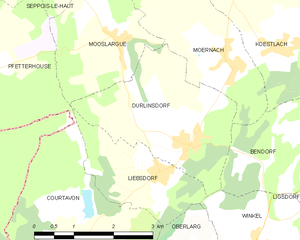
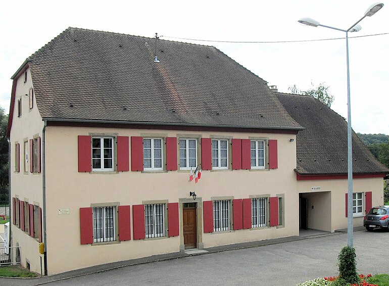
Durlinsdorf
- commune in Haut-Rhin, France
Hiking in Durlinsdorf
Durlinsdorf is a charming village located in the Haut-Rhin department of France, near the borders with Switzerland and Germany. The area is known for its beautiful landscapes, lush forests, and the scenic surroundings of the Vosges Mountains, making it a wonderful destination for hiking enthusiasts....
- Country:
- Postal Code: 68480
- Coordinates: 47° 29' 9" N, 7° 14' 27" E
- GPS tracks (wikiloc): [Link]
- Area: 7.78 sq km
- Population: 569


Hochstatt
- commune in Haut-Rhin, France
Hiking in Hochstatt
Hochstatt is a small town in Germany that may not be widely known for its hiking trails, but the surrounding regions offer some beautiful landscapes and outdoor opportunities. While the immediate area may have limited dedicated hiking paths, there are several nearby locations that are worth exploring for hiking enthusiasts....
- Country:
- Postal Code: 68720
- Coordinates: 47° 42' 7" N, 7° 16' 33" E
- GPS tracks (wikiloc): [Link]
- Area: 8.55 sq km
- Population: 2095

Bettendorf
- commune in Haut-Rhin, France
Hiking in Bettendorf
Bettendorf, located in the Haut-Rhin department of the Alsace region in France, offers beautiful landscapes and hiking opportunities. Surrounded by rolling hills, vineyards, and picturesque villages, this area is a great destination for both beginner and experienced hikers....
- Country:
- Postal Code: 68560
- Coordinates: 47° 35' 2" N, 7° 16' 36" E
- GPS tracks (wikiloc): [Link]
- Area: 4.73 sq km
- Population: 461


Hirsingue
- commune in Haut-Rhin, France
Hiking in Hirsingue
Hirsingue is a picturesque village located in the Alsace region of France, known for its beautiful landscapes and proximity to the Vosges Mountains. While it may not be as well-known as other hiking destinations, it offers several trails and opportunities to enjoy nature....
- Country:
- Postal Code: 68560
- Coordinates: 47° 35' 11" N, 7° 15' 10" E
- GPS tracks (wikiloc): [Link]
- Area: 12.88 sq km
- Population: 2139


Emlingen
- commune in Haut-Rhin, France
Hiking in Emlingen
Emlingen is a small village located in Germany, and while it might not be a widely recognized hiking destination, the surrounding regions may offer some scenic trails and natural beauty for hiking enthusiasts. Here are some general tips and details about hiking in such areas:...
- Country:
- Postal Code: 68130
- Coordinates: 47° 37' 25" N, 7° 17' 28" E
- GPS tracks (wikiloc): [Link]
- Area: 2.42 sq km
- Population: 278


Hirtzbach
- commune in Haut-Rhin, France
Hiking in Hirtzbach
Hirtzbach is located in the Alsace region of France, near the border with Germany. It offers a range of hiking opportunities for nature enthusiasts looking to explore the beautiful landscapes of the area. Here are some highlights and tips for hiking in and around Hirtzbach:...
- Country:
- Postal Code: 68118
- Coordinates: 47° 35' 55" N, 7° 13' 25" E
- GPS tracks (wikiloc): [Link]
- Area: 13.91 sq km
- Population: 1416
- Web site: [Link]

Fislis
- commune in Haut-Rhin, France
Hiking in Fislis
Fislis is not a well-documented hiking destination, so it's possible you might be referring to a specific area, trail, or region that goes by a similar name. However, if you're looking for hiking information in a general context, here's what you can consider if you’re exploring a typical hiking geography:...
- Country:
- Postal Code: 68480
- Coordinates: 47° 30' 16" N, 7° 22' 54" E
- GPS tracks (wikiloc): [Link]
- Area: 7.53 sq km
- Population: 423
- Web site: [Link]

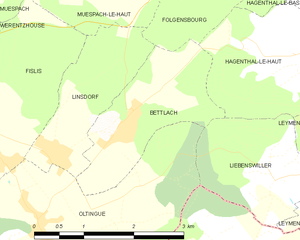
Bettlach
- commune in Haut-Rhin, France
Hiking in Bettlach
Bettlach is a charming commune located in the Haut-Rhin department in the Grand Est region of France. While it may be a smaller and less known area compared to some larger hiking destinations, the surrounding region offers beautiful landscapes, scenic views, and a variety of outdoor activities....
- Country:
- Postal Code: 68480
- Coordinates: 47° 30' 32" N, 7° 24' 51" E
- GPS tracks (wikiloc): [Link]
- Area: 4.09 sq km
- Population: 308

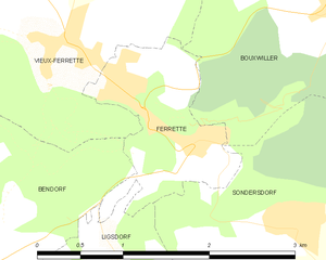
Ferrette
- commune in Haut-Rhin, France
Hiking in Ferrette
Ferrette, a picturesque small town located in the Alsace region of France, is nestled near the border with Switzerland. It offers a variety of hiking opportunities, surrounded by beautiful landscapes, forests, and rolling hills. Here are some highlights and tips for hiking in the Ferrette area:...
- Country:
- Postal Code: 68480
- Coordinates: 47° 29' 38" N, 7° 18' 57" E
- GPS tracks (wikiloc): [Link]
- Area: 1.94 sq km
- Population: 683


Bendorf
- commune in Haut-Rhin, France
Hiking in Bendorf
Bendorf is a small commune located in the Haut-Rhin department in the Alsace region of France. While it may not be as widely recognized as some of the larger hiking destinations in the area, it can offer scenic trails and beautiful landscapes typical of the Alsatian countryside....
- Country:
- Postal Code: 68480
- Coordinates: 47° 29' 15" N, 7° 16' 54" E
- GPS tracks (wikiloc): [Link]
- Area: 7.55 sq km
- Population: 208


Aspach
- commune in Haut-Rhin, France
Hiking in Aspach
Aspach, located in the Haut-Rhin department of the Alsace region in northeastern France, offers beautiful hiking opportunities framed by the picturesque landscapes of the Vosges Mountains and the surrounding countryside. Here are some key points to consider when hiking in this area:...
- Country:
- Postal Code: 68130
- Coordinates: 47° 38' 34" N, 7° 14' 2" E
- GPS tracks (wikiloc): [Link]
- Area: 4.2 sq km
- Population: 1135


Durmenach
- commune in Haut-Rhin, France
Hiking in Durmenach
Durmenach is a charming area surrounded by beautiful landscapes, ideal for hiking enthusiasts. While specific trail information may vary, here are general points about hiking in and around Durmenach:...
- Country:
- Postal Code: 68480
- Coordinates: 47° 31' 37" N, 7° 20' 17" E
- GPS tracks (wikiloc): [Link]
- Area: 5.76 sq km
- Population: 859


Courtavon
- commune in Haut-Rhin, France
Hiking in Courtavon
Courtavon is not widely recognized as a notable hiking destination, so it might be a less explored area. However, if you are interested in hiking in a particular region that includes this name, such as in certain parts of Europe, the experience can vary greatly based on the location....
- Country:
- Postal Code: 68480
- Coordinates: 47° 27' 38" N, 7° 11' 51" E
- GPS tracks (wikiloc): [Link]
- Area: 9.6 sq km
- Population: 370


Frœningen
- commune in Haut-Rhin, France
Hiking in Frœningen
Frœningen is a picturesque location in the Swiss Alps, known for its stunning landscapes and diverse hiking opportunities. It is situated near the charming village of Frœningen, which serves as a great base for outdoor enthusiasts. When hiking in this area, you can expect beautiful mountain vistas, lush meadows, and clear alpine lakes....
- Country:
- Postal Code: 68720
- Coordinates: 47° 41' 27" N, 7° 16' 11" E
- GPS tracks (wikiloc): [Link]
- Area: 4.44 sq km
- Population: 695

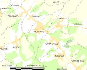
Waldighofen
- commune in Haut-Rhin, France
Hiking in Waldighofen
Waldighofen is a charming village located in the Alsace region of France, known for its picturesque landscapes and outdoor activities, including hiking. When hiking in Waldighofen, you can expect scenic views, a mix of forests, fields, and vineyards, as well as a mild climate suitable for year-round exploration....
- Country:
- Postal Code: 68640
- Coordinates: 47° 33' 3" N, 7° 19' 0" E
- GPS tracks (wikiloc): [Link]
- Area: 4.14 sq km
- Population: 1544
- Web site: [Link]

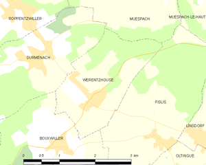
Werentzhouse
- commune in Haut-Rhin, France
Hiking in Werentzhouse
Werentzhouse, located in the Alsace region of France, is not a widely known hiking destination, but the surrounding area offers beautiful landscapes and opportunities for outdoor activities. The region is characterized by its rolling hills, vineyards, and picturesque villages, making it a lovely place to explore on foot. Here are some key points to consider when hiking in and around Werentzhouse:...
- Country:
- Postal Code: 68480
- Coordinates: 47° 31' 1" N, 7° 21' 27" E
- GPS tracks (wikiloc): [Link]
- Area: 4.5 sq km
- Population: 560


Willer
- commune in Haut-Rhin, France
Hiking in Willer
Willer, a small community nestled in a scenic area, offers a variety of hiking opportunities that cater to different skill levels. While specific trails and conditions may vary, here are some key points to consider for hiking in or around Willer:...
- Country:
- Postal Code: 68960
- Coordinates: 47° 35' 9" N, 7° 19' 11" E
- GPS tracks (wikiloc): [Link]
- Area: 6.21 sq km
- Population: 324
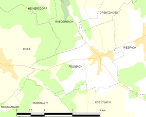
Feldbach
- commune in Haut-Rhin, France
Hiking in Feldbach
Feldbach is a charming commune located in the Haut-Rhin department of the Alsace region in northeastern France. This area is rich in natural beauty, making it a great destination for hiking enthusiasts. Here are some highlights and tips for hiking in and around Feldbach:...
- Country:
- Postal Code: 68640
- Coordinates: 47° 32' 8" N, 7° 15' 51" E
- GPS tracks (wikiloc): [Link]
- Area: 5.02 sq km
- Population: 439
- Web site: [Link]


Schwoben
- commune in Haut-Rhin, France
Hiking in Schwoben
Schwoben appears to be a lesser-known location and may not have extensive hiking information readily available. However, if you’re considering hiking in the broader region of Schwaben (Swabia) in Germany, I can provide some details....
- Country:
- Postal Code: 68130
- Coordinates: 47° 36' 58" N, 7° 18' 14" E
- GPS tracks (wikiloc): [Link]
- Area: 2.38 sq km
- Population: 226


Walheim
- commune in Haut-Rhin, France
Hiking in Walheim
Walheim, located in the Haut-Rhin department of Alsace, France, is surrounded by beautiful landscapes, making it a great starting point for hiking enthusiasts. The region boasts a mix of rolling hills, vineyards, and forests, providing a scenic backdrop for various hiking trails....
- Country:
- Postal Code: 68130
- Coordinates: 47° 38' 31" N, 7° 15' 59" E
- GPS tracks (wikiloc): [Link]
- Area: 4.83 sq km
- Population: 920


Tagolsheim
- commune in Haut-Rhin, France
Hiking in Tagolsheim
Tagolsheim is a small village located in the Alsace region of France, near the border with Germany. While it may not be as widely known as some hiking destinations, it is surrounded by beautiful countryside that offers opportunities for scenic walks and hiking....
- Country:
- Postal Code: 68720
- Coordinates: 47° 39' 20" N, 7° 16' 13" E
- GPS tracks (wikiloc): [Link]
- Area: 3.19 sq km
- Population: 871

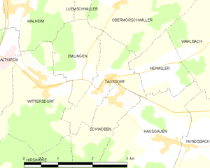
Tagsdorf
- commune in Haut-Rhin, France
Hiking in Tagsdorf
Tagsdorf, while not a widely recognized hiking destination, is a small village in the Alsace region of France, near the German border. This area of Alsace is known for its picturesque landscapes, charming vineyards, and rolling hills, making it a lovely location for hiking enthusiasts looking to explore the natural beauty of the region....
- Country:
- Postal Code: 68130
- Coordinates: 47° 37' 17" N, 7° 18' 6" E
- GPS tracks (wikiloc): [Link]
- Area: 2.5 sq km
- Population: 300


Wittersdorf
- commune in Haut-Rhin, France
Hiking in Wittersdorf
Wittersdorf, a small village located in the Alsace region of France near the border with Switzerland, offers a peaceful and picturesque setting for hiking enthusiasts. The surrounding area is characterized by beautiful landscapes, rolling hills, vineyards, and plenty of natural beauty, making it a delightful spot for both casual walkers and experienced hikers....
- Country:
- Postal Code: 68130
- Coordinates: 47° 37' 18" N, 7° 16' 32" E
- GPS tracks (wikiloc): [Link]
- Area: 4.76 sq km
- Population: 821


Steinsoultz
- commune in Haut-Rhin, France
Hiking in Steinsoultz
Steinsoultz, located in the Alsace region of France near the Vosges mountains, offers a picturesque setting for hiking enthusiasts. The region is known for its stunning landscapes, charming villages, and diverse trails that cater to various skill levels....
- Country:
- Postal Code: 68640
- Coordinates: 47° 33' 14" N, 7° 20' 15" E
- GPS tracks (wikiloc): [Link]
- Area: 4.06 sq km
- Population: 788

Wolschwiller
- commune in Haut-Rhin, France
Hiking in Wolschwiller
Wolschwiller is a charming village located in the Alsace region of France, near the border with Switzerland. The area is known for its beautiful natural scenery, making it a delightful destination for hikers. Here are some key points about hiking in and around Wolschwiller:...
- Country:
- Postal Code: 68480
- Coordinates: 47° 27' 41" N, 7° 24' 29" E
- GPS tracks (wikiloc): [Link]
- Area: 10.14 sq km
- Population: 469


Winkel
- commune in Haut-Rhin, France
Hiking in Winkel
Winkel is a small commune located in the Haut-Rhin department of the Alsace region in northeastern France. While it may not be as well-known as some larger cities or national parks, the area surrounding Winkel offers beautiful landscapes that are perfect for hiking enthusiasts....
- Country:
- Postal Code: 68480
- Coordinates: 47° 27' 40" N, 7° 15' 49" E
- GPS tracks (wikiloc): [Link]
- Area: 7.87 sq km
- Population: 312
- Web site: [Link]


Jettingen
- commune in Haut-Rhin, France
Hiking in Jettingen
Jettingen, located in the Haut-Rhin department of the Grand Est region of France, offers a beautiful setting for hiking, nestled among picturesque landscapes and the natural beauty of the Alsace region. Here are some points of interest and information for hiking in and around Jettingen:...
- Country:
- Postal Code: 68130
- Coordinates: 47° 35' 52" N, 7° 22' 17" E
- GPS tracks (wikiloc): [Link]
- Area: 6.3 sq km
- Population: 511


Illfurth
- commune in Haut-Rhin, France
Hiking in Illfurth
Illfurth is a picturesque village located in the Alsace region of France, near the border with Germany. While it may not be as widely known as some other hiking destinations, it offers access to serene landscapes and scenic trails that are perfect for nature lovers and hiking enthusiasts....
- Country:
- Postal Code: 68720
- Coordinates: 47° 40' 21" N, 7° 15' 54" E
- GPS tracks (wikiloc): [Link]
- Area: 9.16 sq km
- Population: 2486
- Web site: [Link]


Hundsbach
- commune in Haut-Rhin, France
Hiking in Hundsbach
Hundsbach, located in the Haut-Rhin department of the Grand Est region in France, offers a scenic backdrop for hiking enthusiasts. Nestled in the heart of the Alsace region, it's characterized by rolling hills, lush forests, and charming vineyards....
- Country:
- Postal Code: 68130
- Coordinates: 47° 36' 10" N, 7° 20' 1" E
- GPS tracks (wikiloc): [Link]
- Area: 4.03 sq km
- Population: 344