
Ingolstadt (Ingolstadt)


- town in Bavaria, Germany
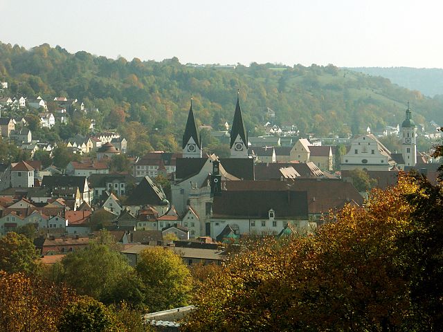
 Hiking in Ingolstadt
Hiking in and around Ingolstadt, a city located in Bavaria, Germany, offers a variety of scenic routes and natural landscapes to explore. While Ingolstadt itself is more urban, it’s conveniently situated near several natural attractions and parks. Here are some key points to consider when hiking in this region:
Local Trails and Parks
-
Danube River Paths: The Danube River runs close to Ingolstadt, providing beautiful walking and biking trails along its banks. The paths are generally flat and well-maintained, making them suitable for hikers of all skill levels. You can enjoy picturesque views of the river, wildlife, and surrounding nature.
-
Klenze Park: Located within the city, Klenze Park is an ideal spot for leisurely walks. It features landscaped gardens, open green areas, and scenic views along the banks of the Danube. While not a hiking trail in the traditional sense, it contributes to local outdoor experiences.
-
Nearby Forests and Nature Reserves: Just outside of Ingolstadt, you can find various wooded areas and nature reserves such as the Eichstätt Forest and Altmühltal Nature Park. These areas provide a chance for more rugged hiking experiences with hills, forests, and scenic vistas.
-
Altmühltal Nature Park: A bit further away, about a 30-minute drive from Ingolstadt, this nature park is well-known for its diverse landscapes, including limestone cliffs, river valleys, and quaint Bavarian villages. There are numerous well-marked hiking trails that cater to different levels of difficulty.
Tips for Hiking in Ingolstadt
- Check the Weather: Bavaria can experience sudden weather changes, so be sure to check the forecast before heading out and dress in layers.
- Maps and Guides: Consider using local hiking guides or mobile apps to find the best trails and stay on track. The local tourist office can provide useful resources.
- Safety: Carry essentials like water, snacks, a first-aid kit, and a fully charged phone. Be aware of your surroundings and stick to marked trails.
- Respect Nature: Follow the Leave No Trace principles to preserve the natural beauty of the areas you visit.
Local Attractions
While hiking, you might also consider taking breaks to explore local attractions. Ingolstadt is home to historical sites, such as the Ingolstadt Fortress, and museums like the Audi Forum, showcasing the region's rich automotive history.
Overall, Ingolstadt and its surroundings offer a great mix of urban and natural settings for both casual walkers and dedicated hikers. Enjoy your outdoor adventures!
- Country:

- Postal Code: 85055; 85053; 85051; 85057; 85049
- Local Dialing Code: 08459; 08458; 08450; 0841; 08424
- Licence Plate Code: IN
- Coordinates: 48° 45' 49" N, 11° 25' 34" E


- GPS tracks (wikiloc): [Link]
- AboveSeaLevel: 368 м m
- Area: 133.35 sq km
- Population: 137072
- Web site: https://www.ingolstadt.de/
- Wikipedia en: wiki(en)
- Wikipedia: wiki(de)
- Wikidata storage: Wikidata: Q3004
- Wikipedia Commons Gallery: [Link]
- Wikipedia Commons Category: [Link]
- Wikipedia Commons Maps Category: [Link]
- Freebase ID: [/m/01dky4]
- GeoNames ID: Alt: [6556096]
- VIAF ID: Alt: [132524888]
- OSM relation ID: [62381]
- GND ID: Alt: [4026991-7]
- archINFORM location ID: [245]
- Library of Congress authority ID: Alt: [n80128697]
- MusicBrainz area ID: [94cf91c4-9ef4-4af9-b011-9d723e86c3c3]
- Quora topic ID: [Ingolstadt]
- Encyclopædia Britannica Online ID: [place/Ingolstadt]
- Gran Enciclopèdia Catalana ID: [0033645]
- EMLO location ID: [4645882d-a2d0-42d4-8708-b4ebff8079f0]
- Facebook Places ID: [108159062550519]
- Great Russian Encyclopedia Online ID: [2007716]
- Bavarikon ID: [ODB_A00000902]
- National Library of Israel ID: [000067032]
- NUTS code: [DE211]
- Klexikon article ID: [Ingolstadt]
- Store norske leksikon ID: [Ingolstadt]
- Encyclopedia of Modern Ukraine ID: [13348]
- German municipality key: 09161000
- US National Archives Identifier: 10046153
- German district key: 09161
Includes regions:
Ingolstadt Süd
- human settlement in Germany
Hiking in Ingolstadt Süd
Ingolstadt Süd is an area located in the city of Ingolstadt in Bavaria, Germany. While it may not be a major hiking destination like some of the nearby national parks or mountainous regions, there are still opportunities for hiking and outdoor activities in and around the area....
- Country:
- Postal Code: 85051
- Coordinates: 48° 42' 54" N, 11° 23' 34" E
- GPS tracks (wikiloc): [Link]
- Area: 2700.1 sq km
- Population: 8544
Etting
- human settlement in Germany
Hiking in Etting
Ettingen, located near Ingolstadt in Bavaria, Germany, offers a scenic environment for hiking enthusiasts. The region is characterized by its picturesque landscapes, which include rolling hills, lush forests, and the Danube River nearby. While specifically discussing hikes in Ettingen may limit the options, the surrounding areas provide numerous trails suitable for various skill levels....
- Country:
- Postal Code: 85055
- Local Dialing Code: 0841
- Coordinates: 48° 48' 20" N, 11° 24' 16" E
- GPS tracks (wikiloc): [Link]
- AboveSeaLevel: 385 м m
- Area: 861.4 sq km
- Population: 4672
Ingolstadt Südwest
- human settlement in Germany
Hiking in Ingolstadt Südwest
Ingolstadt Südwest, located in Bavaria, Germany, offers various opportunities for hiking enthusiasts to explore both natural landscapes and historical sites. Here are some highlights and tips for hiking in the region:...
- Country:
- Postal Code: 85051
- Coordinates: 48° 44' 25" N, 11° 25' 16" E
- GPS tracks (wikiloc): [Link]
- Area: 645.7 sq km
- Population: 10643
Friedrichshofen-Hollerstauden
- human settlement in Germany
Hiking in Friedrichshofen-Hollerstauden
Friedrichshofen-Hollerstauden is a charming area located in Bavaria, Germany, perfect for hiking enthusiasts. Nestled amidst picturesque landscapes, you can explore diverse trails that cater to various skill levels. Here are some highlights and tips for hiking in this region:...
- Country:
- Postal Code: 85049
- Coordinates: 48° 46' 32" N, 11° 23' 5" E
- GPS tracks (wikiloc): [Link]
- Area: 487.6 sq km
- Population: 9430

Ingolstadt Mitte
- Stadtbezirk of Ingolstadt
Hiking in Ingolstadt Mitte
Ingolstadt Mitte, located in the heart of Ingolstadt, Germany, is primarily an urban environment, but it offers several opportunities for walking and enjoying nature in nearby areas. While it might not be a hiking destination in the traditional sense, you can still enjoy scenic walks and explore parks....
- Country:
- Postal Code: 85049
- Coordinates: 48° 45' 55" N, 11° 25' 21" E
- GPS tracks (wikiloc): [Link]
- Area: 1142.4 sq km
- Population: 14339
Ingolstadt Northwest
- human settlement in Germany
Hiking in Ingolstadt Northwest
Ingolstadt Nordwest, located in Bavaria, Germany, is a great area for hiking enthusiasts. While the region itself may not be as famous for its hiking trails compared to other areas in Bavaria, it does offer some nice opportunities for outdoor activities, particularly in and around local parks and natural areas....
- Country:
- Postal Code: 85057
- Coordinates: 48° 46' 39" N, 11° 25' 21" E
- GPS tracks (wikiloc): [Link]
- Area: 469.9 sq km
- Population: 18169
Ingolstadt West
- human settlement in Germany
Hiking in Ingolstadt West
Hiking in and around Ingolstadt West can be a delightful experience, as the region offers a mix of natural beauty and historical sites. Here are some highlights and tips for hiking in this area:...
- Country:
- Postal Code: 85049
- Coordinates: 48° 46' 9" N, 11° 19' 10" E
- GPS tracks (wikiloc): [Link]
- Area: 3341.9 sq km
- Population: 6833
Oberhaunstadt
- human settlement in Germany
Hiking in Oberhaunstadt
Oberhaunstadt, a picturesque area often celebrated for its natural beauty and lush landscapes, offers a variety of hiking opportunities for both beginners and experienced hikers. While specific trails may not be globally renowned, the region is known for its charming countryside, woodlands, and scenic views....
- Country:
- Postal Code: 85055
- Coordinates: 48° 47' 37" N, 11° 26' 27" E
- GPS tracks (wikiloc): [Link]
- Area: 553.1 sq km
- Population: 5047
Ingolstadt Südost
- human settlement in Germany
Hiking in Ingolstadt Südost
Ingolstadt Südost is a district located in the southeastern part of Ingolstadt, Germany. While the area itself is more urban, there are several hiking options nearby that can offer a nice escape into nature. Here are some aspects to consider when planning a hiking trip in and around Ingolstadt Südost:...
- Country:
- Postal Code: 85053
- Coordinates: 48° 44' 44" N, 11° 27' 44" E
- GPS tracks (wikiloc): [Link]
- Area: 1395.5 sq km
- Population: 16765
Münchener Straße
- human settlement in Germany
Hiking in Münchener Straße
Münchener Straße is not typically known as a hiking destination, as it is primarily a street in various German cities, including Munich. However, if you're looking for hiking opportunities in or around Munich, there are several great options:...
- Country:
- Postal Code: 85051
- Coordinates: 48° 44' 5" N, 11° 26' 4" E
- GPS tracks (wikiloc): [Link]
- Area: 449.9 sq km
- Population: 13381
Mailing
- human settlement in Germany
Hiking in Mailing
Mailing is a picturesque area, often associated with beautiful landscapes and walking trails. While there may not be specific trails named "Mailing," there are nearby locations where hiking is popular. If you're referring to an area like Mailing in Kent, England, or perhaps another locality with a similar name, here are some general points about hiking in such areas:...
- Country:
- Postal Code: 85055
- Coordinates: 48° 46' 32" N, 11° 28' 44" E
- GPS tracks (wikiloc): [Link]
- Area: 812.7 sq km
- Population: 5052
Ingolstadt Nordost
- human settlement in Germany
Hiking in Ingolstadt Nordost
Ingolstadt Nordost, part of the city of Ingolstadt in Bavaria, Germany, offers a variety of outdoor activities, including hiking. While the area is not primarily known for extensive hiking trails, it does provide some pleasant walking and hiking options, often through natural landscapes and parks....
- Country:
- Postal Code: 85055
- Coordinates: 48° 46' 31" N, 11° 26' 41" E
- GPS tracks (wikiloc): [Link]
- Area: 473.8 sq km
- Population: 20448
Shares border with regions:
Eichstätt
- district of Bavaria, Germany
Hiking in Eichstätt
Eichstätt, located in Bavaria, Germany, is known for its scenic landscapes, historical towns, and rich natural beauty, making it a fantastic destination for hiking enthusiasts. Here are some highlights and tips for hiking in the Eichstätt district:...
- Country:
- Capital: Eichstätt
- Licence Plate Code: EI
- Coordinates: 48° 55' 12" N, 11° 19' 48" E
- GPS tracks (wikiloc): [Link]
- AboveSeaLevel: 475 м m
- Area: 1214.00 sq km
- Population: 97347
- Web site: [Link]


Neuburg-Schrobenhausen
- district of Bavaria, Germany
Hiking in Neuburg-Schrobenhausen
Neuburg-Schrobenhausen is a picturesque district in Bavaria, Germany, offering a mix of beautiful landscapes, rich history, and outdoor activities. When it comes to hiking in this area, there are several trails and natural attractions to explore. Here’s what you should know:...
- Country:
- Capital: Neuburg an der Donau
- Licence Plate Code: SOB; ND
- Coordinates: 48° 40' 12" N, 11° 10' 12" E
- GPS tracks (wikiloc): [Link]
- AboveSeaLevel: 378 м m
- Area: 740.00 sq km
- Population: 76493
- Web site: [Link]

Pfaffenhofen
- district of Bavaria, Germany
Hiking in Pfaffenhofen
Pfaffenhofen is a district in Bavaria, Germany, known for its picturesque landscapes and outdoor recreational opportunities, including hiking. The region features a mix of rolling hills, forests, rivers, and farmland, providing a variety of scenic routes for hikers of all skill levels....
- Country:
- Capital: Pfaffenhofen an der Ilm
- Licence Plate Code: PAF
- Coordinates: 48° 30' 0" N, 11° 30' 0" E
- GPS tracks (wikiloc): [Link]
- AboveSeaLevel: 439 м m
- Area: 760.00 sq km
- Population: 126244
- Web site: [Link]