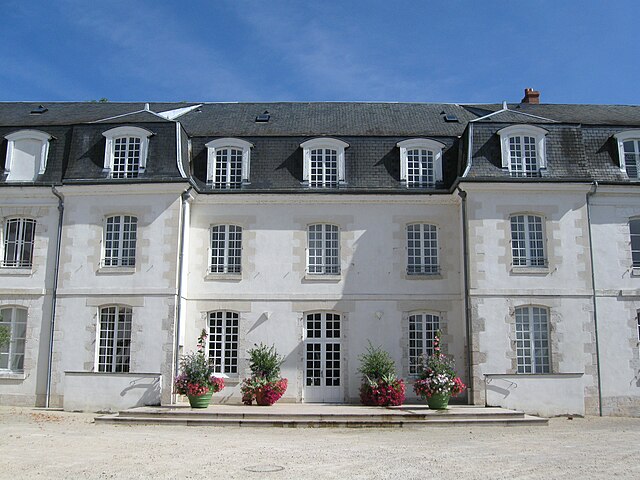
Ingré (Ingré)

- commune in Loiret, France
- Country:

- Postal Code: 45140
- Coordinates: 47° 55' 14" N, 1° 49' 27" E


- GPS tracks (wikiloc): [Link]
- Area: 20.82 sq km
- Population: 8740
- Web site: http://www.ingre.fr
- Wikipedia en: wiki(en)
- Wikipedia: wiki(fr)
- Wikidata storage: Wikidata: Q379164
- Wikipedia Commons Category: [Link]
- Freebase ID: [/m/03nwhkx]
- Freebase ID: [/m/03nwhkx]
- GeoNames ID: Alt: [3012780]
- GeoNames ID: Alt: [3012780]
- SIREN number: [214501694]
- SIREN number: [214501694]
- BnF ID: [152605611]
- BnF ID: [152605611]
- VIAF ID: Alt: [248745940]
- VIAF ID: Alt: [248745940]
- INSEE municipality code: 45169
- INSEE municipality code: 45169
Shares border with regions:

La Chapelle-Saint-Mesmin
- commune in Loiret, France
- Country:
- Postal Code: 45380
- Coordinates: 47° 53' 23" N, 1° 50' 23" E
- GPS tracks (wikiloc): [Link]
- Area: 8.96 sq km
- Population: 10170
- Web site: [Link]


Chaingy
- commune in Loiret, France
- Country:
- Postal Code: 45380
- Coordinates: 47° 53' 1" N, 1° 46' 23" E
- GPS tracks (wikiloc): [Link]
- Area: 21.69 sq km
- Population: 3617
- Web site: [Link]


Saint-Jean-de-la-Ruelle
- commune in Loiret, France
- Country:
- Postal Code: 45140
- Coordinates: 47° 54' 47" N, 1° 52' 24" E
- GPS tracks (wikiloc): [Link]
- Area: 6.1 sq km
- Population: 16365
- Web site: [Link]

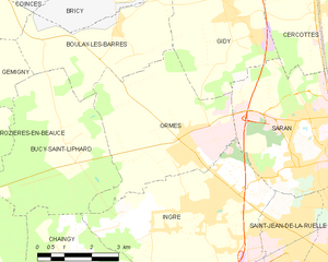
Ormes
- commune in Loiret, France
- Country:
- Postal Code: 45140
- Coordinates: 47° 56' 28" N, 1° 49' 14" E
- GPS tracks (wikiloc): [Link]
- Area: 18.15 sq km
- Population: 4038
- Web site: [Link]

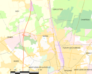
Saran
- commune in Loiret, France
- Country:
- Postal Code: 45770
- Coordinates: 47° 57' 5" N, 1° 52' 49" E
- GPS tracks (wikiloc): [Link]
- Area: 19.65 sq km
- Population: 16259
- Web site: [Link]


Bucy-Saint-Liphard
- commune in Loiret, France
- Country:
- Postal Code: 45140
- Coordinates: 47° 56' 9" N, 1° 45' 54" E
- GPS tracks (wikiloc): [Link]
- Area: 17.84 sq km
- Population: 200