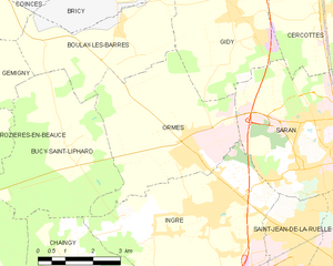
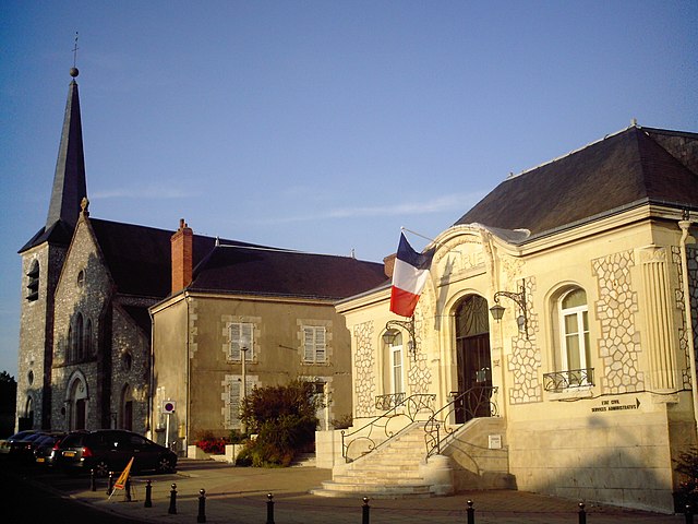
Saran (Saran)

- commune in Loiret, France
- Country:

- Postal Code: 45770
- Coordinates: 47° 57' 5" N, 1° 52' 49" E


- GPS tracks (wikiloc): [Link]
- Area: 19.65 sq km
- Population: 16259
- Web site: http://www.ville-saran.fr
- Wikipedia en: wiki(en)
- Wikipedia: wiki(fr)
- Wikidata storage: Wikidata: Q585690
- Wikipedia Commons Category: [Link]
- Freebase ID: [/m/06vwsb]
- GeoNames ID: Alt: [6434729]
- SIREN number: [214503021]
- BnF ID: [152606948]
- VIAF ID: Alt: [97144648408832129852]
- INSEE municipality code: 45302
- US National Archives Identifier: 10037956
Shares border with regions:


Cercottes
- commune in Loiret, France
- Country:
- Postal Code: 45520
- Coordinates: 47° 59' 7" N, 1° 52' 58" E
- GPS tracks (wikiloc): [Link]
- Area: 24.24 sq km
- Population: 1423
- Web site: [Link]


Saint-Jean-de-la-Ruelle
- commune in Loiret, France
- Country:
- Postal Code: 45140
- Coordinates: 47° 54' 47" N, 1° 52' 24" E
- GPS tracks (wikiloc): [Link]
- Area: 6.1 sq km
- Population: 16365
- Web site: [Link]

Ormes
- commune in Loiret, France
- Country:
- Postal Code: 45140
- Coordinates: 47° 56' 28" N, 1° 49' 14" E
- GPS tracks (wikiloc): [Link]
- Area: 18.15 sq km
- Population: 4038
- Web site: [Link]


Ingré
- commune in Loiret, France
- Country:
- Postal Code: 45140
- Coordinates: 47° 55' 14" N, 1° 49' 27" E
- GPS tracks (wikiloc): [Link]
- Area: 20.82 sq km
- Population: 8740
- Web site: [Link]


Orléans
- city in north-central France
- Country:
- Postal Code: 45100; 45000
- Coordinates: 47° 54' 8" N, 1° 54' 15" E
- GPS tracks (wikiloc): [Link]
- AboveSeaLevel: 116 м m
- Area: 27.48 sq km
- Population: 114644
- Web site: [Link]


Gidy
- commune in Loiret, France
- Country:
- Postal Code: 45520
- Coordinates: 47° 59' 13" N, 1° 50' 12" E
- GPS tracks (wikiloc): [Link]
- Area: 23.91 sq km
- Population: 1888
- Web site: [Link]

Fleury-les-Aubrais
- commune in Loiret, France
- Country:
- Postal Code: 45400
- Coordinates: 47° 55' 55" N, 1° 55' 16" E
- GPS tracks (wikiloc): [Link]
- Area: 10.12 sq km
- Population: 21089
- Web site: [Link]