
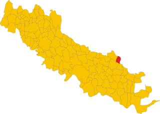
Isola Dovarese (Isola Dovarese)
.svg)
- Italian comune
 Hiking in Isola Dovarese
Isola Dovarese is a charming village located in the province of Cremona in the Lombardy region of Italy. Surrounded by the picturesque landscape of the Po Valley, it offers a less-traveled yet beautiful hiking experience.
Hiking in Isola Dovarese:
-
Scenic Trails: The area around Isola Dovarese features flat terrain and gentle hills, making it ideal for leisurely hikes suitable for all skill levels. The trails wind through lush fields, forests, and along the banks of the Po River, offering stunning views of the rural landscape.
-
Nature and Wildlife: As you hike, you might encounter diverse flora and fauna. Keep an eye out for local wildlife and enjoy the peaceful sounds of nature. Birdwatchers will appreciate the variety of species that can be seen along the trails.
-
Cultural Sites: In addition to the natural beauty, you can explore historical sites in and around Isola Dovarese. The village itself has a charming atmosphere, with traditional Italian architecture and local landmarks. Consider incorporating a visit to nearby towns or villages to experience more of the region's culture.
-
Local Cuisine: After a day of hiking, treat yourself to local culinary delights. The region is known for its hearty Italian dishes, so be sure to sample local cheeses, cured meats, and wines.
-
Seasonal Considerations: Spring and early autumn are ideal times for hiking in this region, as the weather is generally mild and the landscape is vibrant. Summer can be hot, so early morning or late afternoon hikes are recommended, while winter hiking can be a tranquil experience if you dress appropriately.
-
Hiking Safety: Always remember to stay hydrated, wear appropriate footwear, and have a map or GPS device. Inform someone of your hiking plans and duration.
If you’re considering a hiking trip to Isola Dovarese, make sure to check local resources and possibly connect with local hiking groups or guides for the best experience. Enjoy the stunning landscapes and peaceful atmosphere!
- Country:

- Postal Code: 26031
- Local Dialing Code: 0375
- Licence Plate Code: CR
- Coordinates: 45° 10' 33" N, 10° 18' 44" E


- GPS tracks (wikiloc): [Link]
- AboveSeaLevel: 35 м m
- Area: 9.47 sq km
- Population: 1158
- Web site: http://www.comune.isoladovarese.cr.it/
- Wikipedia en: wiki(en)
- Wikipedia: wiki(it)
- Wikidata storage: Wikidata: Q42885
- Wikipedia Commons Category: [Link]
- Freebase ID: [/m/0gjz4j]
- GeoNames ID: Alt: [6540366]
- OSM relation ID: [44354]
- UN/LOCODE: [ITZKR]
- ISTAT ID: 019053
- Italian cadastre code: E356
Shares border with regions:


Casalromano
- Italian comune
Hiking in Casalromano
Casalromano is a small village located in the Lombardy region of Italy, surrounded by beautiful landscapes that are great for hiking enthusiasts. While it may not be as well-known as larger towns or national parks, the area does offer some charming trails and scenic vistas that capture the essence of the Italian countryside....
- Country:
- Postal Code: 46040
- Local Dialing Code: 0376
- Licence Plate Code: MN
- Coordinates: 45° 12' 0" N, 10° 22' 0" E
- GPS tracks (wikiloc): [Link]
- AboveSeaLevel: 42 м m
- Area: 12.03 sq km
- Population: 1510
- Web site: [Link]


Torre de’ Picenardi
- Italian comune
Hiking in Torre de’ Picenardi
Torre de' Picenardi is a small town in the province of Cremona, located in the Lombardy region of Italy. While it may not be as widely known for hiking as some of the more mountainous areas of Italy, there are still opportunities for outdoor activities and exploring the surrounding countryside....
- Country:
- Postal Code: 26038
- Local Dialing Code: 0375
- Licence Plate Code: CR
- Coordinates: 45° 9' 0" N, 10° 17' 0" E
- GPS tracks (wikiloc): [Link]
- AboveSeaLevel: 37 м m
- Area: 17.12 sq km
- Population: 1697
- Web site: [Link]


Canneto sull'Oglio
- Italian comune
Hiking in Canneto sull'Oglio
Canneto sull'Oglio is a charming town located in the Lombardy region of Italy, and while it may not be as well-known for hiking as some other Italian destinations, it offers scenic landscapes and opportunities for outdoor activities. Here are some tips and information for hiking in and around Canneto sull'Oglio:...
- Country:
- Postal Code: 46013
- Local Dialing Code: 0376
- Licence Plate Code: MN
- Coordinates: 45° 9' 0" N, 10° 23' 0" E
- GPS tracks (wikiloc): [Link]
- AboveSeaLevel: 34 м m
- Area: 25.87 sq km
- Population: 4388
- Web site: [Link]
Pessina Cremonese
- Italian comune
Hiking in Pessina Cremonese
Pessina Cremonese is a small municipality located in the province of Cremona in the Lombardy region of Italy. While it's not a popular hiking destination like some of the more mountainous areas in Italy, it still offers opportunities for those looking to enjoy scenic outdoor activities in a serene rural environment....
- Country:
- Postal Code: 26030
- Local Dialing Code: 0372
- Licence Plate Code: CR
- Coordinates: 45° 11' 0" N, 10° 15' 0" E
- GPS tracks (wikiloc): [Link]
- AboveSeaLevel: 42 м m
- Area: 22.02 sq km
- Population: 626
- Web site: [Link]

Volongo
- Italian comune
Hiking in Volongo
Volongo isn't a widely recognized hiking destination, and it seems there might be some confusion regarding its location or its prominence in hiking circles. However, if you're looking for information about hiking in a specific place—perhaps a region, a park, or a mountain range in a country—please provide more details so I can assist you better....
- Country:
- Postal Code: 26030
- Local Dialing Code: 0372
- Licence Plate Code: CR
- Coordinates: 45° 12' 42" N, 10° 18' 9" E
- GPS tracks (wikiloc): [Link]
- AboveSeaLevel: 43 м m
- Area: 8.12 sq km
- Population: 525
- Web site: [Link]