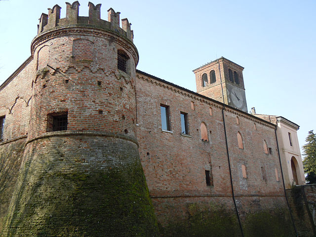
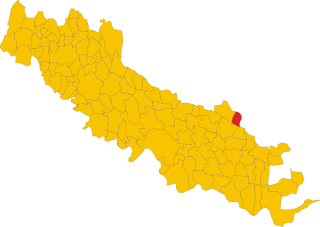
Pessina Cremonese (Pessina Cremonese)
.svg)
- Italian comune
 Hiking in Pessina Cremonese
Pessina Cremonese is a small municipality located in the province of Cremona in the Lombardy region of Italy. While it's not a popular hiking destination like some of the more mountainous areas in Italy, it still offers opportunities for those looking to enjoy scenic outdoor activities in a serene rural environment.
Hiking Opportunities in and Around Pessina Cremonese:
-
Countryside Trails: The area around Pessina Cremonese is characterized by flat, agricultural land interspersed with rivers and canals. You can find paths that take you through the picturesque countryside, allowing for peaceful hikes amidst fields, vineyards, and farms.
-
Plenty of Nature: You may encounter local flora and fauna as you hike, especially near the Po River. Birdwatching can also be an exciting addition to your hike, as the region is home to a variety of bird species.
-
Nearby Parks: A bit further out, you can explore the Parco Regionale Adda Nord, which offers more rugged terrain and a network of trails along the Adda River. This park is a short drive from Pessina Cremonese and provides more diverse hiking experiences.
-
Cultural Hiking: Incorporating cultural sites into your hikes can be a rewarding experience. There may be local churches, historical sites, or countryside villages worth visiting along your hiking route.
Tips for Hiking in Pessina Cremonese:
-
Weather Preparedness: The weather can vary, so check forecasts and dress appropriately. Summer can be hot, while spring and fall may be more pleasant for outdoor activities.
-
Stay Hydrated: Always carry water with you, particularly on longer hikes.
-
Respect Nature: Follow the Leave No Trace principles to preserve the natural beauty of the area.
-
Local Guidance: If you’re unsure about the trails, consider connecting with local hiking clubs or guides who can share their knowledge and suggestions about the best routes.
While Pessina Cremonese may not be as renowned for hiking as other parts of Italy, it offers a charming experience for those looking to appreciate the beauty of the Italian countryside. Enjoy your hike!
- Country:

- Postal Code: 26030
- Local Dialing Code: 0372
- Licence Plate Code: CR
- Coordinates: 45° 11' 0" N, 10° 15' 0" E


- GPS tracks (wikiloc): [Link]
- AboveSeaLevel: 42 м m
- Area: 22.02 sq km
- Population: 626
- Web site: http://www.comune.pessinacremonese.cr.it
- Wikipedia en: wiki(en)
- Wikipedia: wiki(it)
- Wikidata storage: Wikidata: Q42708
- Wikipedia Commons Category: [Link]
- Freebase ID: [/m/0gjzhb]
- GeoNames ID: Alt: [6540642]
- OSM relation ID: [44355]
- ISTAT ID: 019070
- Italian cadastre code: G504
Shares border with regions:


Torre de’ Picenardi
- Italian comune
Hiking in Torre de’ Picenardi
Torre de' Picenardi is a small town in the province of Cremona, located in the Lombardy region of Italy. While it may not be as widely known for hiking as some of the more mountainous areas of Italy, there are still opportunities for outdoor activities and exploring the surrounding countryside....
- Country:
- Postal Code: 26038
- Local Dialing Code: 0375
- Licence Plate Code: CR
- Coordinates: 45° 9' 0" N, 10° 17' 0" E
- GPS tracks (wikiloc): [Link]
- AboveSeaLevel: 37 м m
- Area: 17.12 sq km
- Population: 1697
- Web site: [Link]


Cappella de’ Picenardi
- Italian comune
Hiking in Cappella de’ Picenardi
Cappella de' Picenardi is a small town located in the Lombardy region of Italy. While it may not be as well-known as major hiking destinations, the surrounding countryside offers peaceful trails and scenic views, perfect for those looking to escape into nature....
- Country:
- Postal Code: 26030
- Local Dialing Code: 0372
- Licence Plate Code: CR
- Coordinates: 45° 9' 34" N, 10° 13' 52" E
- GPS tracks (wikiloc): [Link]
- AboveSeaLevel: 42 м m
- Area: 14.2 sq km
- Population: 432
- Web site: [Link]


Gabbioneta-Binanuova
- Italian comune
Hiking in Gabbioneta-Binanuova
Gabbioneta-Binanuova is a small municipality in the province of Cremona in Lombardy, Italy. While it may not be as well-known as some major hiking destinations, the surrounding area offers some natural beauty and opportunities for outdoor activities, including hiking....
- Country:
- Postal Code: 26030
- Local Dialing Code: 0372
- Licence Plate Code: CR
- Coordinates: 45° 13' 0" N, 10° 13' 0" E
- GPS tracks (wikiloc): [Link]
- AboveSeaLevel: 38 м m
- Area: 15.71 sq km
- Population: 860
- Web site: [Link]


Pescarolo ed Uniti
- Italian comune
Hiking in Pescarolo ed Uniti
Pescarolo ed Uniti is a small town located in the Lombardy region of Italy, near the Po River. While the area isn't typically recognized as a major hiking destination compared to larger national parks or mountainous regions, it does offer some opportunities for outdoor exploration, especially for those who enjoy calm walks in picturesque environments....
- Country:
- Postal Code: 26033
- Local Dialing Code: 0372
- Licence Plate Code: CR
- Coordinates: 45° 11' 38" N, 10° 11' 11" E
- GPS tracks (wikiloc): [Link]
- AboveSeaLevel: 45 м m
- Area: 16.54 sq km
- Population: 1544
- Web site: [Link]


Isola Dovarese
- Italian comune
Hiking in Isola Dovarese
Isola Dovarese is a charming village located in the province of Cremona in the Lombardy region of Italy. Surrounded by the picturesque landscape of the Po Valley, it offers a less-traveled yet beautiful hiking experience....
- Country:
- Postal Code: 26031
- Local Dialing Code: 0375
- Licence Plate Code: CR
- Coordinates: 45° 10' 33" N, 10° 18' 44" E
- GPS tracks (wikiloc): [Link]
- AboveSeaLevel: 35 м m
- Area: 9.47 sq km
- Population: 1158
- Web site: [Link]

Ostiano
- Italian comune
Hiking in Ostiano
Ostiano, located in the Lombardy region of Italy, offers a unique opportunity for hiking enthusiasts to explore its scenic landscapes and local culture. While Ostiano itself may not be as widely recognized for extensive hiking trails as some other Italian regions, it serves as a gateway to the surrounding areas that are rich in natural beauty and potential hiking routes....
- Country:
- Postal Code: 26032
- Local Dialing Code: 0372
- Licence Plate Code: CR
- Coordinates: 45° 13' 0" N, 10° 15' 0" E
- GPS tracks (wikiloc): [Link]
- AboveSeaLevel: 43 м m
- Area: 19.49 sq km
- Population: 2945
- Web site: [Link]

Volongo
- Italian comune
Hiking in Volongo
Volongo isn't a widely recognized hiking destination, and it seems there might be some confusion regarding its location or its prominence in hiking circles. However, if you're looking for information about hiking in a specific place—perhaps a region, a park, or a mountain range in a country—please provide more details so I can assist you better....
- Country:
- Postal Code: 26030
- Local Dialing Code: 0372
- Licence Plate Code: CR
- Coordinates: 45° 12' 42" N, 10° 18' 9" E
- GPS tracks (wikiloc): [Link]
- AboveSeaLevel: 43 м m
- Area: 8.12 sq km
- Population: 525
- Web site: [Link]