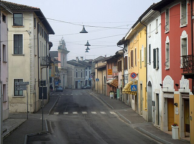
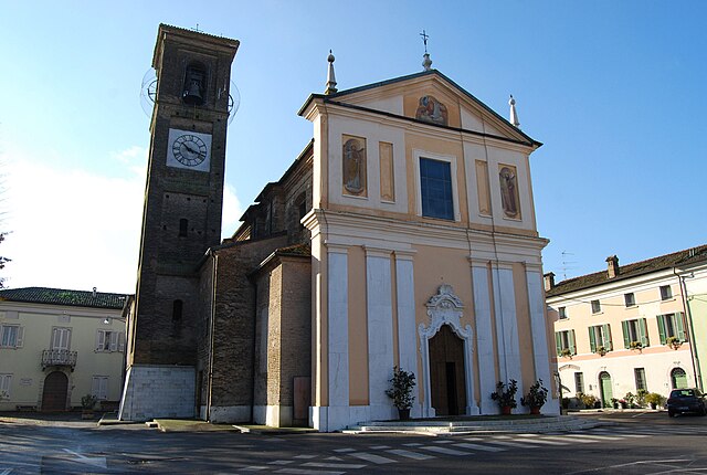
Isorella (Isorella)
.svg)
- Italian comune
 Hiking in Isorella
Isorella is a charming municipality located in the Lombardy region of Italy, known for its picturesque landscapes and tranquil natural settings. While it may not be as widely known for hiking as some other regions in Italy, there are definitely some opportunities for outdoor activities.
When considering hiking in or near Isorella, here are a few things to keep in mind:
-
Scenic Routes: The area around Isorella features gentle rolling hills, farmland, and charming countryside views. You can create hiking routes that explore local trails, allowing you to appreciate the beauty of the region.
-
Il Parco Regionale dell'Oglio Sud: Just a short distance from Isorella, you’ll find the Oglio Sud Regional Park. This park offers various trails that wind through different types of landscapes, including rivers, woods, and farmland. This location is perfect for both casual walks and more extensive hikes.
-
Historic Trails: Hiking in the area also provides an opportunity to explore local history. Some trails might lead to sites of historical interest, including old churches and rural architecture.
-
Local Conditions: Before heading out, it's essential to check the weather and trail conditions. Some areas can become muddy or wet, especially after rain.
-
Equipment and Preparation: Make sure to wear appropriate hiking gear, including sturdy shoes, and bring plenty of water and snacks. Also, a map or a GPS device can enhance your safety and enjoyment while exploring the trails.
-
Wildlife and Flora: Keep an eye out for local wildlife, including various bird species and other fauna. The flora can be diverse, ranging from typical rural plants to more unique species in protected areas.
-
Respect the Environment: Follow the Leave No Trace principles to ensure that the beautiful landscapes remain untouched for future hikers.
If you’re looking to hike in Isorella, take the time to explore and enjoy the tranquillity that the countryside has to offer. Happy hiking!
- Country:

- Postal Code: 25010
- Local Dialing Code: 030
- Licence Plate Code: BS
- Coordinates: 45° 18' 33" N, 10° 19' 24" E


- GPS tracks (wikiloc): [Link]
- AboveSeaLevel: 56 м m
- Area: 15.33 sq km
- Population: 4077
- Web site: http://www.comune.isorella.bs.it/
- Wikipedia en: wiki(en)
- Wikipedia: wiki(it)
- Wikidata storage: Wikidata: Q104920
- Wikipedia Commons Category: [Link]
- Freebase ID: [/m/043plh]
- GeoNames ID: Alt: [6540187]
- VIAF ID: Alt: [127006267]
- OSM relation ID: [44637]
- TGN ID: [1044969]
- UN/LOCODE: [ITBTS]
- ISTAT ID: 017086
- Italian cadastre code: E364
Shares border with regions:

Calvisano
- Italian comune
Hiking in Calvisano
Calvisano is a charming town located in the Lombardy region of northern Italy, known for its picturesque landscapes and proximity to various natural reserves. Hiking opportunities around Calvisano are typically characterized by beautiful scenery, lush countryside, and serene rural settings....
- Country:
- Postal Code: 25012
- Local Dialing Code: 030
- Licence Plate Code: BS
- Coordinates: 45° 20' 56" N, 10° 20' 45" E
- GPS tracks (wikiloc): [Link]
- AboveSeaLevel: 67 м m
- Area: 44.83 sq km
- Population: 8543
- Web site: [Link]
Gambara
- Italian comune
Hiking in Gambara
Gambara is a small town located in the Lombardy region of Italy, known for its picturesque countryside, charming landscapes, and proximity to various natural areas suitable for hiking. While Gambara itself may not have extensive hiking trails, it serves as a great gateway to explore the surrounding areas that offer beautiful hiking experiences....
- Country:
- Postal Code: 25020
- Local Dialing Code: 030
- Licence Plate Code: BS
- Coordinates: 45° 15' 22" N, 10° 17' 40" E
- GPS tracks (wikiloc): [Link]
- AboveSeaLevel: 51 м m
- Area: 31.59 sq km
- Population: 4743
- Web site: [Link]

Ghedi
- Italian comune
Hiking in Ghedi
Ghedi, located in the Lombardy region of northern Italy, is primarily known for its agricultural landscape rather than extensive hiking trails. However, the surrounding areas, such as the nearby hills and nature reserves, offer opportunities for outdoor activities including hiking....
- Country:
- Postal Code: 25016
- Local Dialing Code: 030
- Licence Plate Code: BS
- Coordinates: 45° 24' 7" N, 10° 16' 49" E
- GPS tracks (wikiloc): [Link]
- AboveSeaLevel: 85 м m
- Area: 60 sq km
- Population: 18828
- Web site: [Link]

Gottolengo
- Italian comune
Hiking in Gottolengo
Gottolengo is a small town in the Lombardy region of Italy, located in the province of Brescia. While it may not be as famous for hiking as some of the larger national parks or mountains in the area, there are still opportunities to enjoy the beautiful Italian countryside through walking and exploring the scenic surroundings....
- Country:
- Postal Code: 25023
- Local Dialing Code: 030
- Licence Plate Code: BS
- Coordinates: 45° 17' 34" N, 10° 16' 24" E
- GPS tracks (wikiloc): [Link]
- AboveSeaLevel: 53 м m
- Area: 29.28 sq km
- Population: 5184
- Web site: [Link]
Remedello
- Italian comune
Hiking in Remedello
Remedello is a small town in the Lombardy region of northern Italy, surrounded by scenic landscapes that can offer enjoyable hiking opportunities. While the area is not as widely known for hiking as some other regions in Italy, it does feature beautiful natural surroundings, including rolling hills, vineyards, and picturesque views of the countryside....
- Country:
- Postal Code: 25010
- Local Dialing Code: 030
- Licence Plate Code: BS
- Coordinates: 45° 16' 45" N, 10° 22' 22" E
- GPS tracks (wikiloc): [Link]
- AboveSeaLevel: 47 м m
- Area: 21.46 sq km
- Population: 3384
- Web site: [Link]
Visano
- Italian comune in the Province of Brescia
Hiking in Visano
Visano, a quaint small town in the Lombardy region of Italy, is not widely known for extensive hiking trails like some other areas in Italy. However, it is situated close to beautiful natural landscapes, including the Alps and the Po River, making it a great starting point for hiking adventures....
- Country:
- Postal Code: 25010
- Local Dialing Code: 030
- Licence Plate Code: BS
- Coordinates: 45° 19' 9" N, 10° 22' 24" E
- GPS tracks (wikiloc): [Link]
- AboveSeaLevel: 59 м m
- Area: 11.22 sq km
- Population: 1956
- Web site: [Link]