Issirac (Issirac)

- commune in Gard, France
- Country:

- Postal Code: 30760
- Coordinates: 44° 16' 18" N, 4° 28' 51" E


- GPS tracks (wikiloc): [Link]
- Area: 20.28 sq km
- Population: 289
- Wikipedia en: wiki(en)
- Wikipedia: wiki(fr)
- Wikidata storage: Wikidata: Q859693
- Wikipedia Commons Category: [Link]
- Freebase ID: [/m/03c0t09]
- GeoNames ID: Alt: [6431307]
- SIREN number: [213001340]
- BnF ID: [15254774p]
- INSEE municipality code: 30134
Shares border with regions:

Orgnac-l'Aven
- commune in Ardèche, France
- Country:
- Postal Code: 07150
- Coordinates: 44° 18' 22" N, 4° 26' 0" E
- GPS tracks (wikiloc): [Link]
- Area: 21.84 sq km
- Population: 567


Cornillon
- commune in Gard, France
- Country:
- Postal Code: 30630
- Coordinates: 44° 13' 5" N, 4° 29' 11" E
- GPS tracks (wikiloc): [Link]
- Area: 15.58 sq km
- Population: 925
- Web site: [Link]

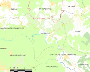
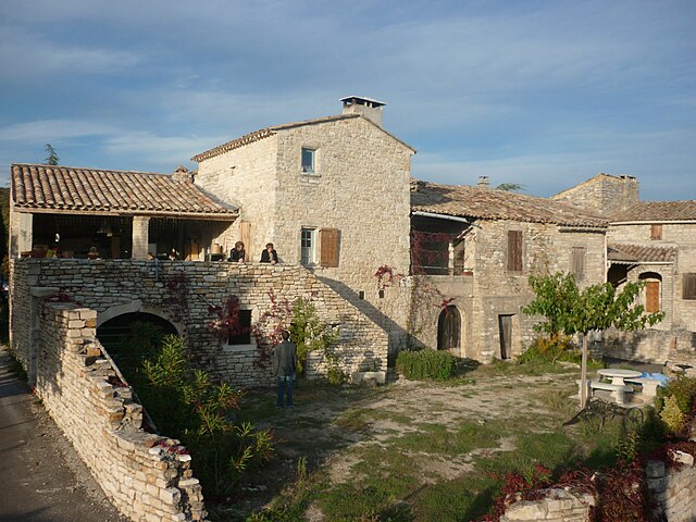
Montclus
- commune in Gard, France
- Country:
- Postal Code: 30630
- Coordinates: 44° 15' 38" N, 4° 25' 11" E
- GPS tracks (wikiloc): [Link]
- Area: 21.88 sq km
- Population: 204
Laval-Saint-Roman
- commune in Gard, France
- Country:
- Postal Code: 30760
- Coordinates: 44° 17' 55" N, 4° 30' 18" E
- GPS tracks (wikiloc): [Link]
- AboveSeaLevel: 134 м m
- Area: 10.5 sq km
- Population: 222


Saint-André-de-Roquepertuis
- commune in Gard, France
- Country:
- Postal Code: 30630
- Coordinates: 44° 14' 26" N, 4° 27' 22" E
- GPS tracks (wikiloc): [Link]
- Area: 12.18 sq km
- Population: 611
- Web site: [Link]

Le Garn
- commune in Gard, France
- Country:
- Postal Code: 30760
- Coordinates: 44° 18' 23" N, 4° 28' 22" E
- GPS tracks (wikiloc): [Link]
- Area: 10.81 sq km
- Population: 233
- Web site: [Link]

Saint-Christol-de-Rodières
- commune in Gard, France
- Country:
- Postal Code: 30760
- Coordinates: 44° 16' 7" N, 4° 30' 48" E
- GPS tracks (wikiloc): [Link]
- Area: 8.07 sq km
- Population: 168