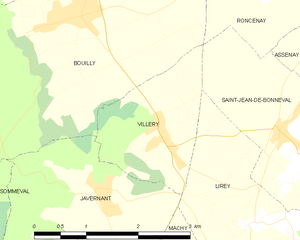
Javernant (Javernant)
- commune in Aube, France
- Country:

- Postal Code: 10320
- Coordinates: 48° 9' 42" N, 4° 0' 8" E


- GPS tracks (wikiloc): [Link]
- Area: 5.62 sq km
- Population: 156
- Web site: http://javernant.voila.net
- Wikipedia en: wiki(en)
- Wikipedia: wiki(fr)
- Wikidata storage: Wikidata: Q1374833
- Wikipedia Commons Category: [Link]
- Freebase ID: [/m/03m8sdl]
- GeoNames ID: Alt: [6426421]
- SIREN number: [211001706]
- BnF ID: [152462690]
- INSEE municipality code: 10177
Shares border with regions:


Lirey
- commune in Aube, France
- Country:

- Postal Code: 10320
- Coordinates: 48° 9' 25" N, 4° 2' 50" E


- GPS tracks (wikiloc): [Link]
- Area: 4.84 sq km
- Population: 108


Bouilly
- commune in Aube, France
- Country:

- Postal Code: 10320
- Coordinates: 48° 11' 46" N, 3° 59' 58" E


- GPS tracks (wikiloc): [Link]
- Area: 15.49 sq km
- Population: 1036
- Web site: [Link]


Villery
- commune in Aube, France
- Country:

- Postal Code: 10320
- Coordinates: 48° 10' 15" N, 4° 1' 8" E


- GPS tracks (wikiloc): [Link]
- Area: 3.59 sq km
- Population: 275


Crésantignes
- commune in Aube, France
- Country:

- Postal Code: 10320
- Coordinates: 48° 8' 28" N, 4° 1' 9" E


- GPS tracks (wikiloc): [Link]
- Area: 2.1 sq km
- Population: 312


Saint-Phal
- commune in Aube, France
- Country:

- Postal Code: 10130
- Coordinates: 48° 7' 18" N, 3° 59' 50" E


- GPS tracks (wikiloc): [Link]
- Area: 33.27 sq km
- Population: 527


Sommeval
- commune in Aube, France
- Country:

- Postal Code: 10320
- Coordinates: 48° 9' 57" N, 3° 57' 55" E


- GPS tracks (wikiloc): [Link]
- Area: 9.57 sq km
- Population: 318
Machy
- commune in Aube, France
- Country:

- Postal Code: 10320
- Coordinates: 48° 8' 23" N, 4° 2' 52" E


- GPS tracks (wikiloc): [Link]
- Area: 2.74 sq km
- Population: 117
