canton of Bouilly (canton de Bouilly)
- canton of France (until March 2015)
- Country:

- Capital: Bouilly
- Coordinates: 48° 11' 33" N, 3° 59' 54" E


- GPS tracks (wikiloc): [Link]
- Wikidata storage: Wikidata: Q1317427
- INSEE canton code: [1005]
Includes regions:
Cormost
- commune in Aube, France
- Country:
- Postal Code: 10800
- Coordinates: 48° 10' 9" N, 4° 8' 13" E
- GPS tracks (wikiloc): [Link]
- Area: 11.36 sq km
- Population: 311


Lirey
- commune in Aube, France
- Country:
- Postal Code: 10320
- Coordinates: 48° 9' 25" N, 4° 2' 50" E
- GPS tracks (wikiloc): [Link]
- Area: 4.84 sq km
- Population: 108

Assenay
- commune in Aube, France
- Country:
- Postal Code: 10320
- Coordinates: 48° 10' 57" N, 4° 3' 33" E
- GPS tracks (wikiloc): [Link]
- Area: 3.42 sq km
- Population: 150


Bouilly
- commune in Aube, France
- Country:
- Postal Code: 10320
- Coordinates: 48° 11' 46" N, 3° 59' 58" E
- GPS tracks (wikiloc): [Link]
- Area: 15.49 sq km
- Population: 1036
- Web site: [Link]
Longeville-sur-Mogne
- commune in Aube, France
- Country:
- Postal Code: 10320
- Coordinates: 48° 8' 56" N, 4° 3' 39" E
- GPS tracks (wikiloc): [Link]
- AboveSeaLevel: 130 м m
- Area: 4.15 sq km
- Population: 149
Maupas
- commune in Aube, France
- Country:
- Postal Code: 10320
- Coordinates: 48° 8' 7" N, 4° 4' 29" E
- GPS tracks (wikiloc): [Link]
- Area: 4.26 sq km
- Population: 110
Souligny
- commune in Aube, France
- Country:
- Postal Code: 10320
- Coordinates: 48° 12' 16" N, 3° 59' 49" E
- GPS tracks (wikiloc): [Link]
- Area: 10.59 sq km
- Population: 426
Fays-la-Chapelle
- commune in Aube, France
- Country:
- Postal Code: 10320
- Coordinates: 48° 7' 48" N, 4° 1' 11" E
- GPS tracks (wikiloc): [Link]
- Area: 0.58 sq km
- Population: 133

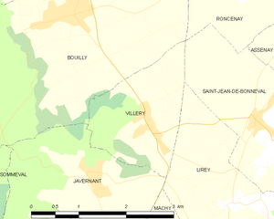
Villery
- commune in Aube, France
- Country:
- Postal Code: 10320
- Coordinates: 48° 10' 15" N, 4° 1' 8" E
- GPS tracks (wikiloc): [Link]
- Area: 3.59 sq km
- Population: 275


Roncenay
- commune in Aube, France
- Country:
- Postal Code: 10320
- Coordinates: 48° 11' 59" N, 4° 3' 4" E
- GPS tracks (wikiloc): [Link]
- AboveSeaLevel: 128 м m
- Area: 3.82 sq km
- Population: 157


Villemereuil
- commune in Aube, France
- Country:
- Postal Code: 10800
- Coordinates: 48° 11' 58" N, 4° 5' 14" E
- GPS tracks (wikiloc): [Link]
- Area: 7.81 sq km
- Population: 241


Saint-Thibault
- commune in Aube, France
- Country:
- Postal Code: 10800
- Coordinates: 48° 12' 20" N, 4° 8' 30" E
- GPS tracks (wikiloc): [Link]
- Area: 11.71 sq km
- Population: 539


Villy-le-Bois
- commune in Aube, France
- Country:
- Postal Code: 10800
- Coordinates: 48° 9' 40" N, 4° 5' 35" E
- GPS tracks (wikiloc): [Link]
- Area: 5.41 sq km
- Population: 58

Crésantignes
- commune in Aube, France
- Country:
- Postal Code: 10320
- Coordinates: 48° 8' 28" N, 4° 1' 9" E
- GPS tracks (wikiloc): [Link]
- Area: 2.1 sq km
- Population: 312

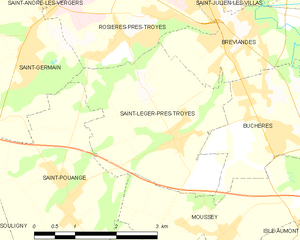
Saint-Léger-près-Troyes
- commune in Aube, France
- Country:
- Postal Code: 10800
- Coordinates: 48° 14' 12" N, 4° 4' 40" E
- GPS tracks (wikiloc): [Link]
- Area: 9.21 sq km
- Population: 863
- Web site: [Link]


Montceaux-lès-Vaudes
- commune in Aube, France
- Country:
- Postal Code: 10260
- Coordinates: 48° 9' 11" N, 4° 9' 44" E
- GPS tracks (wikiloc): [Link]
- Area: 10.11 sq km
- Population: 251

Saint-Jean-de-Bonneval
- commune in Aube, France
- Country:
- Postal Code: 10320
- Coordinates: 48° 10' 20" N, 4° 2' 55" E
- GPS tracks (wikiloc): [Link]
- Area: 6.14 sq km
- Population: 378

Isle-Aumont
- commune in Aube, France
- Country:
- Postal Code: 10800
- Coordinates: 48° 12' 45" N, 4° 7' 28" E
- GPS tracks (wikiloc): [Link]
- Area: 3.48 sq km
- Population: 488


Les Bordes-Aumont
- commune in Aube, France
- Country:
- Postal Code: 10800
- Coordinates: 48° 11' 8" N, 4° 7' 19" E
- GPS tracks (wikiloc): [Link]
- Area: 5.49 sq km
- Population: 544

Javernant
- commune in Aube, France
- Country:
- Postal Code: 10320
- Coordinates: 48° 9' 42" N, 4° 0' 8" E
- GPS tracks (wikiloc): [Link]
- Area: 5.62 sq km
- Population: 156
- Web site: [Link]


La Vendue-Mignot
- commune in Aube, France
- Country:
- Postal Code: 10800
- Coordinates: 48° 9' 24" N, 4° 6' 30" E
- GPS tracks (wikiloc): [Link]
- Area: 10.48 sq km
- Population: 247


Moussey
- commune in Aube, France
- Country:
- Postal Code: 10800
- Coordinates: 48° 12' 51" N, 4° 5' 44" E
- GPS tracks (wikiloc): [Link]
- Area: 7.25 sq km
- Population: 626

Villy-le-Maréchal
- commune in Aube, France
- Country:
- Postal Code: 10800
- Coordinates: 48° 11' 15" N, 4° 4' 31" E
- GPS tracks (wikiloc): [Link]
- Area: 3.29 sq km
- Population: 180


Sommeval
- commune in Aube, France
- Country:
- Postal Code: 10320
- Coordinates: 48° 9' 57" N, 3° 57' 55" E
- GPS tracks (wikiloc): [Link]
- Area: 9.57 sq km
- Population: 318
Saint-Pouange
- commune in Aube, France
- Country:
- Postal Code: 10120
- Coordinates: 48° 13' 29" N, 4° 2' 31" E
- GPS tracks (wikiloc): [Link]
- Area: 10.02 sq km
- Population: 905


Jeugny
- commune in Aube, France
- Country:
- Postal Code: 10320
- Coordinates: 48° 7' 51" N, 4° 2' 12" E
- GPS tracks (wikiloc): [Link]
- Area: 15.85 sq km
- Population: 495
- Web site: [Link]


Buchères
- commune in Aube, France
- Country:
- Postal Code: 10800
- Coordinates: 48° 14' 11" N, 4° 6' 41" E
- GPS tracks (wikiloc): [Link]
- Area: 7.14 sq km
- Population: 1581
Machy
- commune in Aube, France
- Country:
- Postal Code: 10320
- Coordinates: 48° 8' 23" N, 4° 2' 52" E
- GPS tracks (wikiloc): [Link]
- Area: 2.74 sq km
- Population: 117