Lirey (Lirey)

- commune in Aube, France
- Country:

- Postal Code: 10320
- Coordinates: 48° 9' 25" N, 4° 2' 50" E


- GPS tracks (wikiloc): [Link]
- Area: 4.84 sq km
- Population: 108
- Wikipedia en: wiki(en)
- Wikipedia: wiki(fr)
- Wikidata storage: Wikidata: Q1085358
- Wikipedia Commons Category: [Link]
- Freebase ID: [/m/04sxmw]
- GeoNames ID: Alt: [6426439]
- SIREN number: [211001912]
- BnF ID: [15246290t]
- INSEE municipality code: 10198
Shares border with regions:
Longeville-sur-Mogne
- commune in Aube, France
- Country:
- Postal Code: 10320
- Coordinates: 48° 8' 56" N, 4° 3' 39" E
- GPS tracks (wikiloc): [Link]
- AboveSeaLevel: 130 м m
- Area: 4.15 sq km
- Population: 149

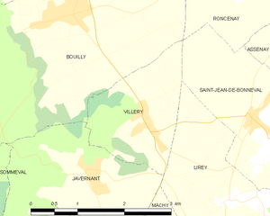
Villery
- commune in Aube, France
- Country:
- Postal Code: 10320
- Coordinates: 48° 10' 15" N, 4° 1' 8" E
- GPS tracks (wikiloc): [Link]
- Area: 3.59 sq km
- Population: 275

Saint-Jean-de-Bonneval
- commune in Aube, France
- Country:
- Postal Code: 10320
- Coordinates: 48° 10' 20" N, 4° 2' 55" E
- GPS tracks (wikiloc): [Link]
- Area: 6.14 sq km
- Population: 378

Javernant
- commune in Aube, France
- Country:
- Postal Code: 10320
- Coordinates: 48° 9' 42" N, 4° 0' 8" E
- GPS tracks (wikiloc): [Link]
- Area: 5.62 sq km
- Population: 156
- Web site: [Link]
Machy
- commune in Aube, France
- Country:
- Postal Code: 10320
- Coordinates: 48° 8' 23" N, 4° 2' 52" E
- GPS tracks (wikiloc): [Link]
- Area: 2.74 sq km
- Population: 117