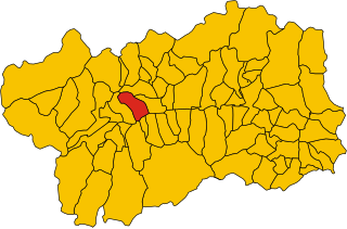
Jovençan (Jovençan)
.svg)
- Italian comune
 Hiking in Jovençan
Jovençan is a picturesque municipality located in the Aosta Valley region of Italy, nestled in the Alps. It's a great destination for hiking enthusiasts, offering a range of trails that cater to various skill levels. Here are some highlights about hiking in Jovençan:
Trail Options:
-
Sentiero del Vino: This scenic trail takes you through vineyards and offers stunning views of the surrounding mountains. It's a relatively easy hike, perfect for families and beginners.
-
Mont Avic Natural Park: Located nearby, this park has several trails of varying difficulty. You'll find well-marked paths that lead to beautiful landscapes, alpine lakes, and diverse flora and fauna.
-
Colle di Jovençan: More experienced hikers may enjoy the trails leading up to the Colle di Jovençan, which offers panoramic views of the Aosta Valley and the surrounding peaks.
-
Alpine Trails: For those looking for a more challenging adventure, there are higher altitude trails that offer the chance to experience the rugged beauty of the alpine landscape.
Seasonal Considerations:
- Spring and Summer: Ideal for hiking when the weather is pleasant, and the trails are clear of snow. This is the best time to enjoy wildflowers and lush greenery.
- Autumn: Offers stunning fall foliage and cooler temperatures, perfect for hiking.
- Winter: While traditional hiking may be less common, winter hiking with snowshoes or trekking in the snowy landscapes can be a unique experience.
Preparation:
- Gear: Make sure to wear appropriate hiking boots and clothing, and bring plenty of water and snacks. A map or GPS device is also helpful.
- Safety: Always check the weather forecast before heading out and inform someone about your hiking plans.
Local Culture:
Enjoying the local cuisine in Jovençan after a long hike is recommended. Try local dishes made from mountain ingredients, and don't miss the chance to sample some regional wines.
Conclusion:
Hiking in Jovençan offers a beautiful blend of nature, culture, and adventure. Whether you're a seasoned hiker or a beginner, you'll find trails that are rewarding and enjoyable. Always remember to respect the natural environment and follow local guidelines to preserve its beauty for future generations. Happy hiking!
- Country:

- Postal Code: 11020
- Local Dialing Code: 0165
- Licence Plate Code: AO
- Coordinates: 45° 42' 56" N, 7° 16' 25" E


- GPS tracks (wikiloc): [Link]
- AboveSeaLevel: 632 м m
- Area: 7 sq km
- Population: 736
- Web site: http://www.comune.jovencan.ao.it/
- Wikipedia en: wiki(en)
- Wikipedia: wiki(it)
- Wikidata storage: Wikidata: Q35116
- Wikipedia Commons Gallery: [Link]
- Wikipedia Commons Category: [Link]
- Wikipedia Commons Maps Category: [Link]
- Freebase ID: [/m/0fwz0h]
- GeoNames ID: Alt: [6543060]
- OSM relation ID: [45848]
- ISTAT ID: 007038
- Italian cadastre code: E391
Shares border with regions:


Aymavilles
- Italian comune
Hiking in Aymavilles
Aymavilles is a picturesque village located in the Aosta Valley region of Italy, known for its stunning Alpine scenery and rich cultural heritage. Hiking in Aymavilles offers a mix of challenging trails, beautiful landscapes, and opportunities to experience the local flora and fauna....
- Country:
- Postal Code: 11010
- Local Dialing Code: 0165
- Licence Plate Code: AO
- Coordinates: 45° 42' 4" N, 7° 14' 25" E
- GPS tracks (wikiloc): [Link]
- AboveSeaLevel: 640 м m
- Area: 53.24 sq km
- Population: 2065
- Web site: [Link]


Gressan
- town and comune in Aosta Valley, Italy
Hiking in Gressan
Gressan is a beautiful municipality in the Aosta Valley region of Italy. Located near the town of Aosta, it's an excellent destination for hiking enthusiasts, offering a variety of trails suitable for different skill levels. Here are some highlights about hiking in Gressan:...
- Country:
- Postal Code: 11020
- Local Dialing Code: 0165
- Licence Plate Code: AO
- Coordinates: 45° 43' 0" N, 7° 17' 0" E
- GPS tracks (wikiloc): [Link]
- AboveSeaLevel: 626 м m
- Area: 25.3 sq km
- Population: 3378
- Web site: [Link]

Sarre, Aosta Valley
- Italian comune
Hiking in Sarre, Aosta Valley
Hiking in Sarre, located in the Aosta Valley of northern Italy, offers a fantastic outdoor experience surrounded by stunning mountain scenery. The Aosta Valley is known for its breathtaking landscapes, rich history, and numerous hiking trails suitable for all levels of experience....
- Country:
- Postal Code: 11010
- Local Dialing Code: 0165
- Licence Plate Code: AO
- Coordinates: 45° 43' 4" N, 7° 15' 27" E
- GPS tracks (wikiloc): [Link]
- AboveSeaLevel: 631 м m
- Area: 28.28 sq km
- Population: 4878
- Web site: [Link]