Enz (Enzkreis)
.svg)
- district of Baden-Württemberg, Germany
 Hiking in Enz
Enzkreis, located in Baden-Württemberg, Germany, is a wonderful area for hiking enthusiasts, offering a mix of picturesque landscapes, historic towns, and diverse trail options. Here’s an overview of some aspects to consider when hiking in this region:
Trails and Nature:
- Trail Variety: Enzkreis features various hiking trails ranging from easy walks to more challenging routes. The area has well-marked trails that cater to different skill levels.
- Scenic Landscapes: Hikers can enjoy beautiful views of forests, valleys, and rolling hills. The region is characterized by its lush greenery, especially in spring and summer.
- Black Forest Proximity: Being near the Black Forest allows hikers to access some of its trails while enjoying the distinct charm of the Enzkreis.
Points of Interest:
- Historic Sites: During your hike, you may come across charming villages, historical ruins, and landmarks that reflect the rich history of the area.
- Natural Parks: Explore nearby natural parks for more extensive hiking opportunities, where you can also experience local flora and fauna.
- Cultural Experiences: The region offers cultural experiences, including local culinary specialties and festivals, which can enhance your hiking adventure.
Hiking Tips:
- Proper Gear: Ensure you wear appropriate hiking footwear and carry essentials like water, snacks, a map, and a first-aid kit.
- Weather Considerations: Always check the weather forecast before heading out, as conditions can change rapidly.
- Respect Nature: Follow Leave No Trace principles to maintain the beauty of the trails and surrounding areas.
Recommended Routes:
- Wanderung auf den Hohenwart: This trail offers stunning panoramic views and is a great option for hikers looking to enjoy both nature and a bit of elevation.
- Burg Hoheneck Runde: A circular trail that takes you around historic sights including the Hoheneck Castle, perfect for those interested in both history and hiking.
Enzkreis provides a lovely blend of nature, history, and community, making it a great destination for hiking enthusiasts. Whether you’re a seasoned hiker or a beginner, you’ll find trails that suit your preference in this beautiful region. Enjoy your hiking adventure!
- Country:

- Capital: Pforzheim
- Licence Plate Code: PF
- Coordinates: 48° 54' 0" N, 8° 45' 0" E


- GPS tracks (wikiloc): [Link]
- AboveSeaLevel: 298 м m
- Area: 573.69 sq km
- Web site: http://www.enzkreis.de/
- Wikipedia en: wiki(en)
- Wikipedia: wiki(de)
- Wikidata storage: Wikidata: Q8184
- Wikipedia Commons Category: [Link]
- Wikipedia Commons Maps Category: [Link]
- Freebase ID: [/m/01hcdh]
- GeoNames ID: Alt: [2929889]
- BnF ID: [11974344q]
- VIAF ID: Alt: [155479905]
- OSM relation ID: [62723]
- GND ID: Alt: [4014983-3]
- archINFORM location ID: [2563]
- Library of Congress authority ID: Alt: [n84154188]
- TGN ID: [7189405]
- NUTS code: [DE12B]
- German district key: 08236
Includes regions:
Engelsbrand
- municipality in Germany
Hiking in Engelsbrand
Engelsbrand is a picturesque village located in the northern Black Forest region of Germany, known for its beautiful nature and hiking opportunities. Here are some highlights for hiking in and around Engelsbrand:...
- Country:
- Postal Code: 75331
- Local Dialing Code: 07082; 07235
- Licence Plate Code: PF
- Coordinates: 48° 50' 0" N, 8° 39' 0" E
- GPS tracks (wikiloc): [Link]
- AboveSeaLevel: 576 м m
- Area: 15.19 sq km
- Population: 4319
- Web site: [Link]


Ölbronn-Dürrn
- municipality in Germany
Hiking in Ölbronn-Dürrn
Ölbronn-Dürrn is a small town located in the state of Baden-Württemberg, Germany, offering a picturesque setting for hiking enthusiasts. The area is characterized by its scenic landscapes, including forests, hills, and agricultural fields, making it a great spot for both novice and experienced hikers....
- Country:
- Postal Code: 75248
- Local Dialing Code: 07237; 07043
- Licence Plate Code: PF
- Coordinates: 48° 58' 0" N, 8° 45' 0" E
- GPS tracks (wikiloc): [Link]
- AboveSeaLevel: 291 м m
- Area: 15.64 sq km
- Population: 3487
- Web site: [Link]


Wimsheim
- municipality in Germany
Hiking in Wimsheim
Wimsheim is a small municipality located in the state of Baden-Württemberg, Germany. While it may not be as famous for hiking as some larger regions or national parks, there are still opportunities for walking and enjoying nature in and around the area....
- Country:
- Postal Code: 71299
- Local Dialing Code: 07044
- Licence Plate Code: PF
- Coordinates: 48° 51' 9" N, 8° 49' 37" E
- GPS tracks (wikiloc): [Link]
- AboveSeaLevel: 415 м m
- Area: 8.06 sq km
- Population: 2832
- Web site: [Link]


Wiernsheim
- small town in Bade-Wurtemberg close to Stuttgart, Germany
Hiking in Wiernsheim
Wiernsheim, located in the state of Baden-Württemberg, Germany, is surrounded by scenic landscapes that make it a lovely destination for hiking enthusiasts. The area is characterized by rolling hills, forests, and charming villages, providing a variety of trails for hikers of different skill levels. Here are some highlights about hiking in Wiernsheim:...
- Country:
- Postal Code: 75446
- Local Dialing Code: 07044
- Licence Plate Code: PF
- Coordinates: 48° 53' 24" N, 8° 51' 2" E
- GPS tracks (wikiloc): [Link]
- AboveSeaLevel: 366 м m
- Area: 24.62 sq km
- Population: 6654
- Web site: [Link]


Sternenfels
- municipality in Germany
Hiking in Sternenfels
Sternenfels is a charming village located in the state of Baden-Württemberg, Germany, known for its beautiful landscapes and scenic hiking opportunities. Nestled in the northern part of the Swabian Jura, this area offers a variety of trails that cater to different skill levels, making it a great destination for both casual walkers and more experienced hikers....
- Country:
- Postal Code: 75447
- Local Dialing Code: 07045
- Licence Plate Code: PF
- Coordinates: 49° 3' 1" N, 8° 51' 2" E
- GPS tracks (wikiloc): [Link]
- AboveSeaLevel: 397 м m
- Area: 17.31 sq km
- Population: 2761
- Web site: [Link]


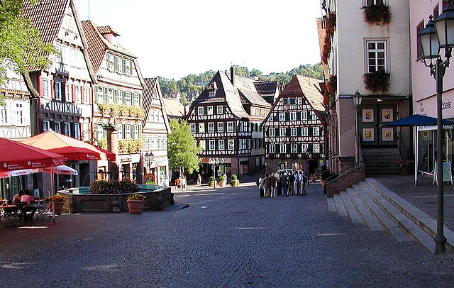
Tiefenbronn
- municipality in Germany
Hiking in Tiefenbronn
Tiefenbronn is a charming village located in the northern part of Baden-Württemberg, Germany. It is surrounded by beautiful landscapes that make it an appealing destination for hiking enthusiasts. Here are some highlights and tips for hiking in and around Tiefenbronn:...
- Country:
- Postal Code: 75233
- Local Dialing Code: 07234
- Licence Plate Code: PF
- Coordinates: 48° 50' 0" N, 8° 48' 0" E
- GPS tracks (wikiloc): [Link]
- AboveSeaLevel: 428 м m
- Area: 14.78 sq km
- Population: 5142
- Web site: [Link]


Maulbronn
- city in Germany
Hiking in Maulbronn
Maulbronn, located in Baden-Württemberg, Germany, is known for its impressive UNESCO World Heritage-listed monastery, but it also offers some scenic hiking opportunities in its beautiful surroundings. Here are some highlights for hiking in and around the area:...
- Country:
- Postal Code: 75433
- Local Dialing Code: 07043
- Licence Plate Code: PF
- Coordinates: 49° 0' 1" N, 8° 48' 39" E
- GPS tracks (wikiloc): [Link]
- AboveSeaLevel: 251 м m
- Area: 25.44 sq km
- Population: 6318
- Web site: [Link]


Knittlingen
- municipality in Germany
Hiking in Knittlingen
Knittlingen, a charming town located in the Baden-Württemberg region of Germany, is surrounded by beautiful landscapes that make it an excellent destination for hiking enthusiasts. Here are some highlights and tips for hiking in and around Knittlingen:...
- Country:
- Postal Code: 75438
- Local Dialing Code: 07043
- Licence Plate Code: PF
- Coordinates: 49° 1' 26" N, 8° 45' 25" E
- GPS tracks (wikiloc): [Link]
- AboveSeaLevel: 196 м m
- Area: 26.33 sq km
- Population: 7946
- Web site: [Link]


Remchingen
- German municipality
Hiking in Remchingen
Remchingen is a charming municipality located in the state of Baden-Württemberg, Germany, situated near the northern edge of the Black Forest. This area offers a variety of hiking opportunities that cater to different skill levels, with scenic landscapes featuring forests, hills, and picturesque views of the surrounding regions....
- Country:
- Postal Code: 75196
- Local Dialing Code: 07232
- Licence Plate Code: PF
- Coordinates: 48° 57' 0" N, 8° 34' 35" E
- GPS tracks (wikiloc): [Link]
- AboveSeaLevel: 171 м m
- Area: 24.06 sq km
- Population: 11673
- Web site: [Link]


Kieselbronn
- municipality in Germany
Hiking in Kieselbronn
Kieselbronn is a small municipality in the state of Baden-Württemberg, Germany, located near Pforzheim. While it may not be as widely known as larger hiking destinations in the region, it offers a charming setting for outdoor activities and hiking enthusiasts. Here’s what you can expect when hiking in and around Kieselbronn:...
- Country:
- Postal Code: 75249
- Local Dialing Code: 07231
- Licence Plate Code: PF
- Coordinates: 48° 56' 0" N, 8° 45' 0" E
- GPS tracks (wikiloc): [Link]
- AboveSeaLevel: 370 м m
- Area: 8.63 sq km
- Population: 3000
- Web site: [Link]


Niefern-Öschelbronn
- municipality in Germany
Hiking in Niefern-Öschelbronn
Niefern-Öschelbronn is a picturesque town located in the Enzkreis region of Baden-Württemberg, Germany. It offers a variety of hiking opportunities given its beautiful natural surroundings, rolling hills, and nearby forests. Here’s an overview of what you can expect when hiking in this area:...
- Country:
- Postal Code: 75223
- Local Dialing Code: 07233
- Licence Plate Code: PF
- Coordinates: 48° 55' 0" N, 8° 47' 0" E
- GPS tracks (wikiloc): [Link]
- AboveSeaLevel: 240 м m
- Area: 22.02 sq km
- Population: 11830
- Web site: [Link]


Mühlacker
- municipality in Germany
Hiking in Mühlacker
Mühlacker, located in the Enzkreis district of Baden-Württemberg, Germany, offers beautiful hiking opportunities, especially for those who enjoy exploring nature and picturesque landscapes. Here are some highlights and tips for hiking in the Mühlacker area:...
- Country:
- Postal Code: 75417
- Local Dialing Code: 07041
- Licence Plate Code: PF
- Coordinates: 48° 57' 0" N, 8° 50' 21" E
- GPS tracks (wikiloc): [Link]
- AboveSeaLevel: 240 м m
- Area: 54.32 sq km
- Population: 25211
- Web site: [Link]


Heimsheim
- municipality in Germany
Hiking in Heimsheim
Heimsheim, a small town in Baden-Württemberg, Germany, offers various opportunities for hiking enthusiasts, especially those who enjoy exploring the scenic trails of the Swabian region. While Heimsheim itself may not have extensive hiking networks directly in town, it is well-positioned near larger nature reserves and trails in the surrounding area....
- Country:
- Postal Code: 71296
- Local Dialing Code: 07033
- Licence Plate Code: PF
- Coordinates: 48° 48' 20" N, 8° 51' 43" E
- GPS tracks (wikiloc): [Link]
- AboveSeaLevel: 413 м m
- Area: 14.32 sq km
- Population: 5111
- Web site: [Link]


Neuhausen
- municipality in Germany
Hiking in Neuhausen
Neuhausen (Enz) is a charming village located in the northern part of the Black Forest region in Germany, specifically in the state of Baden-Württemberg. The area offers various hiking opportunities, thanks to its beautiful natural landscapes, forests, and scenic valleys. Here are some highlights for hiking in Neuhausen (Enz):...
- Country:
- Postal Code: 75242
- Local Dialing Code: 07234
- Licence Plate Code: PF
- Coordinates: 48° 47' 36" N, 8° 46' 43" E
- GPS tracks (wikiloc): [Link]
- AboveSeaLevel: 482 м m
- Area: 29.76 sq km
- Population: 5244
- Web site: [Link]


Neulingen
- municipality in Germany
Hiking in Neulingen
Neulingen, located in Baden-Württemberg, Germany, offers a serene backdrop for hiking enthusiasts. The region is characterized by picturesque landscapes, rolling hills, and woodlands, making it perfect for both casual walkers and avid hikers....
- Country:
- Postal Code: 75245
- Local Dialing Code: 07237
- Licence Plate Code: PF
- Coordinates: 48° 58' 6" N, 8° 43' 29" E
- GPS tracks (wikiloc): [Link]
- AboveSeaLevel: 325 м m
- Area: 23.20 sq km
- Population: 6595
- Web site: [Link]


Keltern
- German municipality
Hiking in Keltern
Keltern, located in Baden-Württemberg, Germany, is an appealing destination for hiking enthusiasts due to its scenic landscapes, charming villages, and accessibility to various outdoor trails. Here are some key points about hiking in Keltern:...
- Country:
- Postal Code: 75210
- Local Dialing Code: 07236
- Licence Plate Code: PF
- Coordinates: 48° 54' 3" N, 8° 34' 33" E
- GPS tracks (wikiloc): [Link]
- AboveSeaLevel: 195 м m
- Area: 29.83 sq km
- Population: 9043
- Web site: [Link]

Neuenbürg
- municipality in Germany
Hiking in Neuenbürg
Neuenbürg, located in the Enzkreis district of Baden-Württemberg, Germany, is a lovely area for hiking enthusiasts. The town is surrounded by scenic landscapes, including forests, hills, and charming countryside, which provide a variety of hiking trails suitable for different skill levels....
- Country:
- Postal Code: 75305
- Local Dialing Code: 07082
- Licence Plate Code: PF
- Coordinates: 48° 50' 46" N, 8° 35' 20" E
- GPS tracks (wikiloc): [Link]
- AboveSeaLevel: 323 м m
- Area: 28.17 sq km
- Population: 7680
- Web site: [Link]


Birkenfeld
- municipality in Baden-Württemberg, Germany
Hiking in Birkenfeld
Birkenfeld (Enz) is a charming town located in the northeast of the Black Forest in Germany. It offers a wealth of hiking opportunities amidst beautiful natural landscapes, diverse flora and fauna, and serene surroundings. Here are some highlights of hiking in the area:...
- Country:
- Postal Code: 75217
- Local Dialing Code: 07231
- Licence Plate Code: PF
- Coordinates: 48° 52' 11" N, 8° 38' 10" E
- GPS tracks (wikiloc): [Link]
- AboveSeaLevel: 315 м m
- Area: 19.04 sq km
- Population: 10158
- Web site: [Link]


Eisingen
- municipality in Baden-Württemberg, Germany
Hiking in Eisingen
Eisingen, a small community in Bavaria, Germany, is surrounded by beautiful natural landscapes that can be quite appealing for hiking enthusiasts. Although it may not be as well-known as some other hiking destinations in the region, it provides access to scenic trails and the tranquil beauty of the Bavarian countryside....
- Country:
- Postal Code: 75239; 75237
- Local Dialing Code: 07232
- Licence Plate Code: PF
- Coordinates: 48° 56' 51" N, 8° 40' 7" E
- GPS tracks (wikiloc): [Link]
- AboveSeaLevel: 259 м m
- Area: 8.03 sq km
- Population: 4721
- Web site: [Link]


Königsbach-Stein
- municipality in Germany
Hiking in Königsbach-Stein
Königsbach-Stein is a picturesque municipality located in the Enzkreis region of Baden-Württemberg, Germany. It's surrounded by lush nature and offers several hiking opportunities for outdoor enthusiasts. Here are some highlights about hiking in this area:...
- Country:
- Postal Code: 75203
- Local Dialing Code: 07232
- Licence Plate Code: PF
- Coordinates: 48° 57' 59" N, 8° 36' 32" E
- GPS tracks (wikiloc): [Link]
- AboveSeaLevel: 177 м m
- Area: 33.72 sq km
- Population: 10010
- Web site: [Link]


Kämpfelbach
- municipality in Germany
Hiking in Kämpfelbach
Kämpfelbach is a small town in Germany, located in the state of Baden-Württemberg. While it may not be as well-known as larger hiking destinations, the area surrounding Kämpfelbach offers various opportunities for outdoor enthusiasts. Here’s what you can expect when hiking in and around Kämpfelbach....
- Country:
- Postal Code: 75236
- Local Dialing Code: 07232; 07231
- Licence Plate Code: PF
- Coordinates: 48° 56' 53" N, 8° 37' 26" E
- GPS tracks (wikiloc): [Link]
- AboveSeaLevel: 250 м m
- Area: 13.64 sq km
- Population: 6292
- Web site: [Link]
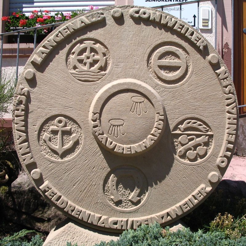
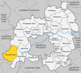
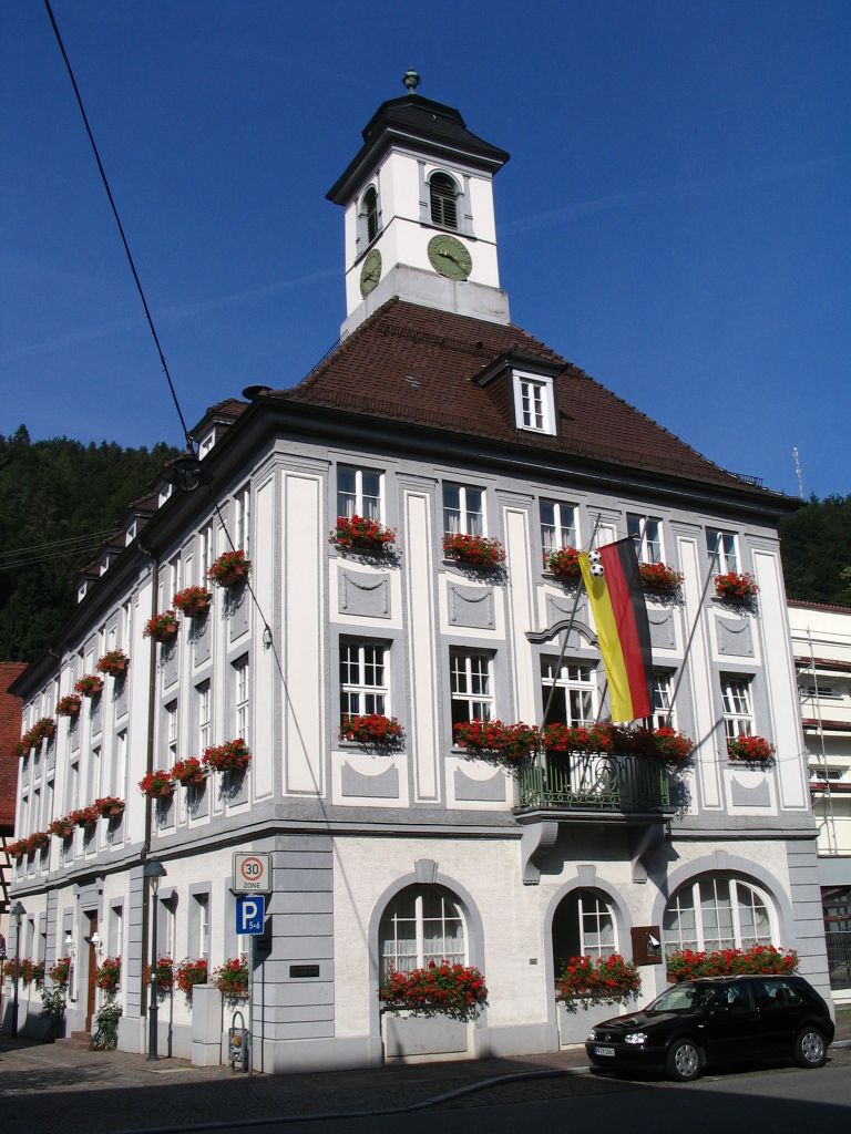
Straubenhardt
- German municipality
Hiking in Straubenhardt
Straubenhardt, located in the northern Black Forest region of Germany, offers a range of hiking opportunities, characterized by scenic views, diverse landscapes, and well-marked trails. Here are some key highlights about hiking in this area:...
- Country:
- Postal Code: 75334
- Local Dialing Code: 07082
- Licence Plate Code: PF
- Coordinates: 48° 50' 43" N, 8° 32' 45" E
- GPS tracks (wikiloc): [Link]
- AboveSeaLevel: 438 м m
- Area: 33.08 sq km
- Population: 10829
- Web site: [Link]


Mönsheim
- municipality in Germany
Hiking in Mönsheim
Mönsheim is a small town located in the Enzkreis district of Baden-Württemberg, Germany. The surrounding landscape is charming and offers several opportunities for hiking enthusiasts. Here are some highlights you can expect while hiking in and around Mönsheim:...
- Country:
- Postal Code: 71297
- Local Dialing Code: 07044
- Licence Plate Code: PF
- Coordinates: 48° 52' 0" N, 8° 52' 0" E
- GPS tracks (wikiloc): [Link]
- AboveSeaLevel: 432 м m
- Area: 16.78 sq km
- Population: 2824
- Web site: [Link]


Ispringen
- municipality in Germany
Hiking in Ispringen
Ispringen is a small town located in Baden-Württemberg, Germany, near Pforzheim. While it may not be as widely known as some larger hiking destinations, the picturesque landscape surrounding the area offers some beautiful opportunities for hiking enthusiasts....
- Country:
- Postal Code: 75228
- Local Dialing Code: 07231
- Licence Plate Code: PF
- Coordinates: 48° 55' 0" N, 8° 40' 0" E
- GPS tracks (wikiloc): [Link]
- AboveSeaLevel: 268 м m
- Area: 8.21 sq km
- Population: 6070
- Web site: [Link]


Friolzheim
- municipality in Germany
Hiking in Friolzheim
Friolzheim is a charming small town located in Baden-Württemberg, Germany, near the northern edge of the Black Forest. While it might not be a well-known hiking destination, it offers access to some delightful trails and beautiful scenery suitable for outdoor enthusiasts....
- Country:
- Postal Code: 71292
- Local Dialing Code: 07044
- Licence Plate Code: PF
- Coordinates: 48° 50' 0" N, 8° 50' 0" E
- GPS tracks (wikiloc): [Link]
- AboveSeaLevel: 447 м m
- Area: 8.54 sq km
- Population: 3918
- Web site: [Link]

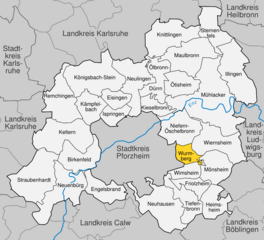
Wurmberg
- municipality in Germany
Hiking in Wurmberg
Wurmberg, the highest peak in the Harz mountain range in Germany, offers a range of stunning hiking opportunities and breathtaking views. Here’s what you should know about hiking in Wurmberg:...
- Country:
- Postal Code: 75449
- Local Dialing Code: 07044
- Licence Plate Code: PF
- Coordinates: 48° 52' 0" N, 8° 49' 0" E
- GPS tracks (wikiloc): [Link]
- AboveSeaLevel: 450 м m
- Area: 7.35 sq km
- Population: 3061
- Web site: [Link]


Ötisheim
- municipality in Germany
Hiking in Ötisheim
Ötisheim is a charming municipality located in the state of Baden-Württemberg, Germany, known for its picturesque landscapes and welcoming environment. If you're interested in hiking in and around Ötisheim, you can expect a range of scenic trails that offer both natural beauty and cultural experiences....
- Country:
- Postal Code: 75443
- Local Dialing Code: 07041
- Licence Plate Code: PF
- Coordinates: 48° 58' 0" N, 8° 48' 0" E
- GPS tracks (wikiloc): [Link]
- AboveSeaLevel: 243 м m
- Area: 14.27 sq km
- Population: 4701
- Web site: [Link]


Illingen
- municipality in Enzkreis, Germany
Hiking in Illingen
Illingen, located in Baden-Württemberg, offers a range of hiking opportunities that allow you to explore the scenic beauty of the region. Here are some key points about hiking in Illingen:...
- Country:
- Postal Code: 75428
- Local Dialing Code: 07043; 07042
- Licence Plate Code: PF
- Coordinates: 48° 57' 19" N, 8° 55' 8" E
- GPS tracks (wikiloc): [Link]
- AboveSeaLevel: 235 м m
- Area: 29.37 sq km
- Population: 7321
- Web site: [Link]
Shares border with regions:

Pforzheim
- German city
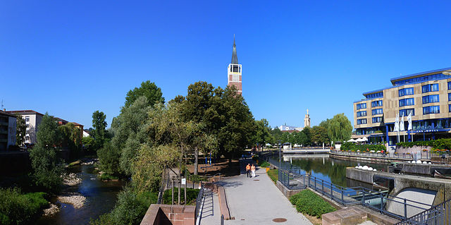
Hiking in Pforzheim
Pforzheim, located in the northern part of the Black Forest in Germany, offers a variety of hiking opportunities that cater to different skill levels. The region is characterized by its lush forests, picturesque landscapes, and scenic trails....
- Country:
- Postal Code: 75172–75181
- Local Dialing Code: 07231; 07234
- Licence Plate Code: PF
- Coordinates: 48° 54' 0" N, 8° 43' 0" E
- GPS tracks (wikiloc): [Link]
- AboveSeaLevel: 273 м m
- Area: 98.07 sq km
- Population: 123493
- Web site: [Link]


Heilbronn
- district in Germany
Hiking in Heilbronn
Heilbronn is a district located in the state of Baden-Württemberg, Germany, characterized by its diverse landscapes, rolling vineyards, and a mix of cultural and historical attractions. Here are some highlights of hiking in the Heilbronn district:...
- Country:
- Capital: Heilbronn
- Licence Plate Code: HN
- Coordinates: 49° 9' 36" N, 9° 15' 0" E
- GPS tracks (wikiloc): [Link]
- AboveSeaLevel: 166 м m
- Area: 1099.93 sq km
- Population: 334388
- Web site: [Link]


Karlsruhe
- district of Baden-Württemberg, Germany
Hiking in Karlsruhe
Karlsruhe, located in the southwest of Germany in the state of Baden-Württemberg, offers a variety of hiking opportunities both in the city and in the surrounding countryside. Here are some key points to consider when hiking in and around Karlsruhe:...
- Country:
- Capital: Karlsruhe
- Licence Plate Code: KA
- Coordinates: 49° 4' 48" N, 8° 34' 48" E
- GPS tracks (wikiloc): [Link]
- AboveSeaLevel: 118 м m
- Area: 1084.95 sq km
- Population: 435841
- Web site: [Link]

Calw District
- district of Baden-Württemberg, Germany
Hiking in Calw District
Calw district, located in the state of Baden-Württemberg, Germany, offers a rich variety of hiking opportunities amidst beautiful natural landscapes. The area is characterized by rolling hills, dense forests, and charming villages, making it a delightful destination for both casual walkers and serious hikers....
- Country:
- Capital: Calw
- Licence Plate Code: CW
- Coordinates: 48° 42' 0" N, 8° 44' 24" E
- GPS tracks (wikiloc): [Link]
- AboveSeaLevel: 648 м m
- Area: 797.54 sq km
- Population: 150709
- Web site: [Link]


Böblingen
- district of Baden-Württemberg, Germany
Hiking in Böblingen
Böblingen, located in Baden-Württemberg, Germany, is surrounded by beautiful landscapes, making it an excellent area for hiking enthusiasts. The district features various trails that cater to different skill levels, from casual walks to more challenging hikes....
- Country:
- Capital: Böblingen
- Licence Plate Code: LEO; BB
- Coordinates: 48° 42' 0" N, 9° 0' 36" E
- GPS tracks (wikiloc): [Link]
- AboveSeaLevel: 444 м m
- Area: 617.82 sq km
- Population: 381281
- Web site: [Link]


Ludwigsburg
- district in Baden-Württemberg, Germany
Hiking in Ludwigsburg
Ludwigsburg is a district located in the state of Baden-Württemberg, Germany, and is known for its picturesque landscapes and rich cultural heritage. While the area itself may not be as prominent as some of the larger mountain ranges in Germany, it offers several beautiful hiking opportunities that cater to different skill levels....
- Country:
- Capital: Ludwigsburg
- Licence Plate Code: LB
- Coordinates: 48° 54' 0" N, 9° 12' 0" E
- GPS tracks (wikiloc): [Link]
- AboveSeaLevel: 266 м m
- Area: 686.83 sq km
- Population: 534074
- Web site: [Link]