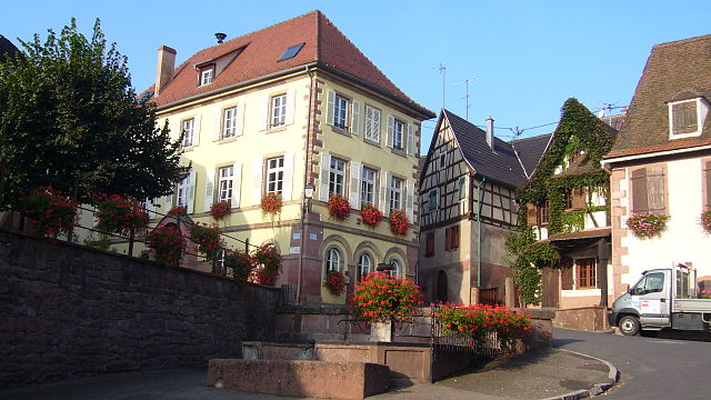
Kintzheim (Kintzheim)

- commune in Bas-Rhin, France
- Country:

- Postal Code: 67600
- Coordinates: 48° 15' 16" N, 7° 23' 48" E


- GPS tracks (wikiloc): [Link]
- Area: 18.78 sq km
- Population: 1612
- Web site: http://www.mairie-kintzheim.fr/
- Wikipedia en: wiki(en)
- Wikipedia: wiki(fr)
- Wikidata storage: Wikidata: Q21432
- Wikipedia Commons Category: [Link]
- Freebase ID: [/m/03m4cc2]
- Freebase ID: [/m/03m4cc2]
- GeoNames ID: Alt: [3011455]
- GeoNames ID: Alt: [3011455]
- SIREN number: [216702399]
- SIREN number: [216702399]
- BnF ID: [15271381j]
- BnF ID: [15271381j]
- VIAF ID: Alt: [202105692]
- VIAF ID: Alt: [202105692]
- GND ID: Alt: [4912423-7]
- GND ID: Alt: [4912423-7]
- INSEE municipality code: 67239
- INSEE municipality code: 67239
Shares border with regions:


Lièpvre
- commune in Haut-Rhin, France
- Country:
- Postal Code: 68660
- Coordinates: 48° 16' 20" N, 7° 16' 57" E
- GPS tracks (wikiloc): [Link]
- Area: 12.55 sq km
- Population: 1751

Orschwiller
- commune in Bas-Rhin, France
- Country:
- Postal Code: 67600
- Coordinates: 48° 14' 29" N, 7° 22' 57" E
- GPS tracks (wikiloc): [Link]
- Area: 6.32 sq km
- Population: 616
- Web site: [Link]


Châtenois
- commune in Bas-Rhin, France
- Country:
- Postal Code: 67730
- Coordinates: 48° 16' 19" N, 7° 24' 3" E
- GPS tracks (wikiloc): [Link]
- Area: 14.57 sq km
- Population: 4128

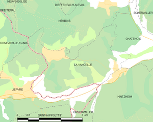
La Vancelle
- commune in Bas-Rhin, France
- Country:
- Postal Code: 67730
- Coordinates: 48° 17' 10" N, 7° 18' 14" E
- GPS tracks (wikiloc): [Link]
- Area: 7.88 sq km
- Population: 406

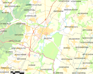
Sélestat
- commune in Bas-Rhin, France
- Country:
- Postal Code: 67600
- Coordinates: 48° 15' 34" N, 7° 27' 15" E
- GPS tracks (wikiloc): [Link]
- AboveSeaLevel: 173 м m
- Area: 44.4 sq km
- Population: 19252
- Web site: [Link]