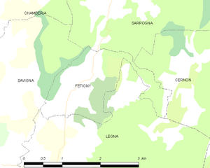
Légna (Légna)
- former commune in Jura, France
Légna is a beautiful hiking destination, often known for its stunning landscapes and diverse trails. While exact details may depend on the specific region or country you are referring to, here are some general highlights of hiking in places like Légna:
-
Trail Variety: Légna typically offers a range of hiking trails that can accommodate different skill levels, from easy walks suitable for families to more challenging hikes for experienced trekkers.
-
Scenic Views: Hiking in Légna often grants access to breathtaking views of mountains, valleys, forests, and sometimes water bodies. The natural beauty is a significant draw for outdoor enthusiasts.
-
Wildlife and Flora: The area may be home to unique flora and fauna, making it an excellent destination for nature lovers. Look out for opportunities to spot local wildlife along the trails.
-
Trail Markings and Maps: Most hiking areas provide clear trail markers and maps. It's always advisable to have a physical map or a reliable GPS device since trail conditions can change.
-
Safety Precautions: As with any hiking adventure, safety is paramount. Be prepared with appropriate gear, sufficient water, snacks, and wear suitable footwear.
-
Weather Considerations: Check the weather forecast before heading out, as conditions can change rapidly, especially in mountainous areas.
If you're planning a specific hiking trip to Légna, be sure to research local trails and resources for the most current information on conditions, regulations, and tips from other hikers who have explored the area. Happy hiking!
- Country:

- Postal Code: 39240
- Coordinates: 46° 25' 37" N, 5° 35' 38" E


- GPS tracks (wikiloc): [Link]
- Area: 10.3 sq km
- Population: 203
- Wikipedia en: wiki(en)
- Wikipedia: wiki(fr)
- Wikidata storage: Wikidata: Q1159516
- Wikipedia Commons Category: [Link]
- Freebase ID: [/m/03npwcq]
- GeoNames ID: Alt: [6433600]
- INSEE municipality code: 39290
Shares border with regions:


Cernon
- commune in Jura, France
Cernon, located in the Jura mountain range of eastern France, offers a beautiful setting for hiking enthusiasts. The Jura is known for its stunning landscapes, rich biodiversity, and a variety of trails that cater to different levels of experience....
- Country:

- Postal Code: 39240
- Coordinates: 46° 24' 11" N, 5° 38' 59" E


- GPS tracks (wikiloc): [Link]
- Area: 16.45 sq km
- Population: 255


Fétigny
- former commune in Jura, France
Fétigny, located in the Jura region of Switzerland, offers a picturesque setting for hiking enthusiasts. The Jura mountain range is known for its rolling hills, lush forests, and scenic views, making it a great destination for outdoor activities....
- Country:

- Postal Code: 39240
- Coordinates: 46° 26' 31" N, 5° 36' 0" E


- GPS tracks (wikiloc): [Link]
- Area: 3.3 sq km
- Population: 88


Savigna
- former commune in Jura, France
Savigna, although not widely recognized in popular hiking literature, could refer to a fictional location or a less-known area. However, if you're interested in hiking in a specific region with a similar name, such as Savigny, or if you're referring to a region in a country like Switzerland or France, I can provide general advice about hiking in European mountainous areas....
- Country:

- Postal Code: 39240
- Coordinates: 46° 26' 26" N, 5° 34' 37" E


- GPS tracks (wikiloc): [Link]
- Area: 9.96 sq km
- Population: 123


Arinthod
- commune in Jura, France
Arinthod, located in the Jura department of France, offers a blend of natural beauty and diverse hiking opportunities. The region is characterized by its rolling hills, dense forests, and charming countryside. When hiking in and around Arinthod, you'll find a variety of trails that cater to different skill levels, from leisurely walks to more challenging hikes....
- Country:

- Postal Code: 39240
- Coordinates: 46° 23' 35" N, 5° 34' 0" E


- GPS tracks (wikiloc): [Link]
- Area: 19.77 sq km
- Population: 1092
- Web site: [Link]

