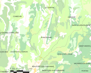
Gigors-et-Lozeron (Gigors-et-Lozeron)

- commune in Drôme, France
 Hiking in Gigors-et-Lozeron
Gigors-et-Lozeron is a beautiful commune located in the Auvergne-Rhône-Alpes region of France, nestled in the picturesque landscape of the French Alps. While it's a relatively small area, its proximity to larger mountain ranges and natural parks offers excellent hiking opportunities for outdoor enthusiasts.
Hiking Trails:
-
Local Trails: The area around Gigors-et-Lozeron features several local hiking trails that range in difficulty, allowing for leisurely walks or more challenging hikes depending on your experience level. The trails often wind through forests, meadows, and offer stunning views of the surrounding mountains.
-
Nearby National Parks: The commune is not far from the Vercors Regional Natural Park and the Chartreuse Mountains, which boast extensive networks of hiking trails. These parks are known for their breathtaking scenery, diverse flora and fauna, and well-marked paths.
-
Vistas and Landmarks: Many hikes in this region will lead you to panoramic viewpoints overlooking valleys and other natural landmarks. Be sure to bring your camera to capture the stunning alpine scenery.
Preparation Tips:
- Check the Weather: Mountain weather can change quickly, so always check the forecast before heading out.
- Proper Gear: Wear sturdy hiking shoes and dress in layers to accommodate temperature changes throughout the day.
- Hydration and Snacks: Bring plenty of water and some snacks to keep your energy up during your hike.
- Trail Maps: Ensure you have a map or a GPS device, as some trails may not be well-marked.
Wildlife and Flora: The region is rich in biodiversity. Keep an eye out for local wildlife, such as deer, various bird species, and a variety of wildflowers during the spring and summer months.
Cultural Considerations: Exploring local trails offers a chance to experience the culture of the area, including small villages, local cuisine, and historical sites. Make it a point to visit local markets or restaurants to taste regional specialties.
In summary, hiking in Gigors-et-Lozeron will provide you with a mix of natural beauty, exercise, and cultural immersion. Whether you're a beginner or an experienced hiker, the stunning surroundings will be sure to delight. Enjoy your adventure!
- Country:

- Postal Code: 26400
- Coordinates: 44° 47' 38" N, 5° 6' 29" E


- GPS tracks (wikiloc): [Link]
- Area: 35.27 sq km
- Population: 163
- Wikipedia en: wiki(en)
- Wikipedia: wiki(fr)
- Wikidata storage: Wikidata: Q860045
- Wikipedia Commons Category: [Link]
- Freebase ID: [/m/03mhgf6]
- GeoNames ID: Alt: [6430096]
- SIREN number: [212601413]
- BnF ID: [15253002n]
- MusicBrainz area ID: [ce218c20-81ef-4f47-95da-e8ad34b06b33]
- WOEID: [592848]
- INSEE municipality code: 26141
Shares border with regions:


Ourches
- commune in Drôme, France
Hiking in Ourches
Ourches is a lesser-known location for hiking, and detailed information about specific trails may be limited. However, if you are referring to a specific area or region (such as Ourches in France), I'd recommend looking for local hiking resources as well as national park guidance if applicable....
- Country:
- Postal Code: 26120
- Coordinates: 44° 48' 17" N, 5° 2' 29" E
- GPS tracks (wikiloc): [Link]
- Area: 9.23 sq km
- Population: 247

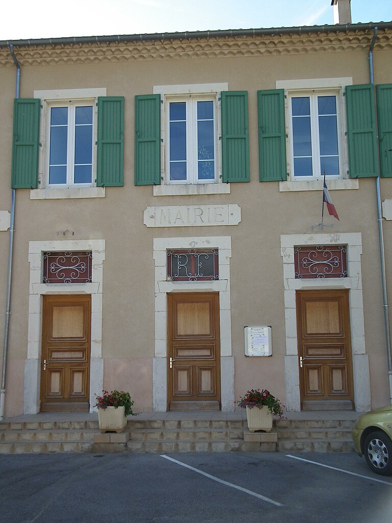
Plan-de-Baix
- commune in Drôme, France
Hiking in Plan-de-Baix
Plan-de-Baix is a picturesque village located in the Drôme department of the Auvergne-Rhône-Alpes region in southeastern France. The surrounding area offers a variety of hiking opportunities, showcasing beautiful landscapes, diverse flora and fauna, and cultural heritage. Here are some highlights for hiking in and around Plan-de-Baix:...
- Country:
- Postal Code: 26400
- Coordinates: 44° 48' 45" N, 5° 9' 57" E
- GPS tracks (wikiloc): [Link]
- Area: 19.39 sq km
- Population: 137

Vaunaveys-la-Rochette
- commune in Drôme, France
Hiking in Vaunaveys-la-Rochette
Vaunaveys-la-Rochette, located in the Auvergne-Rhône-Alpes region of France, offers a fantastic environment for hiking enthusiasts. The village is perched in the foothills of the French Alps, providing hikers with access to stunning landscapes, diverse terrain, and a variety of trails suitable for different skill levels....
- Country:
- Postal Code: 26400
- Coordinates: 44° 46' 5" N, 5° 1' 58" E
- GPS tracks (wikiloc): [Link]
- Area: 21.93 sq km
- Population: 592


Suze
- commune in Drôme, France
Hiking in Suze
Suze is a charming village located in the Drôme department of the Auvergne-Rhône-Alpes region in southeastern France. The area is known for its stunning landscapes, historical sites, and great hiking opportunities. Here are some highlights of hiking in and around Suze:...
- Country:
- Postal Code: 26400
- Coordinates: 44° 45' 34" N, 5° 6' 46" E
- GPS tracks (wikiloc): [Link]
- Area: 14.43 sq km
- Population: 232


Beaufort-sur-Gervanne
- commune in Drôme, France
Hiking in Beaufort-sur-Gervanne
Beaufort-sur-Gervanne is a charming commune located in the Drôme department of southeastern France. Nestled in the picturesque landscape of the French Alps, it offers numerous opportunities for hiking enthusiasts, with trails that vary in difficulty and showcase stunning natural beauty....
- Country:
- Postal Code: 26400
- Coordinates: 44° 46' 41" N, 5° 8' 33" E
- GPS tracks (wikiloc): [Link]
- Area: 9.48 sq km
- Population: 466

La Baume-Cornillane
- commune in Drôme, France
Hiking in La Baume-Cornillane
La Baume-Cornillane is a picturesque hiking area located near Valence in the Auvergne-Rhône-Alpes region of France. The scenery is characterized by rolling hills, forests, and diverse flora and fauna, making it an appealing destination for outdoor enthusiasts. Here are some key points to consider when hiking in La Baume-Cornillane:...
- Country:
- Postal Code: 26120
- Coordinates: 44° 49' 25" N, 5° 2' 25" E
- GPS tracks (wikiloc): [Link]
- Area: 14.42 sq km
- Population: 442
- Web site: [Link]


Le Chaffal
- commune in Drôme, France
Hiking in Le Chaffal
Le Chaffal is a picturesque region located in the French Alps, known for its stunning landscapes, diverse terrain, and rich natural beauty. While it may not be as famous as some of the larger national parks or summits in the Alps, it offers a range of hiking opportunities suitable for various skill levels....
- Country:
- Postal Code: 26190
- Coordinates: 44° 53' 13" N, 5° 10' 57" E
- GPS tracks (wikiloc): [Link]
- Area: 11.58 sq km
- Population: 44

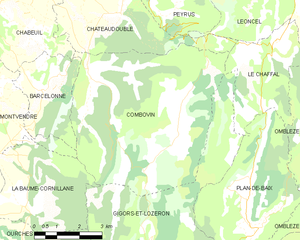
Combovin
- commune in Drôme, France
Hiking in Combovin
Combovin is a charming village located in the Drôme department of the Auvergne-Rhône-Alpes region in southeastern France. It is known for its picturesque landscapes, making it a delightful destination for hiking enthusiasts. Here are some key points about hiking in and around Combovin:...
- Country:
- Postal Code: 26120
- Coordinates: 44° 52' 26" N, 5° 4' 41" E
- GPS tracks (wikiloc): [Link]
- Area: 35.86 sq km
- Population: 405

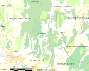
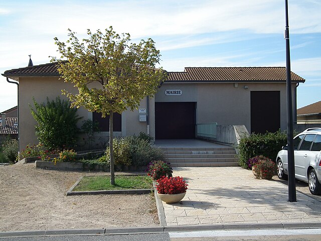
Cobonne
- commune in Drôme, France
Hiking in Cobonne
Cobonne, located in the Drôme department of France, is a charming area known for its natural beauty and outdoor activities, including hiking. Here are some highlights for hiking in and around Cobonne:...
- Country:
- Postal Code: 26400
- Coordinates: 44° 45' 34" N, 5° 4' 30" E
- GPS tracks (wikiloc): [Link]
- Area: 11.2 sq km
- Population: 164