Tirepied (Tirepied)

- commune in Manche, France
- Country:

- Postal Code: 50870
- Coordinates: 48° 42' 36" N, 1° 15' 50" E


- GPS tracks (wikiloc): [Link]
- Area: 18.77 sq km
- Population: 802
- Wikipedia en: wiki(en)
- Wikipedia: wiki(fr)
- Wikidata storage: Wikidata: Q1061463
- Wikipedia Commons Category: [Link]
- Freebase ID: [/m/03nxc7l]
- GeoNames ID: Alt: [6435678]
- SIREN number: [215005976]
- BnF ID: [152625667]
- INSEE municipality code: 50597
Shares border with regions:


Braffais
- former commune in Manche, France
- Country:
- Postal Code: 50870
- Coordinates: 48° 45' 25" N, 1° 15' 40" E
- GPS tracks (wikiloc): [Link]
- Area: 5.79 sq km
- Population: 192


Saint-Georges-de-Livoye
- commune in Manche, France
- Country:
- Postal Code: 50370
- Coordinates: 48° 44' 12" N, 1° 12' 59" E
- GPS tracks (wikiloc): [Link]
- Area: 5.53 sq km
- Population: 203


Saint-Brice
- commune in Manche, France
- Country:
- Postal Code: 50300
- Coordinates: 48° 41' 54" N, 1° 18' 28" E
- GPS tracks (wikiloc): [Link]
- AboveSeaLevel: 80 м m
- Area: 2.55 sq km
- Population: 138


La Chaise-Baudouin
- commune in Manche, France
- Country:
- Postal Code: 50370
- Coordinates: 48° 45' 49" N, 1° 14' 13" E
- GPS tracks (wikiloc): [Link]
- Area: 12.06 sq km
- Population: 489


Ponts
- commune in Manche, France
- Country:
- Postal Code: 50300
- Coordinates: 48° 42' 12" N, 1° 20' 42" E
- GPS tracks (wikiloc): [Link]
- Area: 6.7 sq km
- Population: 615
- Web site: [Link]


Saint-Senier-sous-Avranches
- commune in Manche, France
- Country:
- Postal Code: 50300
- Coordinates: 48° 41' 4" N, 1° 20' 30" E
- GPS tracks (wikiloc): [Link]
- Area: 8.62 sq km
- Population: 1377

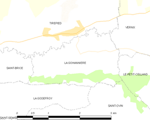
La Gohannière
- commune in Manche, France
- Country:
- Postal Code: 50300
- Coordinates: 48° 42' 23" N, 1° 15' 17" E
- GPS tracks (wikiloc): [Link]
- Area: 3.78 sq km
- Population: 118


Plomb
- former commune in Manche, France
- Country:
- Postal Code: 50870
- Coordinates: 48° 43' 49" N, 1° 18' 9" E
- GPS tracks (wikiloc): [Link]
- Area: 8.16 sq km
- Population: 394

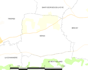
Vernix
- commune in Manche, France
- Country:
- Postal Code: 50370
- Coordinates: 48° 42' 56" N, 1° 13' 29" E
- GPS tracks (wikiloc): [Link]
- Area: 5.84 sq km
- Population: 163