La Chamba (La Chamba)

- commune in Loire, France
- Country:

- Postal Code: 42440
- Coordinates: 45° 45' 19" N, 3° 45' 27" E


- GPS tracks (wikiloc): [Link]
- Area: 5.2 sq km
- Population: 52
- Wikipedia en: wiki(en)
- Wikipedia: wiki(fr)
- Wikidata storage: Wikidata: Q1068769
- Wikipedia Commons Category: [Link]
- Freebase ID: [/m/03nw5m6]
- Freebase ID: [/m/03nw5m6]
- GeoNames ID: Alt: [6456891]
- GeoNames ID: Alt: [6456891]
- SIREN number: [214200404]
- SIREN number: [214200404]
- BnF ID: [15259610c]
- BnF ID: [15259610c]
- INSEE municipality code: 42040
- INSEE municipality code: 42040
Shares border with regions:

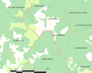
La Chambonie
- commune in Loire, France
- Country:
- Postal Code: 42440
- Coordinates: 45° 44' 50" N, 3° 44' 55" E
- GPS tracks (wikiloc): [Link]
- Area: 4.42 sq km
- Population: 45


Saint-Jean-la-Vêtre
- commune in Loire, France
- Country:
- Postal Code: 42440
- Coordinates: 45° 47' 21" N, 3° 48' 19" E
- GPS tracks (wikiloc): [Link]
- Area: 16.22 sq km
- Population: 328

Noirétable
- commune in Loire, France
- Country:
- Postal Code: 42440
- Coordinates: 45° 49' 2" N, 3° 45' 54" E
- GPS tracks (wikiloc): [Link]
- Area: 40.34 sq km
- Population: 1611
- Web site: [Link]


Vollore-Montagne
- commune in Puy-de-Dôme, France
- Country:
- Postal Code: 63120
- Coordinates: 45° 47' 6" N, 3° 40' 25" E
- GPS tracks (wikiloc): [Link]
- Area: 21.22 sq km
- Population: 306

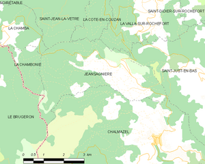
Jeansagnière
- former commune in Loire, France
- Country:
- Postal Code: 42920
- Coordinates: 45° 43' 59" N, 3° 50' 9" E
- GPS tracks (wikiloc): [Link]
- Area: 14.01 sq km
- Population: 83