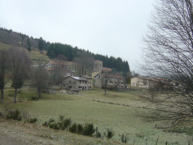
Noirétable (Noirétable)
- commune in Loire, France
- Country:

- Postal Code: 42440
- Coordinates: 45° 49' 2" N, 3° 45' 54" E


- GPS tracks (wikiloc): [Link]
- Area: 40.34 sq km
- Population: 1611
- Web site: http://www.noiretable.fr/
- Wikipedia en: wiki(en)
- Wikipedia: wiki(fr)
- Wikidata storage: Wikidata: Q661710
- Wikipedia Commons Category: [Link]
- Freebase ID: [/m/03nw9pv]
- Freebase ID: [/m/03nw9pv]
- GeoNames ID: Alt: [6434213]
- GeoNames ID: Alt: [6434213]
- SIREN number: [214201592]
- SIREN number: [214201592]
- BnF ID: [15259727c]
- BnF ID: [15259727c]
- archINFORM location ID: [16892]
- archINFORM location ID: [16892]
- INSEE municipality code: 42159
- INSEE municipality code: 42159
Shares border with regions:


La Chamba
- commune in Loire, France
- Country:

- Postal Code: 42440
- Coordinates: 45° 45' 19" N, 3° 45' 27" E


- GPS tracks (wikiloc): [Link]
- Area: 5.2 sq km
- Population: 52


Viscomtat
- commune in Puy-de-Dôme, France
- Country:

- Postal Code: 63250
- Coordinates: 45° 49' 42" N, 3° 40' 34" E


- GPS tracks (wikiloc): [Link]
- AboveSeaLevel: 700 м m
- Area: 25.44 sq km
- Population: 545
Saint-Priest-la-Vêtre
- commune in Loire, France
- Country:

- Postal Code: 42440
- Coordinates: 45° 48' 17" N, 3° 48' 47" E


- GPS tracks (wikiloc): [Link]
- Area: 5.17 sq km
- Population: 153


Saint-Julien-la-Vêtre
- commune in Loire, France
- Country:

- Postal Code: 42440
- Coordinates: 45° 48' 52" N, 3° 49' 29" E


- GPS tracks (wikiloc): [Link]
- Area: 12.9 sq km
- Population: 359


Cervières
- commune in Loire, France
- Country:

- Postal Code: 42440
- Coordinates: 45° 50' 52" N, 3° 46' 20" E


- GPS tracks (wikiloc): [Link]
- Area: 7.56 sq km
- Population: 123


Saint-Jean-la-Vêtre
- commune in Loire, France
- Country:

- Postal Code: 42440
- Coordinates: 45° 47' 21" N, 3° 48' 19" E


- GPS tracks (wikiloc): [Link]
- Area: 16.22 sq km
- Population: 328


Vollore-Montagne
- commune in Puy-de-Dôme, France
- Country:

- Postal Code: 63120
- Coordinates: 45° 47' 6" N, 3° 40' 25" E


- GPS tracks (wikiloc): [Link]
- Area: 21.22 sq km
- Population: 306
Chabreloche
- commune in Puy-de-Dôme, France
- Country:

- Postal Code: 63250
- Coordinates: 45° 52' 44" N, 3° 41' 48" E


- GPS tracks (wikiloc): [Link]
- Area: 9.61 sq km
- Population: 1228


Les Salles
- commune in Loire, France
- Country:

- Postal Code: 42440
- Coordinates: 45° 50' 52" N, 3° 47' 37" E


- GPS tracks (wikiloc): [Link]
- AboveSeaLevel: 690 м m
- Area: 25.22 sq km
- Population: 514
