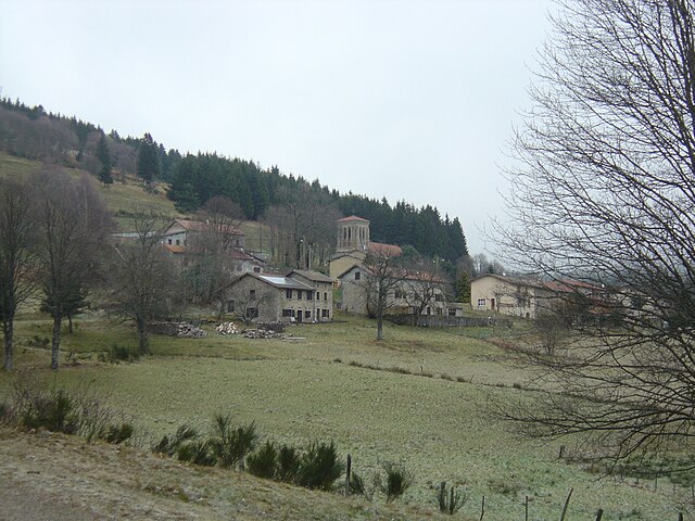
Jeansagnière (Jeansagnière)

- former commune in Loire, France
- Country:

- Postal Code: 42920
- Coordinates: 45° 43' 59" N, 3° 50' 9" E


- GPS tracks (wikiloc): [Link]
- Area: 14.01 sq km
- Population: 83
- Wikipedia en: wiki(en)
- Wikipedia: wiki(fr)
- Wikidata storage: Wikidata: Q922998
- Wikipedia Commons Category: [Link]
- Freebase ID: [/m/03nw9gc]
- Freebase ID: [/m/03nw9gc]
- GeoNames ID: Alt: [3012371]
- GeoNames ID: Alt: [3012371]
- BnF ID: [152596827]
- BnF ID: [152596827]
- INSEE municipality code: 42114
- INSEE municipality code: 42114
Shares border with regions:
La Côte-en-Couzan
- commune in Loire, France
- Country:
- Postal Code: 42111
- Coordinates: 45° 47' 1" N, 3° 50' 46" E
- GPS tracks (wikiloc): [Link]
- Area: 9.11 sq km
- Population: 71

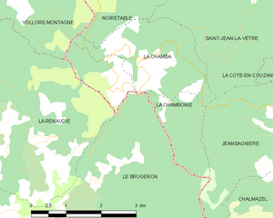
La Chambonie
- commune in Loire, France
- Country:
- Postal Code: 42440
- Coordinates: 45° 44' 50" N, 3° 44' 55" E
- GPS tracks (wikiloc): [Link]
- Area: 4.42 sq km
- Population: 45

La Chamba
- commune in Loire, France
- Country:
- Postal Code: 42440
- Coordinates: 45° 45' 19" N, 3° 45' 27" E
- GPS tracks (wikiloc): [Link]
- Area: 5.2 sq km
- Population: 52
La Valla-sur-Rochefort
- commune in Loire, France
- Country:
- Postal Code: 42111
- Coordinates: 45° 45' 33" N, 3° 51' 8" E
- GPS tracks (wikiloc): [Link]
- AboveSeaLevel: 830 м m
- Area: 8.98 sq km
- Population: 109


Saint-Just-en-Bas
- commune in Loire, France
- Country:
- Postal Code: 42136
- Coordinates: 45° 43' 51" N, 3° 52' 50" E
- GPS tracks (wikiloc): [Link]
- Area: 20.95 sq km
- Population: 291


Le Brugeron
- commune in Puy-de-Dôme, France
- Country:
- Postal Code: 63880
- Coordinates: 45° 42' 43" N, 3° 43' 9" E
- GPS tracks (wikiloc): [Link]
- Area: 27.42 sq km
- Population: 248


Saint-Jean-la-Vêtre
- commune in Loire, France
- Country:
- Postal Code: 42440
- Coordinates: 45° 47' 21" N, 3° 48' 19" E
- GPS tracks (wikiloc): [Link]
- Area: 16.22 sq km
- Population: 328