Targon (Targon)

- commune in Gironde, France
- Country:

- Postal Code: 33760
- Coordinates: 44° 44' 5" N, 0° 15' 49" E


- GPS tracks (wikiloc): [Link]
- Area: 25.88 sq km
- Population: 2047
- Web site: http://www.mairie-targon.com
- Wikipedia en: wiki(en)
- Wikipedia: wiki(fr)
- Wikidata storage: Wikidata: Q471990
- Wikipedia Commons Category: [Link]
- Freebase ID: [/m/03ns2l5]
- GeoNames ID: Alt: [2973365]
- SIREN number: [213305238]
- BnF ID: [152565691]
- VIAF ID: Alt: [139732877]
- GND ID: Alt: [7626844-5]
- Library of Congress authority ID: Alt: [n98017405]
- INSEE municipality code: 33523
Shares border with regions:

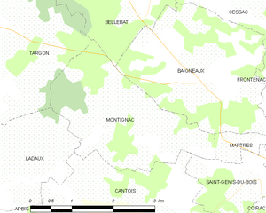
Montignac
- commune in Gironde, France
- Country:
- Postal Code: 33760
- Coordinates: 44° 42' 43" N, 0° 13' 29" E
- GPS tracks (wikiloc): [Link]
- Area: 6.48 sq km
- Population: 154

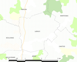
Ladaux
- commune in Gironde, France
- Country:
- Postal Code: 33760
- Coordinates: 44° 42' 2" N, 0° 14' 40" E
- GPS tracks (wikiloc): [Link]
- Area: 4.29 sq km
- Population: 195


Saint-Léon
- commune in Gironde, France
- Country:
- Postal Code: 33670
- Coordinates: 44° 46' 7" N, 0° 16' 21" E
- GPS tracks (wikiloc): [Link]
- Area: 4.49 sq km
- Population: 342
- Web site: [Link]


Soulignac
- commune in Gironde, France
- Country:
- Postal Code: 33760
- Coordinates: 44° 41' 53" N, 0° 17' 0" E
- GPS tracks (wikiloc): [Link]
- Area: 11.49 sq km
- Population: 435


Blésignac
- commune in Gironde, France
- Country:
- Postal Code: 33670
- Coordinates: 44° 46' 31" N, 0° 15' 29" E
- GPS tracks (wikiloc): [Link]
- Area: 2.5 sq km
- Population: 316
- Web site: [Link]


Capian
- commune in Gironde, France
- Country:
- Postal Code: 33550
- Coordinates: 44° 42' 39" N, 0° 19' 52" E
- GPS tracks (wikiloc): [Link]
- Area: 18.23 sq km
- Population: 703


La Sauve
- commune in Gironde, France
- Country:
- Postal Code: 33670
- Coordinates: 44° 46' 10" N, 0° 18' 43" E
- GPS tracks (wikiloc): [Link]
- AboveSeaLevel: 81 м m
- Area: 18.64 sq km
- Population: 1437
- Web site: [Link]

Bellebat
- commune in Gironde, France
- Country:
- Postal Code: 33760
- Coordinates: 44° 44' 21" N, 0° 13' 0" E
- GPS tracks (wikiloc): [Link]
- Area: 4.87 sq km
- Population: 235


Faleyras
- commune in Gironde, France
- Country:
- Postal Code: 33760
- Coordinates: 44° 46' 16" N, 0° 13' 37" E
- GPS tracks (wikiloc): [Link]
- Area: 10.44 sq km
- Population: 412