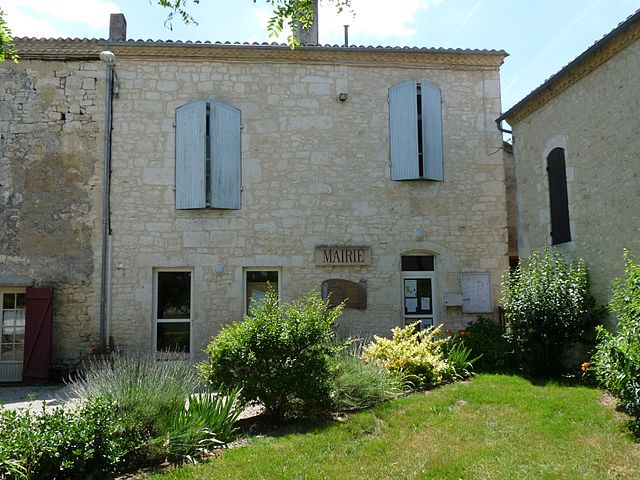
La Sauvetat-du-Dropt (La Sauvetat-du-Dropt)

- commune in Lot-et-Garonne, France
- Country:

- Postal Code: 47800
- Coordinates: 44° 38' 50" N, 0° 20' 20" E


- GPS tracks (wikiloc): [Link]
- Area: 10.37 sq km
- Population: 539
- Web site: http://www.la-sauvetat-du-dropt.fr
- Wikipedia en: wiki(en)
- Wikipedia: wiki(fr)
- Wikidata storage: Wikidata: Q217252
- Wikipedia Commons Category: [Link]
- Freebase ID: [/m/03qm362]
- GeoNames ID: Alt: [6456046]
- SIREN number: [214702904]
- BnF ID: [15261369g]
- INSEE municipality code: 47290
Shares border with regions:


Agnac
- commune in Lot-et-Garonne, France
- Country:
- Postal Code: 47800
- Coordinates: 44° 38' 33" N, 0° 23' 10" E
- GPS tracks (wikiloc): [Link]
- Area: 13.84 sq km
- Population: 441
- Web site: [Link]

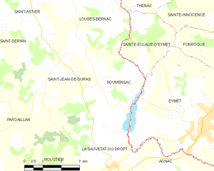
Soumensac
- commune in Lot-et-Garonne, France
- Country:
- Postal Code: 47120
- Coordinates: 44° 41' 23" N, 0° 19' 37" E
- GPS tracks (wikiloc): [Link]
- Area: 11.42 sq km
- Population: 234


Pardaillan
- commune in Lot-et-Garonne, France
- Country:
- Postal Code: 47120
- Coordinates: 44° 39' 49" N, 0° 16' 50" E
- GPS tracks (wikiloc): [Link]
- Area: 19.71 sq km
- Population: 312


Roumagne
- commune in Lot-et-Garonne, France
- Country:
- Postal Code: 47800
- Coordinates: 44° 37' 4" N, 0° 20' 14" E
- GPS tracks (wikiloc): [Link]
- Area: 10.54 sq km
- Population: 559

Saint-Jean-de-Duras
- commune in Lot-et-Garonne, France
- Country:
- Postal Code: 47120
- Coordinates: 44° 41' 39" N, 0° 17' 48" E
- GPS tracks (wikiloc): [Link]
- Area: 16.56 sq km
- Population: 251


Moustier
- commune in Lot-et-Garonne, France
- Country:
- Postal Code: 47800
- Coordinates: 44° 38' 9" N, 0° 17' 57" E
- GPS tracks (wikiloc): [Link]
- Area: 8.33 sq km
- Population: 330

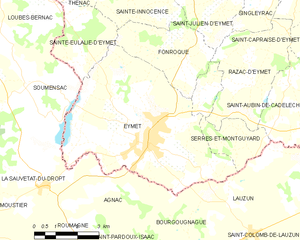
Eymet
- commune in Dordogne, France
- Country:
- Postal Code: 24500
- Coordinates: 44° 40' 3" N, 0° 23' 54" E
- GPS tracks (wikiloc): [Link]
- Area: 31.25 sq km
- Population: 2662
- Web site: [Link]