Soumensac (Soumensac)

- commune in Lot-et-Garonne, France
- Country:

- Postal Code: 47120
- Coordinates: 44° 41' 23" N, 0° 19' 37" E


- GPS tracks (wikiloc): [Link]
- Area: 11.42 sq km
- Population: 234
- Wikipedia en: wiki(en)
- Wikipedia: wiki(fr)
- Wikidata storage: Wikidata: Q1108082
- Wikipedia Commons Category: [Link]
- Freebase ID: [/m/03qm3bk]
- GeoNames ID: Alt: [2973979]
- SIREN number: [214703035]
- BnF ID: [15261382p]
- INSEE municipality code: 47303
Shares border with regions:
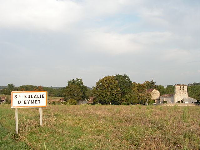
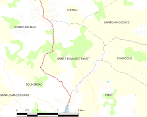
Sainte-Eulalie-d'Eymet
- commune in Dordogne, France
- Country:
- Postal Code: 24500
- Coordinates: 44° 42' 4" N, 0° 21' 57" E
- GPS tracks (wikiloc): [Link]
- Area: 6.72 sq km
- Population: 84


Loubès-Bernac
- commune in Lot-et-Garonne, France
- Country:
- Postal Code: 47120
- Coordinates: 44° 43' 51" N, 0° 17' 39" E
- GPS tracks (wikiloc): [Link]
- Area: 19.31 sq km
- Population: 389

Saint-Jean-de-Duras
- commune in Lot-et-Garonne, France
- Country:
- Postal Code: 47120
- Coordinates: 44° 41' 39" N, 0° 17' 48" E
- GPS tracks (wikiloc): [Link]
- Area: 16.56 sq km
- Population: 251


La Sauvetat-du-Dropt
- commune in Lot-et-Garonne, France
- Country:
- Postal Code: 47800
- Coordinates: 44° 38' 50" N, 0° 20' 20" E
- GPS tracks (wikiloc): [Link]
- Area: 10.37 sq km
- Population: 539
- Web site: [Link]

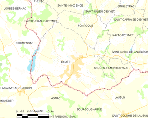
Eymet
- commune in Dordogne, France
- Country:
- Postal Code: 24500
- Coordinates: 44° 40' 3" N, 0° 23' 54" E
- GPS tracks (wikiloc): [Link]
- Area: 31.25 sq km
- Population: 2662
- Web site: [Link]