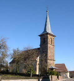
Lachapelle-sous-Rougemont (Lachapelle-sous-Rougemont)

- commune in Territoire de Belfort, France
- Country:

- Postal Code: 90360
- Coordinates: 47° 42' 44" N, 7° 0' 57" E


- GPS tracks (wikiloc): [Link]
- Area: 4.89 sq km
- Population: 597
- Wikipedia en: wiki(en)
- Wikipedia: wiki(fr)
- Wikidata storage: Wikidata: Q290910
- Wikipedia Commons Category: [Link]
- Freebase ID: [/m/03mhf4n]
- Freebase ID: [/m/03mhf4n]
- GeoNames ID: Alt: [6451908]
- GeoNames ID: Alt: [6451908]
- SIREN number: [219000585]
- SIREN number: [219000585]
- BnF ID: [152799996]
- BnF ID: [152799996]
- INSEE municipality code: 90058
- INSEE municipality code: 90058
Shares border with regions:

Eteimbes
- commune in Haut-Rhin, France
 Hiking in Eteimbes
Eteimbes, a picturesque area located near Lake Geneva in Switzerland, offers a range of hiking opportunities that cater to various skill levels. Here are some highlights for hiking in Eteimbes:...
- Country:
- Postal Code: 68210
- Coordinates: 47° 42' 11" N, 7° 2' 59" E
- GPS tracks (wikiloc): [Link]
- Area: 4.96 sq km
- Population: 386


Angeot
- commune in Territoire de Belfort, France
Hiking in Angeot
It seems there might be a typo or confusion regarding "Angeot." If you meant "Angiot," it’s not a recognized location for hiking that I'm aware of up to 2023. However, if you meant to refer to a specific region or area known for hiking, such as a national park or a famous trail, please clarify so I can provide more tailored information....
- Country:
- Postal Code: 90150
- Coordinates: 47° 41' 47" N, 7° 0' 50" E
- GPS tracks (wikiloc): [Link]
- Area: 6.56 sq km
- Population: 336
- Web site: [Link]


Soppe-le-Haut
- former commune in Haut-Rhin, France
- Country:
- Postal Code: 68780
- Coordinates: 47° 43' 55" N, 7° 3' 39" E
- GPS tracks (wikiloc): [Link]
- Area: 7.37 sq km
- Population: 569


Petitefontaine
- commune in Territoire de Belfort, France
- Country:
- Postal Code: 90360
- Coordinates: 47° 43' 17" N, 7° 0' 28" E
- GPS tracks (wikiloc): [Link]
- AboveSeaLevel: 388 м m
- Area: 3.13 sq km
- Population: 191
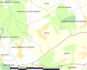
Felon
- commune in Territoire de Belfort, France
- Country:
- Postal Code: 90110
- Coordinates: 47° 42' 25" N, 6° 58' 31" E
- GPS tracks (wikiloc): [Link]
- Area: 4.11 sq km
- Population: 246
- Web site: [Link]