
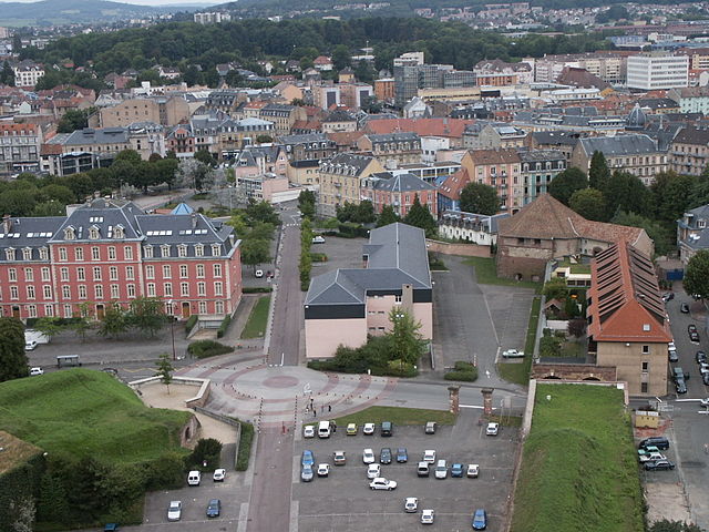
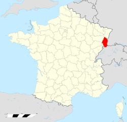
Territoire de Belfort (Territoire de Belfort)


- French department
 Hiking in Territoire de Belfort
The Territoire de Belfort, located in the Bourgogne-Franche-Comté region of eastern France, offers a variety of hiking opportunities amidst its diverse landscapes. Here are some key aspects of hiking in this area:
Scenic Trails:
-
Ballon d'Alsace: This mountain provides numerous hiking trails with stunning views of the Vosges and Jura ranges. The summit can be reached through various paths, catering to different skill levels.
-
Lac des Mortes: A beautiful lake surrounded by forested trails. It's ideal for a peaceful hike, with options for longer treks around the lake or up to the surrounding hills.
-
The Foothills of the Jura: There are various trails that wind through the foothills, offering a mix of woodland paths and open vistas. The natural beauty and wildlife are highlights along these routes.
Nature Reserves:
- Parc Naturel Régional des Ballons des Vosges: While this park stretches beyond just Territoire de Belfort, it contains parts that are excellent for hiking. The park is known for its diverse flora and fauna, as well as historical sites.
Difficulty Levels:
- The region offers trails ranging from easy walks suitable for families to more challenging hikes for experienced trekkers. Many trails are well-marked, making navigation easier.
Local Culture and Landmarks:
- Hike through regions rich in history and culture. You can explore fortifications, villages, and enjoy local cuisine after your hiking adventures.
- The Belfort Lion, a monumental sculpture, is a popular landmark that can be included in a hiking tour of the area.
Seasonality:
- The best time to hike in the Territoire de Belfort is during spring and autumn. Summer can be hot, while winter hiking is possible but often requires additional gear due to snow.
Tips:
- Always check the weather before heading out.
- Bring plenty of water, snacks, and suitable hiking gear.
- Familiarize yourself with the trails and, if necessary, consider hiring a local guide for more complex routes.
Whether you are a beginner or an experienced hiker, the Territoire de Belfort has something to offer everyone who enjoys exploring nature on foot.
- Country:

- Capital: Belfort
- Coordinates: 47° 45' 0" N, 7° 0' 0" E


- GPS tracks (wikiloc): [Link]
- Area: 609.4 sq km
- Population: 144483
- Web site: http://www.territoire-belfort.gouv.fr/
- Wikipedia en: wiki(en)
- Wikipedia: wiki(fr)
- Wikidata storage: Wikidata: Q12782
- Wikipedia Commons Category: [Link]
- Wikipedia Commons Maps Category: [Link]
- Freebase ID: [/m/0108jj]
- GeoNames ID: Alt: [3033789]
- BnF ID: [118623785]
- VIAF ID: Alt: [150806640]
- OSM relation ID: [7410]
- GND ID: Alt: [4225371-8]
- archINFORM location ID: [492]
- Library of Congress authority ID: Alt: [n81007926]
- PACTOLS thesaurus ID: [pcrtveuImchPA9]
- MusicBrainz area ID: [db7d54e5-640f-4f34-9c19-5cc5be0ebf47]
- SUDOC authorities ID: [026360586]
- Encyclopædia Britannica Online ID: [place/Territoire-de-Belfort]
- Gran Enciclopèdia Catalana ID: [0008717]
- HDS ID: [15461]
- NUTS code: [FR434]
- INSEE department code: [90]
- ISO 3166-2 code: FR-90
Includes regions:

arrondissement of Belfort
- arrondissement of France
Hiking in arrondissement of Belfort
The Arrondissement of Belfort, located in the Bourgogne-Franche-Comté region of eastern France, offers a variety of hiking opportunities set against a backdrop of stunning natural landscapes. Here are some highlights and tips for hiking in this area:...
- Country:
- Capital: Belfort
- Coordinates: 47° 40' 0" N, 6° 55' 0" E
- GPS tracks (wikiloc): [Link]
- Area: 609 sq km
- Population: 144483
Shares border with regions:

Haut-Rhin
- French department
Hiking in Haut-Rhin
Haut-Rhin, located in the Alsace region of France, offers some stunning hiking opportunities. The region is characterized by its picturesque landscapes, charming villages, and a rich cultural heritage, making it an excellent destination for hikers of all levels. Here are some highlights and tips for hiking in Haut-Rhin:...
- Country:
- Capital: Colmar
- Coordinates: 47° 57' 51" N, 7° 19' 11" E
- GPS tracks (wikiloc): [Link]
- Area: 3525 sq km
- Population: 762743
- Web site: [Link]


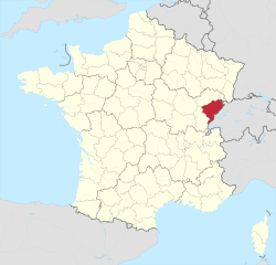
Haute-Saône
- French department
Hiking in Haute-Saône
Haute-Saône, located in the Bourgogne-Franche-Comté region of eastern France, offers a variety of beautiful hiking opportunities thanks to its diverse landscapes, which include rolling hills, forests, rivers, and charming villages. Here are some highlights of hiking in Haute-Saône:...
- Country:
- Capital: Vesoul
- Coordinates: 47° 35' 0" N, 6° 0' 0" E
- GPS tracks (wikiloc): [Link]
- Area: 5360 sq km
- Population: 237706
- Web site: [Link]


Canton of Jura
- canton of Switzerland
Hiking in Canton of Jura
Hiking in the Canton of Jura, Switzerland, is a fantastic experience for outdoor enthusiasts. This region is known for its stunning landscapes, rolling hills, dense forests, and picturesque Jura mountains. Here are some key points to consider if you're planning to hike in the Canton of Jura:...
- Country:

- Capital: Delémont
- Licence Plate Code: JU
- Coordinates: 47° 22' 0" N, 7° 9' 0" E
- GPS tracks (wikiloc): [Link]
- AboveSeaLevel: 435 м m
- Area: 838.51 sq km
- Population: 69100
- Web site: [Link]


Vosges
- French department
- Country:
- Capital: Épinal
- Coordinates: 48° 10' 0" N, 6° 25' 0" E
- GPS tracks (wikiloc): [Link]
- Area: 5874 sq km
- Population: 372016
- Web site: [Link]

Doubs
- French department with 3 arrondissements
Hiking in Doubs
Hiking in the Doubs region, located in eastern France, offers stunning landscapes and a rich natural heritage. The Doubs department is known for its rugged terrain, deep valleys, and diverse ecosystems, making it a wonderful destination for outdoor enthusiasts. Here are some highlights and recommendations for hiking in the area:...
- Country:
- Capital: Besançon
- Coordinates: 47° 10' 0" N, 6° 25' 0" E
- GPS tracks (wikiloc): [Link]
- Area: 5234 sq km
- Population: 536959
- Web site: [Link]