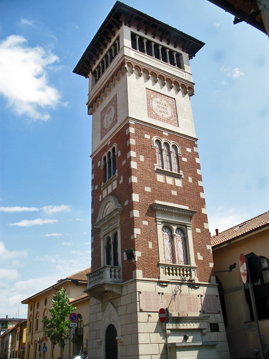
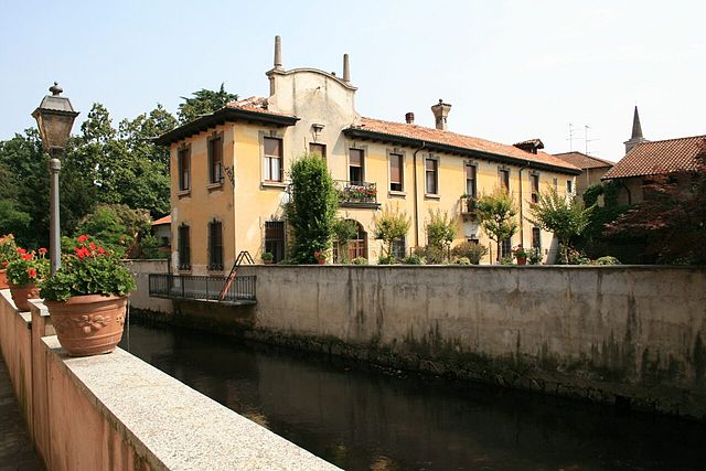
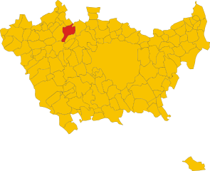
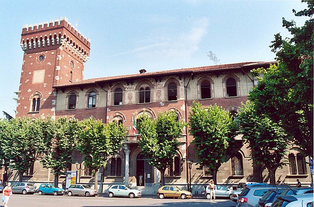
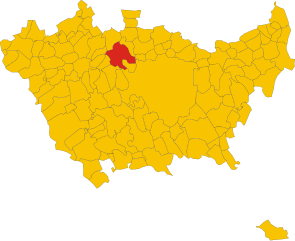
Lainate (Lainate)
.svg)
- Italian comune
 Hiking in Lainate
Lainate is a charming town in the Lombardy region of Italy, located not far from Milan. While Lainate itself might not be widely known for extensive hiking trails, there are several opportunities for outdoor enthusiasts in the surrounding area.
Local Parks and Nature
-
Parco della Pineta: This park is a green space not far from Lainate that offers walking paths and a chance to immerse yourself in nature. It's a great spot for a leisurely hike or a picnic.
-
Greenways and Cycling Paths: The area around Lainate has several greenways that are suitable for both hiking and cycling. You can find paths that connect to nearby towns and natural areas.
Nearby Hiking Areas
If you're willing to travel a bit further from Lainate, you can access more extensive hiking options:
-
Bosco di Legnano: Just a short drive away, this forest area has a network of trails that are perfect for hiking and walking among lush vegetation and wildlife.
-
Parco Regionale delle Groane: Located to the northwest of Lainate, this regional park features many hiking trails through diverse landscapes, including woodlands, wetlands, and fields. It's an excellent location for a day trip.
-
Monte Rosa: For those seeking more challenging hikes, you may consider traveling a few hours north to the Monte Rosa massif, where you can find stunning alpine trails.
Tips for Hiking in the Area
- Appropriate Gear: Always wear comfortable hiking shoes and dress in layers, as weather can change quickly.
- Stay Hydrated: Carry enough water, especially in hotter months.
- Trail Maps: It’s a good idea to have a map or GPS device to help navigate lesser-known trails.
- Respect Nature: Follow Leave No Trace principles to maintain the beauty of the natural areas.
Conclusion
While Lainate may not be a major hiking destination, the nearby parks and natural areas offer a variety of opportunities for hiking enthusiasts. Always explore local resources, such as visitor centers or hiking clubs, for the latest trail information and recommendations. Enjoy your hike!
- Country:

- Postal Code: 20020
- Local Dialing Code: 02
- Licence Plate Code: MI
- Coordinates: 45° 34' 0" N, 9° 2' 0" E


- GPS tracks (wikiloc): [Link]
- AboveSeaLevel: 176 м m
- Area: 12.93 sq km
- Population: 25754
- Web site: http://www.comune.lainate.mi.it
- Wikipedia en: wiki(en)
- Wikipedia: wiki(it)
- Wikidata storage: Wikidata: Q43026
- Wikipedia Commons Gallery: [Link]
- Wikipedia Commons Category: [Link]
- Freebase ID: [/m/0gj67k]
- GeoNames ID: Alt: [6541586]
- VIAF ID: Alt: [231465530]
- OSM relation ID: [45307]
- GND ID: Alt: [4557061-9]
- UN/LOCODE: [ITLTE]
- ISTAT ID: 015116
- Italian cadastre code: E415
Shares border with regions:

Origgio
- Italian comune
Hiking in Origgio
Origgio, located in the Lombardy region of Italy, is surrounded by beautiful landscapes and offers various opportunities for hiking and outdoor activities. While it may not be as well-known for hiking as some other regions in Italy, there are still some lovely trails and outdoor spots nearby that you can explore....
- Country:
- Postal Code: 21040
- Local Dialing Code: 02
- Licence Plate Code: VA
- Coordinates: 45° 35' 49" N, 9° 1' 6" E
- GPS tracks (wikiloc): [Link]
- AboveSeaLevel: 191 м m
- Area: 7.92 sq km
- Population: 7827
- Web site: [Link]
Caronno Pertusella
- Italian comune
Hiking in Caronno Pertusella
Caronno Pertusella, located in the Lombardy region of Italy, is not primarily known as a hiking destination, but it does offer access to various natural areas and nearby trails that can be enjoyable for outdoor enthusiasts. Here are some key points to consider for hiking in and around Caronno Pertusella:...
- Country:
- Postal Code: 21042
- Local Dialing Code: 02
- Licence Plate Code: VA
- Coordinates: 45° 36' 0" N, 9° 3' 0" E
- GPS tracks (wikiloc): [Link]
- AboveSeaLevel: 194 м m
- Area: 8.4 sq km
- Population: 17775
- Web site: [Link]
Garbagnate Milanese
- Italian comune
Hiking in Garbagnate Milanese
Garbagnate Milanese, located in the Lombardy region of Italy, offers a unique blend of urban and natural experiences for hikers. While it's not as mountainous as some other parts of Lombardy, there are several green spaces and trails that cater to various hiking levels....
- Country:
- Postal Code: 20024
- Local Dialing Code: 02
- Licence Plate Code: MI
- Coordinates: 45° 35' 0" N, 9° 4' 0" E
- GPS tracks (wikiloc): [Link]
- AboveSeaLevel: 179 м m
- Area: 9 sq km
- Population: 27226
- Web site: [Link]


Pogliano Milanese
- Italian comune
Hiking in Pogliano Milanese
Pogliano Milanese, located just outside of Milan, is not primarily known for extensive hiking trails like you might find in more mountainous areas, but it does offer some pleasant walking and nature opportunities. Here are a few aspects to consider when hiking around Pogliano Milanese:...
- Country:
- Postal Code: 20010
- Local Dialing Code: 02
- Licence Plate Code: MI
- Coordinates: 45° 32' 0" N, 9° 0' 0" E
- GPS tracks (wikiloc): [Link]
- AboveSeaLevel: 127 м m
- Area: 4.78 sq km
- Population: 8379
- Web site: [Link]
Nerviano
- Italian comune
Hiking in Nerviano
Nerviano is a charming town located in the Lombardy region of Italy, not far from Milan. While it might not be known as a traditional hiking destination, there are various areas nearby where hiking enthusiasts can enjoy some outdoor activities....
- Country:
- Postal Code: 20014
- Local Dialing Code: 0331
- Licence Plate Code: MI
- Coordinates: 45° 33' 0" N, 8° 59' 0" E
- GPS tracks (wikiloc): [Link]
- AboveSeaLevel: 175 м m
- Area: 13.26 sq km
- Population: 17270
- Web site: [Link]
Rho
- municipality in the metropolitan city of Milan
Hiking in Rho
Rho, located in the Lombardy region of Italy, is primarily known for its urban environment and proximity to Milan, but it also offers access to some beautiful natural areas and hiking opportunities in the surrounding surroundings. While Rho itself may not have extensive hiking trails, it serves as a great starting point to explore nearby parks and nature reserves....
- Country:
- Postal Code: 20017
- Local Dialing Code: 02
- Licence Plate Code: MI
- Coordinates: 45° 32' 0" N, 9° 2' 0" E
- GPS tracks (wikiloc): [Link]
- AboveSeaLevel: 156 м m
- Area: 22.24 sq km
- Population: 50767
- Web site: [Link]


Arese
- Italian comune
Hiking in Arese
Arese is a town located in the Lombardy region of Italy, near Milan. While Arese itself might not be widely known for extensive hiking trails, it offers access to beautiful natural areas nearby, particularly within the larger province of Milan or the surrounding regions....
- Country:
- Postal Code: 20020
- Local Dialing Code: 02
- Licence Plate Code: MI
- Coordinates: 45° 33' 11" N, 9° 4' 39" E
- GPS tracks (wikiloc): [Link]
- AboveSeaLevel: 160 м m
- Area: 6.56 sq km
- Population: 19248
- Web site: [Link]