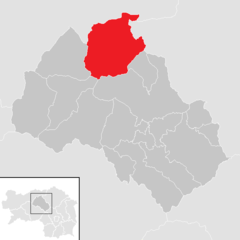
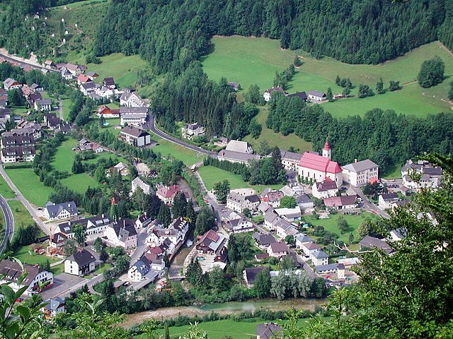
Landl (Landl)
- municipality in Austria
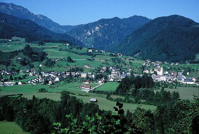
Landl is a picturesque area in Austria, typically associated with stunning landscapes, mountains, and numerous hiking trails suitable for various skill levels. Here are some highlights and tips for hiking in Landl:
Scenic Trails
- Mountain Trails: Landl is surrounded by the Northern Limestone Alps. Trails vary from moderate to challenging, often leading to breathtaking viewpoints.
- Nature Reserves: Explore nearby nature reserves to enjoy diverse flora and fauna. Trail signs usually provide information about local wildlife and plants.
Popular Hiking Routes
- Trails to Sölktäler: This area offers well-marked trails leading through pristine nature, with opportunities for spotting wildlife.
- Summit Hikes: For the more experienced hiker, summiting local peaks like the Schober mountain can provide stunning panoramic views.
Hiking Tips
- Weather Preparedness: The weather in the Alps can change rapidly, so always check forecasts and be prepared for sudden changes.
- Gear Up: Wear proper hiking boots and layers to adapt to varying altitudes and temperatures.
- Hydration and Nutrition: Bring enough water and snacks. Many trails might not have access to drinking water.
- Respect Nature: Stay on marked paths and follow guidelines to protect the natural environment.
Accessibility
- Public Transport: Landl may be accessible via public transport from nearby towns. Plan your route and be aware of the last return times if you’re hiking away from populated areas.
Whether you're an experienced hiker or a beginner looking to enjoy the beautiful Alpine scenery, Landl has trails that cater to all levels, making it a fantastic hiking destination. Always remember to enjoy the journey, take in the stunning views, and leave no trace!
- Country:

- Postal Code: 8931
- Local Dialing Code: 03633
- Licence Plate Code: LI
- Coordinates: 47° 39' 3" N, 14° 44' 13" E


- GPS tracks (wikiloc): [Link]
- AboveSeaLevel: 520 м m
- Area: 104.3 sq km
- Population: 2720
- Web site: http://www.landl.at/
- Wikipedia en: wiki(en)
- Wikipedia: wiki(de)
- Wikidata storage: Wikidata: Q696281
- Wikipedia Commons Category: [Link]
- Freebase ID: [/m/03gwhm8]
- GeoNames ID: Alt: [2773056]
- VIAF ID: Alt: [243886844]
- GND ID: Alt: [4809458-4]
- Austrian municipality key: [61258]
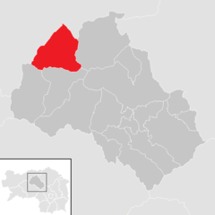
Shares border with regions:


Eisenerz
- municipality in Austria
Eisenerz, located in Austria's Styria region, is a fantastic destination for hiking enthusiasts. Nestled in the foothills of the Alps, the area offers a stunning combination of mountainous landscapes, lush valleys, and rich cultural history. Here are some key highlights and tips for hiking in Eisenerz:...
- Country:

- Postal Code: 8790
- Local Dialing Code: 03848
- Licence Plate Code: LN
- Coordinates: 47° 33' 0" N, 14° 53' 0" E


- GPS tracks (wikiloc): [Link]
- AboveSeaLevel: 736 м m
- Area: 124 sq km
- Population: 4048
- Web site: [Link]

Admont
- town in Styria, Austria
Admont, located in the Austrian state of Styria, is known for its stunning natural landscapes and is a fantastic destination for hiking enthusiasts. Nestled at the edge of the Gesäuse National Park, the region is characterized by its dramatic mountains, lush valleys, and crystal-clear rivers....
- Country:

- Local Dialing Code: 03613
- Licence Plate Code: LI
- Coordinates: 47° 34' 23" N, 14° 27' 40" E


- GPS tracks (wikiloc): [Link]
- AboveSeaLevel: 640 м m
- Area: 299.69 sq km
- Population: 5010
- Web site: [Link]

Göstling an der Ybbs
- municipality in Austria
 Hiking in Göstling an der Ybbs
Göstling an der Ybbs is a picturesque town located in the Ybbstal region of Lower Austria, surrounded by beautiful mountainous landscapes, making it a fantastic destination for hikers of all levels. The area offers a variety of hiking trails that cater to different abilities, from leisurely strolls to more challenging hikes....
- Country:

- Postal Code: 3345
- Local Dialing Code: 07484
- Licence Plate Code: SB
- Coordinates: 47° 49' 0" N, 14° 56' 0" E


- GPS tracks (wikiloc): [Link]
- AboveSeaLevel: 532 м m
- Area: 143.73 sq km
- Population: 2058
- Web site: [Link]

Altenmarkt bei Sankt Gallen
- municipality in Austria
 Hiking in Altenmarkt bei Sankt Gallen
Altenmarkt bei Sankt Gallen, a picturesque village located in the Swiss canton of St. Gallen, offers a variety of stunning hiking opportunities for outdoor enthusiasts. Nestled in the foothills of the Alps, the area is renowned for its beautiful landscapes, lush forests, and panoramic mountain views....
- Country:

- Postal Code: 8934
- Local Dialing Code: 03632
- Licence Plate Code: LI
- Coordinates: 47° 43' 21" N, 14° 39' 7" E


- GPS tracks (wikiloc): [Link]
- AboveSeaLevel: 467 м m
- Area: 43.05 sq km
- Population: 822
- Web site: [Link]


Radmer
- municipality in Austria
Radmer is a picturesque region located in Austria, known for its stunning landscapes and diverse hiking trails. Nestled in the Eastern Alps, Radmer offers hikers opportunities to explore lush forests, alpine meadows, and breathtaking mountain views. Here are some highlights of hiking in Radmer:...
- Country:

- Postal Code: 8795
- Local Dialing Code: 03635
- Licence Plate Code: LN
- Coordinates: 47° 32' 42" N, 14° 45' 28" E


- GPS tracks (wikiloc): [Link]
- AboveSeaLevel: 729 м m
- Area: 82.42 sq km
- Population: 559
- Web site: [Link]

Wildalpen
- municipality in Austria
Wildalpen is a beautiful region located in Austria, known for its stunning natural landscapes, mountainous terrain, and vibrant flora and fauna. It is a popular destination for hiking enthusiasts, offering a variety of trails suitable for different skill levels. Here are some key highlights and tips for hiking in Wildalpen:...
- Country:

- Postal Code: 8924
- Local Dialing Code: 03636
- Licence Plate Code: LI
- Coordinates: 47° 39' 0" N, 14° 59' 0" E


- GPS tracks (wikiloc): [Link]
- AboveSeaLevel: 609 м m
- Area: 203.08 sq km
- Population: 464
- Web site: [Link]

Hollenstein an der Ybbs
- Austrian community
 Hiking in Hollenstein an der Ybbs
Hollenstein an der Ybbs, a charming village situated in the Ybbstal valley of Austria, offers a variety of hiking opportunities that cater to all skill levels. Surrounded by beautiful landscapes, rolling hills, and lush forests, it’s an ideal spot for nature lovers....
- Country:

- Postal Code: 3343
- Local Dialing Code: 07445
- Licence Plate Code: AM
- Coordinates: 47° 48' 11" N, 14° 46' 20" E


- GPS tracks (wikiloc): [Link]
- AboveSeaLevel: 485 м m
- Area: 126.42 sq km
- Population: 1706
- Web site: [Link]

Sankt Gallen
- municipality in the district of Liezen in Styria, Austria
Sankt Gallen in Styria, Austria, is a beautiful region that offers various hiking opportunities, showcasing stunning landscapes, lush forests, and picturesque alpine scenery. Here are some highlights and tips for hiking in this area:...
- Country:

- Postal Code: 8933
- Local Dialing Code: 03632
- Licence Plate Code: LI
- Coordinates: 47° 41' 29" N, 14° 36' 57" E


- GPS tracks (wikiloc): [Link]
- AboveSeaLevel: 513 м m
- Area: 61.01 sq km
- Population: 1821
- Web site: [Link]