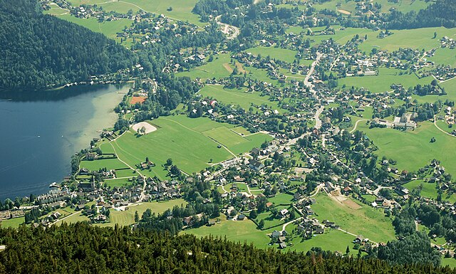
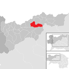
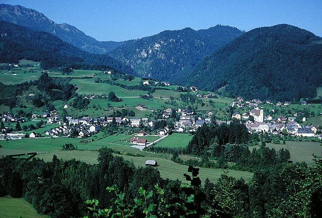
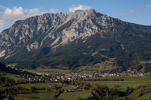
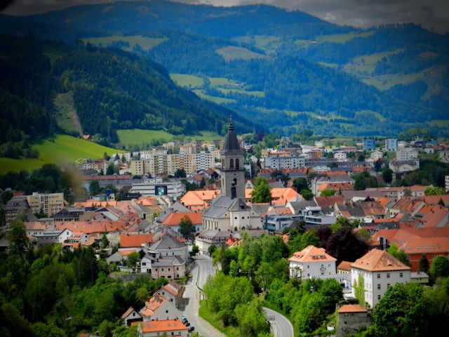
Liezen District (Bezirk Liezen)

- district of Austria
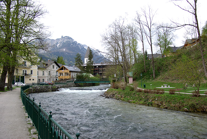
 Hiking in Liezen District
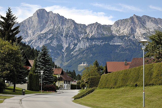
The Liezen District, located in the Styria region of Austria, is a fantastic destination for hiking enthusiasts. It boasts stunning landscapes characterized by rugged mountains, lush forests, and scenic valleys. Here are some highlights and tips for hiking in the Liezen District:
Scenic Trails
- Ennstal Alps: This mountain range provides a variety of trails for different skill levels. The landscape features alpine meadows, rocky peaks, and crystal-clear lakes.
- Salzkammergut Region: Although it’s just outside the district, this area is renowned for its picturesque lakes and rolling hills, making it an excellent addition to your hiking list.
- Großes Palfner: For those seeking a challenge, hiking to the summit of Großes Palfner offers breathtaking panoramic views.
Nature Reserves and Parks
- National Park Gesäuse: This is one of the most beautiful national parks in Austria, with dramatic cliffs, gorges, and rich biodiversity. Several well-marked hikes allow visitors to explore the park's natural wonders.
- Flowing Rivers: The Enns River, which runs through the district, offers pleasant walking paths alongside the water.
Seasonal Hiking
- Summer: Ideal for hiking, with trails accessible and wildflowers in bloom.
- Autumn: Enjoy stunning foliage, making the hike particularly beautiful, as the leaves change colors.
- Winter: While hiking can still be enjoyable, some trails may be covered in snow, requiring proper winter gear.
Tips for Hikers
- Trail Maps: Always carry a detailed map or use a hiking app, as cell service can be spotty in remote areas.
- Weather: Check the weather forecast before your hike, as conditions in the mountains can change rapidly.
- Gear: Wear sturdy hiking boots, and consider trekking poles for stability, especially on uneven terrain.
- Hydration and Snacks: Bring enough water and some snacks, particularly if you plan to hike for several hours.
Local Culture
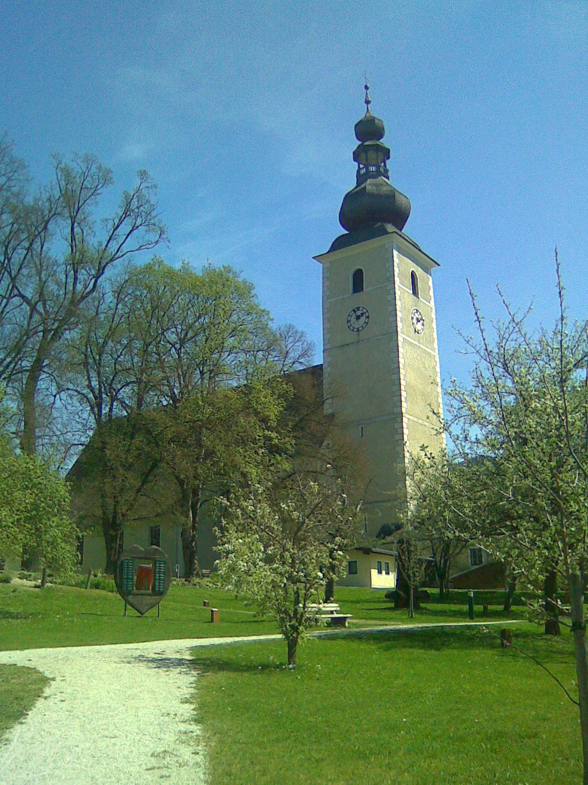
In addition to outdoor activities, the Liezen District is infused with local culture, including charming villages and traditional Styrian cuisine. It's a good idea to plan a stop at a local gasthaus (inn) for a hearty meal after a day of hiking.
Conclusion
Whether you're looking for a leisurely stroll or a more challenging trek, Liezen District has a variety of hiking options to offer. With its natural beauty and outdoor activities, it’s a fantastic destination for both novice and experienced hikers alike. Happy hiking!
- Country:

- Capital: Liezen
- Licence Plate Code: LI
- Coordinates: 47° 31' 37" N, 14° 6' 58" E


- GPS tracks (wikiloc): [Link]
- AboveSeaLevel: 945 м m
- Area: 3317 sq km
- Population: 79862
- Web site: http://www.bh-liezen.steiermark.at
- Wikipedia en: wiki(en)
- Wikipedia: wiki(de)
- Wikidata storage: Wikidata: Q255834
- Wikipedia Commons Category: [Link]
- Wikipedia Commons Maps Category: [Link]
- Freebase ID: [/m/0fnl1j]
- GeoNames ID: Alt: [2772479]
- VIAF ID: Alt: [130183209]
- archINFORM location ID: [14696]
- Library of Congress authority ID: Alt: [n80070837]
Includes regions:
Irdning-Donnersbachtal
- municipality in Austria
Hiking in Irdning-Donnersbachtal
Irdning-Donnersbachtal, located in the Styrian region of Austria, is an excellent destination for hiking enthusiasts. This area is known for its stunning landscapes, picturesque valleys, and a wide variety of hiking trails suitable for different skill levels. Here’s what you can expect when hiking in Irdning-Donnersbachtal:...
- Country:
- Postal Code: 8952, 8953
- Local Dialing Code: 03683
- Licence Plate Code: LI
- Coordinates: 47° 27' 53" N, 14° 7' 34" E
- GPS tracks (wikiloc): [Link]
- AboveSeaLevel: 673 м m
- Area: 199.68 sq km
- Population: 4135
- Web site: [Link]
Michaelerberg-Pruggern
- municipality in Austria
Hiking in Michaelerberg-Pruggern
Michaelerberg-Pruggern, located in the beautiful Steiermark (Styria) region of Austria, is an excellent destination for hiking enthusiasts. The area is characterized by its stunning landscapes, including lush green forests, picturesque hills, and panoramic mountain views....
- Country:
- Local Dialing Code: 03685
- Licence Plate Code: GB
- Coordinates: 47° 24' 36" N, 13° 53' 24" E
- GPS tracks (wikiloc): [Link]
- AboveSeaLevel: 681 м m
- Area: 47.64 sq km
- Population: 1188
- Web site: [Link]

Stainach-Pürgg
- municipality in Austria
Hiking in Stainach-Pürgg
Stainach-Pürgg, located in the Steiermark region of Austria, is a fantastic destination for hikers due to its stunning natural landscapes and diverse hiking trails. The area is surrounded by breathtaking views of the Dachstein mountains and the Ennstal Valley, offering a range of options for both novice and experienced hikers....
- Country:
- Postal Code: 8950, 8951
- Local Dialing Code: 03682
- Licence Plate Code: LI
- Coordinates: 47° 32' 0" N, 14° 6' 0" E
- GPS tracks (wikiloc): [Link]
- AboveSeaLevel: 655 м m
- Area: 72.95 sq km
- Population: 2850
- Web site: [Link]

Sölk
- municipality in Austria
Hiking in Sölk
Sölk is a beautiful area located in the Austrian Alps, known for its stunning landscapes, diverse wildlife, and numerous hiking trails suited for various skill levels. The region is part of the larger Sölk Pass, which is situated in Styria. Here are some points to consider when planning a hiking trip in Sölk:...
- Country:
- Postal Code: 8961, 8962
- Local Dialing Code: 03685
- Licence Plate Code: GB
- Coordinates: 47° 24' 27" N, 13° 58' 8" E
- GPS tracks (wikiloc): [Link]
- AboveSeaLevel: 941 м m
- Area: 288.24 sq km
- Population: 1494
- Web site: [Link]
Mitterberg-Sankt Martin
- municipality in Austria
Hiking in Mitterberg-Sankt Martin
Mitterberg-Sankt Martin, located in the beautiful alpine region of Austria, is a fantastic destination for hiking enthusiasts. The area is known for its stunning landscapes, diverse flora and fauna, and well-maintained trails, catering to various levels of hikers, from beginners to experienced trekkers....
- Country:
- Postal Code: 8954, 8962
- Licence Plate Code: GB
- Coordinates: 47° 29' 20" N, 13° 58' 55" E
- GPS tracks (wikiloc): [Link]
- AboveSeaLevel: 791 м m
- Area: 54.92 sq km
- Population: 1933
- Web site: [Link]
Bad Aussee
- municipality in Austria
Hiking in Bad Aussee
Bad Aussee is a picturesque town located in the Salzkammergut region of Austria, renowned for its stunning mountain landscapes, crystal-clear lakes, and rich cultural heritage. It offers a variety of hiking opportunities suitable for different skill levels. Here are some highlights for hiking in Bad Aussee:...
- Country:
- Postal Code: 8990
- Local Dialing Code: 03622
- Coordinates: 47° 36' 36" N, 13° 46' 58" E
- GPS tracks (wikiloc): [Link]
- AboveSeaLevel: 659 м m
- Area: 82.03 sq km
- Population: 4833
- Web site: [Link]


Schladming
- municipality in Austria
Hiking in Schladming
Schladming, located in Austria's Styria region, is a fantastic hiking destination known for its breathtaking alpine scenery and diverse trail options. The area is part of the Dachstein-Tauern region, offering a combination of stunning landscapes, well-marked trails, and various difficulty levels suitable for hikers of all abilities....
- Country:
- Postal Code: 8970
- Local Dialing Code: 03687
- Licence Plate Code: GB
- Coordinates: 47° 23' 39" N, 13° 41' 21" E
- GPS tracks (wikiloc): [Link]
- AboveSeaLevel: 745 м m
- Area: 10.3 sq km
- Population: 6660
- Web site: [Link]
Aigen im Ennstal
- town and municipality in Styria, Austria
Hiking in Aigen im Ennstal
Aigen im Ennstal is a beautiful region in Austria that offers wonderful hiking opportunities, nestled in the stunning landscape of the Ennstal Valley and surrounded by the majestic peaks of the Alps. Here are some highlights of hiking in this area:...
- Country:
- Postal Code: 8943
- Local Dialing Code: 03682
- Licence Plate Code: LI
- Coordinates: 47° 31' 14" N, 14° 8' 35" E
- GPS tracks (wikiloc): [Link]
- AboveSeaLevel: 652 м m
- Area: 86.40 sq km
- Population: 2722
- Web site: [Link]
Altaussee
- municipality in Austria
Hiking in Altaussee
Altaussee, located in the picturesque Salzkammergut region of Austria, is a fantastic destination for hiking enthusiasts. Nestled among the stunning Dachstein mountains and nestled by the shores of Lake Altaussee, this area offers a diverse range of trails suitable for all levels of hikers....
- Country:
- Postal Code: 8992
- Local Dialing Code: 03622
- Licence Plate Code: LI
- Coordinates: 47° 38' 22" N, 13° 45' 48" E
- GPS tracks (wikiloc): [Link]
- AboveSeaLevel: 712 м m
- Area: 92 sq km
- Population: 1878
- Web site: [Link]
Ramsau am Dachstein
- municipality in Austria
Hiking in Ramsau am Dachstein
Ramsau am Dachstein is a beautiful destination for hiking enthusiasts, located in the Austrian Alps. It's situated at the foot of the Dachstein massif and is known for its stunning landscapes, diverse trails, and picturesque alpine village atmosphere. Here are some highlights about hiking in Ramsau am Dachstein:...
- Country:
- Postal Code: 8972
- Local Dialing Code: 03687
- Licence Plate Code: GB
- Coordinates: 47° 25' 17" N, 13° 39' 17" E
- GPS tracks (wikiloc): [Link]
- AboveSeaLevel: 1135 м m
- Area: 75.4 sq km
- Population: 2766
- Web site: [Link]
Öblarn
- municipality in Austria
Hiking in Öblarn
Öblarn is a charming village in Austria's Styria region, located near the Enns Valley. It offers stunning landscapes and a variety of outdoor activities, including numerous hiking trails suitable for various skill levels. Here are some highlights about hiking in Öblarn:...
- Country:
- Postal Code: 8960
- Local Dialing Code: 03684
- Licence Plate Code: GB
- Coordinates: 47° 27' 0" N, 14° 0' 29" E
- GPS tracks (wikiloc): [Link]
- AboveSeaLevel: 668 м m
- Area: 49.16 sq km
- Population: 2024
- Web site: [Link]

Admont
- town in Styria, Austria
Hiking in Admont
Admont, located in the Austrian state of Styria, is known for its stunning natural landscapes and is a fantastic destination for hiking enthusiasts. Nestled at the edge of the Gesäuse National Park, the region is characterized by its dramatic mountains, lush valleys, and crystal-clear rivers....
- Country:
- Local Dialing Code: 03613
- Licence Plate Code: LI
- Coordinates: 47° 34' 23" N, 14° 27' 40" E
- GPS tracks (wikiloc): [Link]
- AboveSeaLevel: 640 м m
- Area: 299.69 sq km
- Population: 5010
- Web site: [Link]

Donnersbachwald
- former municipality in Austria
Hiking in Donnersbachwald
Donnersbachwald is a beautiful hiking destination located in the Austrian Alps, specifically in the Styria region. It offers a range of hiking opportunities, from leisurely walks to more challenging mountain trails. Here are some highlights and tips for hiking in Donnersbachwald:...
- Country:
- Local Dialing Code: 03680
- Licence Plate Code: LI
- Coordinates: 47° 23' 3" N, 14° 6' 57" E
- GPS tracks (wikiloc): [Link]
- AboveSeaLevel: 960 м m
- Area: 114.29 sq km
- Population: 314
Aich, Styria
- municipality in Austria
Hiking in Aich, Styria
Aich, located in the beautiful region of Styria, Austria, offers a variety of hiking opportunities for enthusiasts of all skill levels. Nestled in the heart of the Ennstal Alps, Aich provides stunning landscapes, lush meadows, and picturesque alpine views....
- Country:
- Postal Code: 8966
- Local Dialing Code: 03686
- Licence Plate Code: GB
- Coordinates: 47° 25' 10" N, 13° 49' 6" E
- GPS tracks (wikiloc): [Link]
- AboveSeaLevel: 694 м m
- Area: 24.68 sq km
- Population: 1294
- Web site: [Link]

Altenmarkt bei Sankt Gallen
- municipality in Austria
Hiking in Altenmarkt bei Sankt Gallen
Altenmarkt bei Sankt Gallen, a picturesque village located in the Swiss canton of St. Gallen, offers a variety of stunning hiking opportunities for outdoor enthusiasts. Nestled in the foothills of the Alps, the area is renowned for its beautiful landscapes, lush forests, and panoramic mountain views....
- Country:
- Postal Code: 8934
- Local Dialing Code: 03632
- Licence Plate Code: LI
- Coordinates: 47° 43' 21" N, 14° 39' 7" E
- GPS tracks (wikiloc): [Link]
- AboveSeaLevel: 467 м m
- Area: 43.05 sq km
- Population: 822
- Web site: [Link]
Lassing
- municipality in Austria
Hiking in Lassing
Lassing, located in Austria, offers a variety of hiking opportunities, especially for those seeking scenic routes and a connection with nature. The region is characterized by beautiful landscapes, including lush forests, rolling hills, and picturesque views of the surrounding mountains....
- Country:
- Postal Code: 8903
- Local Dialing Code: 03612
- Licence Plate Code: LI
- Coordinates: 47° 31' 36" N, 14° 15' 45" E
- GPS tracks (wikiloc): [Link]
- AboveSeaLevel: 782 м m
- Area: 37.2 sq km
- Population: 1719
- Web site: [Link]

Ardning
- municipality in Austria
Hiking in Ardning
Ardning is a picturesque village located in the Steiermark (Styria) region of Austria, known for its stunning natural landscapes and variety of hiking trails. Here are some highlights and tips for hiking in Ardning:...
- Country:
- Postal Code: 8904
- Local Dialing Code: 03612
- Licence Plate Code: LI
- Coordinates: 47° 35' 29" N, 14° 21' 50" E
- GPS tracks (wikiloc): [Link]
- AboveSeaLevel: 696 м m
- Area: 34.03 sq km
- Population: 1239
- Web site: [Link]
Haus im Ennstal
- village in the Liezen district of Styria, Austria
Hiking in Haus im Ennstal
Haus im Ennstal is a charming village located in the Ennstal valley in Styria, Austria, and it serves as an excellent base for hikers looking to explore the beautiful surrounding landscape. The region is part of the larger Dachstein-Tauern area, known for its stunning alpine scenery, diverse trails, and outdoor activities....
- Country:
- Postal Code: 8967
- Local Dialing Code: 03686
- Licence Plate Code: GB
- Coordinates: 47° 24' 27" N, 13° 46' 1" E
- GPS tracks (wikiloc): [Link]
- AboveSeaLevel: 774 м m
- Area: 81.77 sq km
- Population: 2429
- Web site: [Link]

Wildalpen
- municipality in Austria
Hiking in Wildalpen
Wildalpen is a beautiful region located in Austria, known for its stunning natural landscapes, mountainous terrain, and vibrant flora and fauna. It is a popular destination for hiking enthusiasts, offering a variety of trails suitable for different skill levels. Here are some key highlights and tips for hiking in Wildalpen:...
- Country:
- Postal Code: 8924
- Local Dialing Code: 03636
- Licence Plate Code: LI
- Coordinates: 47° 39' 0" N, 14° 59' 0" E
- GPS tracks (wikiloc): [Link]
- AboveSeaLevel: 609 м m
- Area: 203.08 sq km
- Population: 464
- Web site: [Link]
Weißenbach bei Liezen
- former municipality in Austria
Hiking in Weißenbach bei Liezen
Weißenbach bei Liezen is a charming village located in the Steiermark region of Austria, surrounded by beautiful landscapes and mountains, making it an attractive destination for hikers. Here are some highlights and tips for hiking in and around Weißenbach bei Liezen:...
- Country:
- Postal Code: 8940
- Local Dialing Code: 03612
- Licence Plate Code: LI
- Coordinates: 47° 34' 17" N, 14° 12' 7" E
- GPS tracks (wikiloc): [Link]
- AboveSeaLevel: 654 м m
- Area: 35.82 sq km
- Population: 1137
Bad Mitterndorf
- municipality in Austria
Hiking in Bad Mitterndorf
Bad Mitterndorf, located in the heart of Austria's Salzkammergut region, is a fantastic destination for hiking enthusiasts. Surrounded by the stunning landscape of the Totes Gebirge (Dead Mountains) and the Grimming Massif, it offers a variety of trails that cater to different skill levels....
- Country:
- Postal Code: 8984; 8983; 8982
- Local Dialing Code: 03623
- Licence Plate Code: LI
- Coordinates: 47° 33' 19" N, 13° 55' 59" E
- GPS tracks (wikiloc): [Link]
- AboveSeaLevel: 809 м m
- Area: 112.5 sq km
- Population: 4962
- Web site: [Link]


Tauplitz
- former municipality in Austria
Hiking in Tauplitz
Tauplitz, located in the Styria region of Austria, is a fantastic destination for hiking enthusiasts. Nestled within the beautiful landscapes of the Austrian Alps, the area offers a variety of trails that cater to different skill levels, from gentle walks to challenging mountain hikes....
- Country:
- Postal Code: 8982
- Local Dialing Code: 03688
- Licence Plate Code: LI
- Coordinates: 47° 37' 0" N, 14° 0' 0" E
- GPS tracks (wikiloc): [Link]
- AboveSeaLevel: 896 м m
- Area: 53.9 sq km
- Population: 1005
Rottenmann
- municipality in Austria
Hiking in Rottenmann
Rottenmann, located in the Styria region of Austria, is surrounded by impressive mountainous terrain, making it an excellent destination for hiking enthusiasts. Here are some key features and highlights about hiking in and around Rottenmann:...
- Country:
- Postal Code: 8786
- Local Dialing Code: 03614
- Licence Plate Code: LI
- Coordinates: 47° 31' 36" N, 14° 21' 21" E
- GPS tracks (wikiloc): [Link]
- AboveSeaLevel: 674 м m
- Area: 205.33 sq km
- Population: 5232
- Web site: [Link]

Selzthal
- municipality in Austria
Hiking in Selzthal
Selzthal is a picturesque village in Austria, located in the Styria region, known for its stunning natural landscapes and hiking opportunities. Set against the backdrop of the Alps, the area offers a variety of trails suitable for hikers of all levels, from leisurely walks to more challenging paths....
- Country:
- Postal Code: 8900
- Local Dialing Code: 03616
- Licence Plate Code: LI
- Coordinates: 47° 33' 0" N, 14° 19' 0" E
- GPS tracks (wikiloc): [Link]
- AboveSeaLevel: 636 м m
- Area: 16.71 sq km
- Population: 1593
- Web site: [Link]

Pürgg-Trautenfels
- former municipality in Austria
Hiking in Pürgg-Trautenfels
Pürgg-Trautenfels, located in the Austrian state of Styria, is a beautiful region for hiking, offering stunning landscapes and a rich cultural heritage. The area is characterized by rolling hills, lush forests, and picturesque villages, making it a great destination for both novice and experienced hikers....
- Country:
- Postal Code: 8951
- Local Dialing Code: 03682
- Licence Plate Code: LI
- Coordinates: 47° 31' 53" N, 14° 4' 5" E
- GPS tracks (wikiloc): [Link]
- AboveSeaLevel: 645 м m
- Area: 62.69 sq km
- Population: 910
- Web site: [Link]
Palfau
- former municipality in Austria
Hiking in Palfau
Palfau, located in the scenic region of Lower Austria, is an excellent destination for hiking enthusiasts. Nestled within the gorgeous landscape of the Enns Valley, Palfau offers a range of hiking trails that cater to different skill levels and preferences, making it perfect for families, casual hikers, and seasoned trekkers alike....
- Country:
- Postal Code: 8923
- Local Dialing Code: 03638
- Licence Plate Code: LI
- Coordinates: 47° 42' 35" N, 14° 48' 15" E
- GPS tracks (wikiloc): [Link]
- AboveSeaLevel: 512 м m
- Area: 58.07 sq km
- Population: 394
- Web site: [Link]

Treglwang
- former municipality in Austria
Hiking in Treglwang
Treglwang is a lesser-known hiking destination, often appealing to those seeking to explore less crowded areas. While specific trail details may vary, here are some general points to consider when planning a hike in this region:...
- Country:
- Postal Code: 8782
- Local Dialing Code: 03617
- Licence Plate Code: LI
- Coordinates: 47° 28' 34" N, 14° 35' 30" E
- GPS tracks (wikiloc): [Link]
- AboveSeaLevel: 745 м m
- Area: 36.24 sq km
- Population: 366
Weißenbach an der Enns
- former municipality in Austria
Hiking in Weißenbach an der Enns
Weißenbach an der Enns, located in the beautiful region of Styria in Austria, offers a variety of hiking opportunities that cater to different skill levels and preferences. The stunning landscapes, rich natural beauty, and proximity to the Enns River make it an ideal location for outdoor enthusiasts....
- Country:
- Postal Code: 8932
- Local Dialing Code: 03632
- Licence Plate Code: LI
- Coordinates: 47° 42' 21" N, 14° 37' 47" E
- GPS tracks (wikiloc): [Link]
- AboveSeaLevel: 415 м m
- Area: 35.82 sq km
- Population: 483


Gaishorn am See
- municipality in Austria
Hiking in Gaishorn am See
Gaishorn am See is a beautiful area for hiking, located in the Austrian region of Styria, surrounded by stunning natural landscapes. The region is characterized by its picturesque lakes, rolling hills, and dense forests, making it a great destination for outdoor enthusiasts....
- Country:
- Postal Code: 8783
- Local Dialing Code: 03617
- Licence Plate Code: LI
- Coordinates: 47° 29' 24" N, 14° 32' 45" E
- GPS tracks (wikiloc): [Link]
- AboveSeaLevel: 723 м m
- Area: 77 sq km
- Population: 1333
- Web site: [Link]

Weng im Gesäuse
- former municipality in Austria
Hiking in Weng im Gesäuse
Weng im Gesäuse is a picturesque area within the Gesäuse National Park in the Austrian Alps. It's known for its stunning landscapes, rugged mountains, and rich biodiversity. Here are some key points to consider when planning a hiking trip in this beautiful region:...
- Country:
- Postal Code: 8913
- Local Dialing Code: 03613
- Licence Plate Code: LI
- Coordinates: 47° 35' 57" N, 14° 30' 10" E
- GPS tracks (wikiloc): [Link]
- AboveSeaLevel: 608 м m
- Area: 75.63 sq km

Trieben
- municipality in Austria
Hiking in Trieben
Trieben, located in Austria's Styria region, offers a variety of hiking opportunities that cater to different skill levels. Nestled in the picturesque landscape of the Eastern Alps, hikers can enjoy beautiful vistas, lush forests, and the serene atmosphere of the area....
- Country:
- Postal Code: 8784
- Local Dialing Code: 03615
- Licence Plate Code: LI
- Coordinates: 47° 29' 11" N, 14° 29' 8" E
- GPS tracks (wikiloc): [Link]
- AboveSeaLevel: 708 м m
- Area: 45.53 sq km
- Population: 3390
- Web site: [Link]
Wörschach
- municipality in Austria
Hiking in Wörschach
Wörschach is a picturesque area located in Austria, nestled in the Styrian region near the border of Upper Austria. Known for its beautiful landscapes, it offers a range of hiking opportunities that cater to various skill levels. Here are some highlights for hiking in Wörschach:...
- Country:
- Postal Code: 8942
- Local Dialing Code: 03682
- Licence Plate Code: LI
- Coordinates: 47° 33' 8" N, 14° 8' 49" E
- GPS tracks (wikiloc): [Link]
- AboveSeaLevel: 643 м m
- Area: 42.88 sq km
- Population: 1122
- Web site: [Link]
Hall bei Admont
- former municipality in Austria
Hiking in Hall bei Admont
Hall bei Admont is a picturesque village located in the Austrian state of Styria, nestled in the foothills of the Eastern Alps. It offers a wealth of hiking opportunities that cater to a range of skill levels, from family-friendly walks to challenging mountain trails....
- Country:
- Postal Code: 8911
- Local Dialing Code: 03613
- Licence Plate Code: LI
- Coordinates: 47° 35' 56" N, 14° 27' 34" E
- GPS tracks (wikiloc): [Link]
- AboveSeaLevel: 682 м m
- Area: 50.72 sq km
- Population: 1744
Donnersbach
- former municipality in Austria
Hiking in Donnersbach
Donnersbach is a picturesque area located in Austria, nestled in the Styrian region, and is part of the larger Ennstal valley. It’s known for its stunning mountain landscapes, lush forests, and a variety of hiking trails suited for different skill levels. Here are some highlights to consider for a hiking trip in Donnersbach:...
- Country:
- Postal Code: 8953
- Local Dialing Code: 03683
- Licence Plate Code: LI
- Coordinates: 47° 27' 53" N, 14° 7' 34" E
- GPS tracks (wikiloc): [Link]
- AboveSeaLevel: 713 м m
- Area: 63.35 sq km
- Population: 1040
- Web site: [Link]
Gams bei Hieflau
- former municipality in Austria
Hiking in Gams bei Hieflau
Gams bei Hieflau is a charming village located in the Enns Valley of the Styria region in Austria. It offers a variety of hiking opportunities, with stunning landscapes characterized by rolling hills, alpine meadows, and rugged mountain terrains....
- Country:
- Local Dialing Code: 03637
- Licence Plate Code: LI
- Coordinates: 47° 40' 0" N, 14° 48' 0" E
- GPS tracks (wikiloc): [Link]
- AboveSeaLevel: 539 м m
- Area: 46.42 sq km
- Population: 561
Sankt Gallen
- municipality in the district of Liezen in Styria, Austria
Hiking in Sankt Gallen
Sankt Gallen in Styria, Austria, is a beautiful region that offers various hiking opportunities, showcasing stunning landscapes, lush forests, and picturesque alpine scenery. Here are some highlights and tips for hiking in this area:...
- Country:
- Postal Code: 8933
- Local Dialing Code: 03632
- Licence Plate Code: LI
- Coordinates: 47° 41' 29" N, 14° 36' 57" E
- GPS tracks (wikiloc): [Link]
- AboveSeaLevel: 513 м m
- Area: 61.01 sq km
- Population: 1821
- Web site: [Link]
Oppenberg
- former municipality in Austria
Hiking in Oppenberg
Oppenberg is a beautiful hiking destination located in Austria, renowned for its stunning landscapes, diverse trails, and opportunities for outdoor activities. It sits in the Styrian region, surrounded by lush forests, rolling hills, and picturesque mountain views. Here are some key points to consider when hiking in Oppenberg:...
- Country:
- Local Dialing Code: 03619
- Licence Plate Code: LI
- Coordinates: 47° 29' 22" N, 14° 16' 37" E
- GPS tracks (wikiloc): [Link]
- AboveSeaLevel: 1006 м m
- Area: 92.81 sq km
Irdning
- former municipality in Austria
Hiking in Irdning
Irdning is a picturesque town located in the Styrian region of Austria, surrounded by stunning landscapes and abundant opportunities for hiking enthusiasts. The area is characterized by its diverse terrain, including rolling hills, lush forests, and stunning mountain views, making it ideal for various hiking experiences....
- Country:
- Local Dialing Code: 03682
- Licence Plate Code: LI
- Coordinates: 47° 30' 0" N, 14° 6' 0" E
- GPS tracks (wikiloc): [Link]
- AboveSeaLevel: 673 м m
- Area: 21.95 sq km
- Population: 2749
Landl
- municipality in Austria
Hiking in Landl
Landl is a picturesque area in Austria, typically associated with stunning landscapes, mountains, and numerous hiking trails suitable for various skill levels. Here are some highlights and tips for hiking in Landl:...
- Country:
- Postal Code: 8931
- Local Dialing Code: 03633
- Licence Plate Code: LI
- Coordinates: 47° 39' 3" N, 14° 44' 13" E
- GPS tracks (wikiloc): [Link]
- AboveSeaLevel: 520 м m
- Area: 104.3 sq km
- Population: 2720
- Web site: [Link]
Liezen
- municipality in Austria
Hiking in Liezen
Liezen, located in the Austrian state of Styria, offers a range of stunning hiking trails that cater to different skill levels. The scenic landscapes, including mountains, forests, and lakes, make it a perfect destination for outdoor enthusiasts....
- Country:
- Postal Code: 8940
- Local Dialing Code: 03612
- Licence Plate Code: LI
- Coordinates: 47° 34' 0" N, 14° 14' 0" E
- GPS tracks (wikiloc): [Link]
- AboveSeaLevel: 664 м m
- Area: 91.72 sq km
- Population: 8086
- Web site: [Link]

Grundlsee
- municipality in Austria
Hiking in Grundlsee
Grundlsee, located in Austria's Salzkammergut region, is a stunning destination for hiking enthusiasts. The area is renowned for its picturesque landscapes, crystal-clear lake, and impressive mountain backdrops. Here are some highlights and tips for hiking in Grundlsee:...
- Country:
- Postal Code: 8993
- Local Dialing Code: 03622
- Licence Plate Code: LI
- Coordinates: 47° 37' 36" N, 13° 50' 15" E
- GPS tracks (wikiloc): [Link]
- AboveSeaLevel: 732 м m
- Area: 153.22 sq km
- Population: 1199
- Web site: [Link]
Gröbming
- municipality in Austria
Hiking in Gröbming
Gröbming is a picturesque village located in the Ennstal region of Styria, Austria, and it serves as an excellent base for hiking enthusiasts. The area is surrounded by stunning alpine landscapes, making it a popular destination for both casual walkers and experienced hikers. Here’s what you need to know about hiking in Gröbming:...
- Country:
- Postal Code: 8962
- Local Dialing Code: 03685
- Licence Plate Code: GB
- Coordinates: 47° 26' 44" N, 13° 54' 4" E
- GPS tracks (wikiloc): [Link]
- AboveSeaLevel: 770 м m
- Area: 66.94 sq km
- Population: 3013
- Web site: [Link]

Johnsbach
- former municipality in Austria
Hiking in Johnsbach
Johnsbach is a picturesque area located in Austria, specifically within the Steiermark (Styria) region near the Ennstal Alps. It is an excellent destination for hikers and outdoor enthusiasts, offering various trails that cater to different skill levels. Here are some aspects to consider when hiking in Johnsbach:...
- Country:
- Local Dialing Code: 03611
- Licence Plate Code: LI
- Coordinates: 47° 32' 23" N, 14° 35' 4" E
- GPS tracks (wikiloc): [Link]
- AboveSeaLevel: 853 м m
- Area: 97.74 sq km
- Population: 153
Pichl-Kainisch
- former municipality in Austria
Hiking in Pichl-Kainisch
Pichl-Kainisch is a charming village located in the Styrian region of Austria. This area is surrounded by stunning landscapes, making it a fantastic destination for hiking enthusiasts....
- Country:
- Postal Code: 8994
- Local Dialing Code: 03624
- Licence Plate Code: LI
- Coordinates: 47° 34' 10" N, 13° 51' 14" E
- GPS tracks (wikiloc): [Link]
- AboveSeaLevel: 803 м m
- Area: 29.84 sq km
- Population: 740

Stainach
- former municipality in Austria
Hiking in Stainach
Stainach, located in Austria's Styria region, is surrounded by stunning natural landscapes and offers a variety of hiking opportunities. Here are some key points to consider when hiking in and around Stainach:...
- Country:
- Postal Code: 8950
- Local Dialing Code: 03682
- Coordinates: 47° 32' 0" N, 14° 6' 0" E
- GPS tracks (wikiloc): [Link]
- AboveSeaLevel: 655 м m
- Area: 10.26 sq km
- Population: 1957
- Web site: [Link]
Shares border with regions:


Murau District
- district of Austria
Hiking in Murau District
Murau District, located in Styria, Austria, is a fantastic destination for hiking enthusiasts. Characterized by its stunning natural landscapes, lush forests, and picturesque alpine scenery, the area offers a variety of trails suitable for different skill levels, from gentle walks to challenging hikes....
- Country:
- Licence Plate Code: MU
- Coordinates: 47° 7' 1" N, 14° 16' 59" E
- GPS tracks (wikiloc): [Link]
- AboveSeaLevel: 1510 м m
- Area: 1384 sq km
- Population: 28388

Murtal District
- district of Austria
Hiking in Murtal District
Murtal District, located in Styria, Austria, is a great destination for hiking enthusiasts. The region is characterized by its stunning landscapes, which include rolling hills, deep forests, and majestic mountain ranges, making it an ideal spot for nature lovers. Here are some highlights and recommendations for hiking in Murtal District:...
- Country:
- Capital: Judenburg
- Licence Plate Code: JU
- Coordinates: 47° 10' 21" N, 14° 39' 37" E
- GPS tracks (wikiloc): [Link]
- AboveSeaLevel: 714 м m
- Area: 1675.38 sq km
- Web site: [Link]