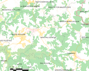
Lapte (Lapte)

- commune in Haute-Loire, France
- Country:

- Postal Code: 43200
- Coordinates: 45° 11' 9" N, 4° 13' 1" E


- GPS tracks (wikiloc): [Link]
- Area: 30.75 sq km
- Population: 1704
- Web site: http://lapte43.fr
- Wikipedia en: wiki(en)
- Wikipedia: wiki(fr)
- Wikidata storage: Wikidata: Q244737
- Wikipedia Commons Category: [Link]
- Freebase ID: [/m/03ntmx6]
- GeoNames ID: Alt: [6434363]
- SIREN number: [214301145]
- BnF ID: [15260019v]
- INSEE municipality code: 43114
Shares border with regions:
Chenereilles
- commune in Haute-Loire, France
- Country:
- Postal Code: 43190
- Coordinates: 45° 8' 0" N, 4° 15' 7" E
- GPS tracks (wikiloc): [Link]
- Area: 14.42 sq km
- Population: 325
Raucoules
- commune in Haute-Loire, France
- Country:
- Postal Code: 43290
- Coordinates: 45° 11' 15" N, 4° 17' 42" E
- GPS tracks (wikiloc): [Link]
- Area: 21.01 sq km
- Population: 911


Grazac
- commune in Haute-Loire, France
- Country:
- Postal Code: 43200
- Coordinates: 45° 11' 15" N, 4° 11' 0" E
- GPS tracks (wikiloc): [Link]
- Area: 21.66 sq km
- Population: 1038

Saint-Pal-de-Mons
- commune in Haute-Loire, France
- Country:
- Postal Code: 43620
- Coordinates: 45° 14' 47" N, 4° 16' 27" E
- GPS tracks (wikiloc): [Link]
- Area: 27.11 sq km
- Population: 2272
- Web site: [Link]


Montregard
- commune in Haute-Loire, France
- Country:
- Postal Code: 43290
- Coordinates: 45° 9' 31" N, 4° 20' 48" E
- GPS tracks (wikiloc): [Link]
- Area: 39.93 sq km
- Population: 607
Sainte-Sigolène
- commune in Haute-Loire, France
- Country:
- Postal Code: 43600
- Coordinates: 45° 14' 35" N, 4° 14' 5" E
- GPS tracks (wikiloc): [Link]
- Area: 30.64 sq km
- Population: 5959
- Web site: [Link]


Saint-Jeures
- commune in Haute-Loire, France
- Country:
- Postal Code: 43200
- Coordinates: 45° 5' 46" N, 4° 12' 18" E
- GPS tracks (wikiloc): [Link]
- Area: 34.14 sq km
- Population: 962


Tence
- commune in Haute-Loire, France
- Country:
- Postal Code: 43190
- Coordinates: 45° 6' 51" N, 4° 17' 28" E
- GPS tracks (wikiloc): [Link]
- Area: 52.12 sq km
- Population: 3106